
-
 7689 Hits
-
 76.93% Score
-
 8 Votes
|
|
Mountain/Rock |
|---|---|
|
|
31.68510°N / 110.949°W |
|
|
Download GPX » View Route on Map |
|
|
Santa Cruz |
|
|
Hiking |
|
|
Spring, Fall, Winter |
|
|
4964 ft / 1513 m |
|
|
Overview
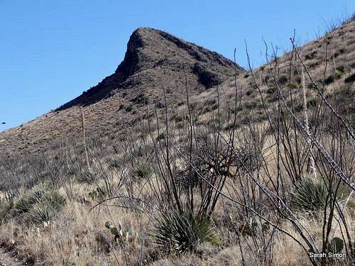
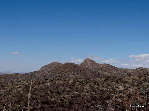
Approaching Devils Cash Box
There’s just something about a mountain with a catchy name like Devils Cash Box and practically begs you to climb it. Roughly 25 miles from the international border between the USA and Mexico, this scrubby desert peak sits on the southwestern outskirts of the Santa Rita Mountains, in the shadow of big neighbors Mount Wrightson and Mount Hopkins. From the top of Devils Cash Box the views are completely unimpeded in all directions. The visitor can see the Whipple Observatory on the summit of Mount Hopkins, Elephant Head and “Little Elephant Head,” and Baboquivari in the western distance. The mountains of neighboring the Mexican state of Sonora seem to roll on forever to the south.
Rank: 3218th highest peak in Arizona
Prominence: 464 feet
USGS Quad: Mount Hopkins
Map: Green Trails Maps: Santa Rita Mountains | Map 2962S
Peak Stats: Lists of JohnGetting There
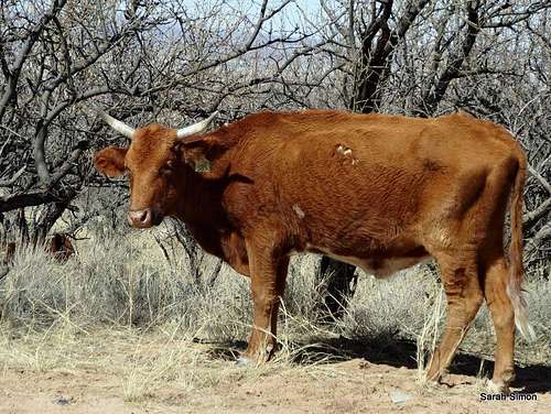
The area surrounding Devils Cashbox is open range, so take care not to hit one of these 24 Feb 2013
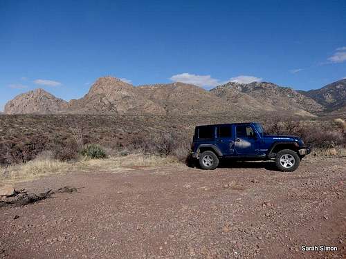
This parking area is near the junction of FS 183 and FS 4077 AK | 24 Feb 2013
To the north end of Elephant Head Trail
Though high-clearance is recommended for this route, it is passable in dry conditions for 2-wheel drive vehicles. Low clearance vehicles can part near the intersection of Mt Hopkins Road and FRS 183.
• I-19 to Exit 56 (Canoa Road)
• Go under highway toward the east utilizing a roundabout.
• Right (south) on Frontage Road for 3 miles to Elephant Head Road. Turn left.
• Cross the Santa Cruz River (usually dry) and continue for an additional mile.
• Right on Mount Hopkins Road (paved) for 5.5 miles to sign: Aqua Caliente Canyon KMSB.”
• Turn left on a dirt Forest Service road FS 183 and travel ½ mile to a right turn on a simple dirt road (FS 4077 AK) then park in a small parking area. If you begin descending steeply into a wash (Aqua Caliente Canyon) you have gone too far and need to turn around.
Note: Higher clearance would be appreciated on FS 183. A Subaru would be fine, my Rubicon was overkill. I have taken an economy rental car on this road, but I would not recommend it. If driving a low-clearance vehicle, simply park at the junction of Mount Hopkins Road and FS 183. There is room for perhaps one vehicle and it will add 1 mile roundtrip to your hike.
Route Information

Ocatillo

Typical route conditions

Park near this sign

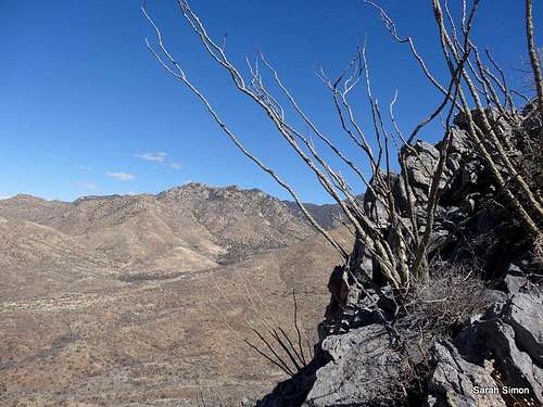
Toward Mount Hopkins

Rising above the desert

Toward Devils Cashbox
With roads almost all around it, this peak could be accessed in multiple ways, all of them relatively short. I outline here the route that I took which blends road accessibility with a moderately gentle
slope to ascend.
Tips: Off-trail travel in the Sonoran desert requires a tolerance for prickly plants. Thankfully, there is no Teddy Bear Cholla, but plenty of everything else, including Prickly Pear and small armies of Ocatillo. Your best bet is to just give all plantlife in this area a wide berth. Allocate just a little more time for this route than the distance (90 minutes should be
sufficient) and elevation gain indicate because maneuvering around thorns makes for slow-going in spots.
· From the high-clearance parking, head about 1/3 of a mile up the dirt road to the east-southeast.
· At a small turn-out, leave the road and look for footpaths heading south up the slope. It’s worth your hassle to remain on the foothpaths for the sake of staying out of the worst of the prickle bushes.
· Upon gaining the ridgeline, simply travel south-southeast toward the summit of Devils Cash Box.
· There are intermittent signs of a use path here and there and the going gets a little steep at times, but nothing that should require scrambling. The primary tactics to employ are sticking to the ridgecrest as much as possible and avoiding the worst of the desert plants.
· After ascending a false summit, push onto the true summit. At the time of my visit, this was marked by a scraggly little cairn.
· Drink in the desert views before heading back downhill.
Roundtrip Distance: 1.75 miles
Elevation Gain: 950 feet
YDS Class: 2See attached GPX file for route map and elevation profile.
Red Tape and Special Considerations

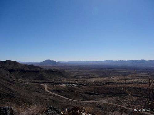
Views along the ridge

Strange rock
There are no fees to access this part of the Coronado National Forest and very few regulations. Devils Cash Box sits outside of the Mount Wrightson Wilderness Area.
Take note, however, than Devils Cash Box sits only 26 miles as the raven flies north of the US-Mexico border. There is a lot of illicit traffic in this border region (La Frontera), and as evidenced by discarded clothing, food wrappers, water containers, backpacks and whatever other refuse, the canyons and trails around Devils Cash Box see their fair share of traffic. Your average migrant likely poses little threat, but traffickers in drugs, weapons or people (los coyotes) are an entirely different matter. Visit in broad daylight and travel in lager groups. Chances are no one is going to bother a hiker / peak hunter, but still remain aware of your surroundings and leverage some common sense.
Weather and Seasons
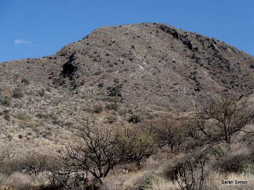
Devils Cash Box
 | This is a great peak to visit in winter. Summer would be dreadfully hot. Spring and fall may be nice, depending on the weather pattern. |  |
Camping and Lodging
Toward Yoas Mountain

Prickly Pear
The nearest available camping is dry, rustic camping off of Forest Service Roads available on a first-come, first served basis. Honestly, I can’t say I would be super-keen on camping in this area due to smuggling traffic. Roughly 30 minutes away (the drive would be shorter if you could get there “as the crow flies) are two options in or near Madera Canyon:
Proctor Road Dispersed Camping Area:
Rustic, dry camping, but many sites are nice and shady and are numbered by the Forest Service. 4x4 is preferable to reaching these sites in dry conditions and very important to have in wet
conditions. Note that a stream road crossing is required to reach these sites.
Ridge views
•13 campsites with tables and fire grills
•Drinking water available
•Toilets
•Paved access road
•Elevation: 5,200'
•Season: Year-round
Hotels: The nearby retirement community of Green Valley provides several standard national chain hotels.
External Links
If you have any trip reports or other information to share on Devils Cash Box, please send notify me via the Additions & Corrections link and I’ll post those URLs here!
 Desert views | 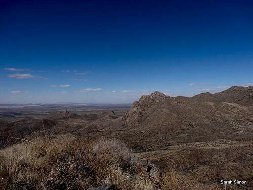 Elephant Head | 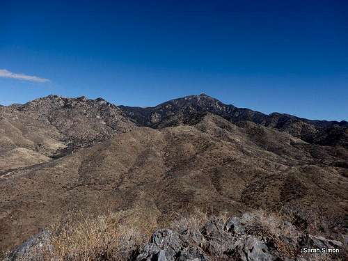 Santa Rita Mountains | 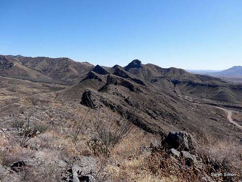 Views to southeast |