
|
|
Mountain/Rock |
|---|---|
|
|
31.72650°N / 110.8301°W |
|
|
Santa Cruz |
|
|
Hiking |
|
|
Spring, Fall |
|
|
8180 ft / 2493 m |
|
|
Overview
Florida Peak is one of prominent summits of the Santa Rita Mountains. It gets far less attention than Mount Wrightson, which is the highest peak in the range, and one of the most popular in Arizona.
It can be combined with nearby 88 Mac 8,853' for a long day hike from the Florida Canyon Trail #145. Unlike 88 Mac (which can be hiked via the Madera Canyon within a reasonable hiking distance and elevation gain), hiking Florida Peak from Madera Canyon requires a whole lot of extra effort. Therefore, it is best hiked from the Florida Canyon Trail from the north or from Gardner Canyon or Cave Canyon from the east.
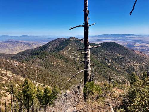
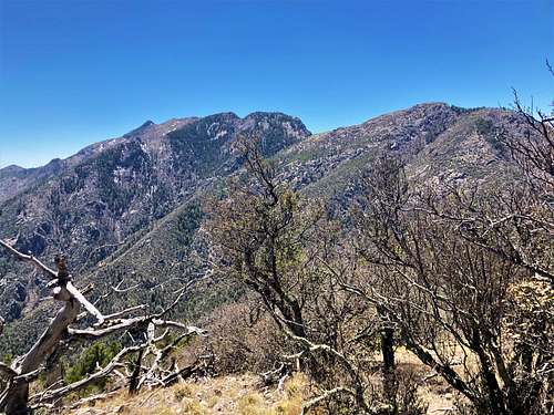
The views from the summit aren’t nearly as impressive as from other peaks in the range. It is more of a minor summit bump, with a prominence of about 360’. However, it is a worthwhile endeavor, especially if combined with nearby 88 Mac.
Because the Florida Canyon Trail is north facing, a fair amount of snow may accumulate in winter months. Therefore, hiking is best done in April. However, it can be hiked as late as November before snow comes to this part of Arizona. If approaching from the east via Gardner Canyon or Cave Canyon, it is certainly possible to hike this in March in a normal snow year.
Getting There
I am providing details for the Florida Canyon approach, which is the primary option. Take I-19 south from Tucson, Arizona and head south to Green Valley, Arizona and take Exit #63 to Continental Road. Head east for 1.2 miles and then turn on E. Whitehouse Canyon Road. This is the road to both Madera Canyon and Florida Canyon. After 7.3 miles, there is a junction leading to Madera Canyon. Continue past it and the road turns to dirt and heads another 2.8 miles east to Florida Canyon. There is a small parking area on the left before reaching a locked gate and a bunch of buildings used for a University of Arizona research facility.
As noted above, there are two other options to reach Florida Peak in the same vicinity – Cave Canyon and Gardner Canyon Trails. Both approach Florida Saddle from the east side. While these approaches cut off a mile each way and approximately 1,000’ of gain compared to the Florida Canyon Trail, they are more remote, with more driving on dirt roads. They both offer good options for day-hiking. However, these not being the primary route, I am only providing information on them from other websites. They are further described on the Santa Rita Mountains page.
There is also a trail from the KWBA-TV Transmitter a little bit north of those options that goes directly below Florida Peak. This is another option if you want to check it out as an alternative. Reaching this starting point is better for 4WD high clearance vehicles.
Route
From Florida Canyon #145:
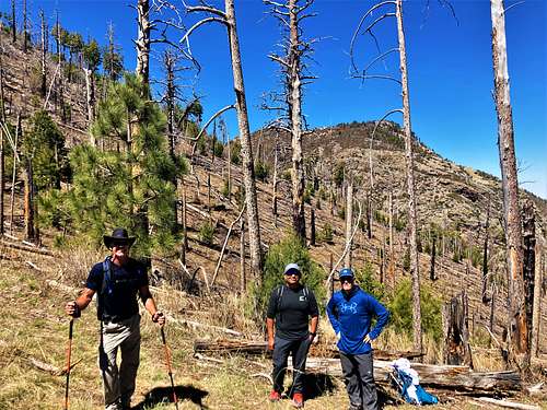
There is a sign from the trailhead saying the Florida Saddle is about 4.7 miles. That is roughly accurate, although it may be a tiny bit shorter. The trail starts with a mix of shade and sun exposure, finally reaching the more heavily forested area after a couple miles. When we were there on April 15, 2023, there was still a lot of burn, reducing some of the shade along the higher elevation part of the trail.
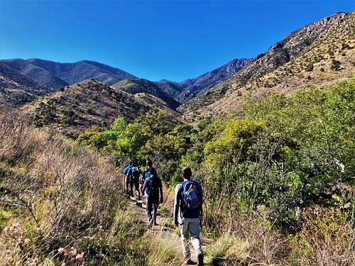
The trail is steep the entire way. Once at the saddle, there is a trail on the left heading towards Florida Peak. The trail continues for over half a mile and can be overgrown. Not far from the summit the trail veers to the right. From here, Florida Peak is just a tenth of a mile ahead and 140’ up. It is an easy off-trail ascent to the summit. The total round-trip distance from the trailhead is about 10.6 miles gaining 3,870’ one way to the summit.
88 Mac adds another 1,035’ and 2 ½ miles to the hike. These two summits can also be combined from Gardner Canyon or Cave Canyon.
Red Tape
There are no permits needed to hike up any of the routes described above.
External Links
Florida Canyon Trail #145: https://www.hikingproject.com/trail/7034019/florida-canyon-trail-145
Forest Service – Florida Canyon Trail: https://www.fs.usda.gov/recarea/coronado/recarea/?recid=25748
Forest Service Gardner Canyon Trail: https://www.fs.usda.gov/recarea/coronado/recarea/?recid=25750
Forest Service – Cave Canyon Trail: https://www.fs.usda.gov/recarea/coronado/recarea/?recid=25738
Cave Canyon Trail details: https://hikearizona.com/decoder.php?ZTN=1387
Gardner Canyon Trail details: https://hikearizona.com/decoder.php?ZTN=625