
|
|
Mountain/Rock |
|---|---|
|
|
31.71900°N / 110.8456°W |
|
|
Santa Cruz |
|
|
Hiking |
|
|
Spring, Fall |
|
|
8853 ft / 2698 m |
|
|
Overview
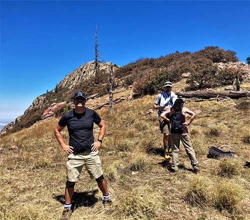
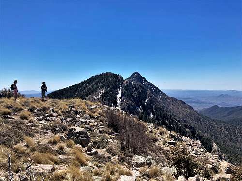
88 Mac is a rocky-topped peak 1 ½ miles north of Mount Wrightson 9,456' in the Santa Rita Mountains. Although it has a prominence of just over 300’, there are wide open views from the summit given its position above the Florida Canyon.
Reaching 88 Mac can be done from the Florida Canyon or Madera Canyon. Both approaches are steep and long, but quite doable.
From the Florida Canyon, it can be combined with Florida Peak 8,180’ in a long day hike. From Madera Canyon it can easily be combined with Mount Ian while Mount Wrightson can be added for a long day.
The best time to hike 88 Mac is generally early spring and fall. April and October are typically the best months.
Florida Canyon starts over 1,000’ lower than Madera Canyon, so it is warmer with less tree cover early on in the hike. Madera Canyon has a longer time window during the spring, so hiking into early May is generally fine absent a major heat wave.
Getting There
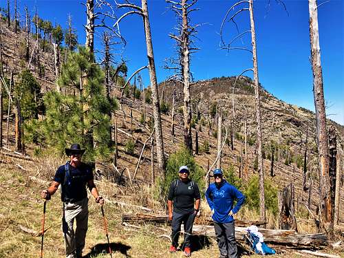
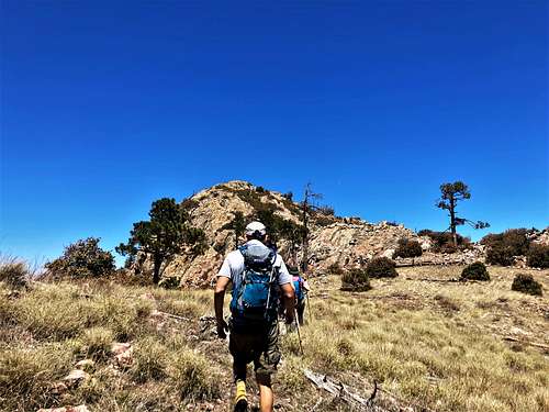
From the north, the primary approach is from the Florida Canyon via the Florida Canyon Trail #145. This trail is famous for being desert to pines – starting among typically desert terrain with prickly pear cactus and tall desert grass, leading up to a pine forest and then rock towers.
If hiking from Madera Canyon, plan for a very long day. Most people might combine 88 Mac with Mount Ian and Mount Wrightson. That involves about 5,400’ of gain and 14 ½ miles.
For either starting point, take I-19 south from Tucson, Arizona and head south to Green Valley, Arizona and take Exit #63 to Continental Road. Head east for 1.2 miles and then turn on E. Whitehouse Canyon Road. This is the road to both Madera Canyon and Florida Canyon. After 7.3 miles, there is a junction leading to Madera Canyon. Take this for the Madera Canyon Route and continue about 6 miles to the end of the road to the Old Baldy Trailhead. If starting at Florida Canyon, continue east towards the Florida Canyon. The road turns to well-graded dirt all the way to the starting point at a small parking area on the left before reaching a locked gate and a bunch of buildings used for a University of Arizona research facility.
There are two other notable options to reach 88 Mac in the same vicinity – Cave Canyon and Gardner Canyon Trails. Both approach Florida Saddle from the east side. While these approaches cut off a mile each way and approximately 1,000’ of gain compared to the Florida Canyon Trail, they are more remote, with more driving on dirt roads. They both offer good options for day-hiking, especially for residents of Tucson (not as much the Phoenix Valley). However, these not being the primary routes, I am only providing information on them from other websites. They are further described on the Santa Rita Mountains page and in the links below.
Route
From Florida Canyon #145:
There is a sign from the trailhead saying the Florida Saddle is about 4.7 miles. That is roughly accurate, although it may be a tiny bit shorter. The trail starts with a mix of shade and sun exposure, finally reaching the more heavily forested area after a couple miles. When we were there in April of 2023, there was still a lot of burn, reducing some of the shade along the higher elevation part of the trail.
The trail is steep the entire way. Once at the saddle, there is a trail on the left heading towards Florida Peak, and a trail going right towards 88 Mac and the main ridge leading to Mount Wrightson, which according to the sign is only 2.9 miles away. At this point, the trail has climbed 3,500’.
To reach 88 Mac, continue up the trail to the right for about eight-tenths of a mile, and you will reach a saddle between 88 Mac and a larger rocky area making up one of the sub-peaks to Mount Ian.
From here, 88 Mac is directly north. There is no trail, but the terrain is open. It is less than half a mile to the summit and just a little over 300’.
The total hiking distance is about 5.8-5.9 miles, with an elevation gain of about 4,550’.
Florida Peak 8,180’ can easily be added by returning to Florida Saddle and hiking another 1 1/3rd miles round trip to and from the summit and adding 360’ of gain.
From Madera Canyon:
Take the Old Baldy Trail to the Baldy Saddle. All of this is well marked. Try and take the shorter route and avoid the Super Trail. Once at Baldy Saddle, take a left towards Mount Ian. While the trail doesn’t go directly up and over Mount Ian, it doesn’t make sense not to hike up to it, given it is 80’ above the trail, and since you can descend further up the trail en route to 88 Mac or vice-versa, it only adds about 100 yards of total hiking distance.
Once off Mount Ian continue along the trail for a little less than a mile to the saddle below 88 Mac and continue a little over 300’ to the summit.
It is about 3,750’ up to Mount Ian from Madera Canyon, at about 4.85 miles and going up to 88 Mac adds another 450’ one way. On the way back to Baldy Saddle, you have to gain back another 570’ and a tiny bit in the forest on the way back. This makes for a total elevation gain of approximately 4,800’ round trip in about 13 miles. That is quite doable to reach two summits in one day in one of the better hiking areas in the State of Arizona.
Other options:
As noted above, additional driving to Gardner Canyon or Cave Canyon Trailheads provides access to both Florida Peak and 88 Mac with less distance and elevation gain. Although these are more remote trailheads, they are fairly accessible from Tucson, but would make a longer day trip from Phoenix. See details in the External Links section.
Red Tape
The Madera Canyon recreational area is a fee area. You can pay $8 per vehicle per day and get a tag that is good for a week and also gets you into a number of other Tucson recreation areas, such as Mt. Lemmon and Sabino Canyon. Or you can get an annual pass. Here are further details.
External Links
Florida Canyon Trail #145: https://www.hikingproject.com/trail/7034019/florida-canyon-trail-145
Forest Service – Florida Canyon Trail: https://www.fs.usda.gov/recarea/coronado/recarea/?recid=25748
Forest Service Gardner Canyon Trail: https://www.fs.usda.gov/recarea/coronado/recarea/?recid=25750
Forest Service – Cave Canyon Trail: https://www.fs.usda.gov/recarea/coronado/recarea/?recid=25738
Cave Canyon Trail details: https://hikearizona.com/decoder.php?ZTN=1387
Gardner Canyon Trail details: https://hikearizona.com/decoder.php?ZTN=625