
-
 9540 Hits
-
 80.49% Score
-
 12 Votes
|
|
Mountain/Rock |
|---|---|
|
|
38.85470°N / 78.205°W |
|
|
Warren |
|
|
2444 ft / 745 m |
|
|
Overview
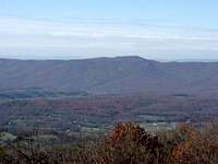
At Carson Mountain in Shenandoah National Park, Dickey Ridge splits off from the main ridge of the Blue Ridge Mountains. The main ridge continues to the northeast. Dickey Ridge goes to the west before turning north for a few miles and ending at the edge of Front Royal. Dickey Hill can be found about a mile north of the turn on Dickey Ridge.Although Dickey Hill is not nearly the tallest peak in Shenandoah National Park at 2,444 feet, visitors can experience an elevation gain of about 2,100 feet on one of the routes to the summit. They can also see the historic Snead Farm, take in views of Hogback Mountain, the Massanutten Mountains (especially Little Crease Mountain), and High Peak, and watch a sunset from the Dickey Ridge Visitors Center.
Getting There
Snead Farm Loop: From Front Royal, go south on US 340 until reaching Skyline Drive. Turn left and follow Skyline Drive to the Dickey Ridge Visitors Center. Turn right into the parking lot and leave your car there.Go to the front of the Visitors Center. Make a right at the flagpole and take the path across Skyline Drive. Bear right when you get to the other side and continue to the blue-blazed Dickey Ridge Trail. Turn right on the Dickey Ridge Trail and follow it for 0.6 miles. Then, turn left on the Snead Farm Trail, which is a road at this point. At the next intersection, bear right to stay on the trail as the road continues downhill to the left. Follow the Snead Farm Trail for 1.4 miles; the remains of the Snead Farm will be on your right after 0.7 miles.
At the intersection with the Dickey Ridge Trail, turn right and follow it for about 0.3 miles. Here, you will find an unblazed trail that ascends to the right. Follow this trail until it forks. The left fork continues to a hang gliding launch site with spectacular views of Hogback Mountain, the foothills of the Blue Ridge, and the Massanutten Mountains. Take the right fork to the summit of Dickey Hill, where you will see a Federal Aviation Administration navigation facility for planes. After returning to the Dickey Ridge Trail, turn right and follow it back to the Visitors Center.
Round trip: 4.3 miles with an elevation gain of about 700 feet.
 |  |  |
Dickey Ridge Trail: From Front Royal, go south on US 340 until reaching Skyline Drive. Turn left and follow Skyline Drive until you see parking areas on both sides of the road. Park here and start hiking on the Dickey Ridge Trail on the right side of the road. Follow the trail for about 5.4 miles until you see a clearing in the trees with views to the right. Just after the clearing, make a left onto the unblazed trail to the launch site. Take the right fork in the trail and follow it to the summit.
Round trip: 10.8 miles with an elevation gain of about 2,100 feet.
If you've worked up an appetite after hiking for nearly 11 miles, cross Skyline Drive after getting back to your car, and continue on the Dickey Ridge Trail for another 0.1 miles. Make a right at US 340, cross Criser Road, and arrive at Dean's Steakhouse.
 High Peak at Sunset
Red Tape
The $15 entrance fee is only applicable if you use the Snead Farm Loop. The parking for Dickey Ridge route is before the park entrance gate on Skyline Drive.When to Climb
Dickey Hill can be climbed all year round. The hike can be particularly delightful from mid-October through mid-November because of the autumn colors. July and August are the worst months for heat, humidity, haze that limits views, and hostile little critters like ticks, yellowjackets, and mosquitoes. The best time for a summer hike is early in the morning. Skyline Drive is often closed during the winter beyond the park entrance gate because of snow and ice, making the Dickey Ridge route a necessity. 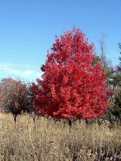 Leaves Turn Red Leaves Turn Red | 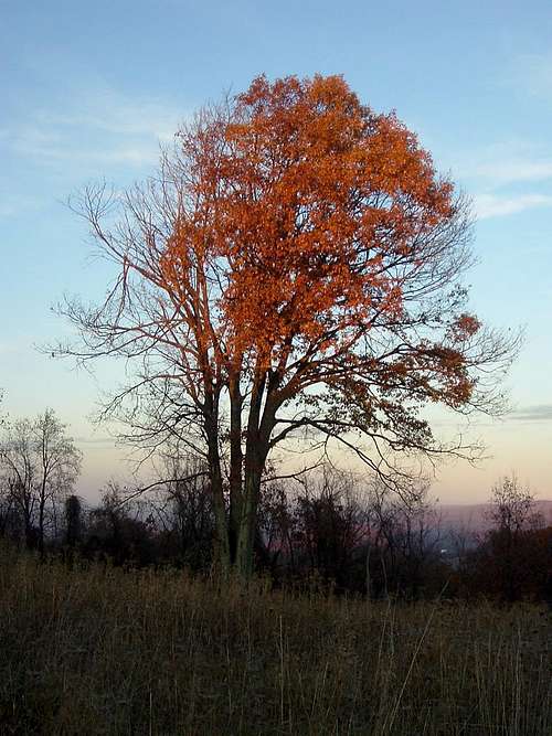 Leaves Turn Orange Leaves Turn Orange |
Sunset is a good time to be at the Dickey Ridge Visitors Center. From the back of the Visitors Center, you can watch gorgeous sunsets over the Massanutten Mountains.
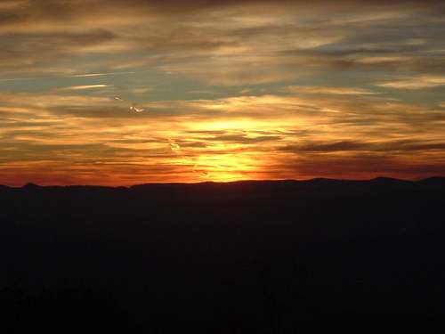 Sunset Over Massanutten Mountains
Camping
Free backcountry camping is allowed throughout Shenandoah National Park. The required permit can be obtained through mail or at entrance stations, park headquarters, or visitor centers. Campfires are only permitted at pre-constructed fireplaces at backcountry huts and day-use shelters. Campsites must be at least:•10 yards away from a stream or other natural water source.
•50 yards away from standing buildings and ruins.
•100 yards away from a hut, cabin, or day-use shelter.
•1/4 of a mile away from a paved road or park boundary.
External Links
Shenandoah National ParkThe Potomac Appalachian Trail Club maintains the trails in the Shenandoah National Park, and provides maps, guidebooks, and other information.