
-
 4743 Hits
-
 77.48% Score
-
 8 Votes
|
|
Mountain/Rock |
|---|---|
|
|
38.60947°N / 78.30407°W |
|
|
Rappahannock |
|
|
Hiking |
|
|
Spring, Summer, Fall, Winter |
|
|
2980 ft / 908 m |
|
|
Overview
Catlett Mountain is in the Central District of Shenandoah National Park, on the east side of Skyline Drive. It is about 1.4 miles southwest of Hazel Mountain, about 2.4 miles northeast of Thorofare Mountain and about four miles north of the extremely popular Old Rag Mountain.
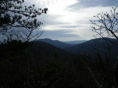
Catlett Mountain is not especially high. It is not especially interesting. (I didn't know that, though - sometimes when I bushwhack to a new peak I am very pleasantly surprised by what I find.) The summit views are partially obscured, as on most Blue Ridge peaks. But it is surrounded by pleasant hiking trails, and a visit to the summit is like a bonus that requires little additional effort. Also, the odds are very good that you will have the summit all to yourself.
Getting There
DIRECTIONS TO THE BROAD HOLLOW TRAIL HEAD:
From the Washington, DC area:
Take 66 west to Exit 43, then take 29 south to Warrenton. In Warrenton, turn right onto 211 west toward Sperryville. 211 eventually becomes coincident with 522. In downtown Sperryville, turn left on 522, then right (south) on 231. In 3.4 miles, turn right on 681/Rolling Road. Go about 2.4 miles and park at a small turnout next to Broad Hollow or nearby, being careful not to block access to private property.
Route
Catlett Mountain is literally surrounded by trails, but no trail goes to its summit. The easiest approach to the summit is probably via the Catlett Mountain Trail. One can access the Catlett Mountain Trail via the Hannah Run Trail or the Hazel Mountain Trail. For example, one could take the Broad Hollow Trail (which crosses Broad Hollow Run three times), turn left onto the Hazel Mountain Trail, then turn right onto the Catlett Mountain Trail. Here is one way to combine several trails and make a loop out of your conquest of Catlett:
Catlett Mountain via Broad Hollow:
Start at the trail post near Broad Hollow Run, to the right of a private driveway. Follow the blue-blazed Broad Hollow Trail.
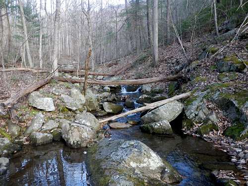
Broad Hollow Run
You will cross Broad Hollow Run three times and pass a seasonal spring.
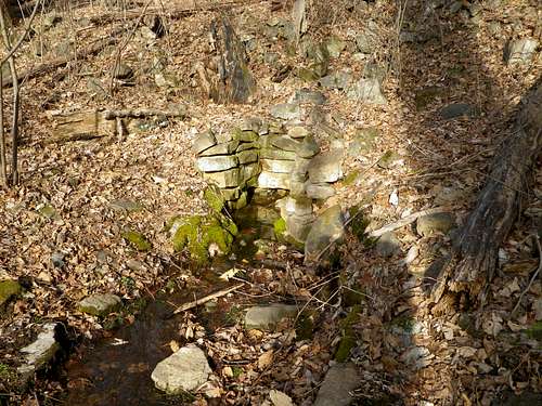
Mountain Spring
You will pass old stone walls, and also pass the ruins of a cabin.
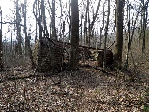
Remains of a cabin along the Broad Hollow Trail
Stay on the Broad Hollow Trail till it ends at a junction with the yellow-blazed Hazel Mountain Trail in about 2.9 miles.
Turn left here and follow the Hazel Mountain Trail about 0.5 miles to a junction with the Catlett Mountain Trail.
Turn right and follow the Catlett Mountain Trail about 0.5 miles till you are due north of Catlett Mountain.
Summit Ridge
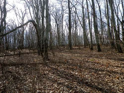
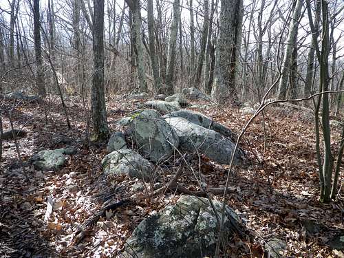
Leave the Catlett Mountain Trail as it passes by the north end of this north-south-oriented peak, and bushwhack south about 0.4 miles. The terrain is fairly open (at least in winter), so one should have little difficulty hiking cross-country along the ridge, passing over the north summit on the way to the south (true) summit. One can easily traverse the peak from north to south in about 20 minutes.
North Summit
South Summit
After enjoying the dubious pleasures of the summit of Catlett Mountain, return to the Hazel Mountain Trail. You can do this by retracing your steps northward, or you might wish to save time by bushwhacking directly east about 0.4 miles back to the Hazel Mountain Trail. The latter is doable, but the terrain is less friendly here; it is steeper, and there are some patches of greenbrier to circumnavigate.
After reaching the Hazel Mountain Trail again, turn right to head south. In about 0.6 miles, the Hazel Mountain Trail ends where the Pine Hill Gap Trail begins.
The Beginning and the End
At this point, if you handled the bushwhacking on Catlett Mountain easily enough and feel ready for a more adventurous cross-country experience, you might wish to leave the trail here and head south about 0.6 miles to the summit of Hot Mountain. However, the vegetation is denser on Hot Mountain and the going is slower.

A Glimpse of Catlett Mountain from Hot Mountain
As on Catlett, there are two summits, and the southern one is higher.
A Bushwhacker Approaches the Summit of Hot Mountain
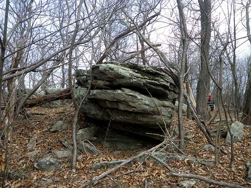
On Hot Mountain the sensible thing to do is return the same way you came, heading north from the summit back to the trail. Look for an outcrop with good views of Old Rag and Thorofare Mountain on the west side of the ridge, just before you reach the trail again.
Hot View - Old Rag in Middle Distance
By now you will have hiked about 6.4 miles. The rest is easy. Follow the Pine Hill Gap Trail as it descends to Pine Hill Gap. At Pine Hill Gap, turn left to follow old the Pine Hill Gap fire road. Stay on this road till it ends at Rolling Road, then continue on Rolling Road about 0.3 miles back to the Broad Hollow trail head. This loop (including the two bushwhacks) is approximately 8.8 miles.
Red Tape
There are no fees to enter Shenandoah National Park at the Broad Hollow Trail Head.General Shenandoah National Park fee information
When to Climb
Catlett Mountain can be climbed in any season. Winter is best, however, for minimally obstructed views and minimal obstructive undergrowth.Camping and Lodging
Camping informationLodging information