
-
 40368 Hits
-
 86.37% Score
-
 22 Votes
|
|
Canyon |
|---|---|
|
|
35.11000°N / 106.26000°E |
|
|
Hiking, Mountaineering, Trad Climbing, Bouldering, Scrambling |
|
|
Spring, Summer, Fall, Winter |
|
|
Overview
This hike goes deep into Domingo Baca Canyon, a rugged part of the Sandia Mountains. It continues to the site of the wreckage of a TWA flight that crashed into the mountain on February 19, 1955, killing 16 people. The hike covers quite a range of terrain over its length. The lower part is bare and rocky. The upper portion, which has flowing water, is lush and overgrown with greenery.
The hike to TWA canyon is not along an officially maintained trail. Do not attempt this hike by yourself - this is what most Sandia trail guide books tell you (I visited the TWA crash site 3 times, each time alone - well with Duchess. I found trail finding difficult the first time, and then in the winter it can be confusing if there is a lot of snow).
Getting There

Take Tramway Boulevard north past Academy, and turn east to the Elena Gallegos Open Space parking area. Park at the northeast corner (N: 35 09 797, W: 106 28 199), 6511 feet elevation.
Follow Nature trail from the Elena Gallegos parking area towards the entrance to the Sandia Mountain Wilderness. There are signs along the way pointing the way to Domingo Baca Trail. The hike towards the Sandia Wilderness sign is about 0.75 miles (12 min).
You will come upon the ruins of an abandoned shelter (just its rock foundation is left), 1.7 miles (35 min).
The turn off to TWA Canyon is 0.2 miles from the shelter (40 min). You must be hiking along the streambed to find this turn-off. As you walk east along the stream, look closely to your right for a crude path taking you up the 20-foot embankment toward the southeast. There is sometimes a cairn marking this spot (but not today). If you miss this turn-off and continue up the stream, you will soon run into a dead end canyon blocked by a 30-40 foot high wall or rocks. N 35 10.886 W 106 27.594.
The good news is that once you scramble up the embankment, you will find a relatively good trail for the remaining 1.6 miles up to the crash site. However, the trail is quite steep, gaining about 1,400 feet in elevation over that distance.
The trail crosses some open, sandy terrain for a short distance. It then joins another stream, which it follows for the rest of the hike. You can find some camping spots in this area.
The hike up the canyon is pretty rugged and steep, through dense tree cover. Along the way, you may hear the Sandia Tram passing above you. The trail becomes less distinct as it makes its way up the canyon. There is a significant rock obstacle, about 10-15 feet high, that you must scramble up along the way.
After perhaps another 10 min walk through the dense foliage, you will come upon the first of the wreckage. There is a large portion of the fuselage with a large number 416 of the side, and two rubber tires. As you continue up the canyon there are hundreds of pieces of the plane strewn around, including parts of the engine, propeller, and landing gear.
The site is humbling and rather sad to visit. Please treat it with respect.
Red Tape

Parking fee at Elena Gallegos - 1$ on weekdays, 2$ on weekends.
Free camping in the wilderness area.
The Elena Gallegos parking area has a gate, which locks at 7PM, and does not open until 7 am.
Locals who know the area just park in the neighborhood (north of Elena Gallegos) and obviously have a free parking and a shorter approach to the Domingo Baca and TWA canyon.
Camping
Anywhere in the wilderness area.
This hike is just outside the city of Albuquerque, so plenty of hotel/motel type of accommodations are available.
Rock climbing
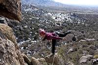
There is rock climbing in the Domingo Baca canyon - mostly slab, some crack climbing. The rock is facing south, so you can climb there pretty much year round (unless there is a fresh snow fall covering the rock).
Please see attached album for photos of Domingo Baca rock or click here photo album
On Line Guide for rock climbing in Domingo Baca
Mountain Project
Climbing in TWA canyon is more technical and requires a longer approach.
Mountain Project
MAP
History behind the plane crash

Parts of the plane

Plane under the snow
TWA crash in the Sandias was one of New Mexico's biggest air and ground searches. The plane took off at 7 am from Albuquerque airport for a 29 minute hop to Santa Fe. Three minutes later pilot radioed that the plane was off the ground and on its way. Then there was silence. The search was difficult due to violent snowstorms. The rugged west face of the Sandia Mountains yielded the scattered and burned wreckage of a Trans World Airlines plane. Bits of the plane were spotted from the air early Sunday morning (the accident happened on Saturday). Ground crews reached the desolate site of the crash near sundown. They reported no signs of life. The plane was about 10 miles off course and 13 miles from its point of takeoff. No one had an explanation as to why the plane apparently continued to swing in a tight right turn into the mountains after taking off in a southeasterly direction.
External Links
Map and hike info including GPS
You Tube