-
 14309 Hits
-
 76.74% Score
-
 8 Votes
|
|
Mountain/Rock |
|---|---|
|
|
40.51403°N / 111.78693°W |
|
|
SALT LAKE COUNTY |
|
|
Hiking |
|
|
Spring, Summer, Fall, Winter |
|
|
9322 ft / 2841 m |
|
|
Overview
Interesting Discovery On Top
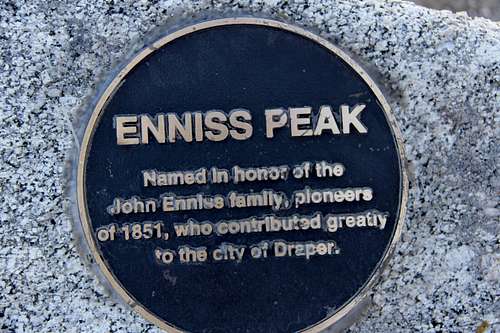
A highly overlooked hike along the Wasatch Front, Enniss Peak, however, is another of Wastch Front's "four thousand foot hikes" besides the highly popular Mount Olympus. Hundreds, if not thousands, of hikers stream by it every year, ignoring it, on their way to the more lofty Lone Peak, but it itself is a worthy goal.
Getting There
As seen from 2000 E.
The stairway leads up to the trails.
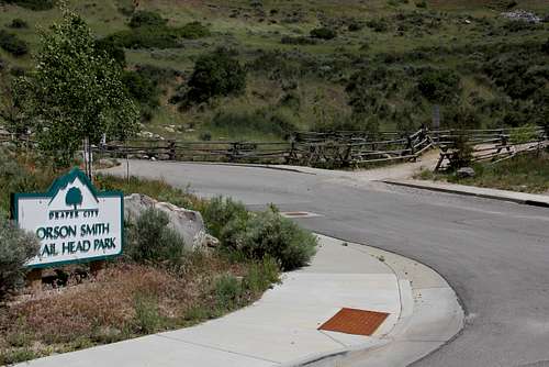
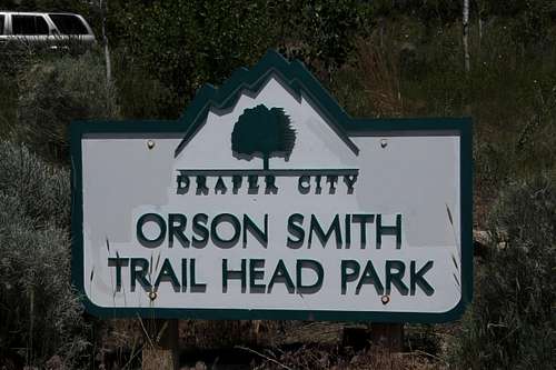
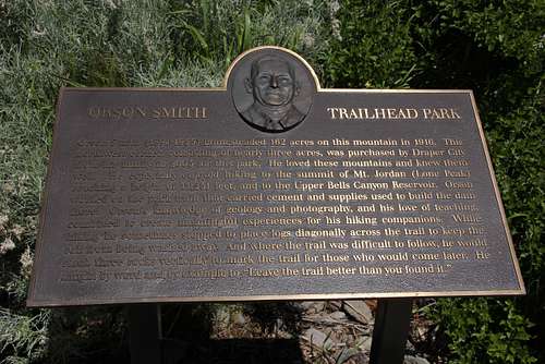
Corner Canyon road veers to the right and parking for Orson Smith Trailhead Park continues up and to the left.
Routes
ORSON SMITH/BEAR CANYON TH - CHERRY CANYON LOGGING TRAIL(*see SP "Cherry Canyon Logging Trail" page by SP member Joseph Bullough)
This is the first of three (that I know of) trails to Enniss Peak and beyond, but it is the one I haven't hiked except for a short distance up to the cross over to Cherry Canyon side of the ridge. It begins at Orson Smith Trailhead Park that climbs a set of easy switchbacks to the Bonneville Shoreline Trail. From there signage leads you to the Bear Canyon Trailhead which starts the Cherry Canyon Logging Trail. The trail climbs a series of swithbacks up the south side of Bear Canyon until it eventually crosses over to the north side of Cherry Canyon. The trail eventually traverses across the head of Cherry Canyon where it joins with the Draper Ridge Trail. It is the longest and highest climb of the three trails.
DRAPER RIDGE TRAILHEAD
This is what the unofficial trailhead for the Draper Ridge Trail looks like. There is some wide space off the road on the other side to park.
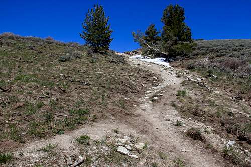
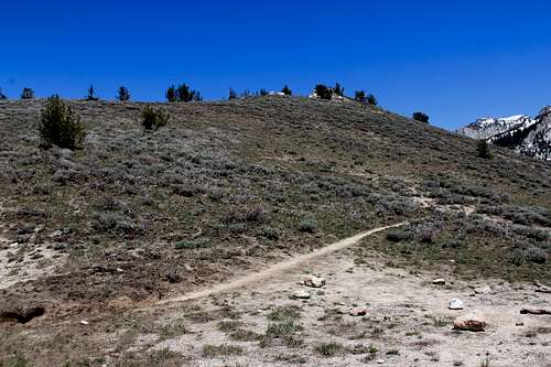
This is the fork in the trail where Jacobs Ladder trail and Draper Ridge trail meet to form what I call the Lone peak trail. At the top of the small wash the trail levels out to traverse horizontaly the base of Enniss Peak.
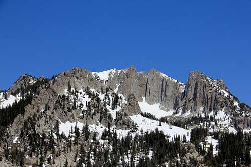
The outcropping at the top is the top of Enniss Peak. This view is from Lone Peak trail. There isn't trail to the top from here but a short cross country traverse will get you there. Hooray!!!
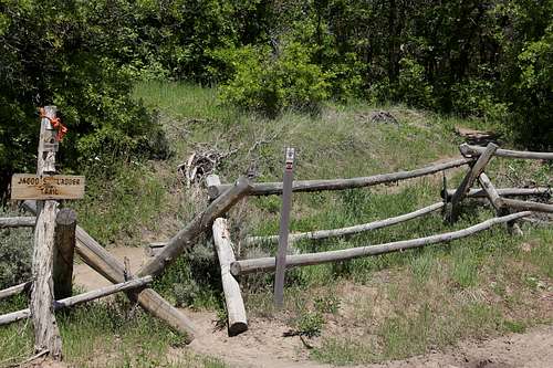
JACOB'S LADDER TRAILHEAD
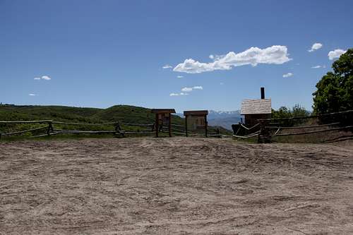
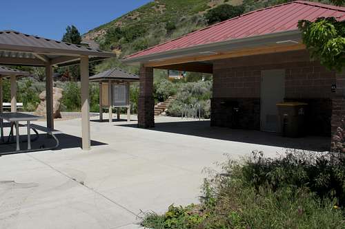
This is the parking lot with restroom and picnic facilities for the Jacob's Ladder Trailhead, and for the Ghost Falls Trailhead as well. If it's been raining or snowing this can be a real muddy mess.
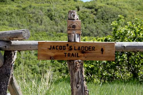
Jacob's Ladder trail this way. It's a short walk up and across the road from the parking,
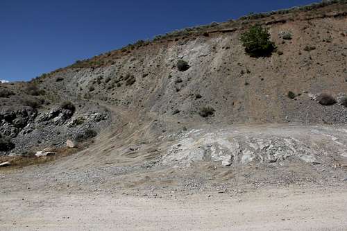
Only the most stout of heart and intrepid of mind enter here.
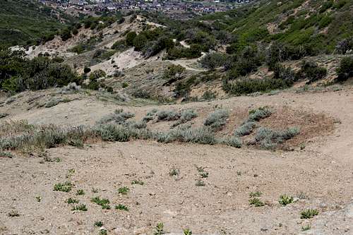
This is looking west. From here on it's straight up as you climb north.
Red Tape
I am not aware of needing any special permit to recreate in the area but Draper City Parks has numerous rules for their Corner Canyon trail system. The only problems I'm aware of is that there are three gates along Corner Canyon Road and at particular times of the year they will be closed and locked. If one had a special reason for vehicular use beyond these closed gates I don't know if it would be possible to obtain special dispensation to do so or not, nor do I know who to contact other than the Draper City Parks department.When to Climb
When to climb??- When there aren't blizzard conditions.
- When you have the strength and energy.
- When you have snow shoes if required.
- When you don't feel like doing Lone Peak.
- On the way going to and coming from Lone Peak.
- When you feel like it. When you get the urge.
- Before your time is up.
Camping
There are no camping facilities in the Corner Canyon area, at the trailheads, nor along the road. Since it is all within Draper City's jurisdiction I'm pretty sure it is not allowed. However as you climb the trails you enter into National Forest Service land and it would only seem reasonable that except maybe for open fires their rules for camping would apply. As I hiked the Jacob's Ladder trail there were a few little clearings where backpack camping was possible and where there were signs that it had been done. East of Enniss Peak there is a large meadow area where in the past my son and I did some camping before continuing on to Lone Peak.Neighboring Prominent Peaks of Enniss Peak
LONE PEAK OVERLOOKS EVERTHING
Lone Peak as seen from Enniss Peak
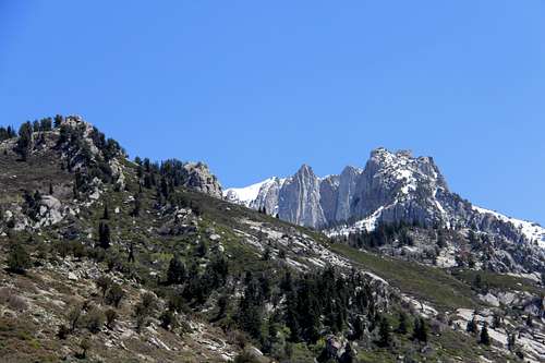
Lone Peak looming above along the Jacobs Ladder trail.
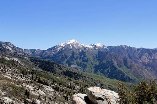
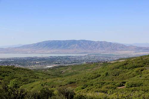
TIMPANOGOS MASSIF
The Timpanogos Massif slowly rises above the skyline as you climb the Jacobs Ladder trail.
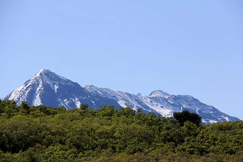
THE ONE AND ONLY BOX ELDER PEAK
As seen from the Jacobs Ladder trail.
TRAVERSE MOUNTAINS
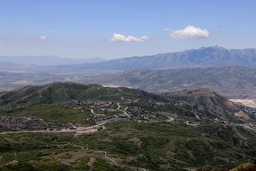
Traverse Mountain as seen from the Jacobs Ladder Trail
THE OQUIRRHS
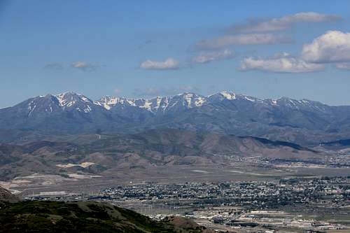
The southern end of Oquirrh Range across the Salt Lake Valley
LAKE MOUNTAINS OF UTAH COUNTY
Lake Mountains in Utah County on the other side of Utah Lake
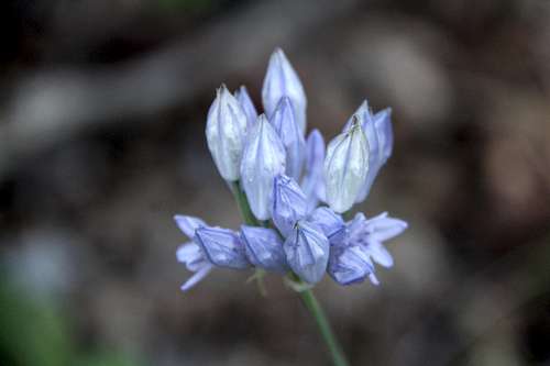
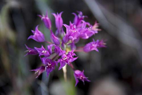
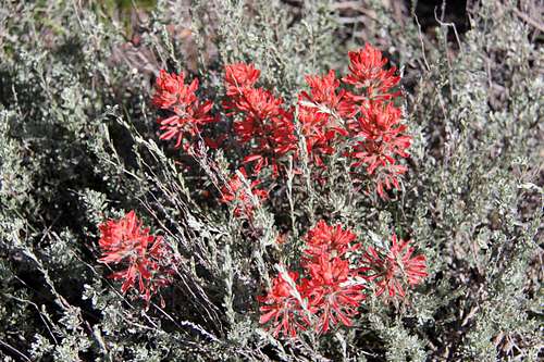
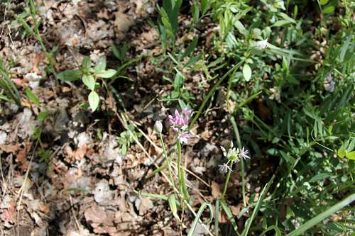
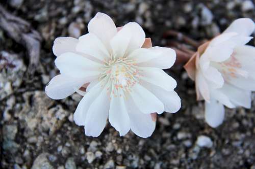
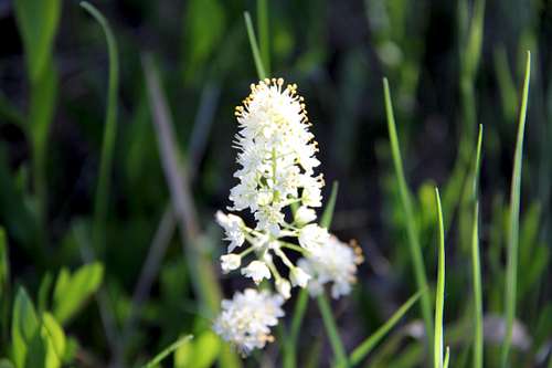
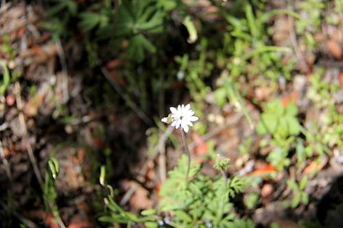
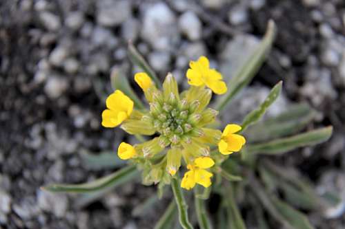
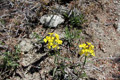
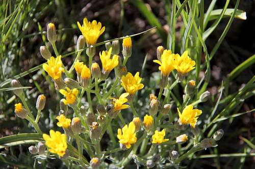
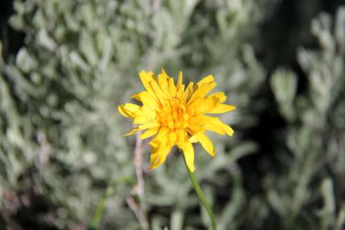
Jacob's Ladder Trail Wildflower Garden
Indian Paintbrush and Wild Onion along Jacob's Ladder Trail
White Wildflowers along the trail
Yellow Wildflowers adorning the trailside
Blue and Purple Wildflowers