
-
 985 Hits
-
 76.66% Score
-
 7 Votes
|
|
Route |
|---|---|
|
|
46.51151°N / 14.75020°E |
|
|
Download GPX » View Route on Map |
|
|
Hiking |
|
|
Summer, Fall |
|
|
Half a day |
|
|
Easy hike up (T2 on the Swiss Hiking Scale) |
|
|
Introduction
Nice, easy and very popular round tour on one of the panoramic summits of Peca / Petzen, with a high trailhead.
General Information
Difficulty (grading is on the Swiss Hiking Scale): T2. It's a usual mountain hike by well beaten and marked paths. On a few places paths are a bit rugged and some forrest sections are a bit steeper. Overall it's just easy, appropriate for almost everyone.
Altitude to overcome: 630 m overall (from 1700 m to 2113 m), a few ups and downs.
Time for the whole round tour (including return): 3 h 45 min.
Time for summit ascent only: 2 h.
Best season: Summer and autumn months, normally from June till November (or first snow).
Best hour: Any time of the day, but generally, when the cable-car operates (8:00-16:15).
Gear: Good shoes and poles.
Maps: Online Open Street Map is ok.
Huts: Restaurants and huts by the upper cable-car station.
Getting There
The starting point is the upper station of Petzen cable-car, 1711 m, on the Austrian side of the mountain. In summer it operates daily from 8:00 till 16:15.
Parking place coordinates: 46.542780, 14.774839.
Route Description
Ascent
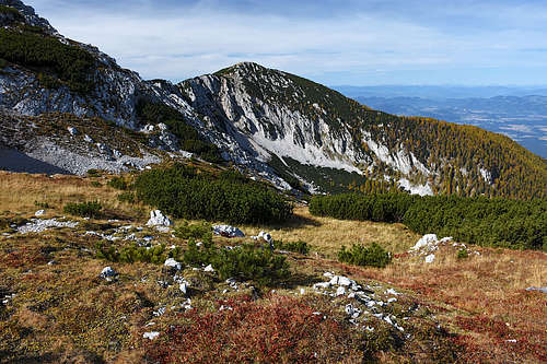
From the upper station we start hiking southwards, up by broad ski terrains, following the inscriptions for "Oberer Petzen-Rundmarsch" (Upper Petzen Round Tour, trail numbers: 603, P3, P4).In the upper part of ski terrains, there's a bench, where we continue by the left trail - towards the main ridge. Soon we are on the broad Knips / Knieps saddle, 2012 m, and in another 15 minutes on Končnikov vrh / Knieps, 2110 m. That's one of the main summits in the ridge of Peca / Petzen, only a little lower than Kordeževa glava / Kordeschkopf, 2126 m, or Bistriška špica / Feistritzer Spitze, 2113 m.
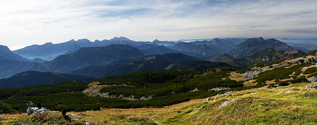
From Končnikov vrh we continue by a good, marked trail by the panoramic main ridge. Its direction is at first west, then it turns towards northwest. The next elevation we cross is Križnik, 2109 m, then the trail follows the main ridge or just left below it till Bistriška špica / Feistritzer Spitze, 2113 m.
Descent
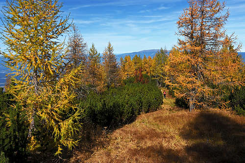
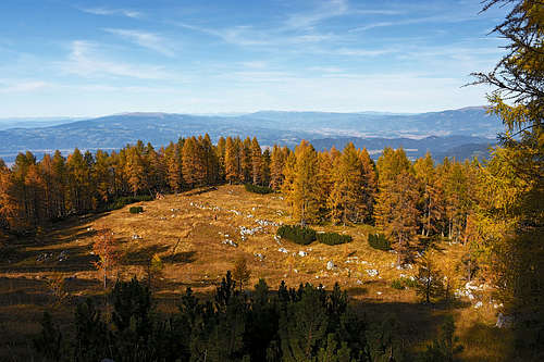
From the summit we continue some 100 m towards the N-NW, till the meadow, where trails are branching. There we turn right, towards the E-NE. The path is descending through dwarf pines, following a distinct side ridge, which separates dry, rubble basins of Deutschmannkar and Obere Krischa. A bit lower the trail goes through nice larch woods, then it reaches a nice, quite big meadow.
|
|
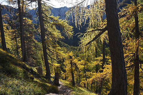
Then the trail (marked yellow) becomes a bit steeper and in turns it descends in mostly larch forrests. Soon it starts keeping right, towards the E and even SE. When reaching the valley bottom, the trail hits Krischahuette (hunters' hut), soon after it, there's another trail branching. While the left trail descends northwards (into the valley), we continue by the right trail, which again ascents quite steeply through the larch woods. It avoids picturesque rock towers and crags and after some 150 m of ascent we exit by the upper cable-car station.