
|
|
Mountain/Rock |
|---|---|
|
|
33.87250°N / 112.3413°W |
|
|
Maricopa |
|
|
Hiking |
|
|
Spring, Fall, Winter |
|
|
2757 ft / 840 m |
|
|
Overview
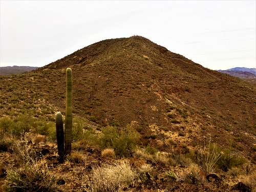
Francis Rogers Mountain (aka Baldy Mountain) is located west of Lake Pleasant northwest of the Phoenix valley. Lake Pleasant itself is a popular destination. There are small mountains that rise above Lake Pleasant on its east and west sides.
The most accessible of these is Francis Rogers Mountain. It has a trail all the way up. The start of the trail isn’t marked, and the trail itself can be faint at times. However, there are plenty of cairns that mark the way.
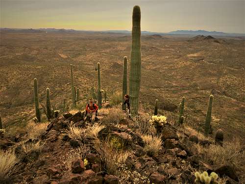
From the summit, there are excellent views towards Lake Pleasant, although some of the view is impeded by the fence and by Cholla Mountain 2,396’ to the east (which can also be hiked off-trail).
Francis Rogers Mountain offers a simple and straight-forward hike, with excellent views in all directions. The hike is only about 3 ½ miles round trip but can easily be combined with a trip to the lake.
Francis Rogers Mountain is best hiked in winter months when there is less growth. This is rattlesnake country, and you don’t want to be on the thin trails in the area when they are around. So, December through February is ideal.
Getting There
Take the New River Highway (SR 74) 12 miles west from I-17 to Castle Hot Springs Road. Turn right up the road and travel about 2 ½ miles. You will pass paved a Lake Pleasant access road on your right. Continue for another 300 yards and park on the dirt on the right side of the road past the end of a guard rail.
Head towards a dirt road on the hill above you. You have to dip under a fence. Once on the road go south for about 100 yards and you will see a cairn marking a trail on the right. The trail leads all the way to the summit gaining about 975’ in about one and two/thirds of a mile. The last section is steep, but manageable.
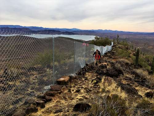
Near the summit, there is a fence. The trail seems to die out, but all that needs to be done is to continue along the fence line to the highest point. There is a large rock pile at the true summit.
Red Tape
There is no red tape to hike Francis Rogers Mountain. Just park on the road and take the trail to the summit. It isn’t clear what the fence is for, since there are no signs of any indication. The mountain itself is on federal public lands managed by the Bureau of Land Management (BLM).
External Links
All Trails: https://www.alltrails.com/trail/us/arizona/baldy-mountain
Hike AZ: https://hikearizona.com/decoder.php?ZTN=15411
Scott Surgent Trip Report: http://surgent.net/highpoints/az/mobile/franrog_m.html