
|
|
Mountain/Rock |
|---|---|
|
|
33.59170°N / 112.5829°W |
|
|
Maricopa |
|
|
Hiking |
|
|
Spring, Fall, Winter |
|
|
3780 ft / 1152 m |
|
|
Overview
The Twin Peaks are in the White Tank Mountains, approximately 1.2 miles south of Barry Goldwater Peak 4,083'. The White Tank Mountains are a 13 miles north/south mountain range that separates suburban Phoenix from pure isolated desert. While the southern and central part of the range are quite popular, the northern part of the range is very rarely visited.
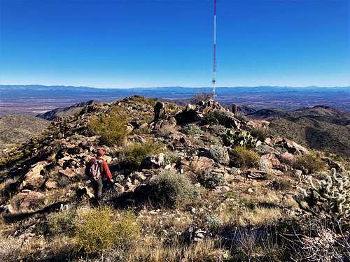
The highest of the Twin Peaks, Twin Peaks East, is 3,780’ and it is the third highest summit in the White Tank Mountains. A saddle sits at about 3,490’ between it another unnamed point that doesn’t even have a number associated. It appears from Google Earth™ to be 3,749’. This is Twin Peaks West.
Reaching these summits involves a lot of hiking distance, however, it can be done as a straight-forward day hike from the north via Arizona State Lands.
There isn’t a whole lot of information online about these two summits, despite them being relatively accessible.
The best time to hike the Twin Peaks is wintertime. It can be done in spring or fall if done early, but given the length of the hike, it is best to do in winter to avoid overheating and rattlesnakes.
Getting There
While the Twin Peaks can be approached from the east via Mesquite Canyon, that is a very long route. If taking established routes, it is 17 miles total. While there are options to make it shorter, that would require a ton of route-finding.
Alternatively, from the north, there are two starting points that can accomplish this same task in 13 ½ miles, all of it on road to the saddle, with minimal route-finding required. This route is via the D Mark Road leading up to the Tower Road that leads to Barry Goldwater Peak.
Here’s how to reach these two access points – because it can be confusing. Off the Sun Valley Parkway heading east, there are a couple starting points. The problem is you cannot access them heading west. You need to turn around at one of the turn-around spots every mile or so along the road.
The first trailhead entrance is located at 33.6604, -112.5704. Blink and you will miss it, so make sure to use the coordinates provided.
The second trailhead is located at 33.6604, -112.5824, also 243rd Avenue. Blink and you’ll miss that one as well. Coordinates are needed.
Have your State Lands permit on the dashboard. Parking is more available in the first trailhead, while the second trailhead has only about three parking spots.
Sun Valley Parkway is reached from Arizona State Route 303.
Route
The saddle between the two summits is roughly 6 ¼ miles from either trailhead.
For the first trailhead – take the road generally straight south-southwest for 1 ½ miles.
For the second trailhead at 243rd Avenue – take the road generally south for 1 ½ miles. For the first half a mile there are two roads that parallel each other but eventually meet up.
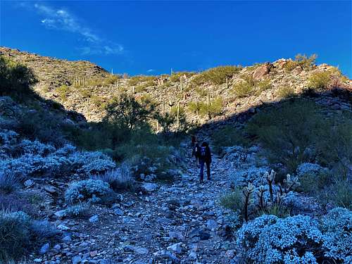
The roads from both trailheads generally meet at the same point – at the Tower Road. Take the road as it heads slightly southwest, southeast of a nearby hill. After a mile or so, the road starts going directly north.
Finally, the road starts gaining elevation quickly, while the quality of the road deteriorates significantly. This is generally because the main tower road servicing Barry Goldwater Peak and Radio Summit from the south is also used for the towers below Twin Peaks East.
Eventually, the D-Mark Pass is reached at just under 3,000’. From here, the Twin Peaks come into view. It is about a mile to the saddle between the two peaks. The road descends less than 30’ before reascending about 525’ to the saddle.
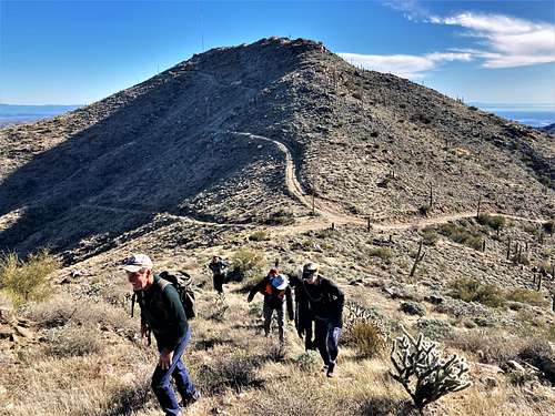
Once at the saddle, the route to either summit is straightforward, because they are both very close, with minimal distance required to reach them.
For the lower Twin Peaks West, just head straight up. It will take less than 10 minutes to reach the top.
For Twin Peaks East, there are a couple options. There is a road leading up the peak towards some towers located just east of the summit. You can take the road to the towers which are reached in about 0.4 miles. Then just hike up the hillside to the summit which is about 250 yards away. You only gain about 95’ to the summit, but most of that happens directly above the towers, so it is a little steep.
Alternatively, just walk a quarter mile up the road, and go straight up the side. This is steep, but doable, and takes no longer than if walking to the towers. Alternatively, you take the longer way up, and the shorter way back down to the road.
The total elevation gain is roughly 2,500’, +/- based on the trailhead used and whether taking the shorter or longer way up to Twin Peaks East. Both involve about 13 ½ to 14 miles to reach both summits. The only off-trail sections are the final stretches to each summit, but those sections aren’t a challenge. The first part of the hike is relatively flat, easy, road walking.
Red Tape
Both parking areas are on Arizona State Lands. Keep a copy of the permit on your dashboard and carry a permit on your person. It is unlikely that you will be searched on the road, but possible your vehicle will be checked. To download and purchase an Arizona State Lands Permit, a one-year permit can be purchased here for $16.
If approaching from the east via Mesquite Canyon, you must go through the White Tank Mountain Regional Park. The park is closed during the night and charges a $7 fee to enter per vehicle. It is open 6 a.m.
External Links
Twin Peaks East – Lists of John: https://listsofjohn.com/peak/77154