
|
|
Mountain/Rock |
|---|---|
|
|
33.62690°N / 112.5436°W |
|
|
Maricopa |
|
|
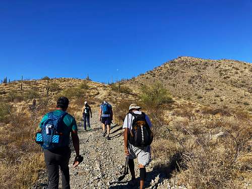
Hiking |
|
|
Spring, Fall, Winter |
|
|
3185 ft / 971 m |
|
|
Overview
The White Tank Mountains are a 13 miles north/south mountain range that separates suburban Phoenix from pure isolated desert. While the southern and central part of the range are quite popular, the northern part of the range is very rarely visited.
The northernmost ridge of the White Tank Mountains contains two summits located only 0.8 miles apart from each other. They are fairly accessible, and a fairly easy route can be used to summit them both. There is no set trailhead for these summits, however, the most direct route is from a parking area on Arizona State Lands. There are options from White Tank Mountains Regional Park, but these require some route-finding.
The best time to hike these summits is wintertime. It can be done in spring or fall if done early morning, but given the length of the hike, it is best to do in winter months to avoid overheating and rattlesnakes.
Getting There
The best route to these peaks is from the north. The northern trailhead entrance is located at 33.6604, -112.5704. To get there from Surprise, AZ drivers will need to drive out on Sun Valley Parkway, and then take a U-Turn and drive back to the starting point. Leave your State Lands permit on the dashboard.
If wanting to hike from the southeast within White Tank Mountains Regional Park, take the Olive Road exit off of the 303 and travel about 5 miles west through farms, new homes and desert to the entrance kiosk. Pay your entrance fee and follow the main park road.
Once in the park, there are a couple options from the Sonoran Loop Competitive Track or the Mesquite Canyon Trailhead. Either are about the same hiking distance as from the northern route, except with some route-finding and good study of hiking trails in the Park required. This is why it is recommended to hike from the north.
Route
From the north, the goal is to reach the saddle between the two summits, which is roughly 3 ½ miles from the trailhead.
Take the road generally straight south-southeast for about 0.8 miles. The road reaches a junction. Take a left and continue for about four-tenths of a mile. Another road goes north to the right of a small summit. Continue for another 0.8 miles to the junction with the road to the saddle. Take this for about 1 ½ miles to the saddle gaining about 1,000 feet.
Once at the saddle, take a right for Light No. 1 Benchmark or a left for Peak 3185. For Light No. 1 Benchmark, it is a third of a mile to a road heading up to the summit. This steep road gains about 265’ in less than a third of a mile.
For Peak 3185, from the saddle take a left and hike for a little under a mile and find a high spot on the road. Before it descends leave the trail and walk up the ridge to the summit.
Combined, reaching both summits requires less than 11 miles of hiking, gaining a little over 2,100’. The only off-trail portion of this hike is 300 yards and 170’ up to the summit of Peak 3185, which is pretty benign.

As noted above, the summits can be reached from the southeast. A park map and satellite maps are useful in planning these routes. See the Park Map: https://www.maricopacountyparks.net/white-tank-mountain-regional-park-wt/
However, the northern route remains the simplest way to reach the summit.
Red Tape
The northern parking area is on Arizona State Lands. Keep a copy of the permit on your dashboard and carry a permit on your person. It is unlikely that you will be searched on the road, but possible your vehicle will be checked. To download and purchase an Arizona State Lands Permit, a one-year permit can be purchased here for $16.
If approaching from the east via Mesquite Canyon, you must go through the White Tank Mountain Regional Park. The park is closed during the night and charges a $7 fee to enter per vehicle. It is open 6 a.m.
Given the northern route is a better option, and the State Lands Permit lasts for one year, this only strengthens the recommendation to approach from the north.
External Links
Hiking route from the north – Lists of John: https://listsofjohn.com/tr?Id=25909&pkid=77808