
-
 11558 Hits
-
 82.48% Score
-
 15 Votes
|
|
Mountain/Rock |
|---|---|
|
|
46.93980°N / 121.26447°W |
|
|
Hiking, Scrambling, Skiing |
|
|
Spring, Summer, Fall, Winter |
|
|
6473 ft / 1973 m |
|
|
Overview
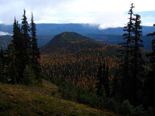
Goat Peak is located just off Highway 410 near Mount Rainier. Having slightly over 800 feet of prominence, it stands proud above nearby terrain and offers great views of Mount Rainier to the west and the Stuart Range to the north. It also lies just far enough east from Chinook Pass that it is clear much more often then peaks just a little further west. In the fall the display of western larches is beautiful. This is the best time to visit this peak right when the color is at the peak around the end of October.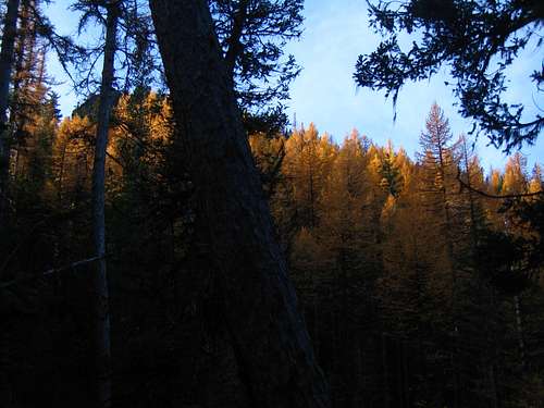 Larches on Goat Peak trail Larches on Goat Peak trail | 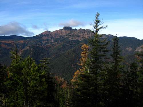 Larches on Goat Peak trail Larches on Goat Peak trail |
Getting There
From Seattle
If you are coming from the Seattle area, there are two main routes to the trailhead. During the summer season, when Chinook Pass is open it is best to take SR 167 south from Renton and continue on SR 410 heading east. Pass through Buckley and Enumclaw and enter Mount Rainier National Park. Continue past the White River Road and bear left at a junction. If you continue right, you will end up heading south on SR 123. Heading left, you quickly begin climbing up Chinook Pass. From the pass, descend east for 14 miles to Hells Crossing, where the highway crosses the American River for the frist time. Just past this bridge is a large pull-out which marks the Goat Peak trailhead. From downtown Seattle, this drive is 100 miles and takes about 2.5 hours. If Chinook Pass is closed, you will need to drive I-90 east to Ellensburg, continue east on I-82 to Yakima than take US 12 west for 17 miles and bear right onto SR 410. Once on SR 410 continue 31 miles to the trailhead at Hells Crossing.
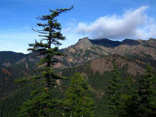
 Beautiful view from Chinook Pass
Route - Goat Peak Trail
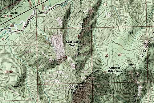
This peak has a trail heading the entire way up. It begins right at the trailhead next to the bridge. You want to make sure and take the trail heading left (the one going up). It starts climbing up through forests of pine and larches, follows a small stream a bit then switchbacks up the north slopes before following along the north ridge to the summit. Just before reaching the summit you will pass a signed trail junction for the American Ridge Trail. Don't take this trail but continue to the right. Views of the gold and yellow western larches can be found everywhere in the fall. This trail is fairly steep and offers no flat sections making it a good training hike. It's four miles long each way and rises 3,200 feet.
 Larches on Goat Peak trail Larches on Goat Peak trail | 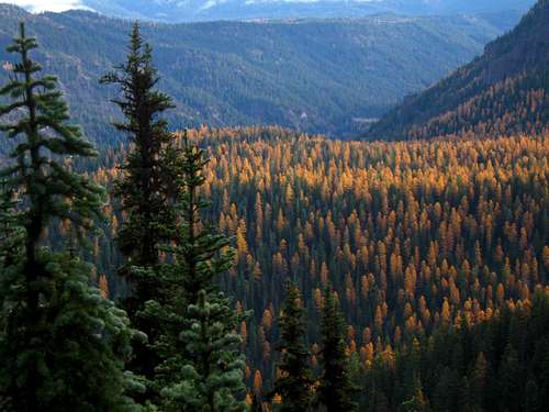 Larches on Goat Peak trail Larches on Goat Peak trail |
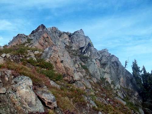 Goat Peak summit
Views of Fifes Peak across the valley are quite impressive.
 Fifes Peak across the valley Fifes Peak across the valley | 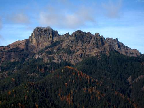 Fifes Peak across the valley Fifes Peak across the valley |
Camping
There are a few good camp grounds along Highway 410 between the trailhead and Chinook Pass including the Pleasant Valley, Lodgepole, Hells Crossing, and Pine Needle Campgrounds. All these will require a fee. You could camp off the highway at the trailhead as well but camping along the trail doesn't make much sense as this is nearly always done as a day hike.
Red Tape
This trail enters wilderness so no motorized vehicles or bikes are allowed on the trail. A NW Forest Pass is NOT required to park at the trailhead!
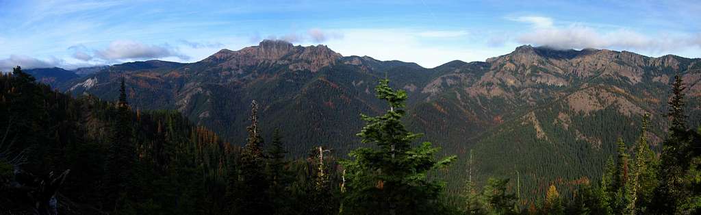
Summit Views
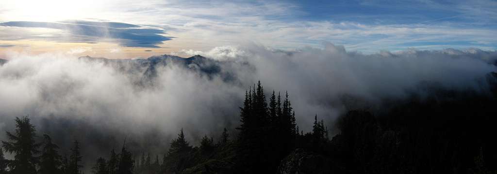
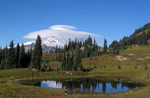
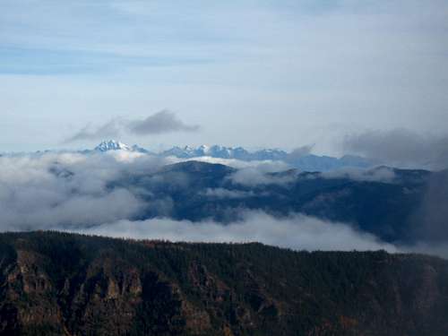 Stuart Range from Goat Peak Stuart Range from Goat Peak | 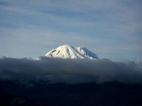 Mount Rainier from Goat Peak Mount Rainier from Goat Peak |
Map
External Links
See NOAA for a weather forecast for the peak.
See NWAC for an avalanche forecast during the winter.
See this page for more great information about the peak including the American Ridge Trail and more photos.
excosray - Jul 24, 2013 3:35 am - Hasn't voted
NW Trail Pass? noWhen I asked at the Naches RD on July 26, 2013, I was told the Hell's Crossing trailhead to Goat Peak does NOT require a NW Trail Pass and indeed there was no requirement sign posted at the trailhead either.
Matt Lemke - Aug 1, 2013 6:45 pm - Hasn't voted
Re: NW Trail Pass? noThanks for the update! Actually, I believe it is now illegal for the Forest Service to require people to pay to park anywhere just as long as you don't use any provided facilities. I never buy one. I will update the page.