
Viewing: 1-1 of 1

chugach mtn boy - Sep 7, 2013 10:45 pm - Voted 10/10
NiceCool idea for a page
Viewing: 1-1 of 1
|
|
Trip Report |
|---|---|
|
|
Nov 30, 0000 |
|
|
Hiking |
|
|
Spring, Summer, Fall |
While the places of the Midwest unmistakably wither in comparison to the Appalachians and the vast scenic areas of the West, I have found some to be enjoyable in their own light. Within a collection of summaries about several trips of mine throughout the general Midwest, I offer observations and opinions regarding what the region has to offer. This is not an exhaustive piece concerning all the recreation opportunities, but it does include at least a fair representation of each of the following areas.
Almost exclusively, the state of Illinois is a sleepy blanket of smooth farmland. But near the confluence of the Ohio and Mississippi Rivers, unglaciated land harbors hilly and sometimes rocky terrain that distinguishes itself within the state. The Shawnee National Forest preserves the area's interesting places, most notably the Garden of the Gods Wilderness. Southwest of Garden of the Gods a dozen miles, there lie the most convenient access points to another designated wilderness area, the Lusk Creek Wilderness. I hiked in for a first look at the Indian Kitchen trailhead in the southwest quadrant. The trail through hickory and oak was especially soft and muddy for a foot traveler. Some wet conditions were understandable following an extended rain that preceded my visit, but heavy equestrian use leaves the trail sunken, potholed, and even more conducive to retaining water in all seasons. It is just something that comes with the trail system. While the two miles to Indian Kitchen are relatively uneventful, the reward at the end justifies the efforts taken through and around the trail mud. Farther east along the northern banks of the Ohio River, there rests a long tract of interior plateau wooded ecoregion that is preserved as the Hoosier National Forest. On one fleeting late afternoon, I rushed into the Buzzard Roost Recreation Area for the first time. The trail at Buzzard Roost traces the edge of the forest along an elevated view of the wide, low-lying Ohio River. It is a short walk even from the more distant parking area to the trail's end, but the roost lifted me high enough above water level to see a nice section of the waterway. Where an adjacent creek suddenly cuts down the ridge into the river, the trail follows it to the general state boundary with Kentucky at the river bank. I grabbed a souvenir rock from this leaf-littered creek, tossed it in the river, and then took another one to keep. I spent almost as much time hiking the trail as I did chatting with a pioneering camper along the trail. He had parked his camper-van along the trail at probably the best single viewpoint, a noteworthy sight once I realized he must have literally driven the van a short distance on the hiking trail to get it there. At the end of the most recent ice age, glacial meltwater runoff from the Wisconsin Glacier started to carve through areas of sedimentary rock in current-day western Indiana. In the centuries to follow, Sugar Creek and its tributaries have continued this erosion to form an oasis of outdoor recreation amongst the grain fields. Indiana has organized two state parks here within a few miles of each other: Turkey Run and Shades. This environment was interesting, but my expectations of accompanying peacefulness were wholly unfounded. The nature preserve was hopping with hikers and curious floaters who paused to explore one bank or the other. The latter group was undoubtedly the largest, loudest, and most intoxicated segment of the park's visitors. Sugar Creek was virtually choked with vacationers drifting along westward in canoes or inner tubes. There must have been hundreds on the river inside the park at any one time. Inside Rocky Hollow, one of the jewels of the park, it was particularly crowded. The hollow started near the river as a wide bottom lined by high walls of an estimated fifty feet in places. As the trail ascended north, the walls steadily closed in and airborne mist intensified. Around each bend of the hollow was another terrific scene of lush vegetation and mist; the micro-environment sort of had this rainforest feel to it. Eventually the creekside trail funnels into the cramped chasm at the north end of the hollow, and the trail merges into the waterway that smoothly cascades over the sandstone. From the northern end of Rocky Hollow, I continued to explore the nature preserve westward through Bear Hollow, another waterway encased in sandstone walls. In Boulder Canyon on the west edge of the preserve, I found my only respite of quiet ambience. Boulder Canyon had one interesting rock overhang that formed a theater-like shallow cave, which was slowly being bisected by the erosion of water flowing into it. This was the roughest section of trail that I encountered in the park. In relative terms, it was indeed about as close as this area comes to featuring boulders and canyons. Just as I was climbing down through a narrow chasm into Falls Canyon, a tempest announced its impending arrival in the skies, and the solid rain soon followed. The trails thinned out, but the boisterous river floaters were just as unphased as me. I must have passed a hundred more of them on my hike back east to the covered bridge, which was fittingly packed with shelter-seeking hikers. The most lasting impression that Turkey Run conveyed to me was its crowds. Shades State Park, though only ten miles farther upstream along Sugar Creek, has offered me a much quieter experience. The terrain is essentially the same as Turkey Run, given their close proximity, but with only a fraction of the visitors. While I found no individual places as terrific as Turkey Run's Rocky Hollow, the trail through Pearl Ravine comes close. Going counterclockwise around the Trail 2 Loop, I started inside a small gully flanked by sandstone. That gully steadily grew into a wide ravine complete with cliff faces on each side. Top to bottom, the ravine may come close to a hundred feet of relief. Trees obscure many of the potential lines of sight from the park's ridges, but from the viewpoint on Lover's Leap, adjacent to the Trail 2 Loop, I was able to find a few decent views through the gaps of the forest. Additional trails through Frisz Ravine and Kintz Ravine lead from the park interior to Sugar Creek. The walls through these gullies are packed more tightly, and ladders are built into the trails to negotiate the occasional sheer drops of the waterways. Such traits make it harder to avoid the muddy sections, but for the majority of the route there is rock on both sides and underfoot, which is a nice surprise in the Midwest. The access to Sugar Creek was especially rewarding to me in autumn, when the creek was lower and the fall colors were in bloom. Turkey Run State Park, Indiana: B- As is the generally the case for the Midwest's roughest terrain, direct or indirect glacial activity played a key role in the Driftless Area. This regional pocket of relatively pronounced hills and valleys escaped the flattening effects of history’s most recent continental ice sheets. The region includes northeast Iowa and southwest Wisconsin, as well as small pieces of Minnesota and Illinois. It particularly stands out from the surrounding lands when one is driving into it. An even grid of straight and level roads suddenly dives into twists, crests, and valleys. This sudden transformation is plainly visible near Iowa’s White Pine Hollow State Forest. Surrounded by miles of gently rolling farmland, a low-lying oasis of trees hides a large valley. I suppose in hindsight, since this was just rural Iowa, I let down my guard concerning navigation. I apparently missed following the correct waterway and ended up hacking through wild brush and thorns to reach a random corn field to the east. The field was not my intent, but since I was in it, I followed it west to the access road near my car. When I came within view of my car, there was some stranger staring curiously into it. He turned out to be a nice guy doing some observations of the natural area, apparently in addition to my automobile interior, so I eventually forgot all about it. He recommended a visit to Turkey River Mounds or the Yellow River State Forest. I was thinking about the latter already, so I drove north alongside the mighty Mississippi to the forest. I registered to occupy one of the free walk-in campsites at Yellow River State Forest, but right away, I could see this place was not quite the same as White Pine Hollow. The local terrain was comparatively gentler, and the trails were used as forest roads. Many of the paths were stamped with tire tracks. Along the road to my backcountry campsite was evidence of fresh logging. I staked my tent and took a shot on the Red Oak, Firetower and Saddle Trails, but all of them disappointed me in the same way. This is why I liked Iowa’s White Pine Hollow so much; it was surprisingly wild terrain that appeared to be undisturbed. The Yellow River State Forest, however, appeared to be neither wild nor undisturbed. The most enjoyment I received was when I bushwhacked steeply down from the Saddle Trail out of sheer boredom. At the base of the hill beside Paint Creek was a pretty meadow of blue flowers. I was pleased to find that, but without much enthusiasm, I shuffled back from there to my tent for the night. On the eastern edge of the Driftless Area, Blue Mound State Park bills itself as the highest hill in the southern half of Wisconsin. As recreational visits in the region are mostly limited to this and other state parks, this park predictably had a fairly large area of family-oriented developments, but it also linked to the wild forest with a thorough trail system. More than anything else, the trail names are what lured me to this particular park. These include Basalt & Papper, Gneiss & Smooth, and my personal favorite, the Holy Schist Trail. Most trails were primarily geared toward mountain biking, but they were decent for hiking too. I walked several trails on the park’s east side, and they were most notable for the unique dolomite scattered all over the ground. Blue Mound is actually a monadnock, meaning the hill was formed by erosion of the land surrounding it, while the resistant dolomite served as a protective shield. In places where windows had been cleared into the forest, I could gaze a fair distance down to the neighboring Wisconsin lowlands, but most of the park was average to me. White Pine Hollow State Forest, Iowa: B Kentucky has its share of terrific mountains along its eastern border with Virginia. Closer to its Midwestern neighbors along the Ohio River, the Bluegrass State is predictably much more subdued. About halfway between, the districts of the Daniel Boone National Forest demarcate the rolling hills from the western edges of the Cumberland Plateau. Inside lies a wide band of terrific outdoor destinations, just within a relatively short drive of Indiana and Ohio. Some of Kentucky’s most striking features were a short distance to the north anyway. Natural Bridge State Resort Park lies tucked inside the Cumberland Ranger District of the national forest. I crossed a pedestrian bridge over the Middle Fork Red River and entered this park of dramatic local elevation changes around a large plateau. Several trails accessed the plateau; I chose the Balanced Rock Trail on the east edge. There were nice places for an amateur climber like me to scramble up the rocks, as well as interesting formations to admire. None were more amazing than the natural bridge itself, the roof of a large arch eroded into the remaining plateau. The symmetrical and blocked characteristics of the natural bridge are remarkable, both the work of nature's steady hand. I hiked the trail up to the bridge and explored the plateau northward to check out the available views for a while. Of course, the same color limitations of late winter applied here, but the sights were still the neatest I have seen in the Bluegrass State. On my way back from the arch, I picked up a pale blue souvenir rock from one of the plateau walls along the trail, and then I trotted back down to the Middle Fork to call it a day. After that brief taste of the gorge at Natural Bridge, I took advantage of an autumn weekend to explore it further within the designated Red River Gorge Geological Area. The Red River Gorge is not a single gorge, but a network of gorges and ridges where every open ridgetop view will present a sight to behold. Routes 77, 715 and 15 can be used for a nice grand circle tour of the gorge, and I decided to start mine going clockwise from the Nada Tunnel. The neat traits of this tunnel were unknown to me until I followed another car right into it. Nada Tunnel is one-sixth of a mile long and just one lane wide, but fortunately no cars from the other side met me in the middle. After a stop at the Gladie Center for mandatory overnight registration, I crossed over the Red River to Sky Bridge in the south half of the geological area. A short loop trail here goes over the Sky Bridge arch, out to some cliff-edge views, and back beside the arch on a different plane. Much of the return hike traversed beneath overhanging rock; this greater erosion at the bases of rock walls is a common feature here. Whistling Arch, a mile to the south of Sky Bridge, was less of a typical arch and more of a tiny window bored into a sandstone mass. But this arch was noteworthy for the terrific views it yielded after a short scramble to the top. This particular pocket of forest showcased some bright autumn colors close and far away; it was a great place to stop for a while. Continuing south, I made an attempt to park for the evening and camp somewhere along the Rough Trail, a seven-mile designated path that meanders west-east through the heart of the area. It started out as a quality trail through colorful and rugged ground, but very quickly my pace slowed because of navigational issues. It was very difficult to distinguish any semblance of trail from the carpet of yellow leaves lying as confetti on the forest floor. For a mile or two, I followed what I thought was the Rough Trail, and I passed by enough backcountry campers along the way to support my asserted route. Eventually, I acknowledged the growing risk of getting lost and I backtracked my way to the trailhead to improvise a new camping plan. Immediately to the east was the Clifty Wilderness, accessible by a few trails including the Sweet Camp Creek Trail from Rock Bridge Arch. I decided to walk past this arch on my way to an eventual backcountry campsite, and this was my best decision of the day. Of the many arches in the gorge, Rock Bridge Arch is the most amazing to see in person. Unlike other arches deemed to be bridges, this one is just what the name implies - a natural bridge over an actual creek. All the water was still, Creation Falls is another fine photo opportunity along the trail just to the west. The best place in the gorge for sightseeing was on the Auxier Ridge, a few more miles northwest on Tunnel Ridge Road. I decided to make a loop of the ridge's three trails, and my day began inauspiciously enough on a closed forest road to Double Arch. Walking a mile on a forest road eliminates any sense of wilderness spirit and much of the enjoyment for me, but things got better when I reached the proper Double Arch Trail. This path traced the outside of a long wall of stone, circled around it, and ascended to the aptly-named destination. Like Rock Bridge Arch, Double Arch was a unique oddity that was unlike any stone formation I had encountered before. It is worth the hike to see front and center. After a quick backtrack, the Double Arch Trail intersects with the Auxier Branch detour to the main Auxier Ridge Trail. Courthouse Rock sits at the end of these trails, on the northern tip of Auxier Ridge, and it is the most obvious rock formation in the immediate vicinity. It is climbable, albeit with more effort than the simple stroll needed to get there. A crack in the sandstone on the formation's east face is suitable for a chimney climb and scramble right to the roof of the ridge. The reward is a series of clear views nearly three-fourths of the way around. The most direct route from trail-end to trailhead is via the main Auxier Ridge Trail. Like the summit of Courthouse Rock, the trail is packed full of great scenes showcasing the unique topography of the region. In all directions, an intricate web of ridges stand suspended above the adjacent valleys, and almost every ridge is flanked with sheer rock faces. The area is heavily forested, yet the sheer faces create limitless clear lines of sight for pictures and general viewing. Hikers can make the trip as safe as they desire by staying away from the edges, where the views are basically the same, and bypassing the climb of Courthouse Rock. I believe the area is at its best in autumn, where the cool air and often-clear skies meet the peak of foliage colors. But even at any other time of year, Auxier Ridge is a wonderful place for a day hike. Middle Sheltowee Trace Area, Kentucky: C+ (London District of Daniel Boone National Forest) Upon my first foray into the Upper Peninsula, I was amazed at the density and continuity of the northern hardwood forests. All of the roads skirted walls of trees surrounding each bend, and those walls went unbroken for seemingly hours. At the far west of Michigan's northern half, there lies the wonderful Porcupine Mountains State Park. In my visit, I perused my map at the park office and left content to hike some interior forest trails. But a few miles southwest on South Boundary Road, the trailhead to Summit Peak and Mirror Lake yielded a strong first impression of resistance. Momentarily after I stepped outside, an aggressive swarm of flies wasted no time harassing me. When I thought something was on the backside of my arm, I discovered a spot of blood about the diameter of a pencil. On my other arm, there were alarmingly several such blood spots shining in a random arrangement. I was aware that insects could be significant in places of the Northwoods, but I never thought it would involve a quantity of open wounds on this scale. I retreated quickly to the shelter of my car, where I wiped away the messes and pondered a solution. I had no insect repellant with me, so I considered that already to be a hard lesson learned. Though it was pretty warm outside, my best option was to cover all my skin with long sleeves and pants and continue. On my second attempt of the Summit Peak Trail, my defensive tactics made things stuffy but tolerable. I soon reached the viewing tower built upon the peak and, high above the flies on the forest floor, I was able to peacefully take in the scenery. The forest canopy from this peaceful view was a smooth rolling green carpet that stretched far to the Lake Superior horizon under a white smearing of clouds. But back on the interior forest floor, the black flies resumed a vicious attack. There was soon not a second that passed where I was not flailing my arms to sweep the flies away. It really sapped the enjoyment from this hike, to the point where I abandoned it altogether and forged another hasty retreat to my car. Later, I took the paved road to Lake of the Clouds. My first view of the lake was impressive. The immediate elevation differences were much more pronounced here than the areas I had already been today. From the high escarpment north of the shore, I could see the entire body of water extending about one and a half miles toward Cuyahoga Peak. It was a shimmering dark blue with brilliant green forests ringing every inch of its banks. I followed the pink bluffs along the Escarpment Trail in both directions to observe the forests and picture the vistas at each overlook. Farther east in the Upper Peninsula, also along the shoreline of Lake Superior, is the beautiful Pictured Rocks National Lakeshore. The protected lakeshore stretches about forty miles from western sandstone cliffs to eastern sand dunes and beaches. It is bounded on either side by vividly colored waters or dense woodlands. Back to the west half of Pictured Rocks, the namesake lakefront bluffs attract more hustle and bustle than the backcountry beaches, and they do so for good reason. They are striking to see up close, whether the views are from floating vessels or atop the ledges themselves. Mineral stains add varying shades of grays and browns to the walls, which are surrounded by greens and blues from the trees above and the brilliantly hued waters below. Miners Castle, a noteworthy rock formation on the shore, offers both a pleasant photograph and good trailhead to access this terrific section of the North Country Trail. Heading east of the castle, the escarpment temporarily moves inland to permit a stretch of sandy beach, and then it returns back to shore to form the area's most striking rock faces. It is all part of the Niagara Escarpment, which is traceable eastward through the full Upper Peninsula and beyond. Farther east of Pictured Rocks, nearing the eastern extent of the Upper Peninsula, the Mackinac Bridge connects Michigan's peninsulas over the Straits of Mackinac. Crossing the bridge is a treat in itself, as is the Hiawatha National Forest scenery that welcomes all northbound travelers. I lingered for a couple of days backpacking a North Country Trail section through the Hiawatha's eastern district. Redundant for me to say, the forest stretches forever. It is a cathedral of evergreens randomly interspersed with smaller deciduous trees. Most of the ground is grassy with occasional moss-covered rocks, reminders of the ancient mountainous area this used to be. Within the Hiawatha, I encountered no others on the North Country Trail over several days, aside from a moose or two. Porcupine Mountains, Michigan: B- (Really a terrific place, but black fly season leaves haunting memories) The most viable mountain range in the Midwest rises in northern Minnesota, high above the north shore of Lake Superior. These are the mountains of the Sawtooth Range, a weathered line of ridges, cliffs, and high points remaining from voluminous lava flows a billion years past. The Sawtooths' elevation reaches above 2000 feet inland from Superior, but it is the peaks adjacent to Superior that provide the most spacious views. In the spaces between, a litany of cascading rivers have carved a series of deep gorges in the bedrock. Covered by many diverse tracts of northern forest, it is a unique environment that I began to explore northeast to southwest on a spring weekend. A grand view above the forest awaits all visitors to Pincushion Mountain, about a three-mile outbound hike away from a Superior Hiking Trailhead north of Croftville. That hike has its own share of spectacles on the way, thanks to a traverse of the rugged Devil Track River Gorge. The cascading waters of these North Shore rivers all lose a lot of elevation over a short distance to the big lake. For the Devil Track, it is over a thousand feet in under ten miles. Every view of the river along this section of the Superior Hiking Trail was one of rapids in varying turbulence. After crossing it via a trail bridge, the ascent is short but steep to the Pincushion Mountain spur trail, which runs the length of its summit table to open views. It was here on Pincushion that I could see dozens of lakeshore miles fronting the serrated Sawtooth ridges to the south. This admirable panorama is a must-see for any hikers in the northern reaches of the Minnesota Sawtooths. Continuing southwest along the range, I spent the substantial part of a day exploring the Carlton Peak area of the Superior Hiking Trail. This was personally my favorite area of the whole North Shore. From the easily-accessible trailhead on Britton Peak, I first hiked to the adjacent top of Britton for a view of Carlton Peak to the south, and then I proceeded toward Carlton. The trail within this section sees high traffic and it is very developed. There are well-groomed gravel surfaces as well as boardwalks over the soggy parts of the Carlton Creek valley. About midway between Britton and Carlton, the trail twisted through an environment of countless birches. Their white trunks gleamed in stark contrast to the otherwise gray pre-spring landscape. Several miles southwest of Temperance River, I reconnected with the Superior Hiking Trail to enter Tettegouche State Park. Two of the more popular destinations within Tettegouche were part of my itinerary - Mount Trudee and the Baptism River's High Falls. I reached the river first on my long westbound hike and the falls were roaring. The high water volume and colorful rocks created an impressive sight, and the abundant mist in the air quickly cooled me down. I shared the sight with quite a few others. This park contains numerous developed amenities in close proximity to the falls and other features, so it sees a fair amount of visitors comparable to Carlton Peak. Foreseeing a quieter morning later, I continued west into the forest. Just beyond the proper North Shore, I found time to visit a place on the map named Jay Cooke State Park. There was absolutely no idea in my mind about what to specifically expect, but as it turned out, this park was worth the stop. The Saint Louis River has carved through the land here about ten miles from a meeting with the extreme western tip of Lake Superior. Inside the river valley, the grounds were scattered with giant boulders of dark gray slate. They were uniquely tilted at angles or fully upright above the waters. The rocks and slabs provided a way to hop across parts of the river to some of the water rapids, and I grabbed one tiny piece as a souvenir rock. Since the day was just beginning, I hiked a good part of the early morning along the river before the park was even officially open. No other visitors arrived until I was just leaving - a nice park to have to yourself during a quiet sunrise.
Northern Sawtooths - Cascade River/Magney, Minnesota: B I headed kind of blindly into southeast Missouri - without a relevant regional map - just awaiting a familiar point of reference. That reference appeared in Fredericktown, and it was under an hour’s drive from there to the Bell Mountain Wilderness. I loaded my backpack with a day's supply of food and water at the trailhead, and then I disappeared into the wilderness. The elevation change here is naturally minimal; around 600 feet of gain lies between the trailhead and highest point. But the trail is still a nice climb to the Bell Mountain Loop Trail junction, and it yields pleasing scenes. None were more visually attractive to me than the igneous glades common to this area. These random grass meadows were naturally clear of forest because of exposed igneous rock. When the sun would shine through a gap in the clouds, it really made these rocks stand out to the naked eye in shimmering purple, so I grabbed one as a souvenir. After a leisurely return hike down the west slope of the mountain, I toured out of the Mark Twain National Forest to some nearby attractions. Clustered in the same general area as Bell Mountain, there is the loftiest point of these highlands at Taum Sauk Mountain, as well as interesting rock formations at two adjacent state parks. A few miles downstream of the Shut-In Creek valley I viewed yesterday, the East Fork Black River flows freely, except for the occasional blockade of hard rock. One such example lies in Johnson’s Shut-Ins State Park, where a tough exposure of ancient rhyolite turns the river into a series of tumbling narrow channels. The broad river valley upstream suddenly constricts with steep walls on each side of the channels. Between the tiny pockets of water, the rock is scattered like a checkerboard of limitless pathways to hop and jump from one side to the other. Much of the gray igneous rock looks like it has been polished to a smooth shine. Once I worked up a bit of perspiration scrambling over the riverbed and up the valley walls, the river itself was served as a cool respite. My last stop in the Saint Francois area was Elephant Rocks State Park, a quirky area of giant pink granite boulders. This is a very developed park with one accessible paved trail ringing the full perimeter of the most noticeable boulders. Inside that perimeter, it is a free-for-all of fun scrambling for amateur climbers. The rocks look like they have simply been plucked and set down on top of a mammoth granite exposure, but some of them weigh many tons, making them anything but mobile. Their origins actually lie underground and erosion has revealed them over time. The biggest rocks, bearing resemblance to elephants that spawned the park name, are three times taller than the average person. I clambered over the big boulders until I was content, ate lunch, and left these highlands very impressed with their variety and opportunities for enjoyment. Overall, the Saint Francois Mountains are wild and enjoyable settings with pleasing panoramas, rustic hikes, and eye-catching rock formations. The end of Marblehead Peninsula, with its share of local ferries and boats, is the gateway to Ohio’s Erie Islands. The islands are organized as sort of a conglomerate of state parks: Catawba Island, Kelleys Island, the Bass Islands, and a few more. Kelleys Island, a state park interspersed with the island’s community of permanent residents, was the most convenient island for me to visit using a regularly-scheduled four-mile ferry ride. After a few minutes, I had seen all there was to see, so I walked over to the nearby North Shore Loop Trail. After walking a half-mile or so through the damp understory of this skinny forest, the trail drew near to the lakeshore and I cut through to it. All along the northern coast of the island stretches an alvar habitat of limestone bedrock and sparse soil. These limestone outcrops meet the water's edge and take the cumulative abuse of the season's waves and freeze-thaw cycles. The rock ledges are uneven and fractured, spanning the spectrum of grays from bleached to darkened. They are not especially tall. At their highest, they lifted me perhaps fifteen feet above the water level, although that was enough to give me better views of nearby Pelee and Middle Bass Islands, and even a distant glimpse of the Canadian shore on the horizon between. I balanced my way around the ledges and protruding rocks for a while east along the lake, and then I reversed course and did the same on the more rugged and exposed shore going west. Clumps of moss affixed themselves around the edges of several damp rocks near water level - it made for treacherous rock-hopping for as long as I was daring enough to try it. A satisfying lunch on the highest ledge seemed like a better idea than further tempting fate on the slippery surface boulders. The lake stretching north of my picnic site appeared more blue than beside the mainland, a nearly seamless blend into the cloudless sky. Its surface was dotted with distant fishing boats in every direction. They seemed motionless from my view, only an occasional hum of an engine ever indicated otherwise. It was an especially peaceful setting, ideal for reading a while after my meal. I took a souvenir rock from the shore here as I left. With the rest of the time I had before my ferry departure, I explored the first fraction of a mile along the interior East Quarry Trail. Rock quarrying fills a large part of the island's developed history - there was another large example directly adjacent to the Glacial Grooves site - and this pit had filled with enough water to create a large lake. The path around the perimeter of this lake offers some decent views, but as a man-made landform, I could only look at it with a certain mindset. Needing a mention is Inscription Rock, on the south shore of the island, on which is etched a largely-weathered native pictograph that is centuries old. The interpretive displays allow you to imagine how it must have looked before erosion took its toll. The sun was beginning to set as I made my first arrival to Wisconsin's Apostle Islands National Lakeshore. In all candor, some means of aquatic surface travel is needed to explore the core of the park - its numerous islands northeast of the Bayfield Peninsula. Without such means, my experiences were limited in scope, as is this summary. Staying rooted to the mainland, I accessed the lakeshore at Meyers Beach to absorb the wonderful sights. The water here was much more vigorous than it was at other points I visited earlier in the day. The repetitive crash of the waves provided a neat contrast to the soothing light on the western horizon. I stayed until twilight, which seemed to descend relatively late at this northern latitude around the summer solstice. A walk to the northeast on the Lakeshore Trail directed me towards an area of sea caves, unseen to hikers except on the bitterest of cold winter days when the lake surface turns into a sturdy floor of ice. I was left to my imagination concerning everything but the setting sun, agitated waves, and sandy beach. Apostle Islands National Lakeshore, Wisconsin: B Cool idea for a page
Garden of the Gods provides backcountry hiking access as well as the developed Pharaoh Campground for a $12 nightly fee. The immediate area is notable for eye-catching rock formations and some of the most dramatic relief in the state. Both traits are showcased abundantly on the garden’s Observation Trail. Hiking on a crisp spring morning with the trail to myself, there appeared to me a quaint collection of sandstone formations peeking over the deciduous forest. Pillars and hoodoos are the sort of shapes I only expect to see far away in the intermountain west. But here they were, tucked inside the heartland of America. These hoodoos presented some fun bouldering possibilities and camera-worthy views from atop the highest ones. I clawed my way up a few of them and had a great time doing it for a couple of hours. The trail also passes by some inviting entrances to the forest as it snakes through the stone towers. I explored one of them and grabbed a souvenir rock from the sloping forest floor below. For anyone wishing to see some quality scenes the Land of Lincoln can offer, I would recommend the Garden.


 An Indian Kitchen viewpoint.
 Lusk Creek's clean waters ahead of a canyon wall.
A hiking-only path network branches into the Lusk Creek Canyon Nature Preserve from Indian Kitchen. Only a short walk later, the precipice of an impressive canyon appears, one with more immediate vertical relief than the preceding two miles of access trail altogether. On both sides here, the stone walls are predominantly sheer cliffs that can approach a hundred feet high. Inside one bend of Lusk Creek, there is a gentler slope that leads down to the waterway with only one slightly precarious spot to negotiate along the way. This access point affords an opportunity to hike beside the creek and a terrific expanse of high canyon walls. The bit of dry creekside land lasts for only a limited distance, but in times of low water further exploration may be feasible without a canoe. The water is pristine, the cliffs are striking and the trickling water coming down them is serene. In my estimation, this is the single most stirring background in the Shawnee.
Lusk Creek Wilderness is also traversed by the River-to-River Trail, along its route from rivers Wabash to Mississippi. The same caveats about mud and horses apply here, but my hike in this area lacked the scale of dramatic formations that the canyon harbored downstream. Lusk Creek is just as unspoiled at these northern river crossings, which are rustic fords through knee-deep water. As part of an afternoon loop, I explored a creekside path linking two of them in particular - Bowed Tree Crossing and Old Guest Farm Crossing. The blue waters and subdued rock exposures make it a pleasant creek to hike beside.
 Lusk Creek, here bounded by stone walls.
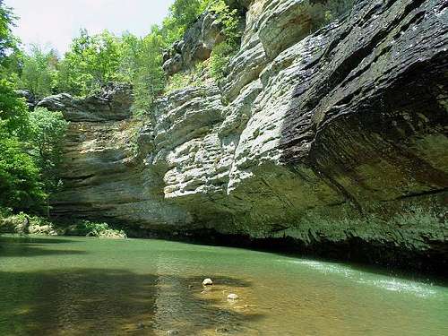 Water drips from a sheer Lusk Creek Canyon cliff.
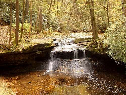
After I hiked back along the Ohio, I hurried north a few miles to the Hemlock Cliffs area. Though it was getting very dark at the time, I took to the trail with my flashlight to get a general sense of the Hemlock Cliffs area. Gray cliffs line both sides of the valley to form a neat natural corridor, and the trail follows it to a magnificent natural amphitheater of rock. Though it was barely a cave in terms of depth, the volume of the formation was impressive. I explored it with the flashlight before making the return hike under a moon-lit sky.
 Buzzard Roost to Ohio River.
 Creek at Buzzard Roost.
Shawnee National Forest, Illinois: C+ (includes automatic bias against my original home state Illinois)
Hoosier National Forest, Indiana: CIndiana's Sugar Creek Valley
In my first proper visit to the Sugar Creek Valley area, I visited a crowded Turkey Run State Park. This recreation area has parking for hundreds of vehicles, possibly even a thousand when you include the adjacent businesses catering to tourists. Although it was an ordinary non-holiday weekend, it looked like most spaces were in use. Visitors were everywhere as I loaded my pack for a day hike through the Rocky Hollow-Falls Canyon Nature Preserve.
The amenities were bustling, but I figured the nature preserve would more sparse. On this day, there was a four-mile round-trip detour via Narrows Covered Bridge (one of many in this region) to reach the preserve. The trails here conveyed that hiking feeling more than I expected. This was not a leisurely walk through the woods. The trails undulated up and down between various exposures of sandstone - maybe not enough to make me forget it is Indiana, but enough to leave my resting pulse rate behind. Beech and maple trees around me were tall and thick, and virgin stands of hundred-foot black walnuts towered as high as anywhere else in the state.
 Sugar Creek at the Turkey Run confluence.
 Vegetation inside the preserve hollows.
 Sandstone face near the northern banks.


 Descending on Boulder Canyon Trail.
 A theater-like rock overhang at Boulder Canyon.
 Trail through Shades' Pearl Ravine.
 Lover's Leap viewpoint of Sugar Creek.
Shades has a backpacking option available to anyone who wants to contribute a nominal fee to the Indiana Department of Natural Resources. The Backpack Trail itself does not visit any dramatic stone features; it is more or less a winding walk through the deciduous forest. Near the designated backcountry camping area, the trail encounters a barren stretch of power lines and a service road, eliminating any rustic feel that may persist to that point. This is the only backcountry area between the two state parks, so I really see the area as more suitable for day hiking than backpacking. For hiking, the Sugar Creek valley is the most enjoyable natural landscape within a hundred-mile radius. Given the sizable regional population base and lack of many outdoor alternatives, it is no wonder that even a generic Saturday can bring visitors in relative masses to Sugar Creek. But it is a wonder that they all flock to Turkey Run, leaving Shades as the quieter alternative in the Sugar Creek valley.
 Aftermath of a sandstone fall.
 Sugar Creek in autumn.
Shades State Park, Indiana: BIowa & Wisconsin's Driftless Area
 Walls of White Pine Hollow.
In my visit to White Pine Hollow, I started north from the forest entrance on a well-marked path, but it instantly dissolved into a myriad maze of indistinguishable game trails. There were no maintained trails in my sight and no map in my possession, but I charged ahead anyway. The hollow was a great chasm underscored by the forks of a tiny waterway, the Little Turkey River. The creek forks flowed by some significant rock escarpments and surprisingly steep valley slopes bursting beautifully with lively spring growth. Those bullying glaciers may have tried to create pervasive monotony over all of Iowa, but they failed here. I followed the river generally north for a couple of miles before I took a souvenir rock from the riverbed and aimed to return.


 Yellow River wildflowers.
Moving on from Yellow River, I decided to leave for southeast Minnesota. On the Great River Road, I entered a sharp landscape of hills and ridges around Great River Bluffs State Park. Although the past glaciers did not directly cover this area, they still managed to affect it in other ways. Glacial melting in the latest Ice Age fueled a gigantic Mississippi River, which stretched across for many miles and carved into the ancient bedrock. Those extremely high waters have since subsided, leaving river bluffs along the sides. I first visited the Kings Bluff Trail and hiked less than a mile to its best available overlook. The sheer river-facing sides of Kings Bluff and Queens Bluff are protected as state natural areas, so I hiked farther east in my search for an unobstructed vista. Although I understand why they are protected, I do wish all of the bluff areas were accessible, because it felt like I had to settle for second-best. I eventually found the best available sights at a clearing named South Overlook. It took some effort, because the trail network is ambiguous in places (for example, South Overlook is somehow north of East Overlook). Miles of the braided Mississippi were visible from here, as well as the ancient eastern river banks very far in the distance. This waterway must have been quite a sight just after the Ice Age.
 Kings Bluff Trail in Great River Bluffs.
 South Overlook in Great River Bluffs.
 A small window to see miles from Wisconsin's Blue Mound.
Yellow River State Forest, Iowa: D
Great River Bluffs, Minnesota: B-
Blue Mound State Park, Wisconsin: CKentucky's Cumberland Plateau
In the London District of the national forest, part of the northern Cumberland Plateau, twisting gravel roads lead into the woods and the S-Tree Recreation Area. My first visit was in the evening of an unrelenting downpour that saturated the grounds through the following morning. Under clearing skies above this oak and hickory forest, I gathered my things and started on the Renfro Loop Trail. Several areas of the trail were mud pits or standing water pools. At first, I made a concerted effort to hop around these spots, but later I just resigned myself to the mud. Most of my enjoyment was found just off-trail, as I sort of wandered through the dripping wet forest adjacent to the maintained trail. Hidden in the numerous hills and valleys of the plateau, I found exposed rock formations, soggy meadows, and brimming creeks. The loop went about four miles through the forest before returning to camp, at which point I took a short hike on the nearby Sheltowee Trace National Recreation Trail. I have read that it is a great trail extending three hundred miles through Kentucky, but I must have found one of its less remarkable sections. My short hike went through a couple of ordinary valleys missing the variety I had seen on the Renfro Loop. Once I ran into a pack of off-road vehicles sharing the trail, I quickly decided this was not the area for me.
 Rocks on Renfro Loop.
 Bog on Renfro Loop.
 View from Natural Bridge.
 Underneath the bridge arch.


 View above Whistling Arch.
 Down in the valleys on the Rough Trail.

 Double Arch.
 Courthouse Rock.
 A mid-trail viewpoint.
 Along Tunnel Ridge Road.
 Courthouse Rock's summit view.
Red River Gorge Area, Kentucky: A (Cumberland District of Daniel Boone National Forest)Michigan's Upper Peninsula
 Lake Superior shore at Porcupine Mountains State Park.
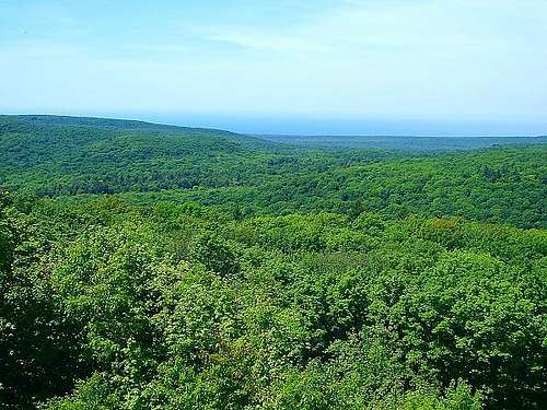 Porcupine Mountains from Summit Peak.
 Lake of the Clouds.
If I circled back around to the lakeshore, I figured I could possibly enjoy a beachfront free of the annoying black flies. I made the drive and stopped first at Union Bay on the park’s northeast edge. There were wonderfully no insects here to ruin the day. I took advantage of their absence to slow down and snack on the beach. Later, I waded out into the moderately cold water to discover a neat characteristic of the lake. Walking was difficult on the uneven rounded rocks, but each time I stepped farther away from shore, I could only see the same level carpet of rocks ahead. I never found out exactly how far the shallows extended, but according to the park map, it appeared to be a half-mile in some places. I took one of the rocks from the lake as a souvenir.
 Forest on the Escarpment.
 Layers of Escarpment.
 Lake view below ridge top.
 Miners Castle viewpoint in Pictured Rocks National Lakeshore.
Among many opportunities from which to choose, my first trek here was into the Beaver Basin Wilderness in the center of the park. From the Little Beaver Lake trailhead, the hike was 4.6 miles to a designated backcountry camping area at Pine Bluff, miles which wandered mostly along forested ridges and bluffs high above this sandy and remote section of shoreline. Never more than a few steps from the trail, past any trees rooted between trail and ledge, there was an expansive vista of deep blue Lake Superior out to the horizon.
My campsite felt very isolated in a positive way; the beach appeared empty for all the miles I could see. The ground atop these bluffs was clean, light-colored sand, nearly as white as the beaches themselves. Those beaches are strewn with rounded rocks and driftwood, and the lake tends to pound them with ferocious waves. The setting was wonderful for a leisurely lakefront stroll to satisfy the rockhound curiosity inside me and otherwise relax. Later, in this otherwise silent northwoods forest, the waves provided a nice soundtrack to sleep beside.
 North Country Trail, west of Pictured Rocks' Mosquito Beach.
Eventually, I encountered a wonderful area at the mouth of the Mosquito River, about five miles from the castle. The sandstone here drops into the lake as a series of tables above, at, or just below the surface. There was a secluded cove next to the east edge of the lakefront cliffs that I thought was great for a short swim, despite very cold water. Just a short distance into the water, the tables abruptly stop and drop into a deep blue abyss. Although the waters were chilly, the sunlight on this day was enough to warm me quickly, and I found the cove to be an inviting place to stay a while.
 Upper Falls, Tahquamenon Falls State Park.
I did wish to see Tahquamenon Falls while I was in that area, and the Tahquamenon Falls State Park is just outside the eastern district of the Hiawatha. My understanding was that the Upper Falls were most marvelous, so I only went to that section of the park. Even with seasonally low water volume here in late summer, these falls are wonderful. The massive width of the falls is what sets it apart. There was not an entirely clear vantage point for a photo but the trail does take you right beside the powerful falls. This is a developed park, so it was about a one mile hike with ample pavement, and it was fairly crowded. But the North Country Trail, a common denominator in most great Upper Peninsula locations, does travel two directions into the wilderness from here for nice hiking possibilities. Something about the ambiance here makes it all seem appealing to me.
Pictured Rocks, Michigan: A
Hiawatha National Forest, Michigan: B-Minnesota's North Shore
 Brule River rapids.
 Brule's Upper Falls.
One of the many state parks spaced along the shore between Duluth and Grand Portage, C.R. Magney State Park is a developed frontcountry area that connects to miles of wild forests wrapped around the Brule River. Here the park trail flows north-south beside the river in conjunction with the Superior Hiking Trail. I shared its smooth, constructed surface with a host of other local tourists to the Devil's Kettle & Upper Falls section of the river. North from the falls, the trail turns more rustic and solitary as it slowly ascends the Sawtooth grade away from Lake Superior. Eventually after a few miles, the trail moves east out of Magney, over the Flute Reed River, and atop a ridge with lake views out to Isle Royale - making this a fine perch that I used for a quiet overnight stay.
 North from Pincushion.
 Devil Track River Gorge, along the Superior Hiking Trail.
 Sawtooth Range from Pincushion Mountain.
Carlton Peak's distinct rock faces came within my grasp after about a lazy hour's hike from Britton Peak. As I later discovered on an out-and-back hike to the Temperance River, the faces are most striking on the approach from the southwest. There is a lot of sheer local relief here. I played around within my average abilities on the southern rocks en route to the top, but there is a smooth trail that accesses the summit from the saddle between Carlton Peak and Tofte Overlook. As expected, the views from the top of both were very far-reaching. I preferred Tofte Overlook's panorama because it includes a lot of lakeshore, but during the autumn colors, I imagine either viewpoint would be tremendous.
 Carlton Peak's profile.
 Carlton summit, Tofte Overlook.
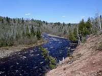 Temperance River.
 North from Mount Trudee.
 East from Mount Trudee.
On this afternoon journey to Mount Trudee, it seemed as if I was catching the very emergence of the warm spring. Compared to northerly Sawtooths from which I had just arrived, the trail through Tettegouche contained more green shoots beginning to grow underneath the aspen and birch stands. Songbirds were more vocal here - they noticeably broke the silence in many interior sections of forest - and mosquito repellant was more necessary. My hike undulated gently through a few water bogs and gentle inclines until I reached a sudden direct climb signed as "The Drainpipe." The top of this ridge presented another nice open view of Lake Superior, one that was perfectly situated as sort of a midway rest point.
After another steady hour going west to the Superior Hiking Trail junction and south on the blue-blazed trail, I reached the flanks of Mount Trudee. The quick and direct climb presented a view understandably similar in depth to those I had seen over the previous day. Had I arrived later in summer (or obviously in autumn), the colors certainly would have been more dynamic. But on this day, it was still fun to gaze around during a rest on one of the mountain's rocky perches. I waited until the lengthy daylight began to fade before hiking to a backpack camp, where I took shelter from a fast-emerging mosquito army. Insects rule the Sawtooths from late May through June. There is a tiny window of time after the snow melts before their onset, however, and I had just beaten the buzzer on it.


Central Sawtooths - Temperance River/Tettegouche, Minnesota: B+
Jay Cooke State Park, Minnesota: B-Missouri's Saint Francois Mountains
The loop itself is about eight miles after the two-mile approach, and it tours interior crests and dips of the forest on top of Bell Mountain. The trail was a rustic path obstructed by a few fallen trunks and patches of overgrowth, but I liked the accompanying undeveloped feel. I followed it clockwise past Joes Creek through hearty forests of oak, hickory and elm. The highpoint of the mountain rests on the backside of the loop, beside a ridge with sweeping views over the Shut-In Creek valley. The edge of the ridge is also bordered with more of the spacious purple granite meadows I saw on the approach. To my misfortune, a backcountry campsite on the edge was already occupied by the only other hiker I saw on Bell Mountain, but I found another site in the nearby forest and rested for the night.


 Overhead view of Black River.
 River approaching the shut-ins.
 Overlooking the shut-ins.
 Seeing the shut-ins at eye level.
 Downstream on the East Fork Black River.


Saint Francois Mountains, Missouri: A-Ohio's Erie Islands
 Dry Kelleys Island quarry.
 Flooded Kelleys Island quarry.
I disembarked and went clockwise around the shoreline drive of the three-mile diameter island. It took little time to reach the hiking trailhead at the North Shore State Nature Preserve. Just adjacent to this trailhead was the impressive Glacial Grooves State Memorial. The rock formations here were naturally hidden over time by the elements of erosion, but that organic material has been cleared to display a long series of rounded channels slowly carved during the Ice Age. Massive glaciers used stray rocks and boulders to gouge these channels as they crept along over time. Though smoothly sculpted at first glance, the grooves had a pretty rough texture to them from the recent years of exposure.


 Beginning of the alvar shore.
 Additional glacial evidence.
 Slippery ledges on Lake Erie.
Kelleys Island was the only island I visited, but with nearly all the islands & parks within a ten-mile radius of a single point, I thought it was representative of the area as a whole. The Erie Islands are a fine place to spend a warm spring day as I did, but in terms of repeat visits, I would put several other areas of the Great Lakes before them.
Lake Erie Islands State Park, Ohio: C+Wisconsin's Superior Shore
 Inlet at Meyers Beach.
 Choppy lakeshore waters.
 Lake Superior sunset on Meyers Beach.
Viewing: 1-1 of 1
chugach mtn boy - Sep 7, 2013 10:45 pm - Voted 10/10
Nice
Viewing: 1-1 of 1
Comments
Post a Comment