
|
|
List |
|---|---|
|
|
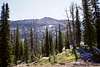
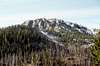
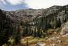
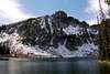
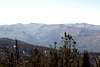
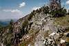
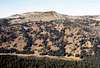
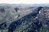
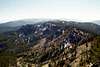
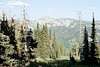
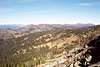
The Grassy Mountains
The Grassy Mountains are the westernmost sub-range of the extensive Salmon River Mountains of central Idaho.Criteria:
>= to 8,000 and named
or
>= 8,000 feet and >= 300 feet of prominence
Each entry includes:
*Name - with rank
*Elevation
*Prominence
*Location
*Photos
There are many worthwhile peaks below 8,000 feet that are not included, but this list most of the interesting points. Elevations may vary slightly from other sources for a variety of reason. Primarily if no stated elevation can be found, the value halfway between the highest elevational line and the next line that would be above it is used as an estimate. This list is similar to the one on the Grassy Mountains area page, but was created to include the same information with many more photos made available.
If you have a good photo of a mountain on this list, especially if the mountain is lacking a photo, please call it to my attention and I will be happy to add it.
The List
Patrick Butte - 1
8,841 - elevation
2,881 - prominence
45.3177N -116.2071W
 |
 |
 |
 |
|
|
Bruin Mountain (north) - 2
8,767
1,627
45.1760N -116.1189W
 |
 |
 |
 |
 |
 |
 |
 |
Bear Pete Mountain - 3
8,752
2,312
45.276N -115.9789
 |
 |
 |
 |
Hard Butte - 4
8,659
1,039
45.2605N -116.2090W
 |
 |
 |
 |
 |
 |
 |
 |
Bruin Mountain (south) - 5
8,607
387
45.1640N -116.1256W
 |
 |
 |
 |
 |
Peak (west of Black Tip) - 6
8,500
1,040
45.1530N -116.0807W
Granite Mountain - 7
8,478
1,713
45.0935N -116.2064W
 |
 |
 |
 |
 |
 |
 |
Peak (Mac Han Lake) - 8
8,420
800
45.1788N -116.0885W
Peak (Bear Pete Lake) - 9
8,375
515
45.2944N -115.9695W
Peak (Bear Pete Ridge south) - 10
8,349
529
45.2404N -115.9720W
Peak (south of Black Tip) - 11
8,340
320
45.1449N -116.0740W

Lava Butte - 12
8,328
748
45.2861N -116.1227W

Black Tip - 13
8,292
232
45.1551N -116.0745W
Squaw Point - 14
8,286
386
45.2177N -115.9706W
Peak (French/Little French divide) - 15
8,268
368
45.1982N -116.6644W
Sams Throne - 16
8,283
623
45.2986N -116.1243W
Peak (Hidden Lake) - 17
8,256
516
45.1378N -116.1357W
Peak (Lake/Partridge divide) - 18
8,253
393
45.3060N -116.2157W
Hershey Point - 19
8,232
392
45.3123N -116.1226W
Slab Butte - 20
8,225
765
45.0923N -116.1404W
 |
 |
 |
 |
 |
 |

 |
 |
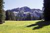
Peak (Grass Mountain) - 21
8,180
1,300
45.1535N -116.2008W
 |
 |

Peak (Grass Mountain) - 22
8,156
336
45.1636N -116.1956W
Peak (Bear Pete Ridge north) - 23
8,156
376
45.3266N -115.9777W

Peak (Grass Mountain) - 24
8,126
306
45.1780N -116.1867W
Peak (Piper Lake) - 25
8,101
521
45.3036N -116.2478W

Peak (Hard Creek Lake north) - 26
8,039
499
45.1779N -116.1462W
Peak (French/N. Fk. Payette divide) - 27
8,028
488
45.1792N -116.0424W