
|
|
Mountain/Rock |
|---|---|
|
|
50.70189°N / 17.10966°E |
|
|
Hiking, Skiing |
|
|
Spring, Summer, Fall, Winter |
|
|
1289 ft / 393 m |
|
|
Overview
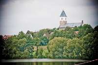
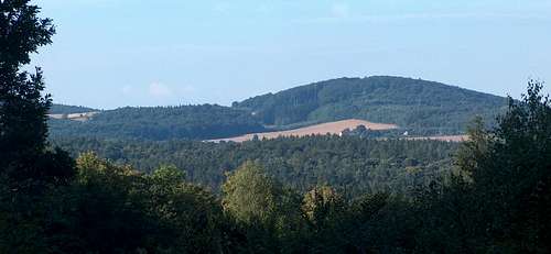
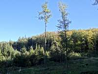 Gromnik from NW
 Early autumn tones
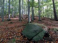 Granite boulder
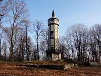 New outlook tower
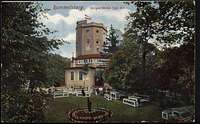 Old outlook tower
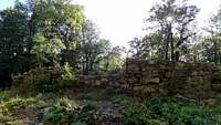 Castle ruins
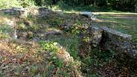 Castle ruins
Gromnik (393m, formerly Rummelsberg in German), is the tallest top of the range, if we can call it so, of the Stzrelin Hills (Wzgórza Strzelinskie), stretching from Strzelin to Ziębice over more than 20km, from north to south, and more than 5km wide in places.
Just like the mountain Ślęża, located at the same latitude few kilometers West, this range belongs to the Sudetes, depite being an exclave detached to it. From Ziębice however, the Góry Złote aren't so far. Gromnik, like most of these hills, are made of metamorphic granite, whose quality explains the presence of a huge former quarry near Strzelin.
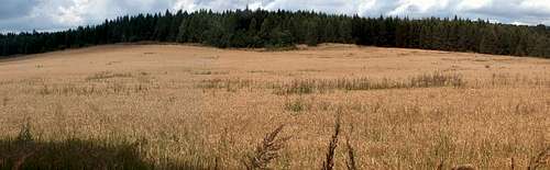
These hills are not a mountain range in the real sense of the term especially speaking height, but they cover a considerable area, quite undulated and steep, with beautiful mountainous vegetation (pines, larches, fir and beech trees...). They are stretched by countless forestry tracks and trails that fulfill the dreams of hikers and, more and more recently, mountain-bikers and even trail-runners. In winter, this is a perfect area for cross-country skiing too.
The top Gromnik is a long-ago visited place, where prehistoric pagan celebrations were taking place, similarly to Ślęża. In the middle-age, a medieval fortress was standing there. Across the centuries it slowly became a ruin, whose remains were mentioned as late as the beginning of the 20th century. Between the two world wars, Germans enhanced the top by building an outlook tower, with a mountain hut serving as well as a restaurant. With benches, umbrellas, clean grass and flowers, "Rummelsberg" was a fashionable place; on a postcard one would not tell it was a mountain top. When the East front neared at the end of the second war, it became a strategic military place, and was sub-consequently swept away by some aerial bombing.
From this moment no other new development took place on the site during the socialistic years, apart from some dodgy-looking picnic tables, whose bins were vomiting garbage. As late as 2008, someone visiting Gromnik would have been repulsed, finding only a pile of wild dumping on the site.
However, during recent years, conjoint effort from the surrounding localities and from the region led to a progressive rehabilitation of the top of Gromnik, which is one of the reasons that encouraged me to post this page.
Archaeological researches are currently being held in order to study the foundations of the medieval castle, whose perimeter and shape is nowadays well visible. There is also what seems to be the scene of an open-air theatre during the season.
Even better, in 2011 was erected a brand new outlook tower. However, this topic is quite controversial: unlike Wielka Sowa or the likes, the tower is not (yet ?) open to the public (excursions are organized by the surrounding villages, owning the key). But, even worse: the architects designed a too small tower, from where one cannot see anything but trees ! A tree-pruning operation is being studied in order to remedy to it...
 An unlucky outlook tower...
Getting There
 Autumn
 Pine trees
 No one is immortal
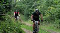 Strange sightnings
 Ślęża ahead
 Winter
 White road
 Summer
The Strzelin hills in general are accessible from a multitude of starting points dispatched on the perimeter of the area, but it's likely that most people will arrive from the North, from Wrocław or other exit of the A4.
For those seeking a significant hike in the whole area, Strzelin is the obvious entrance gate. It is also the best locality to arrive by public transports. Cross then the centre and get to the south of the town. Few meters after we pass the bridge over the Oława river, turn right and walk the street Ulica Sosnowa, which becomes the main red trail.
The lazy and motorized ones might find it quicker to park at the very foot of Gromnik, a little further than a village named "Romanów", over Biały Kościół and on the only road pass that crossses the range west to east.
Wyświetl większą mapę
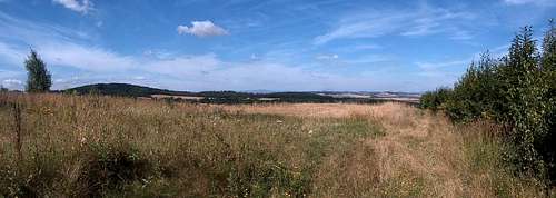
 Góry Złote in the distance
External Links
 Biały Kosciół
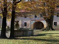 Henryków
 Henryków
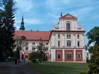 Henryków
 Ziębice
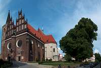 Ziębice
* Strzelin: There is unfortunately little to say from the purely touristic point of view about this town, owning few old houses, but made mostly of firms and blocks of flats. One can however wash bikes at the petrol station, or swim in the beautiful pool.
* Biały Kościół ("White Church" in Polish), is a pretty village owning a ... white church. There is also little lake with a summer resort, and a bike rental for those seeking to explore the area. To tell you how much this locality is into mountain-biking, a race is organized every year since... 2003, without any sponsor but local volunteering !
* Henryków owns a very famous Cistercian Cloister from 1270 that one must visit, as well as a beautiful park behind, popular for horse-riding.
* Ziębice is a beautiful medieval town, about the same size than Strzelin, but much more interesting to visit. There is a magnificent market square and lots of old churches and other medieval buildings. It is worth a couple of hours of visit.
* Dobroszów, Pogroda and Romanów are three close settlements at mid-distance in the heart of the massif. There is not much to say about them apart from some pretty houses in the typical Silesian style.
 Gromnik from Biały Kosciół
Red Tape
 Oak on the summit
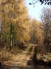 Larches magic
Hunting is taking place on Sundays from early morning to 14am. Usually trails within the hunting perimeter are barred with some orange tape, but not all the massif.
Herds of wild boars and deers are met...
Don't forget to check your skin: ticks are frequent, and if you hesitate about clothing, take long trousers and long sleeves...
Accomodation
 Ziębice
 Skalice
No mountain hut is located withing the massif. There are however few shelters in which people sometimes bivouac, especially one located at the junction of the red and blue trails north from Gromnik.
Due to the water resort, Biały Kościół is the place where most accommodations are found.
yatsek - Nov 29, 2012 4:50 pm - Voted 8/10
GeologyMetamorphic granite doesn't exist. Granite is an igneous rock. Gromnik is probably of granite (I've been there both on foot and on my bike, or rather carrying my bike :) but I don't remember what the rock was). The Strzelin Hills are composed of both granitoid rocks and metamorphic rocks.
yatsek - Nov 29, 2012 5:02 pm - Voted 8/10
More about the nameIt reads here that in the 15th century the German name was Romsberg, which literally translates as Gromnik.
visentin - Nov 30, 2012 2:37 pm - Hasn't voted
Re: More about the nameJust a question before I publish the changes, despite of my (modest) searches I have no clue what Gromnik means (something tells me it could mean fortified place but I just don't see how). In German too, I have no clue what Roms neither Rummels means...
yatsek - Nov 30, 2012 5:34 pm - Voted 8/10
Re: More about the nameThe Polish name means a hill that attracts thunderbolts. The problem is, although the text implies Romsberg means the same as Gromnik, online dictionaries don't seem to confirm that (I don't speak German). One thing is sure: The Polish name stems from the word "grom", which translates as "thunderbolt" in English.