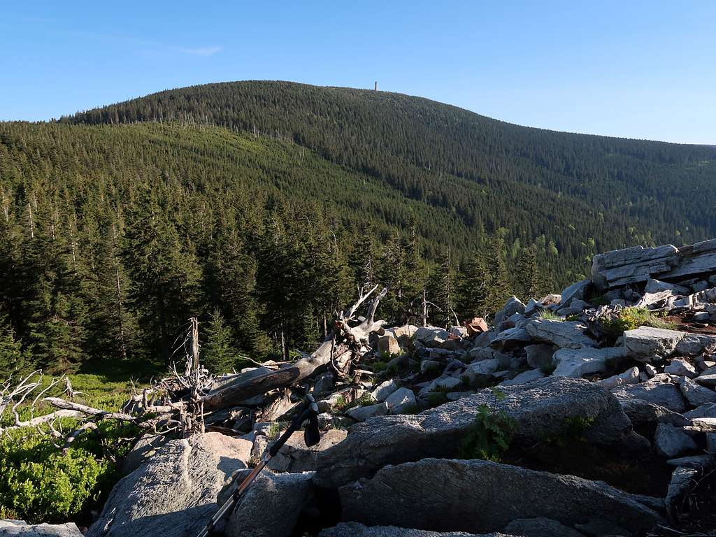
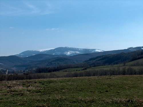
Śnieżnik (Polish)/Králický Sněžník (Czech)/Schneeberg (German) is the highpoint and the focal mountain of the Śnieżnik Massif (chapter 3). The elevation of the summit is 1425 m (or 1424 m according to the Czech maps), its prominence is 657 m. Its grass-covered summit dome rises about two hundred metres above the highest of the saddles that surround it. The second highest mountain within the massif, Mały (Little) Śnieżnik/Malý Sněžník/Kleiner Schneeberg, is nearly a hundred meters lower than Śnieżnik. Śnieżnik is the only mountain in the massif whose summit rises over the tree line. Besides, straddling the Poland-Czechia border, it is one of the peaks that make up the Crown of Poland's Mountains.
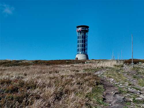
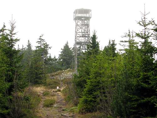
The blender
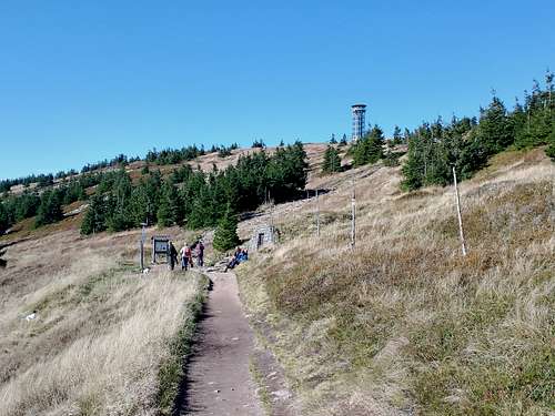
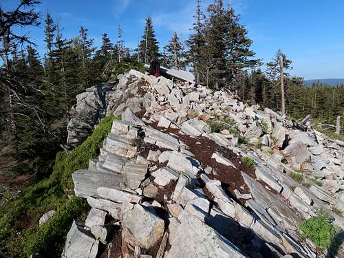
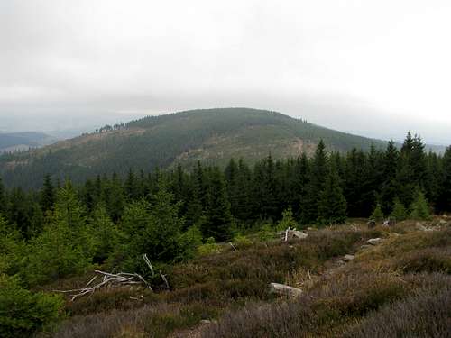
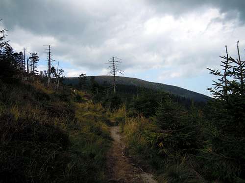
The top of Śnieżnik is broad and virtually flat. In September 2022 a controversial observation tower, nicknamed ‘blender’ and attracting crowds, was opened on the very summit. As Śnieżnik – apart from the Karkonosze range - is the only mountain in the Polish Sudetes that rises above the treeline, you didn't actually need a tower to have good views from the summit, or rather the summit area.
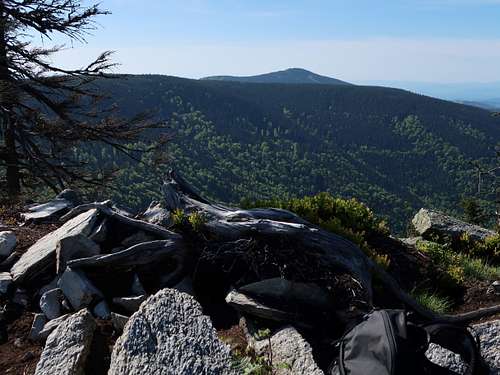
Tower view NE
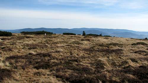
Summit view N
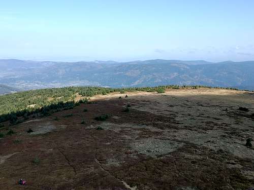
Summit view E
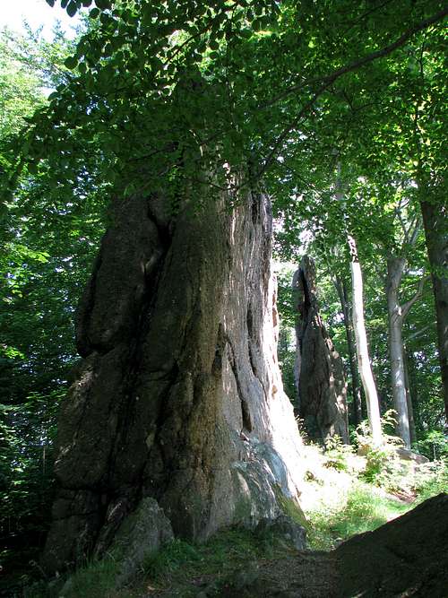
Please keep to the waymarked paths as the grass-covered summit dome of Śnieżnik is strictly protected as a nature reserve. The dwarf pine (Pinus mugo) is not a native species here but was introduced by man.
Source of Morava
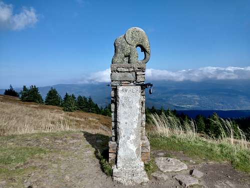
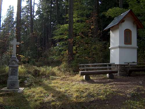
On the Czech side of the mountain, about five minutes' walk off the summit, at 1380 m is the source of the River Morava, which has been encased in a stone wall and is accompanied by an interpretive panel. Another few minutes' walk down the trail will lead you to where the Liechtenstein Hut stood until the early 1970s. Beside its ruin is a lone statue of an elephant placed here in 1932 by a society of young artists who were also mountain lovers. For Czech hikers, the elephant has become a symbol of the mountain.
The elephant
Name
The name of the mountain derives from the word snow. Śnieżnik is covered by snow over 200 days per year. Snowfalls might occur in August, the last can happen as late as June. The full Polish name of the mountain is Śnieżnik Kłodzki, referring to the nearby town of Kłodzko. The Czech name, Králický Sněžnik, after the town of Kraliky, distinguishes the mountain from another Sněžnik in the Czech Republic, Decinsky Sněžnik. The old German names Glatzer Schneeberg and Grulicher Schneeberg mean the same as the Polish Śnieżnik Kłodzki and the Czech Králický Sněžnik respectively, since Glatz and Grulich are the German names for Kłodzko and Kraliky. Austrians often use the name Spieglitzer Schneeberg after what was once called Spieglitz, now part of the Czech town of Staré Město.
Śnieżnik Massif
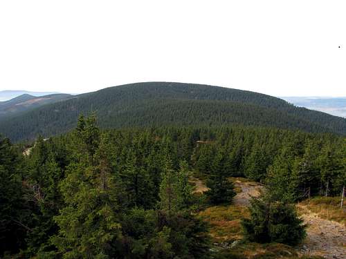
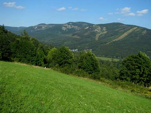
The Śnieżnik Massif is the second highest, westernmost mountain group in the Eastern Sudetes. Its western slopes fall into the Kłodzko Basin. The northern boundary, if the foothills are included, will be the River Biała Lądecka. The eastern limit is less clear within the confines of Poland, and is supposed to be formed by the River Morawka. Płoszczyna/Kladské Pass (817m) on the Polish-Czech border separates the Śnieżnik Massif from the Bialskie Mountains, which are part of the Złote (Polish name)/Rychlebské (Czech name) Mountains. The eastern boundary of the massif in the Czech Republic is obvious: the valley of the River Krupá (beyond which, less than ten kilometres away stands the highest mountain group in the Eastern Sudetes, namely the Hrubý Jeseník). Finally, to the south the Śnieżnik Massif reaches as far as the west-east stretch of the River Morava east of the town of Králíky. (The river has its source just below the summit of Śnieżnik, flows south within the massif and takes a sharp turn left on leaving it.)
Śnieżnik from WSW
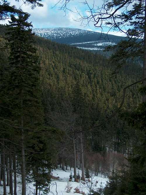
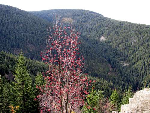
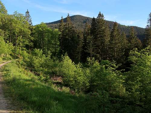
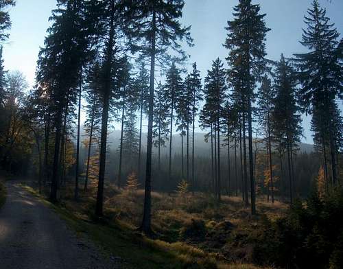
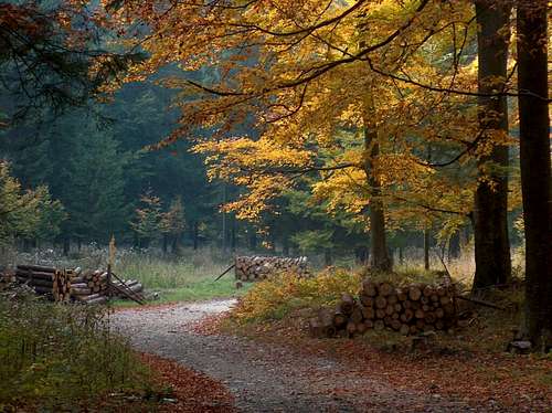
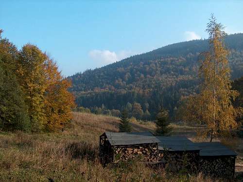
The vast forests of Śnieżnik Massif consist mainly of spruce. At lower elevations beech can also be common. Among the animal species which live in the area are the chamois and mouflon, but these elusive animals (brought in the Sudetes by man) keep away from the human paths. Much more common are red deer, whose herds can be observed at dusk or dawn in the clearings dotting the woodland. Among the other animal species which can be seen or heard are the black grouse, capercaillie, raven, common European adder, fire salamander.
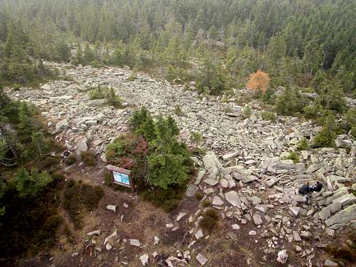
Rocks
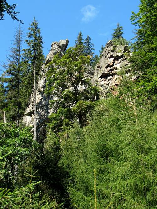
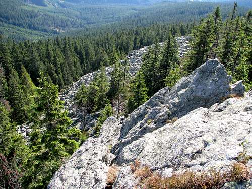
The rocks of the massif are ancient. They were formed during the Proterozoic and Paleozoic eras and consist primarily of gneisses and crystalline schists. Among them occur lenses of marble, and consequently caves. There are not many rock formations within the massif but patches of bare rock - little groups of rocks as well as blockfields - do occur within the forest, as a rule off the marked trail.
Ridges
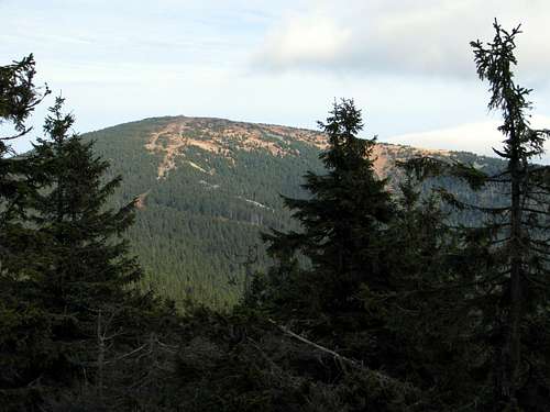
Besides Śnieżnik, three other mountains within the massif reach 1300 m, namely Mały (Little) Śnieżnik/Malý Sněžník/Kleiner Schneeberg at 1326 m on the Poland-Czech Republic border; Sušina/Dürre Koppe at 1321 m and Podbělka/Lattichberg at 1307 m in the Czech Republic. These summits are located on two of the six ridges that protrude from below the summit dome of Śnieżnik, forming the backbone of the massif.
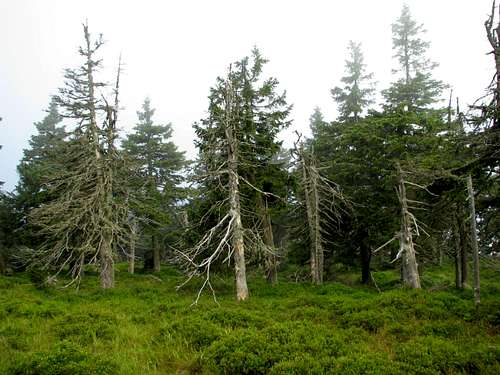
SW ridge with the summits of Little Śnieżnik (1326m), Puchacz/Hleďsebe(1175m) and Trójmorski Wierch/Klepáč (1145m) is part of the main ridge forming the border between Poland and the Czech Republic. The southwest ridge - fairly wild, no doubt the most attractive of all the ridges - makes for a long, interesting and convenient descent route from Śnieżnik if you rely on public transport, since the ridge ends near both Polish and Czech railway stations. The most interesting mountain on the way is Little Śnieżnik at 1326m, whose six meters lower, southern summit is called Goworek/Hraniční skály. The mountain is all covered with forest, whose highest growing trees have taken on weird shapes as they grow near the timberline, which the summit does not reach. Many of the trees died in the early 1980s, when the woodland was heavily affected by acid rains and assaulted by insects.
SW Ridge
Dead forest on Mały Śnieżnik
Śnieżnik from Mały Śnieżnik
Puchacz/Hleďsebe
On top of Peak of Three Seas
Down by the tower
Trójmorski Wierch at 1145m, which has a simple, wooden lookout tower on the top, owes its Polish name - which translates as Peak of Three Seas - to the peak's being the junction of three major watersheds. Most of the main ridge of the Śnieżnik Massif constitutes the boundary between the drainage basins of the Nysa Kłodzka – a tributary of the Odra/Oder, which flows into the Baltic Sea – and the Morava, which discharges into the Danube (which flows to the Black Sea), but on the south side of Trójmorski Wierch begins Liptovský Creek, whose waters – via the Orlice, then the Labe/Elbe – end up in the North Sea. The Czech (Klepáč or Klepý) and the old German (Klappersteine) names of the summit are believed to refer to the clatter you hear while walking over the blockfields which cover considerable parts of both the top and the sides of the mountain.
Sridge with Sušina/Dürre Koppe (1321m) and Podbĕlka/Lattichberg (1307m), where Czech bunkers built before World War II can be seen
The south ridge
E ridge, the other part of the main ridge (and the Poland-Czechia border), dropping steeply to below 950m at a pass called Siodło Martena or Głęboka Jama, then continuing to Płoszczyna/Kladské Pass (817m)
On the east ridge
NW ridge, called Żmijowiec, running to Czarna Góra (1205 m)Czarna Góra from Stroma
Nridge with Stroma (1167m) and Młyńsko (991m)
Stroma from N
short W offshoot: rather flat, with Średniak at 1210m
Średniak on the left
Away From Summits
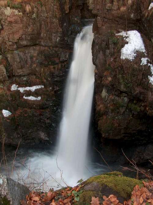
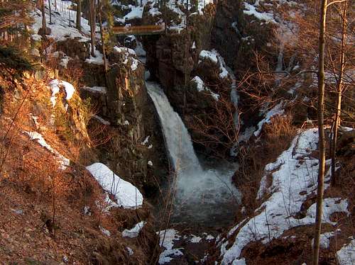
Wodospad Wilczki (Wilczka Falls)
Located in the town of Międzygórze on the River Wilczka, this is the second highest waterfall in the Polish Sudetes (after Kamieńczyk Falls in the Karkonosze). Wilczka Falls is 22m high. In fact, until 1997 the waterfall was 5 metres higher. Then a huge flood destroyed its top, which turned out to have been man-made. Wilczka Falls and its surroundings are a nature reserve. Unfortunately, the water can still smell of sewage.
Jaskinia Niedźwiedzia (Bear Cave)
The cave - discovered in 1966 - is 3.3km long, which makes it the longest cave in the Sudetes. It is located in the side of a mountain called Stroma, near the village of Kletno. The cave became famous when the skeleton of a cave bear as well as remains of other Pleistocene creatures were found in it, but it is the few, but nevertheless beautiful, stalactites and stalagmites that draw tourists here (guided tours only). Official site of the cave
Czech caves
There are also caves in the valley of the Morava River, south of the summit of Śnieżnik, on the Czech side. The most interesting of them is Patzelt Cave, named after a ranger who fell into an underground pond in there while walking through the forest. No marked trail leads to the cave, which is located nearly half a mile east of a resurgence (karst spring) known as Mléčný pramen. Bear in mind a visit can be dangerous.
Pasterskie Skały (Shepherds' Rocks)
Like a row of gigantic fins formed of conglomerate, these rocks mark the crest of a hill near the village of Idzików, at the western foot of the Śnieżnik Massif. As legend has it, seven shepherds were turned to stone here. Topos for rock climbers can be found on wspinanie.pl.
Pod Strašidly falls
Pasterskie Skały
Pasterskie Skały
Red Tape
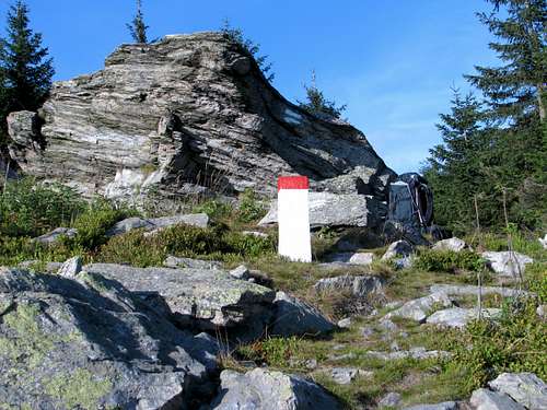
Most of the Polish part of the massif is protected as Śnieżnicki Park Krajobrazowy (Śnieżnik Scenic Area). Similarly, most of the Czech part has been designated a nature reserve (Národní přírodní rezervace Králický Sněžnik). Camping is illegal. The top of Śnieżnik is strictly protected - you are only allowed to walk along the marked trails there.
According to the Polish authorities, the trail from Międzylesie to the hut below the summit of Śnieżnik, which runs along the SW ridge (red, then green marks - see the SW Ridge chapter) is closed in winter. The same goes for the blue trail from the village of Jodłów. (The reason is that in recent years some people have got in trouble there due to difficult navigation in inclement weather.)
Maps
A good paper/waterproof/digital map (and many more maps that are not that good) can be purchased online or in any city/bigger town in Poland, also in Międzygórze.
The biggest town near Śnieżnik is Kłodzko. This little city is located approximately 80 km south of Wrocław, the capital of Lower Silesia, to which it is connected with E67 (and a railroad). From Kłodzko drive south, along DK (national road) 33, to Żelazno, past Bystrzyca Kłodzka and Niedźwiedna, then turn left to Międzygórze. Another option is to take the road to Stronie Śląskie (from Żelazno), then to drive further south to Kletno or Kamienica.
There's a through train from Wrocław to Międzylesie (and a bus from Domaszków to Międzygórze), and a bus from Wrocław to Stronie Śląskie.
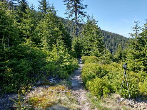
There are plenty of both marked and unmarked trails in Śnieżnik Massif. The usual traiheads are in the villages of Międzygórze (via the red marks less than 2.5 hours' walk up to the summit), Kletno and Kamienica.
Międzygórze
Czarci Gon
Kletno
Sněžník from NE
River Morava
Shrine by the trail
Czech side
All trailheads are located ten to thirty km northeast of the town of Králiký, which is on Road I/43, just 5 km away from the border with Poland.
The standard route is marked yellow, runs from the village of Horní Morava (or Dolní Morava), has been recently turned into an interpretive trail and really is interesting but is also the most frequented.
From Strbrnice, past the Návrší Hut via blue marks and then by red/yellow marks: Much less frequented but the ascent is fairly boring until the trail nears the crest of the ridge.
From Podlesí (train) or Vojtíškov via blue marks, or from Sklené via green marks, to Sušina, then by red/yellow marks - fairly mudddy, concrete bunkers built before World War II between Sušina and Podbĕlka.
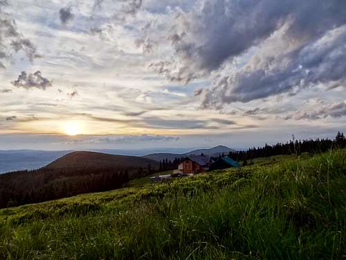
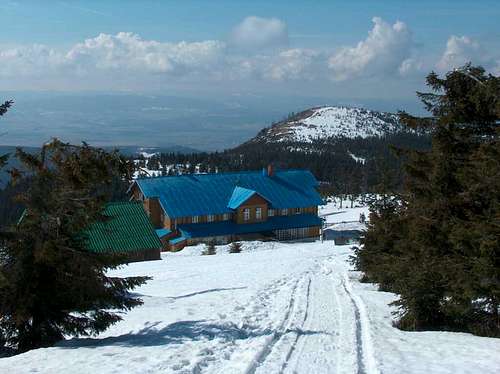
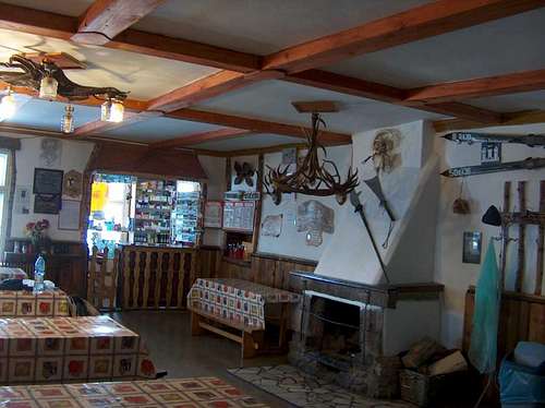
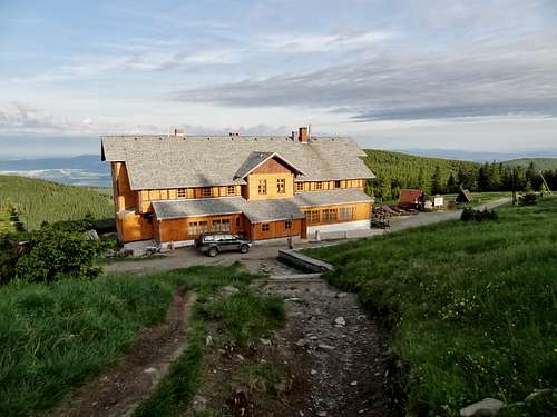
The most conveniently located hut is Schronisko "Na Śnieżniku", which sits just about a half-hour's walk west of the summit. It is not difficult to find a guest house or a hotel in the villages around Śnieżnik. The standard varies, so do the prices. One option on the Czech Side might be a mountain hut located some 4km SE of the summit: Chata Návrší
Mountain Conditions
The best time for hiking is from late spring to early autumn. In summer no special equipment is needed. In winter expect a lot of snow. Snowshoes or skis, depending on the route, are advisable. Avalanches are possible, especially below the summit of Śnieżnik, especially in and below the niche cradling the source of the River Morava.
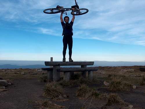
The first version of this page was created in 2009 thanks to a set of photos provided byvisentin, the French biker in the picture below. Most of those photos are still featured here.
Children refers to the set of objects that logically fall under a given object. For example, the
Aconcagua mountain page is a child of the 'Aconcagua Group' and the 'Seven Summits.' The
Aconcagua mountain itself has many routes, photos, and trip reports as children.
Parents refers to a larger category under which an object falls. For example, theAconcagua mountain page has the 'Aconcagua Group' and the 'Seven Summits' asparents and is a parent itself to many routes, photos, and Trip Reports.