
|
|
Area/Range |
|---|---|
|
|
50.73610°N / 15.74015°E |
|
|
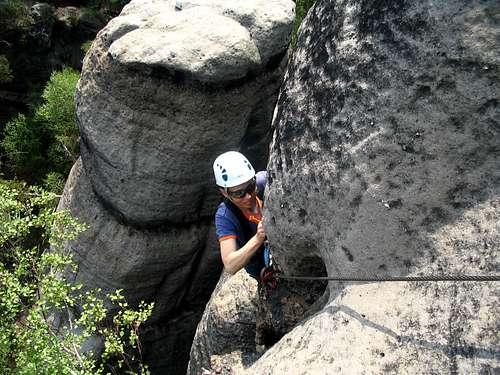
Hiking, Trad Climbing, Sport Climbing, Toprope, Bouldering, Scrambling, Via Ferrata, Skiing |
|
|
Spring, Summer, Fall, Winter |
|
|
5259 ft / 1603 m |
|
|
Overview
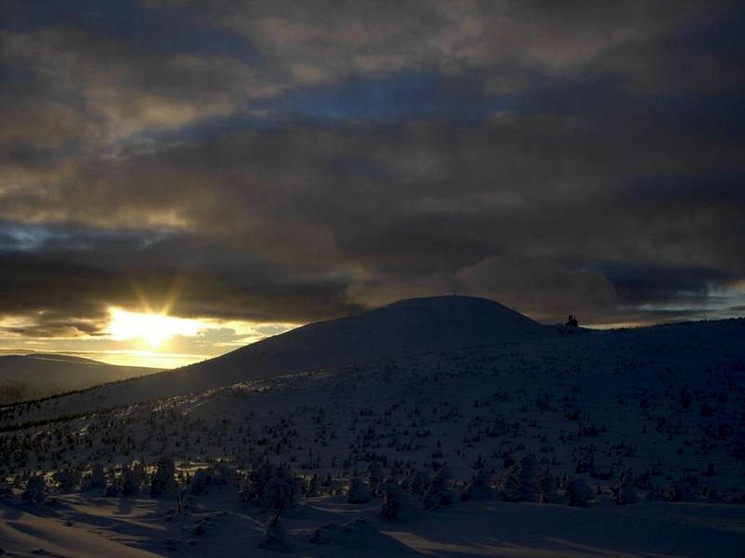
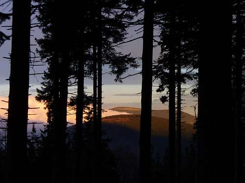
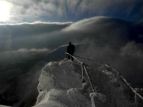
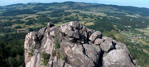
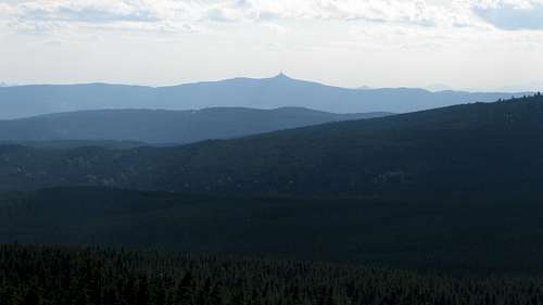
Both images at the top of the page (profile image by koCZmeed) and the first photo below show the Giant Mountains, the highest mountain range in the Sudetes.
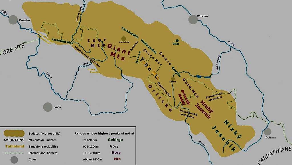
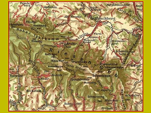
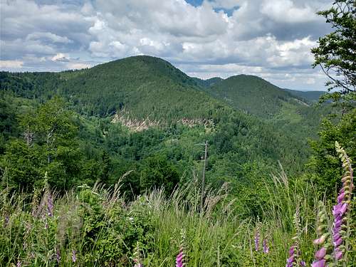
The Sudety (Polish/Czech) Sudeten (German) Sudetes (English) form the northeast rim of the ancient, diamond-shaped Bohemian Massif, one of the Precambrian cornerstones of Europe, which sits right in the centre of the continent and makes the bulk of Czechia. The mountains span about 300 kilometres reaching the so called Saxon/Bohemian Switzerland in the west, not far from the city of Dresden, and the Moravian Gate (the depression separating the Sudetes from the Carpathians). The Sudetes are usually divided into the Western Sudetes (often called Krkonošská oblast by Czechs), the Central Sudetes (Orlická oblast) and the Eastern Sudetes (Jeseníky). The border between the Western and the Central Sudetes is believed to run just east of the Giant Mountains (see the sketch map), and - farther north - along the east foot of the Rudawy Janowickie. The border between the Central and Eastern Sudetes runs several kilometres east of the upper course of the River Nysa Kłodzka, and a little west of the upper course of the River Morava.
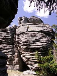
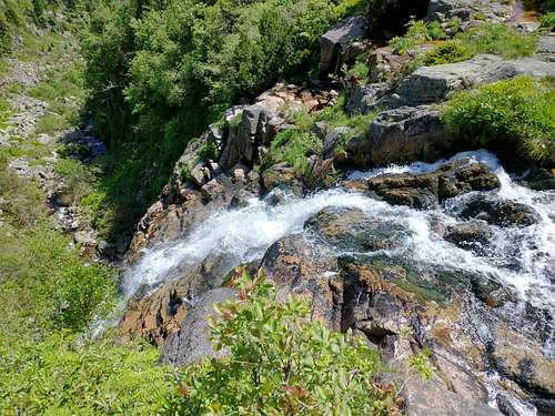
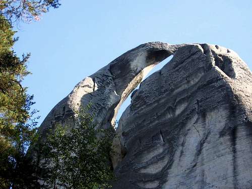
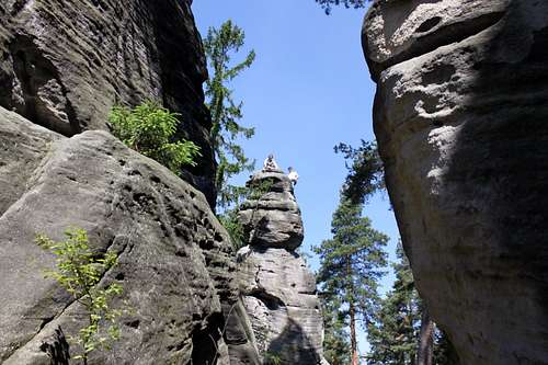
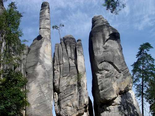
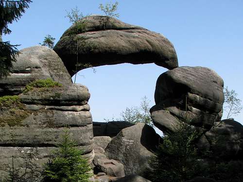
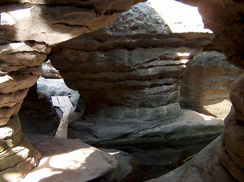
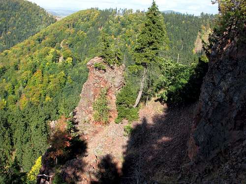
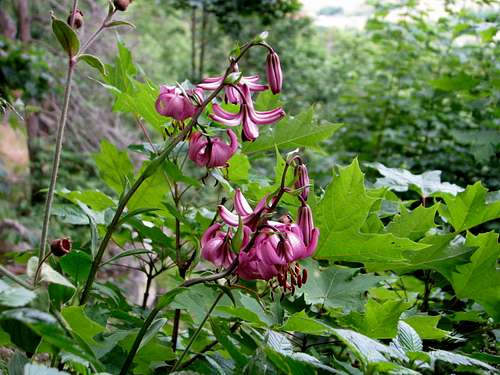
Geology & ReliefMore than half of the photos in this chapter by Romuald Kosina. Archean gneiss Archean gneiss Gems along the trail Gems along the trailMost of the rock material forming the mountain ranges and massifs within the Sudetes is Paleozoic. But some of the gneisses are Archean, ranking among the oldest rocks in Europe. Crystalline rocks predominate: metamorphic (mainly various kinds of gneiss and schist) and igneous (plutonic, such as granite; or volcanic, such as porphyry). In the sea of the commonest rocks there is a wide range of other rocks and minerals - often semi-precious stones, which attract geology-lovers and gem collectors. In the late Mesozoic (Cretaceous), around the Sudetes existed a sea whose waters also engulfed most of the Central Sudetes. Into this sea the rivers brought plenty of sand, which later turned into sandstone, out of which erosion has created fabulous 'rock cities'. Such mazes of slot canyons, buttes, towers and pinnacles – attractive to the hiker and the technical climber alike – can also be found around the Western Sudetes. In the Tertiary, the seas were already gone and all the Sudetes underwent extensive weathering under tropical climate conditions, which led to them looking like a vast plain with occasional hills of the most resistant rocks. The tectonic forces of the Alpine orogeny, while folding the Alps and the Carpathians in the south, made their northern foreland of the Hercynian Europe crack and rise again. Inside the Sudetes, horsts and basins were formed. The major topographical lines in the Sudetes reflect the fault lines, but the prominent summits and bizarrely shaped groups of rocks result from diverse rock resistance that consequently leads to differential weathering/erosion.
 Sudetes begin/end somewhere near here Sudetes begin/end somewhere near here |


Foothills
|
One of the most important fault lines drawn during the Alpine cycle is the hundred mile long Sudetic Marginal Fault. It runs NW-SE and forms the clear-cut NE edge of the mountains, separating them from what was sentenced to becoming just foothills, known as Przedgórze Sudeckie, southwest of the city of Wrocław. Before the Alpine orogeny, these hills ranked among the highest peaks in the Sudetes, but they have been cut off the Sudetes proper and left down below at elevations of just a few hundred meters. Now only one of them exceeds 600m, namely Ślęża at 719m, which is made of gabbro and granite and was regarded as a sacred mountain by many a people that inhabited Lower Silesia in the pre-Christian era. Further west, the uplands around the Sudetes have a different geological make-up and history. Their Polish part is known as Pogórze Zachodniosudeckie, which extends across the Poland-Germany border to form the foothills of the Lusatian Mountains. All along the outskirts of the Western Sudetes volcanic necks abound, and in several places bizarre sandstone formations occur.
|


Western Sudetes
|
The westernmost reaches of the Sudetes are called the Lusatian Mountains (Lužické hory/Góry Łużyckie/Lausitzer Gebirge). The area - its apex being the summit of Luž at 793m - is dotted with volcanic (basalt) necks as well as sandstone rocks.
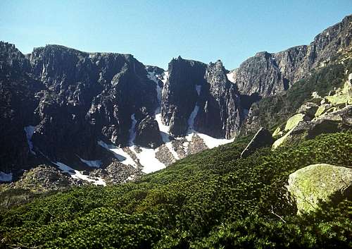
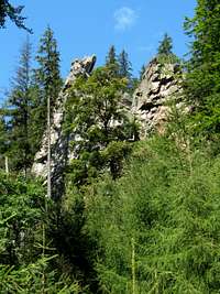
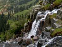
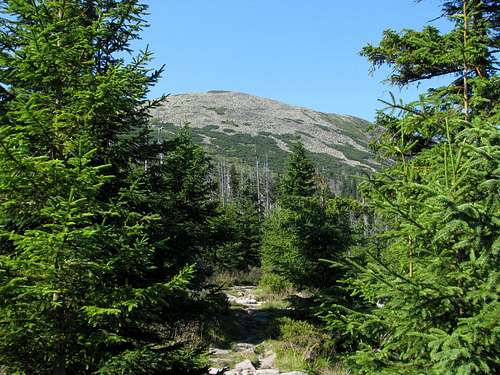
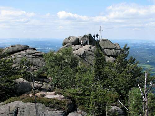
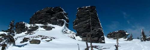
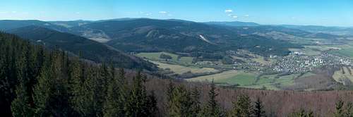
The heart of the Western Sudetes is granite, Hercynian (Variscan) of age, namely the batholith of the Iser-Giant Mountains-Jelenia Góra Basin with metamorphic rocks around it. Hence the double-faced, i.e. granite-gneiss/schist, nature of the Iser (Izerskie/Jizerské), Giant (Karkonosze/Krkonoše) and Rudawy Janowickie mountains, which surround the city of Jelenia Góra (Hirschberg in German). The granite chunks of all these mountains, i.e. especially the north of the Rudawy, the Polish part of the Giant Mountains and the Czech part of the Iser Mountains, teem with clusters of tors. 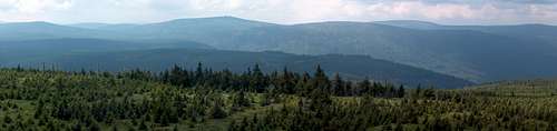 Rebirth of the forest in the Iser Mountains Rebirth of the forest in the Iser MountainsSouthwest of JeleniaGóra sit the Iser Mountains, which are a vast area of broad, gentle, heavilyforested ridges with plenty of soggy ground. The mountains, whose three massifs (Zielona Kopa with its highpoint Wysoka Kopa, Smrk-Smrek and Jizera) exceed 1120m, take their name from the River Iser (Izera/Jizera). The river rises in the north of the mountains to traverse them generally south-southeast, mostly along the Poland-Czechia border. Along the uppermost stretch of the Iser as well as its tributary, Jizerka, stretch pretty extensive peatbogs. To the south of Jelenia Góra rears up the main ridge of the Giant Mountains. This is the only range in the Sudetes which rises well above the tree line, cradled several mountain glaciers in the Ice Age, and sports several fine cirques and a couple of decent tarns.
The main ridge of the Giant Mountains as well as the Polish side of the range are mostly of granite but the highest peak (of all in the Sudetes), Sněžka/Śnieżka at 1603m is formed of hornfels (hornstone), a rock which is super-resistant to erosion as it was hardened through contact with hot granitic magma. Also, the long side ridges on the Czech side, which is much bigger than the Polish Karkonosze, are made of metamorphic rocks. Getting back to granite, the highpoint of the western part of the Giant Mountains, Vysoké Kolo/Wielki Szyszak at 1509m, is made of this rock. Two kilometres west of this summit rises the River Elbe.
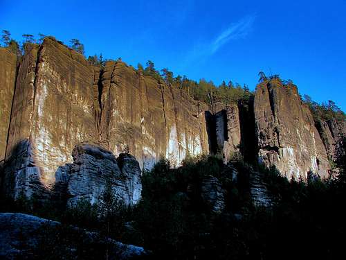
 Kaczawskie Mts viewed from Sokolik Kaczawskie Mts viewed from Sokolik Rudawy Janowickie (granite) Rudawy Janowickie (granite)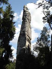 Czech Paradise (sandstone) Czech Paradise (sandstone)North of the Jelenia Góra Basin extends a low mountain range (barely above 700m) named the Kaczawskie Mountains (after the River Kaczawa), displaying Caledonian (early Paleozoic) folds and arange of rock types typical of the Sudetes. Besides being the only bit of the Western Sudetes where crystalline limestone occurs, the Kaczawskie Mountains show volcanic rocks - both old (lava that covered the bottom of the Paleozoic sea) and relatively young (Tertiary). The mountains take their name from the River Kaczawa, which rises inside them and flows through them. The mountains have been extensively mined and quarried for several centuries, along with their neighbours, the Rudawy Janowickie ("Rudawy" means Ore Mts) which extend south from the little town of Janowice, on the other side of the River Bóbr (Bober in German). The mountain ridge of the Kaczawskie Mountains that faces the Rudawy Janowickie across the gorge of the Bóbr is named Góry Ołowiane, literally the Lead Mountains (Turzec, 684m). The Rudawy Janowickie are partly of granite and teem with fine crags, especially their northwestern part including twin hills called Sokoliki/Góry Sokole (Falkenberge/Falcon Mts), which are a mecca for rock climbers from the west of Poland. (People from southwestern Poland usually do their climbing course there, which also happened to me towards the end of the 1980's.) Southwest of the Iser Mountains, on the other side of the uppermost section of the Lusatian Neisse river (Lužická Nisa in Czech), a long, mostly granite ridge of Ještěd-Kozákov runs from NW to SE. The highest summit of this ridge, Ještěd, which stands in the west, towering over the city of Liberec, has an elevation of 1012m (and 517m of prominence). At the eastern end of the Ještěd-Kozákov Ridge - halfway between the Elbe Sandstone Mountains and the tableland of the Central Sudetes – some sandstone rock cities can be found. This area, which lies just outside the Sudetes, is usually called the Czech or Bohemian Paradise.
|
Central Sudetes
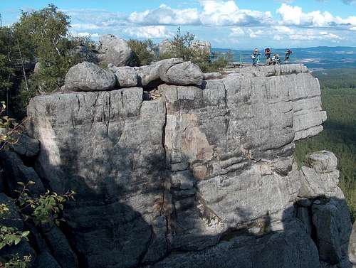
This part of the Sudetes, hardly rising above 1000m, is – in geologic terms – a depression between the ancient blocks of the Sowie (Owl) Mountains in the north and the Orlickie (Eagle) Mountains in the south, both composed of Precambrian rocks. The central part of this basin was filled with sandstone, whose remains form a complex of plateaux and cuestas (Adršpach-Teplice Rocks - the principal Czech climbing ground; Broumovské stěny; Góry Stołowe proper; plus a couple of smaller mesas, such as Ostaš, and lower cuestas, such as Zawory) making up what can be called the Table Mountains (in Polish literally Góry Stołowe/Czech: Polická vrchovina (Police Highlands)/German: Politzer Bergland und Heuscheuergebirge). The tableland sits north of the Kudowa-Polanica hollow in Poland and extends northwesterly, across the winding Polish-Czech border as far as another section of the border, over 20 km away. This area, its highest point being Szczeliniec Wielki at 922m (in Poland) boasts several picturesque "rock cities". The Polish chunk of the Table Mountains has recently been designated a National Park.
 Main ridge trail, Sowie Mts Main ridge trail, Sowie Mts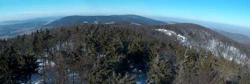 Horst of the Sowie (Owl) Mountains Horst of the Sowie (Owl) Mountains
|


Eastern Sudetes
The Eastern Sudetes extend east of the upper reaches of the River Nysa Kłodzka. They are usually called Jeseníky by Czechs, whereas Poles never use the term "Jesioniki" for the Polish part of them. In these mountains - if one excludes the Giant Mountains - the highest peaks of the Sudetes will stand. They are to be found in Hrubý Jeseník (High Jesenik) in the territory of the Czech Republic and in the nearby Śnieżnik Massif/Králický Sněžnik, which straddles the Czech-Polish border. The following summits have both a prominence of at least 100m and elevation of over 1,400m: Praděd at 1,491m, Vysoká hole at 1465m, Śnieżnik/Králický Sněžnik at 1,425m and Keprnik at 1423m.
 On the top of Vozka (Fuhrmann in German, 1377m), Keprník Massif On the top of Vozka (Fuhrmann in German, 1377m), Keprník Massif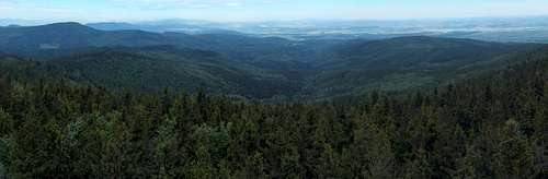 Looking north from Borůvková Hora Looking north from Borůvková Hora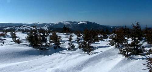 In the heart of the High Jesenik In the heart of the High Jesenik
 Zlaté Hory Highlands with Vysoká hole-Praděd-Keprnik-Śnieżnik-Gold Mts skyline Zlaté Hory Highlands with Vysoká hole-Praděd-Keprnik-Śnieżnik-Gold Mts skyline
|


Pieces of History

 Chojnik Castle (Kynastburg) Chojnik Castle (Kynastburg) Towards where Gross-Iser sat Towards where Gross-Iser sat Postcard from 1898 Postcard from 1898 In Iser Mts In Iser Mts Iser Mts 100 years ago Iser Mts 100 years agoIn the early 1990's the Soviet Union is dissolved. The economy undergoes structural changes and in the Sudetes nearly all coal mines and most of the industrial era factories are closed down. In 2004 Poland and the Czech Republic enter the European Union. In December 2007 both countries get embraced by the Schengen pact and at long last there is no difficulty crossing the international border any more.
|


Red Tape
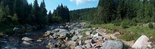 River Iser, part of the Czech-Polish border River Iser, part of the Czech-Polish border |


Maps
Paper maps you can buy online
Weather

|
|
|
Accommodation
As to accommodation possibilities, there are plenty: mountain huts (called chata or bouda in Czechia and schronisko in Poland), guesthouses, B&B, campsites, hotels of varied standard and prices. As far as the most attractive areas and huts are concerned, in peak season early booking is necessary. For more information, please see the child pages as well as reading what Liba Kopeckova writes here, which goes for the Polish side, too.
 For the ambience For the ambience |
 For free/the free For free/the free |
 For the tough For the tough |
Getting There
 Sudetes end/begin somewhere near here
Acknowledgements
About a third of the photos featured on this page (and 75% of the larger size ones!) were submitted by
