
|
|
Mountain/Rock |
|---|---|
|
|
45.80933°N / 11.16123°E |
|
|
7228 ft / 2203 m |
|
|
Alpine ski tour in the Pasubio group: Il Dente Austriaco
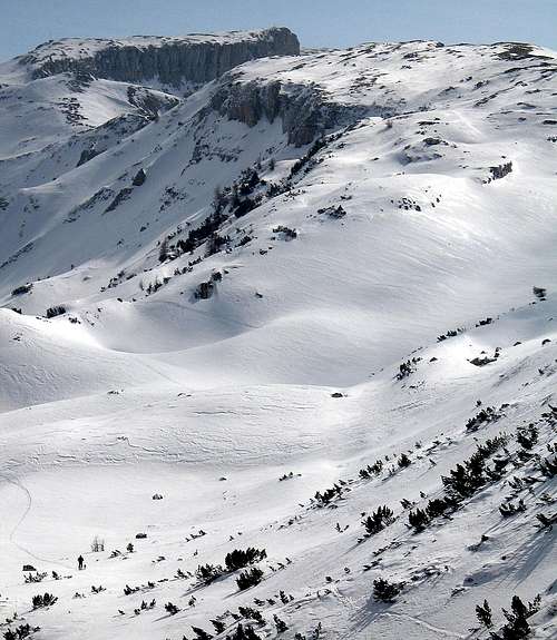
Alpine sky tour in the Pasubio: Doss della Paura and right the north - eastern side of the Dente Austriaco 2203m.
Overview
The Austrian Tooth 2203m. in the Group of the Pasubio is situated in the zone that was battlefield between Austria and Italy during 1° world war: between the two Italian Teeth and Austrian passed the line of the Front; the mountain was transformed in a true underground stronghold: arcades to 25 meters of depth, warehouses, observatories, room undermines, hides etc. Today the range surrounding the Palon is national monument.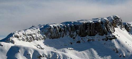
Pasubio - col Santo group: Il dente Austriaco 2127m.
Route
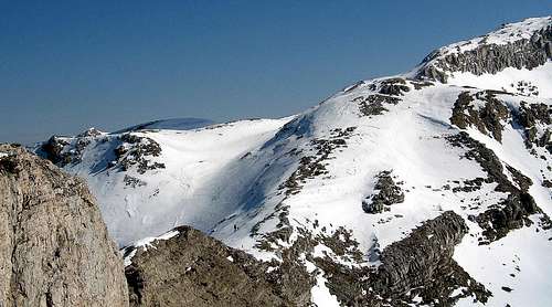
The area from Alpe Pozza (Rifugio Lancia) to the Saddle of the Campiluzzi and the Austrian Tooth is very attractive specially in winter. Spectacular the panoramas from the tops of the Monte Roite, from the Monte Buso, from the Austrian Tooth. ski mountaineering route: Start from Lancia Refuge 1825m and go toward Malga Pozze folding more to the right under the slopes of the Monte Roite until the final ascent that leads to the Saddle of the Campiluzzi and to the Bivouacs Campiluzzi 2026m. Herefrom cross toward East above the Roite and the Piccolo Roite, avoiding to loose too much height and paying attention, when snow is fresh and abundant, to possible snowfalls from Piccolo Roite. On to the Doss della Paura 2132m, cross it taking off the skis, then down, crossing a long channel oriented to South. Restart ascending up to the next saddle gettin the Dente Austriaco 2203m.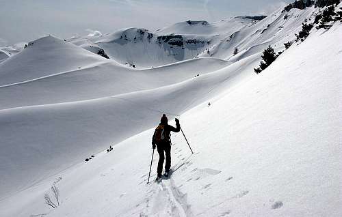 Dente Austriaco | 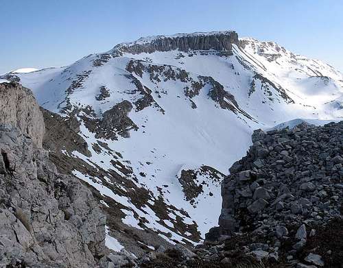 Dente Austriaco | 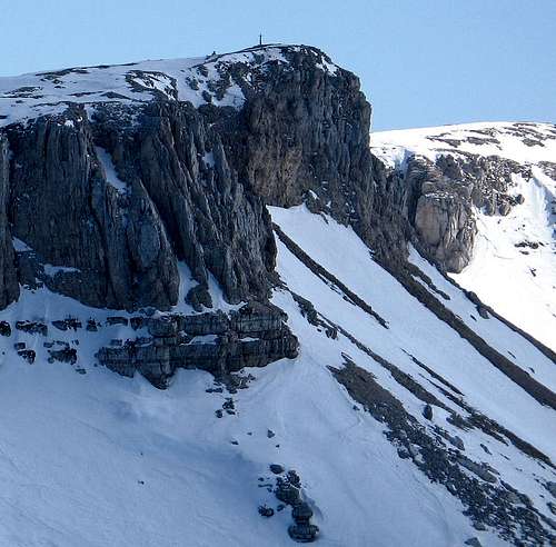 Pasubio 2007 |
Getting There
From Vallarsa ( north Pasubio) Car: Vallarsa can easily be reached from north and south on the Brennero state road 12 or the motorway A22, exit at the toll gate of Rovereto Sud, from there on the SS46 Pasubio or the road SP89. Train To the railway station of Rovereto and from there by bus. Airplane The nearest airports are Verona Catullo (90 km), Venice Marco Polo (195 km), Milan Linate (245 km) and the new airport in Bolzano (60 km

Refuges
Rifugio Vincenzo Lancia Gruppo: Pasubio Localizzazione: Alpe Pozza Quota: 1825 Comune: Vallarsa| n°sentiero | destinazione | ore |
| 101 | Cheserle - Gizzera | 1.50 |
| 102 | Bocchetta delle Corde-Bocchetta dei Foxi-Val dei Foxi-Anghebeni | 3.00 |
| 102-102A | versante nord Monte Testo-Bocchetta dei Foxi (Val dei Zocchi) | 0.40 |
| 105 (E5) | Bocchetta delle Corde-Roite-Denti italiano e austriaco-Palon-rifugio Papa | 3.00 |
| 105-134 | Bocchetta delle Corde- Val di Cosmagnon | 2.00 |
| 120 | Sella delle pozze-Sella dei Campiluzzi-Sette Croci-Rif.Papa | 2.20 |
| 120-133 | Sella dell Pozze-Val Zuccaria-Malga Campobiso-Strada delle Malghe | 1.40 |
| 120-133-147 | Sella dell Pozze -Val Zuccaria-Malga Costa-Passo Borcola | 3.30 |
| 132 -101 | Alpe Alba -Senter delle ULL-Giazzera | 1.40 |
| 131 | Col Santo -Doss dell'Anziana-Malga Costoni | 1.50 |
| 120-131-131A | Sella dei Colsanti-Strada delle Malghe-Malga Costoni | 1.50 |
Map and Books
 Campiluzzi | 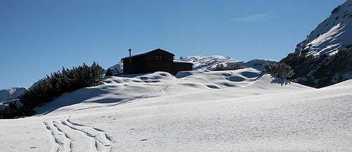 Bivacchi Campiluzzi |
"Sentieri Pasubio Carega" 1:25.000 sezioni vicentine del CAI "Rovereto Monte Pasubio" kompass 101 1:50.000 "Dal Tonale al Monte Pasubio" E5 Sentiero della Pace Helmut Dumler itinerari di sci alpinismo nel Trentino Meridionale Gianmario Baldi, Giancarlo Dorigotti by Manfrini Arti Grafiche 1984 PIEROPAN, Gianni, Piccole Dolomiti e Monte Pasubio, Milano, CAI, TCI, 1978 (Guida dei Monti d'Italia) Hiking Giude: Itinerari sul Pasubio e nelle valli del Leno, Calliano (TN), Manfrini, 1997 Cartografia: Carta dei sentieri Pasubio Carega: foglio 2 nord, Verona, Sezioni vicentine del CAI, 1991, Scala 1:20.000
My friend and his dog
Links
Vallagarina and Rovereto info Vallarsa info Tiroler kaiserjaeger Pasubio:sulle orme del soldatoMountain conditions
For weather and avalanche conditions in Trentino look at this pages: wetterzentrale Meteotrentino Meteo Alpin Società Meteorologica ItalianaInteractive map in Trentino
Mappe Interattive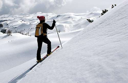
Dente Austriaco