
|
|
Mountain/Rock |
|---|---|
|
|
45.83373°N / 11.17704°E |
|
|
Hiking, Skiing |
|
|
6824 ft / 2080 m |
|
|
overview.
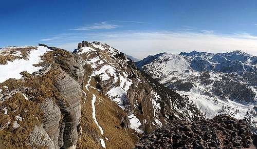
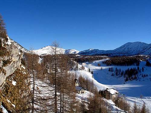
The spectacular view from Col Santino 2110m.: in the background from left Monte Buso, Sella Campiluzzi, Monte Palon 2232m.
The Mount Buso is situated in the Southeastern side of the Pasubio group (South - East of the Trentino Region).
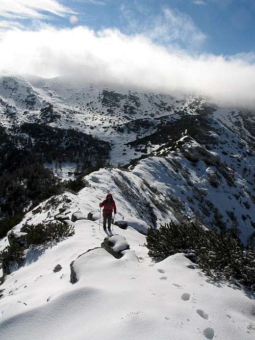
To reach this peak you must go through the top of the Pasubio range that presents spacious basins and long route, sometimes hard
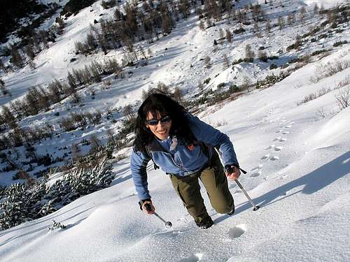
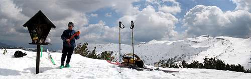
You can enjoy this route especially in winter with ski: beautiful and unique landscapes, in solitude, the high summits around you, the spacious sights of almost the whole group and for the physical engagement asked for.
In this environment there are considerable recent tracks of story concerning the first world war like trenches, pierces, etc
 Monte Buso | 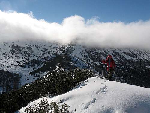 Monte Buso |
Routes
TrambilenoFrom Rovereto drive to Vallarsa Valley in the direction of Trambileno, Pian delle Fugazze Pass.. there is a cross 3 km. after with a road sign: "Rifugio Lancia".
Drive till Giazzera (1092m.) and then go on foot along the "segnavia101".
The path starts in the wood and then becomes an easy forestal road till Malga Cheserle.
The path 101 arrives then to the beautiful Alpe Pozza and the Refuge Lancia (1650m.)..
Alpe Pozze : THE HEART OF PASUBIO
Further on till the centre of the massif, the hollow of Alpe Pozze: a wide basin between the Col Santo and Col Santino (NE) and the ridge joining the M.Buso to Roite (SE).
Here, near the Pasubio meadows (Alpe Pozza) lies the Rif. Lancia.
Giving a glance toward SE one can see the Capiluzzi saddle, between Roite and M.Buso and, in background, the higher summits of Pasubio : Dente Austriaco, Dente Italiano e Cima Palon (tragic stage of First World War) bordered by the Piana of Cosmagnon: the entire area is surrounded by steep rocky walls, the only small plan hosts the Rifugio Papa and the malghe Pasubio e Pasubietto
From Rifugio Lancia, through the wide plans of Alpe Pozze you get the base of Monte Buso.
In winter usually can be seen tracks of wild animals: chamois, foxes, hares etc
Accesses to the summit of Monte Buso:
Getting there
.."Via direttissima":) al Monte Buso 2080m.
From Vallarsa ( north Pasubio)
Car:
Vallarsa can easily be reached from north and south on the Brennero state road 12 or the motorway A22, exit at the toll gate of Rovereto Sud, from there on the SS46 Pasubio or the road SP89.
Train
To the railway station of Rovereto and from there by bus.
Airplane
The nearest airports are Verona Catullo (90 km), Venice Marco Polo (195 km), Milan Linate (245 km) and the new airport in Bolzano (60 km
Map and Books
"Sentieri Pasubio Carega" 1:25.000 sezioni vicentine del CAI"Rovereto Monte Pasubio" kompass 101 1:50.000
"Dal Tonale al Monte Pasubio" E5 Sentiero della Pace Helmut Dumler
PIEROPAN, Gianni, Piccole Dolomiti e Monte Pasubio, Milano, CAI, TCI, 1978 (Guida dei Monti d'Italia)
Hiking Giude:
Itinerari sul Pasubio e nelle valli del Leno, Calliano (TN), Manfrini, 1997
Cartografia: Carta dei sentieri Pasubio Carega: foglio 2 nord, Verona, Sezioni vicentine del CAI, 1991, Scala 1:20.000
 Alpe Pozze:Lancia Refuge and... | 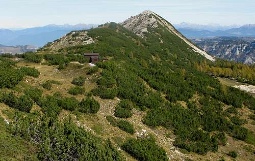 Campiluzzi Bivouac |
Mountain conditions
For weather and avalanche conditions in Trentino look at this pages:wetterzentrale
Meteotrentino
Meteo Alpin
Società Meteorologica Italiana
Monte Buso