
-
 47674 Hits
-
 98.23% Score
-
 79 Votes
|
|
Area/Range |
|---|---|
|
|
38.02580°N / 109.54°W |
|
|
Hiking, Trad Climbing |
|
|
Spring, Summer, Fall, Winter |
|
|
5765 ft / 1757 m |
|
|
Foreword
I consider Indian Creek a huge project, and was hoping that someone would make a SP page before me, so I kept waiting until I lost my patience.
I will welcome any input from frequent visitors to the area, and please consider this site as a “work in progress” – I will keep adding photos, routes, crags, and information. Luckily, my home in western Colorado, allows me frequent visits.
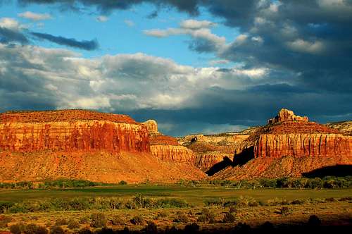 Sunset at Indian Creek Sunset at Indian Creek |
Overview
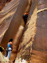
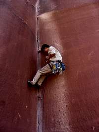
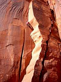
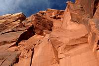
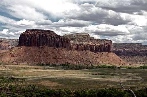
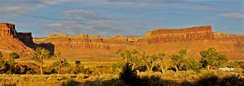
Indian Creek is the undisputed home of crack climbing, A.K.A. crack city. It is the perfect cragging destination in the U.S., and hosts a wide array of classic climbs like the famous Supercrack, and towers like North and South Six Shooters.
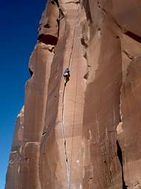
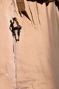
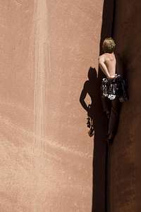
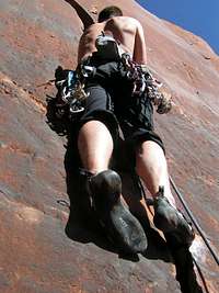
Climbing Cracks may seem like another sport to some, it is so different from the face climbing, but once you handle this skill, you start to feel that a rock without a crack is naked, and almost insecure.
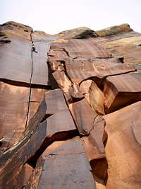
Cracks of every size and difficulty split the Creek’s stunning cliffs of red Wingate Sandstone. Rating is hard, you don’t see the typical 5.10a,b,c,d rating – it all depends on the size of your finger, hand and its fit for the crack. The same crack can be an easy 5.10 for some, and a difficult 5.11 for others.
 Playing in Binou Crack Playing in Binou Crack |
 Horse and climber Horse and climber |
 Autumn at the Creek Autumn at the Creek |
 Moon and IC Moon and IC |
 What a splitter! What a splitter! |
Some say that the climbing in Indian Creek is world class and that the camping is even better. And for those, who don’t climb there are many other things to enjoy: pristine desert scenery, Indian Petroglyphs, abundant wildlife, and unmatched night skies. The Needles District of Canyonlands National Park is nearby making this a great family destination too.
 Sunset over Six Shooters Sunset over Six Shooters |
A popular misconception of climbing is that it requires great strength and nerve. If that were true then the strongest men would be the best climbers, which is not so. Strength is obviously an asset to a climber, but the most important thing is a combination of the mental ability to work out technical problems, physical suppleness and agility and the right amount of confidence. The first two of these qualities are quiet common, and are demonstrated on the smaller boulder problems which are found below most crags, but a combination of all three is quite rare.
To the people who are bitten by the climbing bug, it becomes more than a pastime. It is a way of life. One tends to become disconnected at work and to live only for the weekend climbing. Many climbers have given up good jobs which interfered with climbing. It is very difficult to analyze the reasons for climbing. Each person feels differently about it, and feelings change from day to day. Perhaps it isn't necessary to have a reason. Many times I have heard climbers say, "What would life have been like if we hadn't started climbing?"
Joe Brown "The Hard Years"
 Happy after a hard day of climbing Happy after a hard day of climbing |
Native American History

Newspaper Rock

6 digit toe
The Anasazi Indians lived here for hundreds of years. Many of the buttresses bear traces of their ghosts in the form of house ruins and petroglyphs.
Newspaper Rock is 200 square foot (19m2) rock covered by hundreds of ancient Indian petroglyphs. It is one of the largest, best preserved, and easily accessed petroglyph places in the Southwest. The first carving at the Newspaper rock site were made around 2,000 years ago, left by people from Archaic, Basketmaker, Fremont, and Pueblo cultures. The exact nature of these symbols meaning is still not clearly understood. But they are typical of many sites throughout the Southwest. The drawings consist of animals, human figures and many inexplicable symbols – a six-toed foot? Some believed that six-foot people were giants, and there are many places around the world documenting six digit humans.
6 digit giants from around the world
Petroglyphs at mile marker 4
There is a small pullout on the side of the road, and a small trail leading to the petroglyphs on the cliff ahead. The approach time is less than 5 minutes.
 Approach trail Approach trail |
 Detail Detail |
 Petroglyphs, mile marker 4 Petroglyphs, mile marker 4 |
Anasazi Ruins near the Sparks Wall
Turn onto Beef Basin Road (same as driving for Bridger Jacks or Cottonwood area wall), continue on country road 107 until the Sparks Wall, about 3.8 miles. Look at the South Cliff, you should be able to spot Anasazi ruin from the road.
 Beta photo for the approach Beta photo for the approach |
 Well preserved ruins Well preserved ruins |
 Cliff covered Cliff covered |
 Little scramble Little scramble |
 Pottery Pottery |
Ghost at Indian Creek?
After turning onto State Highway 211 from U.S. 191 there are numerous abandoned buildings beside the road. These structures are remains of a religious colony “Home of Truth” founded by Mrs. Marie Ogden. Marie founded the Home in 1933 after arriving in the area with her followers. To become a member of the Home one had to give up all personal property for the use of the group, and if one chose to leave, nothing was returned. All worldly ambition was abandoned and one had to abstain from liquor, tobacco, and sex, and contribute labor for the common good of the colony.

Among Marie’s colonist was Mrs. Edith Peshak who had joined the Home with her husband in hopes she would be miraculously cured of her cancer. When Mrs. Peshak died in 1935, Marie asserted that she was not dead, she claimed that she sensed “vibrations” in the dead woman. Colony members prayed over her body and tried to bring her back to life. Marie was hearing messages from the dead woman, so she decided to take care of the corpse. The corpse of Mrs. Peshak was placed in a nearby cave where three times a day a community member washed the corpse and sometimes even fed it.
Rumor of the happening soon spread throughout the state. As time passed the rumors became wilder and wilder. Soon Sheriff started to investigate the situation. By this time the corpse was partially mummified. The son of Mrs. Peshak wanted to burry his mom. This never happened, perhaps because his father was still a colony member and clinging to the hope that his wife would be brought back to life. The report stated that the mummy was not a menace to health since it was so well preserved; Marie was able to keep the body.
But rumors ballooned and the Home of Truth shut down to all visitors. Slowly colony members began to leave. By 1942 there were only seven left of what was once 100.
1937, Mrs. Marie Odgen announced publickly that Mrs Peshak was going soon to return to life. The vibrations from the dead woman had become much stronger. State authorities demanded a death certificate and to give up the body. A man named Tommy testified that he had been present at the final burial of Mrs. Peshak; the body was burned. Tommy also told that he had been very interested in the mummy, and before the cremation he dug a couple of vertebrae from its back. The horrified reporter asked Tommy if he still had them, to which he shook his head and said: ”A damn sheep dog snitched them from me.”
So, don’t be surprise if you see ghosts over there ☺.
How To Get There
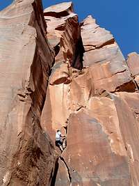
 Climber Climber |
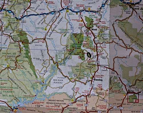 Indian Creek is in southeastern Utah - dark green oval marks the spot Indian Creek is in southeastern Utah - dark green oval marks the spot |
 Non-climber Non-climber |
From the North: Take exit from I-70 to Higway 191, going through Moab. IC (=Indian Creek) is located 40 miles south of Moab. Turn on Higway 211.
From the East: Highway 128 from Telluride to Naturita, then Higway 90 west through Paradox Valley, which becomes 46 when you cross to Utah. Then take Highway 191 south, and Higway 211 west.
From South: Highway160 west from Durango to Cortez, then Highway 491 from Cortez to Monticello Utah, north on Highway 191 for 14 miles to Highway 211 west.
A short clip of the scene
Indian Creek from sinuhe xavier on Vimeo.
This one is perhaps too much advertising for Marmot, but the First Ascent of Supercrack is definitively worth watching. You can see this clip in Supercrack Buttress section below.
Crags
 Supercrack Buttress Supercrack Buttress Karma Karma |
 Crag Map Crag Map |
 Elephant Man 5.10 Elephant Man 5.10 |
 The Author The Author |
David Bloom is the author of Indian Creek: A climbing Guide. The first edition was well received and forever changed the face of climbing guidebooks. The first edition was the kind of book that you'd want to keep on your coffee table and pick up to drool over time and time again - as written in one on-line review. This was the first full-color guide in the US. The book captured the aura and the feel of The Creek and allowed readers to dream of the place they weren't there. The 2nd edition has more descriptions (documenting more than 100 new routes, and new walls: The Sinbad Wall, Shock and Awe Buttress, and the Selfish Wall), and features even better photography. There are also some new assays by notable Creek personalities.And the 3rd edition will be coming up soon.Indian Creek: A Climbing Guide 2nd edition by Sharp End Publishing |
Friction Slab
I know so atypical to start describing a crack climbing area with friction slabs, but this is how it comes in order when arriving to Indian Creek.
It is 12.8 miles from the junction of Highway 191 and Highway 211 to Friction Slabs, and about 1/2 mile from Newspaper Rock. The approach time is about 5 min. Slabs are well visible from the road.
There are several routes. I climbed only Sundance 5.7, which is a long run out (2 bolts on 70 foot climb). David Bloom's guide book describes at least 3 more slabs, rated 5.9, 5.10, and 5.11R.
I enjoyed stopping there on my way home when my hands got too beat up from the cracks, but again not typical climbing for IC.
 Slabs as seen from 211 Slabs as seen from 211 |
 Sundance 5.7 Sundance 5.7 |
 My turn to lead My turn to lead |
 Along the base of slabs Along the base of slabs |
 View down towards 211 View down towards 211 |
Blue Gramma Cliff
This is one of the first wall with nice cracks and very close to the road. Approach time: 5-10 minutes.
Mileage: 15.4 from the junction of Highway 191 and Highway 211.
Some of the best petroglyphs are adjacent to climbs at Blue Gramma - please respect and help to preserve. Most of the routes are 5.10 to 5.11 range. There is one 5.9+. The IC guide book describes 14 routes, 8 named "Unnamed".
 Blue Gramma Cliff Blue Gramma Cliff |
 Cactus in bloom Cactus in bloom |
 Beat up hand Beat up hand |
 Blue Gramma 5.11 Blue Gramma 5.11 |
 Blue Gramma 5.11 Blue Gramma 5.11 |
 Approach to Blue Gramma Approach to Blue Gramma |
 Unnamed 5.9+ Unnamed 5.9+ |
 Unnamed 5.10 Unnamed 5.10 |
 Unnamed 5.10 Unnamed 5.10 |
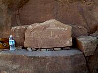
 Plaque Plaque |
 detail of crack detail of crack |
 unnamed 5.10 unnamed 5.10 |
 Petrelli Motors 5.10 Petrelli Motors 5.10 |
 Blue Gramma start Blue Gramma start |
 Blue Gramma 5.11 Blue Gramma 5.11 |
Mountain Project description of Blue Gramma Cliff
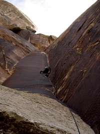
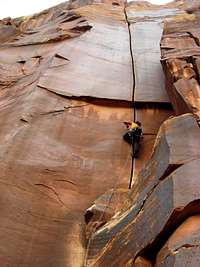
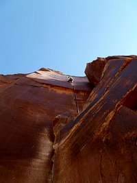
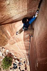
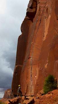
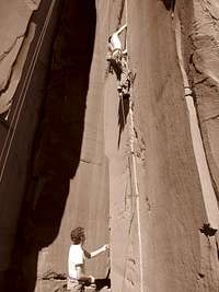
Supercrack Buttress
Supercrack Buttress is one of the most popular areas to climb at Indian Creek, named after the famous Supercrack.
Mileage: 16.3 miles from the junction of Highway 191 and 211. There is a nice big parking lot (shared with the access for Donelly Canyon), the approach hike is short on a well maintained trail, and there is a high concentration of nice 5.10s.
Supercrack - the climb that started it all! In 1976, Indian Creek was a little known, dried-up, ancient riverbed in southeastern Utah, but Supercrack changed it all. Supercrack of the Desert - the route was first ascended by Earl Wiggins, Ed Webster, and Bryan Becker and at the time the trio were joined by Stewart Green and Dennis Jackson who documented the ascent with photos and film (see below). The date was November 1976, the Creek was still there to be discovered and it was Wiggins who established "a new frontier of desert sandstone crack climbing".
It is worth remembering that camming devices hadn't been invented at the time - the revolutionary Friend was invented by Ray Jardine and Wild Country two years later - and so the route was protected with hexentrics and nuts. Perhaps it's worth remembering that the line was also given a different name - Luxury Liner - but in the end this didn't stick: Supercrack was simply too nice and representative. The original route lead to the rim of the crag. Nowadays few climbers make the effort to climb all the way to the top.
Supercrack is the world's most photographed and desired crack climb!
 |
 |
 |
 |
 |
 |
 |
 Luxury Liner Luxury Liner |
 |
 |
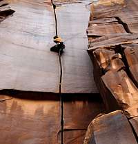
Supercrack Buttress is not only one great crack = The Supercrack. There are more than 45 routes ranging from 5.9 to 5.12. I climbed several routes here, the easier ones, and observed climbers on others. My problem at the Creek is that after a couple days, my hands are so beat up, that I cannot climb anymore.
 Incredible Handcrack 5.10 Incredible Handcrack 5.10 |
 Twin Cracks 5.9 Twin Cracks 5.9 |
 Twin Crack 5.9 Twin Crack 5.9 |
 Wild Works of Fire 5.10 Wild Works of Fire 5.10 |
 3 AM Crack 5.10 3 AM Crack 5.10 |
 The Incredible Hand Crack 5.10 The Incredible Hand Crack 5.10 |
 Ruins below Supercrack Buttress Ruins below Supercrack Buttress |
 Busy Belayer Busy Belayer |
 The Incredible Hand Crack again The Incredible Hand Crack again |
 Master of the Crack Master of the Crack |
 Supercrack Parking Supercrack Parking |
 Fingers in a Lightsocket 5.11+ Fingers in a Lightsocket 5.11+ |
 Gorilla 5.10 Gorilla 5.10 |
 Can you share? Can you share? |
 3 AM Crack 3 AM Crack |
Donnelly Canyon
Donnelly Canyon is a good wall to begin your tour at Indian Creek. This is another popular wall with a high concentration of moderate routes. The approach is short and well marked. The parking area is the same as for Supercrack Buttress, there are toilet facilities at the parking area.
Mileage: 16.3 miles from the junction of Highway 191 and Highway 211.
 Generic Crack 5.10 Generic Crack 5.10 |
 Donnelly Canyon Donnelly Canyon |
 Ansaid Tower Ansaid Tower |
 Chocolate Corner 5.9 Chocolate Corner 5.9 |
 Detail Chocolate Corner Detail Chocolate Corner |
 Well marked access Well marked access |
 White Apache with his hexes White Apache with his hexes |
 Detail Binou's crack Detail Binou's crack |
 Chocolate corner Chocolate corner |
Binou's crack |
 Silly rap Silly rap |
 Donnelly scene Donnelly scene |
 Hand detail Hand detail |
 Elephant Man 5.10 Elephant Man 5.10 |
 Elephant Man 5.10 Elephant Man 5.10 |
Donnelly Canyon on Mountain Project
Battle of the Bulge
The sister buttress to Supercrack as the book says, but with more 5.11s routes. Home to three of Indian Creek's testpiece cracks: Ruby's Cafe, Disco Machine Gun, and Air Swedin. You can use the same parking lot as for Donnelly Canyon and Supercrack Buttress. There is another small parking area 0.1 miles down on the left side of the road. The approach time from the parking lot for Supercrack and Donelly is about 5 to 10 minutes, the trail starts close to the road, and is easy to follow.
I have not personally climbed there, so would really enjoy an input for this area. 5.11s are still too much work for me (couple of climbs would waste me for the rest of the trip). I just wandered along the cliff base on a hot day, and there were not climbers at all. We took a nice break with Duchess inside the Cave. Plaques with route signs were missing here.
 Ruby's Cafe 5.13- Ruby's Cafe 5.13- |
 Duchess inside the Cave Duchess inside the Cave |
 Battle of the Bulge, Donnelly side Battle of the Bulge, Donnelly side |
 Approach to Battle of the Bulge Approach to Battle of the Bulge |
 Battle of the Bulge Battle of the Bulge |
Battle of the Bulge on SP by CClaude
Battle of the Bulge on Mountain Project
Scarface Wall
Another popular wall with mostly 5.11s. The book describes at least 47 cracks ranging from 5.9 (only one) to 5.12. This wall faces south east and is located just before the Dugout ranch. The approach trail takes about 30 min.
Mileage: 18.5 miles from the junction of Highway 191 and Highway 211.
 Wavy Gravy 5.10- Wavy Gravy 5.10- |
 Scarface 5.11- Scarface 5.11- |
 Scarface Wall Scarface Wall |
 Scarface Wall by BigRob Scarface Wall by BigRob |
Scarface 5.11 |
Scarface Wall on Mountain Project
Reservoir Wall
 Reservoir Wall as seen from 4x4 Wall
The guide books says: A stellar wall with something for everyone, at least 45 routes ranging from 5.10 to 5.13.
All climbs on the Reservoir Wall should be approached from the parking area opposite the Beef Basin turnoff. There is a small parking lot. Pass through the gate and go slightly right on a good trail.
Mileage: 20 miles from the junction of Highway 191 and Highway 211.
Reservoir Wall on Mountain Project
Cat Wall
Named after the catlike formation that sits on top of Reservoir Wall and faces Cat Wall. There are more climbs per square foot here than any other buttress in Indian Creek. The cliff is so wide there are two distinct trailheads.
Mileages from the junction of Highway 191 and Highway 211: 20 and 21 miles. The cliff receives a lot of sunshine (excellent for cragging in the winter).
The guide book describes more than 80 routes, 5.10 to 5.13 range.
 Johnny Cat 5.11+ Johnny Cat 5.11+ |
 And a real cat - my friend kept her in the campground And a real cat - my friend kept her in the campground |
 King Cat 5.11 King Cat 5.11 |
 Getting Ready Getting Ready |
Selfish Wall
Take a right turn on the first dirt road past the Fin Access - across from Bridger Jack. There is no sign, and you can see a gate from the Highway 211. Please close the gate so cows don't get out. This is BLM land and I have seen people camping out there although there is no official campground over there. Go 0.8 miles down a road/wash until it forks - to the right would be access for the Six Star Buttress. Go left and park soon. The Selfish Wall is left of Six Star Wall and right of Disappointment Cliffs. Hike left of the wash along a bench on a well maintained trail. Follow the trail, which will bring you close to Hand Solo climb. Approach time is around 15-20 min.
Mileage: 22.2 miles from the junction of Highway 191 and Highway 211.
 Hair and Roses 5.10 Hair and Roses 5.10 |
 Solo West 5.11 Solo West 5.11 |
 The Duo 5.11- The Duo 5.11- |
 Selfish Wall Selfish Wall |
 Taq Team 5.10 Taq Team 5.10 |
 Tag Team 5.10 Tag Team 5.10 |
 Making a plaque Making a plaque |
 Cool hat Cool hat |
 Hand Solo 5.9 Hand Solo 5.9 |
 Scenery from Selfish Wall Scenery from Selfish Wall |
Selfish Wall on Mountain Project
Meat Walls
What a name! "Meat Walls", so there is a: First Meat Wall, Second Meat Wall, Tenderloins, Original Meat and Sacred Cow Wall, all located next to each other. I climbed only at the 2nd Meat Wall, which is per report the best.
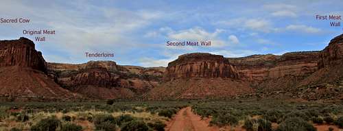 Overview of climbing walls in the Meat Wall area.
First Meat Wall is a seldom visited cliff, and is an extension of the left side of The Disappointment Cliffs. It is almost always in the shade. The book describes 10 climbs, ranging from 5.10 to 5.12.
Second Meat Wall called the filet mignon of the Meat Wall group. The cliff is shaped like a semi-circle, so it is possible to follow the shade or sun, depending on the season.
Turn right on the first dirt road after Six Star Canyon. Close the gate behind your vehicle. Follow a good dirt road. You will see Second Meat Ball right in front of you. The approach time is about 15-20 min. There are more than 50 routes there, ranging from 5.9 (only 1) to 5.12.
Dow's SP page on 2nd Meat Wall
Tenderloins This may be the smallest of the Meat Walls, but its lack of size is more than made up for by the quality of the routes. The book describes 16 routes, mostly 5.11s, a couple of 5.10s.
Original Meat Wall The wall for people who think that # 3.5 Friends are perfect hands (huge hands). It is shaded in the afternoon, and easy to combine climbing on Sacred Cow and Original Wall. The guide book describes 20 routes, mostly 5.10s and 5.11s.
Sacred Cow Has a lot of morning shade. The book describes 13 routes, mostly 5.11s, and few 5.12s.
 Top Sirloin 5.11 Top Sirloin 5.11 |
 Smell the Meat 5.10 Smell the Meat 5.10 |
 Cube Steaks 5.10 Cube Steaks 5.10 |
 Cube Steaks 5.10 detail Cube Steaks 5.10 detail |
 X-tra Lean 5.12- X-tra Lean 5.12- |
 Tofu Crack 5.10 Tofu Crack 5.10 |
 Busy shaded spot Busy shaded spot |
 T-bones tonight 5.12- T-bones tonight 5.12- |
 Plaque with route name Plaque with route name |
 Tube Steaks Tomorrow 5.10+ Tube Steaks Tomorrow 5.10+ |
 Belayer with a nice background Belayer with a nice background |
 Top Sirloin 5.11 Top Sirloin 5.11 |
 Girls enjoying beer Girls enjoying beer |
 Turdus Interruptus 5.11 Turdus Interruptus 5.11 |
 2nd Meat Wall 2nd Meat Wall |
2nd Meat Wall on Mountain Project
Original Meat Wall on Mountain Project
Tenderloins on Mountain Project
Cliff of Insanity
This cliff is not as popular, and typically uncrowded. The rough 4WD road leads to its base (right across from Superbowl campground). There is a huge potential for new route developments, and many new routes are put up (not mentioned in the Indian Creek guidebook).
Most routes are named after scenes from the famous movie Princes Bride. The cliff has a very obvious prow which allows you to climb in the sun or shade based on the conditions.
Drive 1.3 miles past the Meat Wall turn-off. Turn right on a dirt road (across to the south would be a turn off for Superbowl campground, unsigned). The road is rough and ends up at a small parking lot.
 Cliffs of Insanity Cliffs of Insanity |
 Man in Black Man in Black |
 North Six Shooter as seen from Cliffs North Six Shooter as seen from Cliffs |
 Unnamed 5.11 Unnamed 5.11 |
 True Love 5.11 True Love 5.11 |
 Cave/tunnel Cave/tunnel |
 As You Wish 5.11 As You Wish 5.11 |
 Mawwage 5.9+ Mawwage 5.9+ |
 Prepare To Die 5.10 Prepare To Die 5.10 |
 Puzzle Factory 5.12 Puzzle Factory 5.12 |
Cliffs on Insanity on Mountain Profect
South Six Shooter on Mountain Project
North Six Shooter on Mountain Project
![Bridger Jack]() Nice little summits and top quality climbing.
Nice little summits and top quality climbing.
Some Images of Bridger Jack area
Bridger Jack on Mountain Project
Gear Loop Topo for Bridger Jack These are handy, waterproof (sweat proof) pocket sized climbing beta resources. I have seen those in climbing shops in Moab.
Optimator on Mountain Project
From the junction of Highway 211 and Beef Basin Road, drive 1.2 miles to the third cattle guard on the road. Park in a small turnoff on the left. The trail angles up and right, and is well marked with cairns. Approach time: 15-20 min.
4x4 on Mountain Project
The wall features some shorter routes and offers some shade, but there is also a 3-pitch classic Pistol Whipped, rated as 5.12-. The wall was named after this route. There is also one of the easiest cracks at Indian Creek with a fine name of Short and Stupid, rated only 5.8. I found this crack a little bit awkward, but it could be a great first time lead at Indian Creek.
Pistol Whipped on Mountain Project
Way Rambo on Mountain Project
Since most of the cracks follow a straight line, most climbers do not use slings. Climbers clip their rope directly to the camming device.
Only very old fashioned (nowadays very rare) climbers use hexes and nuts.
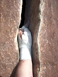
Taping - bring lots of tapes. There are many different ways to tape, but always try to protect the dorsum of your hands. Some people like crack gloves, but the disadvantage is that it does make your hand thicker and not fitting for some cracks. I have used Co-Flex for taping and found it very useful + it comes in different colors:). Co-Flex is not my idea. I have seen another doctor climbing with it, and she loved it.
B
Camping at Bridger Jack and Creek Pasture, is restricted to designated camping zones. Another popular site is Superbowl campground.
Dow Williams Thanks Dow for the great page on the 2nd Meat Wall.
Radek I possibly misspelled his name, but in Czech it would be spelled like this :).
Dan Leonhard Thanks for the great primary image photo.
Seth@LOKI Wonderful photos from Bridger Jacks
SKI Nice actions photos and thanks for positive encouragement on working on this site. I like your profile statement: "Poor, Uninsure and Ambitious as Hell".
Dean Nice photo of Bridger Jack!
Dan Dalton Lots of nice images from Supercrack and Donelly.
poorboy44 Nice action photo on Fingers in a Lightsocket, Supercrack Buttress.
nattfodd Action photo on Incredible Handcrack, Supercrack Buttress
batesem Thanks for images from Cat Wall area.
BigRob Nice images from Scarface.
Steve Marr Images from Six Shooter Peaks.
spectreman Incredible image of Sunset at Indian Creek.
jhalz and Rocker Paully Images of Way Rambo
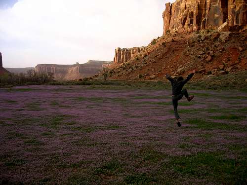
gremlin jumping photo among purple wildflowers (below Supercrack Buttress?), what an inspiration!
ds several action photos from Pistol Whipped Wall.
Rick Graham great images from Supercrack Buttress</center
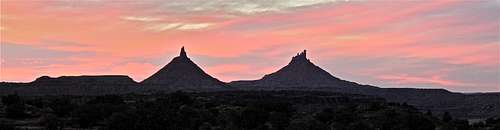
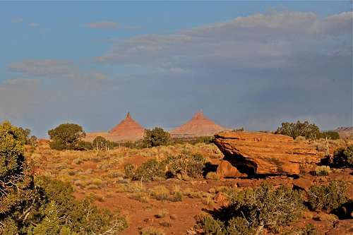
Six Shooters
There are two desert towers towards the end of Indian Creek - North and South Six Shooter Peaks. South Six Shooter Peak is one of the easiest desert towers in the area - 5.6 climb. The southeast face of North Six Shooter Peak hosts of the classic desert tower routes Lighting Bolt Cracks 5.11.
Both peaks are visible from the main road through the Creek. I will not write any descriptions since they have their own summit post page.
 Sunrise over Six Shooters Sunrise over Six Shooters |
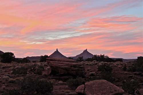 Sunset over Six Shooters Sunset over Six Shooters |
South Six Shooter on Mountain Project
North Six Shooter on Mountain Project
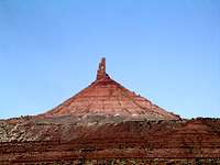
 South Six Shooter South Six Shooter |
 North Six Shooter North Six Shooter |
 North Six Shooter North Six Shooter |
 Rappel from S. Shooter Rappel from S. Shooter |
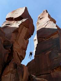
Bridger Jack Mesa
The Bridger Jacks are a group of relatively short spires in the heart of Indian Creek. If you get tired of cragging, want to get away from the crowds and are looking for a little more adventure to the top of a tower, then this is the place for you. The approach is short, and you can climb multiple towers in a day because of the easy access. The rock is excellent, the views are great and the climbing can feel very different from one climb to another.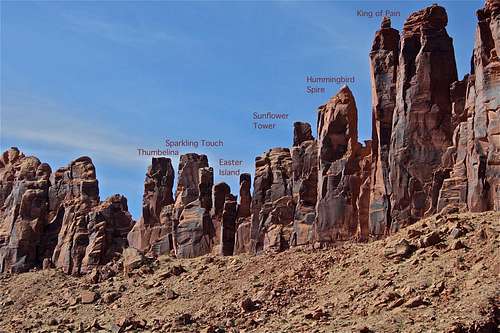 Nice little summits and top quality climbing.
 Easter Island Easter Island |
 Thunderbolts on Easter Island Thunderbolts on Easter Island |
 Climber on Bridger Jack Climber on Bridger Jack |
 Bridger Jack Butte Bridger Jack Butte |
 Easter Island rappel Easter Island rappel |
Bridger Jack on Mountain Project
Gear Loop Topo for Bridger Jack These are handy, waterproof (sweat proof) pocket sized climbing beta resources. I have seen those in climbing shops in Moab.
Optimator Wall
Optimator Wall is located near Bridger Jacks (take the road towards the Jacks, but fork left. There is a small parking lot. The wall is named after a route The Optimator. This was has seen a lot of development. Annunaki is another famous climb here, which supposedly stays dry in the rain.
 Brodie Machine 5.9 Brodie Machine 5.9 |
 Doggy bowl Doggy bowl |
 Unknown 5.11 Unknown 5.11 |
 Anunnaki 5.11+/5.12- Anunnaki 5.11+/5.12- |
 Yellow-headed collared lizard Yellow-headed collared lizard |
Optimator on Mountain Project
4x4 Wall
4x4 wall is on the west side of the Cottonwood Canyon. There are a lot of new routes here not described in the 2nd edition of Bloom's Indian Creek climbing guide. The wall faces north, so is great on hot sunny days.From the junction of Highway 211 and Beef Basin Road, drive 1.2 miles to the third cattle guard on the road. Park in a small turnoff on the left. The trail angles up and right, and is well marked with cairns. Approach time: 15-20 min.
 Start 4x4 5.11 Start 4x4 5.11 |
 4x4 5.11 4x4 5.11 |
 Unnamed 5.9 Unnamed 5.9 |
 Boys getting ready Boys getting ready |
 Unnamed 5.11 Unnamed 5.11 |
 Unnamed 5.10 Unnamed 5.10 |
 Trail along 4x4 wall Trail along 4x4 wall |
 Collision Course 5.11 Collision Course 5.11 |
 4x4 Wall 4x4 Wall |
 Plaque Plaque |
 Handsome dog Handsome dog |
 4x4 roof was the crux 4x4 roof was the crux |
 Petroglyph on a boulder Petroglyph on a boulder |
 Approach to 4x4 Approach to 4x4 |
4x4 on Mountain Project
Pistol Whipped
This wall is located far down in the Cotton Creek Canyon. Drive 4.8 miles down Beef Basin Road to the junction of 107 and County road 1041. Turn left on 1041, cross over Cottonwood Creek and turn right, go 1.5 miles and park on the right.The wall features some shorter routes and offers some shade, but there is also a 3-pitch classic Pistol Whipped, rated as 5.12-. The wall was named after this route. There is also one of the easiest cracks at Indian Creek with a fine name of Short and Stupid, rated only 5.8. I found this crack a little bit awkward, but it could be a great first time lead at Indian Creek.
 Steve's Whimpout 5.10 Steve's Whimpout 5.10 |
 Short and Stupid 5.8 Short and Stupid 5.8 |
 Revenge of the Rock Gods 5.10 Revenge of the Rock Gods 5.10 |
 Rump Roast 5.11 Rump Roast 5.11 |
 Approach to Pistol Whipped Approach to Pistol Whipped |
Pistol Whipped on Mountain Project
Way Rambo
The book says a stellar cliff that has seen some recent development. Turn off 211 as for Bridger Jack, then onto road 107, and then left on 1041. Cross Cottonwood Creek. There is a parking lot in the direction of Pistol Whipped Cliff. Do not block the road since the ranchers are using it. This wall offers plenty of moderate routes ranging from 5.8 to 5.11 (a couple of 5.12). The guide book describes more than 30 routes.
 Rambo Wall as seen from Sparks Wall Rambo Wall as seen from Sparks Wall |
 Fuzz 5.10 Fuzz 5.10 |
 Fuzz 5.10 Fuzz 5.10 |
 Slice and Dice 5.12 Slice and Dice 5.12 |
 Fuz 5.10 Fuz 5.10 |
 Names of routes Names of routes |
 Rochambeau 5.9 Rochambeau 5.9 |
 Way Rambo 5.12- Way Rambo 5.12- |
 Cockometer 5.10 Cockometer 5.10 |
 Layaway Plan 5.11d detail Layaway Plan 5.11d detail |
 Layaway Plan 5.11d Layaway Plan 5.11d |
 Closed Course 5.8 Closed Course 5.8 |
 Way Rambo 5.12 Way Rambo 5.12 |
 Blue Sun 5.10 Blue Sun 5.10 |
 Blue Sun 5.10 detail Blue Sun 5.10 detail |
Way Rambo on Mountain Project
Indian Creek Rack
What to bring? A lot of camalots. These one pitch routes are very intensive, and the crack is often unchanging in size for long stretches. It is not unusual to need 8 #1 red camalots etc. Most people put their gear together, and then you see climbers at parking lots sorting out their gear. It is very useful to have several of the most common sizes: 0.5, 0.75, 1, 2, and 3 cams.Since most of the cracks follow a straight line, most climbers do not use slings. Climbers clip their rope directly to the camming device.
Only very old fashioned (nowadays very rare) climbers use hexes and nuts.
Taping - bring lots of tapes. There are many different ways to tape, but always try to protect the dorsum of your hands. Some people like crack gloves, but the disadvantage is that it does make your hand thicker and not fitting for some cracks. I have used Co-Flex for taping and found it very useful + it comes in different colors:). Co-Flex is not my idea. I have seen another doctor climbing with it, and she loved it.
 Czech climbers sorting out their gear Czech climbers sorting out their gear |
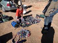 More cams needed More cams needed |
 Taping techniques Taping techniques |
 Minimalist tape Minimalist tape |
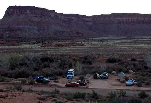
Camping
Camping in the area of Newspaper Rock has been closed due to flash danger.Camping at Bridger Jack and Creek Pasture, is restricted to designated camping zones. Another popular site is Superbowl campground.
How to choose where to camp?
Bridger Jack campground requires a 4WD access, and has no vault toilets. Both Creek Pasture and Superbowl are accessible via good dirt road for 2WD vehicles and have vault toilets. The plan is that there will be a fee for using Creek Pasture campground starting in 2014 (currently camping is free).
There are primitive dispersed camping opportunities on public land (please do not camp on private ranch land), and sort of undeveloped Cottonwood Campground. These places offer more privacy.
All camping is for free. You can contribute to Friends of Indian Creek at the entry to campgrounds.
I have personally camped at Bridger Jack's, Creek Pasture, Cottonwood, and Superbowl. Bridger Jack's does require a high clearance vehicle access as mentioned above, is very scenic, offers great views of both Six Shooter Peaks, and more private.
Creek Pasture is the place where most of the actions happen, e.g.: Dash Days or National Public Lands Day.
![Alpenglow from Creek Pasture Campground]() Alpenglow from Creek Pasture
Alpenglow from Creek Pasture
The Creek is absolutely a beautiful place for camping, but if you hit windy days, it can be nasty too. I had some nights when my sleeping bag inside the tent got all covered with red sand, and it got inside my mouth/nose/ears, and also destroyed my camera. Spring can be windy sometimes with unpredictable weather, autumn is usually very beautiful and weather is more stable, summer is very hot (most of the campgrounds do not have high trees to provide shade).
![Indian Creek Scenery]()
Creek scenery near the ranch
Long before climbers there were ranchers at Indian Creek
Anyone driving through Indian Creek will notice cows (sometimes walking along the main highway 211), horses, and ranching land. All that property is owned by Dugout Ranch ran by the fourth generation of Redds who live and work there.
The Dugout property used to be entirely open to camping, but it became too much. There got too many people and too much trash was left behind. Please be aware of this and camp only in established campsites. Be also respectful when accessing some of the cliffs, either by crossing their property, or closing gates.
These days, the ranch is owned by The Nature Conservancy. The historic cattle ranch encompasses 5,200 acres of private land and 300,000 acres of associated public grazing allotments. The Conservancy purchased the Dugout Ranch to save it from the looming threat of subdivision and development, ensuring that is magnificent landscapes and rich habitat will remain intact.
<center
I used images from the following SP members:All camping is for free. You can contribute to Friends of Indian Creek at the entry to campgrounds.
I have personally camped at Bridger Jack's, Creek Pasture, Cottonwood, and Superbowl. Bridger Jack's does require a high clearance vehicle access as mentioned above, is very scenic, offers great views of both Six Shooter Peaks, and more private.
Creek Pasture is the place where most of the actions happen, e.g.: Dash Days or National Public Lands Day.
 Alpenglow from Creek Pasture
The Creek is absolutely a beautiful place for camping, but if you hit windy days, it can be nasty too. I had some nights when my sleeping bag inside the tent got all covered with red sand, and it got inside my mouth/nose/ears, and also destroyed my camera. Spring can be windy sometimes with unpredictable weather, autumn is usually very beautiful and weather is more stable, summer is very hot (most of the campgrounds do not have high trees to provide shade).
 Dog Friendly Dog Friendly |
 Dash Days at Creek Pasture Dash Days at Creek Pasture |
 Evening fire Evening fire |
 Cooking for boys Cooking for boys |
 Creek near the Creek Pasture Creek near the Creek Pasture |
 Dash Days Dash Days |
 Bridger Jack Campground Bridger Jack Campground |
 Bridger Jack Camp Bridger Jack Camp |
 Creek Pasture Campground Creek Pasture Campground |
 Lunch is served Lunch is served |
 Superbowl Campground Superbowl Campground |
 Superbowl Campground Superbowl Campground |
 Camping at Superbowl Camping at Superbowl |
 Social events at Creek Pasture Social events at Creek Pasture |
 Six Shooters as seen from turn off to Creek Pasture Six Shooters as seen from turn off to Creek Pasture |
Dugout Ranch

Creek scenery near the ranch
Anyone driving through Indian Creek will notice cows (sometimes walking along the main highway 211), horses, and ranching land. All that property is owned by Dugout Ranch ran by the fourth generation of Redds who live and work there.
The Dugout property used to be entirely open to camping, but it became too much. There got too many people and too much trash was left behind. Please be aware of this and camp only in established campsites. Be also respectful when accessing some of the cliffs, either by crossing their property, or closing gates.
These days, the ranch is owned by The Nature Conservancy. The historic cattle ranch encompasses 5,200 acres of private land and 300,000 acres of associated public grazing allotments. The Conservancy purchased the Dugout Ranch to save it from the looming threat of subdivision and development, ensuring that is magnificent landscapes and rich habitat will remain intact.
<center
Dow Williams Thanks Dow for the great page on the 2nd Meat Wall.
Radek I possibly misspelled his name, but in Czech it would be spelled like this :).
Dan Leonhard Thanks for the great primary image photo.
Seth@LOKI Wonderful photos from Bridger Jacks
SKI Nice actions photos and thanks for positive encouragement on working on this site. I like your profile statement: "Poor, Uninsure and Ambitious as Hell".
Dean Nice photo of Bridger Jack!
Dan Dalton Lots of nice images from Supercrack and Donelly.
poorboy44 Nice action photo on Fingers in a Lightsocket, Supercrack Buttress.
nattfodd Action photo on Incredible Handcrack, Supercrack Buttress
batesem Thanks for images from Cat Wall area.
BigRob Nice images from Scarface.
Steve Marr Images from Six Shooter Peaks.
spectreman Incredible image of Sunset at Indian Creek.
jhalz and Rocker Paully Images of Way Rambo
gremlin jumping photo among purple wildflowers (below Supercrack Buttress?), what an inspiration!
ds several action photos from Pistol Whipped Wall.
Rick Graham great images from Supercrack Buttress</center