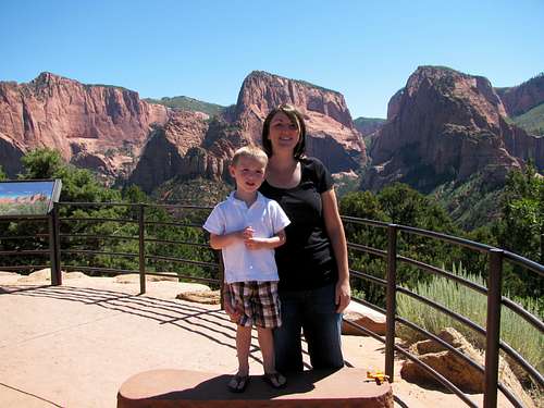
Return to Rivendell
![Yosemite Falls Family Photo]() First Yosemite trip
First Yosemite trip
Our first visit to Yosemite in the winter of 2009 left me wanting more. Due to seasonal road closures and the fact that we were walking around with our son Matthew who was less than a year and a half old, our short sightseeing stay was limited to Yosemite Valley. We drove over from the Bay Area on a Saturday, stayed at the Yosemite Lodge for one night, and drove back on Sunday. We walked around the bases of Bridal Veil Falls, Yosemite Falls, and the Swinging Bridge area, but we’d have to wait until a later time to see what it was like on top of the giant granite cliffs surrounding the valley.
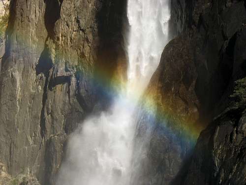
![Rainbow at Lower Yosemite Fall]() Yosemite Falls rainbow
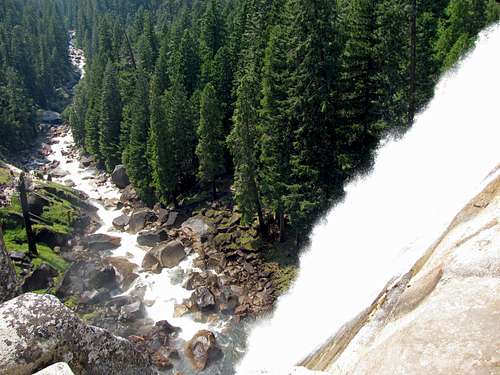
Yosemite Falls rainbow![Yosemite Falls and Sequoias]() Yosemite Falls
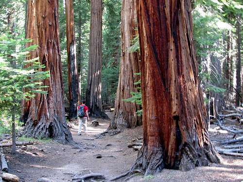
Yosemite Falls![Admiring the Sequoias]() Admiring the sequoias
Admiring the sequoias
Early in the spring a couple years later we were presented with an opportunity to go back to Yosemite, so I began planning a fun Sierra family trip. Half Dome and Mount Whitney were at the top of my peak list, and despite the fact that I had missed the opportunity to apply for Whitney day hike permits via the lottery, I was hopeful something would open up within a few days of when we would be staying in Lone Pine. I was working around my brothers’ school/work schedules, so our only window was from August 12th to the 16th. My main goal was always Half Dome though, so I was excited to successfully get two permits for Saturday, August 13th by laying siege to the recreation.gov website that issues them (after creating an account, I was refreshing my web browser every few seconds before 7am Pacific Time on May 1st trying to get them, and all of the permits for the entire month of August were gone within just a couple minutes).
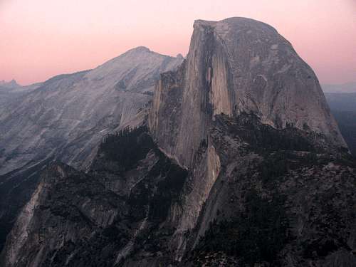
![Sunset on Half Dome]() Half Dome from Yosemite Valley
Half Dome from Yosemite Valley![El Capitan and Half Dome]() El Capitan
El Capitan![Leaning Tower]() Leaning Tower
Leaning Tower
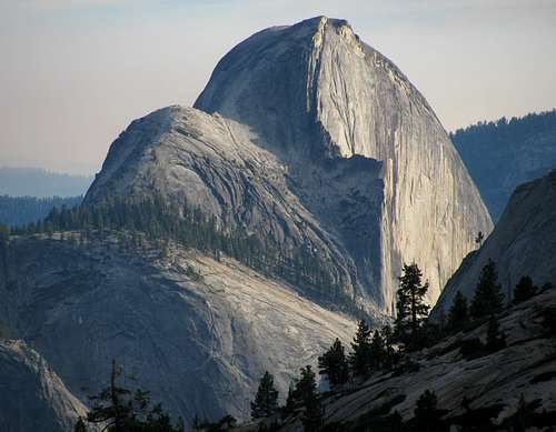
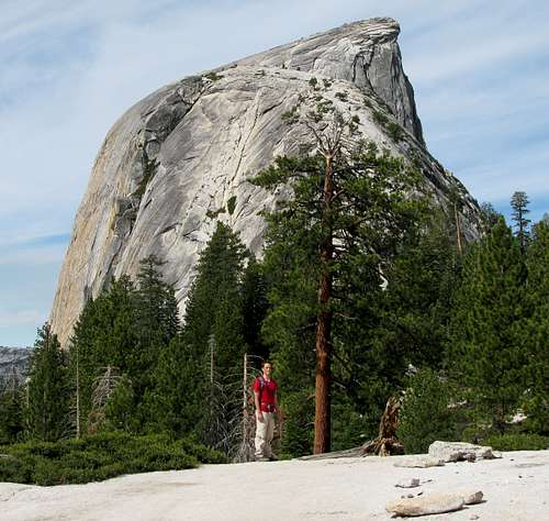
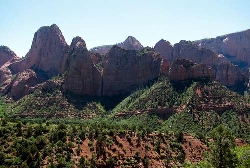
Despite the fact that Yosemite would likely be swarming with tourons at the time and the negative press relating to the recent deaths on the Mist Trail/Cables/Half Dome, I just couldn’t resist the opportunity to climb it. Half Dome is impressive when viewed from any angle, and is second in spire measure of all of the peaks in California after Mount Shasta (beats out anything in Utah or Colorado, though), which is a metric I now subscribe to when looking for impressive peaks to climb. We’d also get to see the other spots around Yosemite we missed out on the first time (Glacier Point, Mariposa Grove, Tuolumne Meadows, & Tufa Trail), and Mount Whitney would be a bonus if the permits became available.
Day 1 – Drive to Yosemite National Park
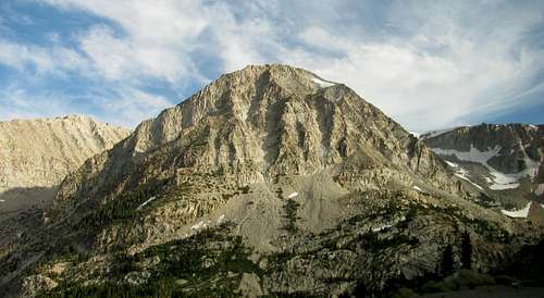
![Wheeler Peak]() Wheeler Peak
Wheeler Peak![Boundary Peak north aspect]() Boundary Peak
Boundary Peak
We took the drive to Yosemite in shifts, with my Dad driving the first leg to Ely. On the way we passed by the southern end of the House Range in Utah (didn’t get the classic view of the Notch Mountain cliffs I was expecting to see though, which must have been farther north) as well as the northern end of Great Basin National Park. Wheeler Peak and Jeff Davis Peak looked quite impressive from the north, and in the event that the Whitney permits fell though, it looked like coming back to hike Wheeler and check out the Lehman Caves might be fun. Driving through Ely changed my family’s mind about that though (since we didn’t bring camping gear and would have had to stay in a hotel there).
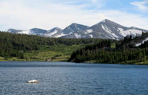
![Tioga Lake]() Tioga Lake
Tioga Lake![Tioga Pass peak]() Lee Vining Canyon
Lee Vining Canyon![Ellery Lake run-off]() Lee Vining Canyon waterfall
Lee Vining Canyon waterfall![Tioga Pass ridges]() Ridge below Mt. Dana
Ridge below Mt. Dana
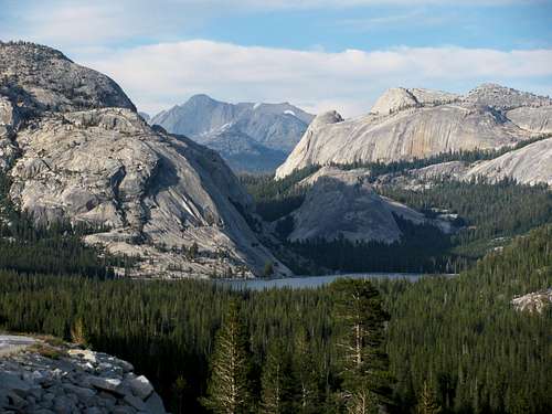
I drove from Ely through Tonopah all the way past the Nevada/California border by Boundary Peak, another ultra-prominence peak (where they asked us about what fruits and vegetables we had with us), and continued on past Mono Lake to the eastern entrance of Yosemite, at which point my Mom took over driving. While almost all of the snow from the deep snowpack had melted in the Wasatch, in the eastern Sierra we could still see quite a bit of snow up higher as we approached the mountains. This made me hopeful that the waterfalls in the park would still be worth seeing. As the road wound up Lee Vining Canyon, I told Matthew that this is where Herbie had one of his races in the “Love Bug” (not sure if it’s true, but I know it was filmed somewhere in the Sierra), which is one of his favorite movies, and this made him more excited about the scenery outside. The ridge above Ellery Lake was quite impressive, as well as the mountains west of Tioga Lake near the entrance to the park by Tioga Pass (at almost 10,000 feet elevation).
![Olmstead Point]() Clouds Rest & Half Dome from Olmstead Point
Clouds Rest & Half Dome from Olmstead Point![Tenaya Lake from the west]() Tenaya Lake from Olmstead Point
Tenaya Lake from Olmstead Point![Tenaya Lake cliffs]() Tenaya Peak
Tenaya Peak![Tenaya Lake from Olmstead Point]() Mount Conness
Mount Conness
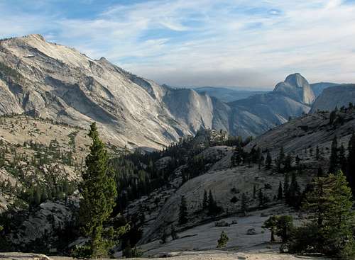
Matthew was getting a little antsy at this point, so after driving through Tuolumne Meadows (which we’d take more time to enjoy on our way back) we let him stretch his legs and throw a few rocks into Tenaya Lake just off the side of the main road. Just a bit further we stopped off at a large parking lot, and made the short hike to Olmstead Point. From here we had an awesome view looking back at the peaks over Tenaya Lake to the east, as well as Clouds Rest and Half Dome to the southwest. Johnny was quite impressed with Half Dome from this angle, and I assured him that the cables installed along the upper east side of the peak made the climb much easier than it looked from here.
![Half Dome from Olmstead Point]() View of the cables route on Half Dome
View of the cables route on Half Dome![Smoky Yosemite]() Smoky hills
Smoky hills![Half Dome sunset]() Half Dome sunset
Half Dome sunset
We kept driving along Tioga Pass Road until it connected with Big Oak Road, and then descended towards Yosemite Valley as the sun was setting. Along the way we noticed smoke from several small fires, which we later found out were controlled fires started along the Glacier Point Road. With Bridal Veil Falls and other waterfalls visible for this part of the drive, it looked a lot like Rivendell from the “Lord of the Rings” movies. Upon reaching the bottom of Big Oak Road, we took a right turn and followed the road along the Merced River. After a short stop for dinner sandwiches and snacks at a gas station, we arrived at our destination at the Cedar Lodge in El Portal just a few miles west of the park entrance.
![Bridal Veil Fall sunset]() Bridal Veil Falls & Merced River
Bridal Veil Falls & Merced RiverDay 2 – Half Dome, Mariposa Grove, & Glacier Point
![Happy Isles Trail]() Paved trail
Paved trail![Vernal Falls from first bridge]() Vernal Falls sighting
Vernal Falls sighting
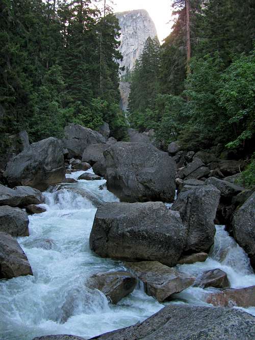
We drove up through Yosemite Valley early the next morning, and my Dad dropped me and Johnny off near Curry Village at around 6:30. Since the first shuttles didn’t start operating until 7, I figured this would be early enough for us to avoid the majority of the crowds. The road was blocked off before the Happy Isles Trailhead, which would add another mile each way on the day’s hike. At the Happy Isles Trailhead, where a paved road crossed over the Merced River, a wide dirt trail proceeded to the south. It narrowed and became paved again a short time later, and this wide paved walkway continued past a bridge where we caught our first glimpse of Vernal Falls.
![Liberty Cap & Merced River]() Merced River from bridge crossing
Merced River from bridge crossing
The views on the well-maintained trail along the Merced River with steep granite cliffs all around were top-notch, so much that I lost my bearings for a short time and we ended up on the John Muir Trail instead of the Mist Trail. When I realized this, I figured it didn’t really matter since they both met again at the top of Nevada Falls, and decided to keep going since it would give us a different experience than what most people get. The Muir trail had horse messes in a few places but was more gradual than the alternative, meaning it was easier for us going up. Here are some of the views we encountered on the Muir Trail:
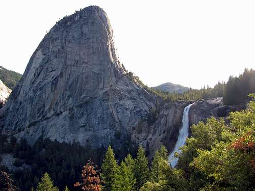
![Liberty Cap & Nevada Falls]() Liberty Cap & Nevada Falls
Liberty Cap & Nevada Falls![Half Dome southeast face]() South face of Half Dome above Mount Broderick
South face of Half Dome above Mount Broderick![Nevada Falls from Muir Trail]() Nevada Falls from Muir Trail
Nevada Falls from Muir Trail![Muir Trail wet rock]() Wet walls
Wet walls
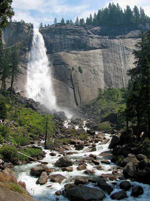
Among the people we passed on the way up was a family excited to be climbing Half Dome for the first time, who we took a picture of with Nevada Falls in the background. The views to the northeast of Half Dome, Mount Broderick, Liberty Cap, and Nevada Falls became better and better the higher we got, and I was glad to see that the waterfalls were still coming down strong (usually by the end of July they’re down to a trickle, so we picked the right year to come in August).
![Liberty Cap]() Liberty Cap from Nevada Falls bridge
Liberty Cap from Nevada Falls bridge![Top of Nevada Falls]() Top of Nevada Falls
Top of Nevada Falls![Merced River]() Looking upstream
Looking upstream
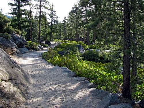
We eventually got to a spot where water from up above was running all along the wall to the side of us, and the spray from the mist felt quite refreshing. We followed the sometimes water-covered trail until we came to another bridge over the Merced, with Liberty Cap towering above us to the north and Nevada Falls plunging down below us to the west. After this, the Mist Trail and John Muir Trail met back up again, with a large restroom shack just off of the merged trail. Shortly thereafter, the stone/dirt trail changed to sand. I didn’t care much for this part, since walking through sand doesn’t really lend itself to a mountain experience, but it was gradual and easy enough for the most part. Just as it started to get hot, we started walking through a more densely forested section.
![Giant sequoias]() Walking between the giant sequoias
Walking between the giant sequoias![Sandy Muir Trail]() Sandy trail
Sandy trail![Subdome]() South face of sub-dome
South face of sub-dome![Branchless tree]() Branchless sequoia
Branchless sequoia
The sequoia trees here were quite impressive, and every now and then we’d come across giant sequoias, which were distinguishable by their thicker trunks and red bark. We started seeing more people coming back down the trail here, so I was hopeful that enough people had started early enough that there would not be any congestion issues when we arrived at the cables. Among those we saw coming down were three guys who thought it would make for a good laugh to wear suits on their hike. While it isn’t something I’d ever have the desire do, I applauded them for their efforts. We kept marching a couple more miles through the sequoias until the trees started opening up more, and we could make out the summit of Half Dome to the west.
![The dome]() … on both the south (left) and north (right) sides.
… on both the south (left) and north (right) sides.![Half Dome east aspect]() A shot of Half Dome’s steepness …
A shot of Half Dome’s steepness …![Subdome switchbacks]() Up the sub-dome switchbacks
Up the sub-dome switchbacks![Down the subdome]() Looking back at Clouds Rest
Looking back at Clouds Rest
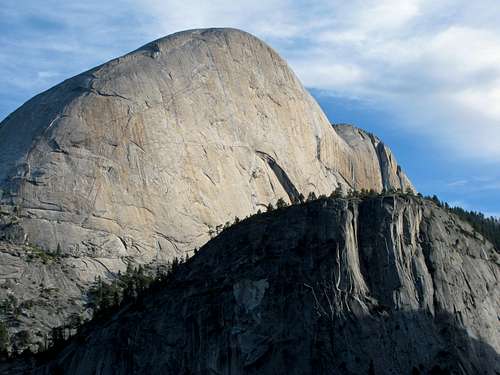
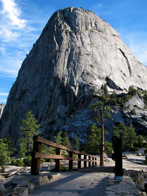
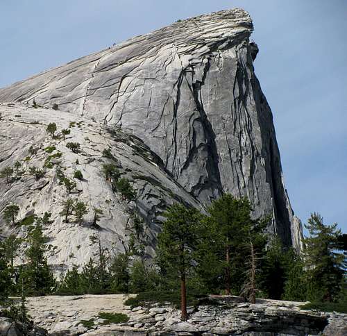
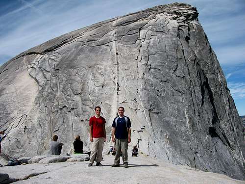
From here we could see the steep cliffs on both the north and south ends of Half Dome, which dropped off quite abruptly for thousands of feet to either side. As we got closer to the base of the sub-dome, I spotted two rangers who were checking people’s permits. They were strategically located at a spot where it would have been very difficult for someone to slip by them un-noticed without sliding down the slick granite slopes to the side. We came up behind a group just as the rangers were finishing their “cables safety” spiel, so they let us go through without having to listen to the whole thing again. The switchbacks leading up the sub-dome were the steepest ones we’d seen so far that day, and closer to the top, the trail disappeared, leaving us to just walk straight up the remainder of the granite slope to the cables. The views looking back on Clouds Rest and the other summits in the distance to the east were great.
![Half Dome Cables]() Johnny & Brandon, with the cables behind
Johnny & Brandon, with the cables behind![Half Dome south slope]() South face
South face![Up the Cables]() Looking up from bottom of cables
Looking up from bottom of cables
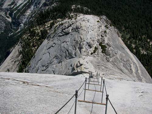
On top of the sub-dome, with no more trees in sight, you really gain an appreciation for how rugged Half Dome is. Johnny was hungry so we stopped for a short snack break while I assessed the cables, and even though it appeared we wouldn’t run into any bottlenecks, I decided it would be best to go up and down quickly just in case, since I had no desire to be in a conga line like the ones I’d seen in pictures online. At the base of the cables was a large stack of gloves, and even though we’d brought our own, we decided to use some more suitable-looking ones (rough palm material that would give us more grip on the metal cables) that people had kindly left behind. I started up, and soon found why the wood planks and poles every 15 feet or so were invaluable. Despite the fact that the route rarely got any steeper than 50 degrees, the granite was so smooth that on this otherwise harmless slope my shoes could not get a decent grip. As a result, I was thankful the planks were there. The guys in front of us were moving at a decent pace, so we took quick breaks for just a few seconds at each plank on the way up to catch our breath. The crux was at a point about halfway up the cables where you have to step up onto the next slab of granite about halfway between planks, but it was nothing a short forward burst of momentum couldn’t solve.
![Diving board]() View west from Half Dome summit, with the “diving board” in the foreground.
View west from Half Dome summit, with the “diving board” in the foreground.![Half Dome north aspect]() North face
North face![Half Dome summit cairns]() Summit cairns
Summit cairns
The steepness of the slope lessened, and eventually we made it to the end of the cables. Looking west from here you can see across the large summit area of Half Dome, which is somewhat similar to the large summit of Longs Peak in Colorado, but not as flat. The highest point lay further to the north though, so we hiked a couple hundred feet more in this direction. From the highest point, I could see some people posing on top of the diving board to the west, but we didn’t stay here long because of all of the flies (I’m guessing someone got desperate and relieved them self in between one of the boulders). The crowds weren’t too bad on top, but we kept walking until we settled on an unclaimed slightly lower spot near the northeast corner of the summit, where we had some more snacks. While the views looking west weren’t that great (mainly just a forested landscape), the view to the east was quite impressive, with granite domes popping up here and there and snow covering the higher peaks between 11,000 and 13,000 feet. Besides Clouds Rest, I wasn’t familiar with any of them, but it helped me see that with Half Dome in the bag, the northeast area of the park would probably be the best spot to summit a couple more peaks in the future.
![Eastern Yosemite]() Peaks to the east
Peaks to the east![Half Dome summit view]() Yosemite Valley narrowing to the northeast
Yosemite Valley narrowing to the northeast![Mount Conness from Half Dome]() Mount Conness
Mount Conness![Cocksomb from Half Dome]() Cockscomb
Cockscomb
Descending the cables was probably my favorite part of the day. Only a few people were coming up (among them a young boy whom I lent a few words of encouragement), so we basically did a quick semi-rappel down the cables, facing sideways to the south. We moved our feet the same way you would playing defense in basketball, without letting them cross, and were down in less than two minutes. We probably freaked people out coming down towards them that fast, but I felt it was easier and no less safe that way, and a lot more fun as well. In between tension points on the cables they can actually bend out by about a foot if you put the weight of your hands on them, so that way we still gave people coming up the cable on the other (north) side plenty of space to get by. I wasn’t sure how Johnny would handle going back down, but he didn’t think twice about the exposure, which was awesome.
![Down the Cables]() Descending the cables
Descending the cables![Mount Starr King]() Mount Starr King
Mount Starr King![Deer near Nevada Falls]() Curious deer
Curious deer
Back at the bottom of the cables, I was no longer worried about getting stuck behind a group of slow people, so we relaxed and ate the rest of our lunch. My guess is that cables congestion is less of an issue now that the current quota system of 400 hikers a day is in place. The trail back down to the top of Nevada Falls was pretty easy-going, and along the way we saw the rest of the people hiking Half Dome that day (passed about 100 people on the way up with 100 people going back down at the same time, and saw about 200 people still coming up on our way down), mixed with a few backpackers solely hiking the John Muir Trail.
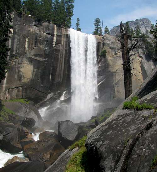
![Nevada Falls]() Looking up at Nevada Falls
Looking up at Nevada Falls![Nevada Falls from Mist Trail]() Nevada Falls side view
Nevada Falls side view![Merced River]() Merced cascades
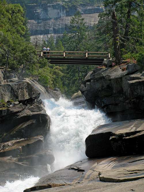
Merced cascades![Bridge between Vernal & Nevada Falls]() Mist Trail bridge
Mist Trail bridge
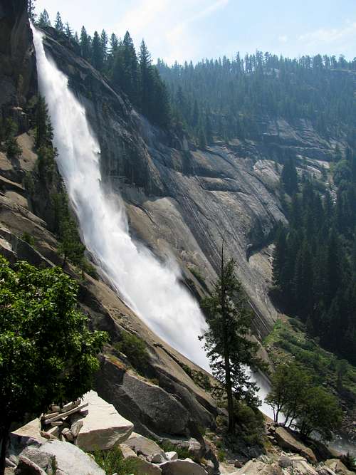
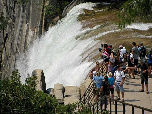
With the temperatures creeping up, I was looking forward to a cool down on the Mist Trail. As we came around the north side of Nevada Falls on our way down, I was impressed with the sheer amount of water coming down. We crossed a bridge about halfway between Vernal Falls and Nevada Falls, and I gradually became aware of more and more people lounging in the shade off to the side of the trail as we got closer to the top of Vernal Falls. Upon arriving at the spot where three people had recently been swept over Vernal Falls, I was horrified by the sight before me. There were literally hundreds of people wedged together along the sides of the rails, many of whom where splashing their feet in the water with their shoes off behind the signed railing, seemingly oblivious to the strength of the current. After taking it all in, I was surprised that only 17 people or so had died in Yosemite so far that summer, what with all the mindless riff-raff. I waited my turn to approach the railing near the top of the falls to get a couple pictures, and then Johnny and I made a bee-line for the trail to get out of there.
![Mist Trail bridge]() ”Small” waterfall between Nevada Falls & Vernal Falls
”Small” waterfall between Nevada Falls & Vernal Falls![Mist Trail guardrail]() Steep trail with guardrail
Steep trail with guardrail
On our way down near Nevada Falls, we had passed someone who we referred to from that point on as “the orange-shirt lady”, who liked taking her sweet time and had the uncanny ability of blocking potential passers behind her. Several times when I had tried passing her, I think she caught sight of me out of the corner of her eye, and she would discretely move over into the middle or my side of the trail in an attempt to prevent me from going by. After descending the steep trail just below Vernal Falls I stopped a few minutes to take some more pictures, when I noticed that she had almost caught up with us, and that she had a line of at least a couple hundred people behind her. We scampered back to the trail as fast as we could and made it before her just in time, granting us smooth sailing the rest of the way down.
![Vernal Falls drop]() Vernal Falls drop-off
Vernal Falls drop-off![Vernal Falls]() Run-off still going strong
Run-off still going strong
We didn’t actually encounter any mist until the portion of trail near the bottom of Vernal Falls, and at this point it just made me feel more hot and sticky. I suppose it was to be expected since we were doing the hike on a Saturday in August when there was a larger combination of both locals on weekend trips and foreigners on their summer vacation (ironically, my brother Chris, whose schedule only permitted us to come at this time, ended up bailing on the trip after we booked the hotel rooms and permits), but droves and droves of people kept making their way up the trail past us (had to at least be two thousand, by my estimate). Most of them were French, which made me feel like we were somewhere in the south of France. We finally made it to the spot near the road where we’d been dropped off earlier, at which point we plopped down on some rocks and amused ourselves by watching people drive by and get honked at by shuttle buses for stopping in the wrong places.
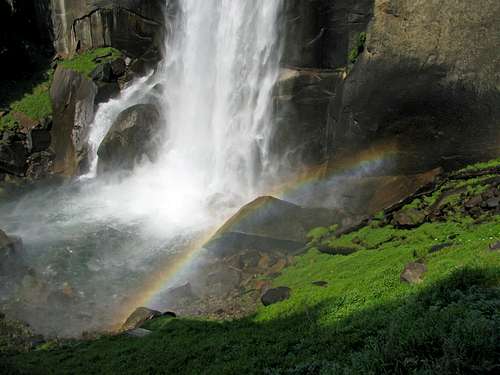
![Vernal Falls from Mist Trail]() Looking up at Vernal Falls
Looking up at Vernal Falls![Vernal Falls rainbow]() Rainbow at the base of Vernal Falls
Rainbow at the base of Vernal Falls
I called Liz and she said that they were still stuck in traffic somewhere in the valley, but they figured it would be easier to meet back up by driving to us instead of parking and having us ride a shuttle to meet them. While we were waiting, I called up the Inyo National Forest one last time to see if there were any newly available day hike permits for Mount Whitney on August 15th, but unfortunately there weren’t, so I called up the Dow Villa Motel in Lone Pine to change our hotel reservations from three rooms to two and for only a single night instead of two (if I’d gotten the permits, David would have driven out and done the hike with me, since Johnny wouldn’t have been up for the same suffer-fest as me after already doing Half Dome), and also called David to tell him the bad news.
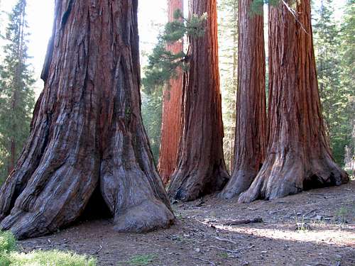
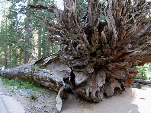
![Cluster of giant sequoias]() Cluster of giant sequoias
Cluster of giant sequoias![Fallen Monarch]() Fallen Monarch
Fallen Monarch
Eventually the rest of the family made it to us, and we caught up on the day’s activities. My Mom, Dad, Liz, & Matthew had seen most of the main spots in the valley (Bridal Veil Fall, Yosemite Falls, Swinging Bridge, etc.), but they said most of their time was spent circling around looking for parking spaces. I guess there’s a reason they call Yosemite the Disneyland of the national park system. With plenty of daylight to spare, we drove down towards Mariposa Grove. Upon arriving at the parking lot near the south entrance of the park, a young worker blocked off the road and said only shuttles were allowed to drive up. Despite the fact that we had seen a dozen cars come back down while we were waiting in line for him to tell us this, he said we had to park there and take a shuttle up. So we parked and walked across the street to wait for the shuttle, at which point he proceeded to lift the gate and let more cars through (guess he was done working for the day and didn’t really care what happened). A shuttle them came by, but the driver said it was pointless to ride up now, since we wouldn’t have time to walk around Mariposa Grove in time to catch the last return shuttle. Learning firsthand the joys of dealing with large crowds and clueless workers, we then made our way back to the car and drove up, finding a parking spot after circling the lot a single time.
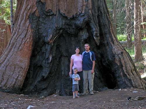
![Giant sequoia family pic]() Family picture in Mariposa Grove
Family picture in Mariposa Grove
Matthew loved the giant sequoias, and despite the fact that I’ve never been a fan of forest hikes (I prefer wide open spaces with panoramic mountain views) I was amazed at the sheer size of the trees. While the redwood trees in northern California may be higher, these ones were the absolute biggest in terms of sheer mass. The root system coming out the bottom of the Fallen Monarch was mind-boggling, and the size of the Grizzly Giant tree was overwhelming as we got closer to it. We learned that the Grizzly Giant was 96 feet in circumference at the base (with a diameter of 28 feet), and that one of its branches had a diameter of 6 feet. Matthew loved the giant trees, and found a small walking stick to use as he let his imagination run rampant along the trail.
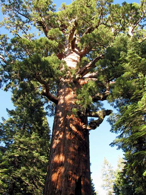
![Grizzly Giant]() Looking up at the Grizzly Giant
Looking up at the Grizzly Giant![Giant sequoia]() These trees sure are big (check out the people at the bottom)!
These trees sure are big (check out the people at the bottom)!
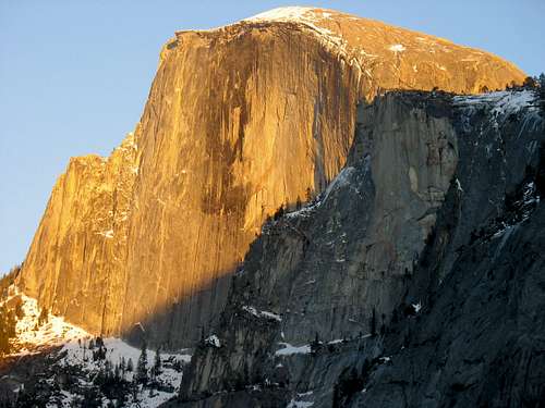
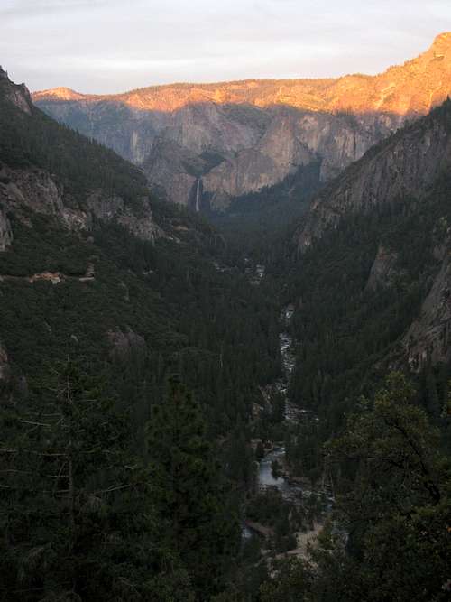
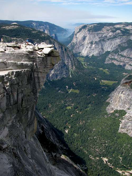
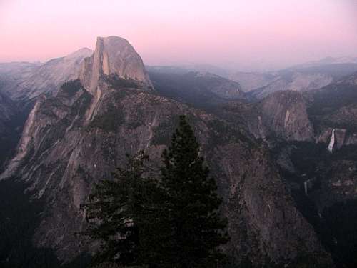
The sun was low in the sky when we made our way back to the car, so my Dad drove straight to Glacier Point in an attempt to make it there before sunset. On the way we passed smoky parts of the road with small controlled fires burning right off to the side, but the road wasn’t blocked off so we kept going. We finally came around a corner where the view opened up to the east at Washburn Point, and my Mom, upon seeing Half Dome, remarked “You climbed that?!” It definitely looked un-climbable from this perspective. We continued to the Glacier Point parking lot a short distance later, and walked up to the main viewing area as the last rays of sun were lighting up the diving board near Half Dome’s summit. Surprisingly, the crowds here actually weren’t too bad here (maybe the smoky haze on the road up scared them off). Soaking in the magnificent views, the smoke in the distance actually made the sky a brighter pink color, which was cool. We then made the drive back down to El Portal, where we bought some good but over-priced pizza for dinner, which we ate on a deserted dining table outside our second floor rooms. We crammed a lot into that one day, and it was rewarding thinking back on all the sights we’d seen.
![Glacier Point at dusk]() Glacier Point view just after sunset (with Half Dome on the left and Nevada Falls the largest waterfall on the right)
Glacier Point view just after sunset (with Half Dome on the left and Nevada Falls the largest waterfall on the right)Half Dome Stats
DISTANCE:
17 miles roundtrip
HAPPY ISLES TRAILHEAD:
4,105 feet
SUMMIT ELEVATION:
8,842 feet
ELEVATION GAIN:
4,800 feet
DIFFICULTY:
Class 3
TIME:
8.5 hours
![Half Dome from Glacier Point]() Half Dome seen from Glacier Point
Half Dome seen from Glacier PointDay 3 – Tuolumne Meadows, Tufa Trail, & drive to Lone Pine
![Echo Peak]() Echo Peak
Echo Peak![Pothole Dome]() Pothole Dome
Pothole Dome
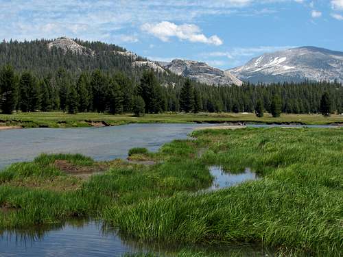
The next morning we checked out of our hotel and drove back up along the Tioga Pass Road. I figured the rest of the family would enjoy an easy hike somewhere in the Tuolumne Meadows area, but wasn’t partial to any specific ones I’d seen in our Easy Yosemite Day Hikes book or the www.yosemitehikes.com website. We pulled up in front of Pothole Dome and it didn’t seem too crowded, so we decided to give it a try.
![Tuolumne River]() … along the Pothole Dome Trail next to the Tuolumne River.
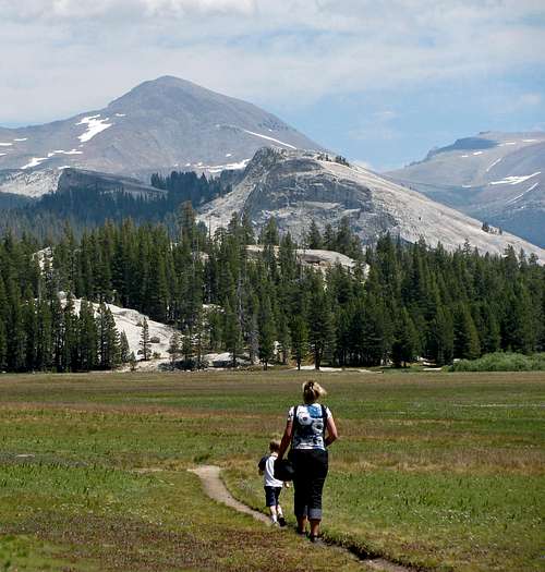
… along the Pothole Dome Trail next to the Tuolumne River.![Tuolumne Meadow hike]() Matthew and my Mom leading the way through Tuolumne Meadows …
Matthew and my Mom leading the way through Tuolumne Meadows …
I didn’t know the trail looped all the way around the eastern side of Pothole Dome, skirting the western edge of Tuolumne Meadows, but we continued following it since it seemed like a nice trail, and I’m glad we did. To the east we had nice expansive views across the meadows to the gentle, rounded domes on the other side, with nice views of Unicorn Peak, Cathedral Peak, and Eichorn Pinnacle behind us to the south. We spotted a deer about a hundred feet to our east where the trees met the meadows, and discovered that she had a couple babies with her as well, which Matthew was happy about since he’d seen deer before but never ones this small. We tried to get a little closer to them, but they got spooked and made a run for it across the trail we were walking on. Here are some of our deer sighting pictures:
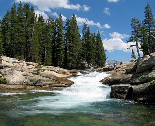
![Hidden waterfall]() … and the bottom.
… and the bottom.![Tuolumne River mini cascades]() Looking at the little cascades from the top …
Looking at the little cascades from the top …![Tuolumne River north of Pothole Dome]() Tuolumne River
Tuolumne River
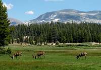
Just a bit farther we came to some small cascades, which seemed like a good stopping point. The area was quite scenic (looking along the Tuolumne River, the views reminded me of ones in Yellowstone), and the best part about this area was that we only saw a few other people, which was a welcome change from the previous day. Overall, I think it was only a mile and a half from where we parked off the side of the road. After Matthew got his fill of splashing around in the water with his newly discovered sticks, we headed back. On the way back along the Pothole Dome Trail we saw the same deer, along with 3 bucks who were busy chowing down on grass in the meadows to the east.
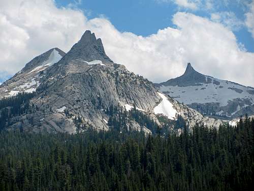
![Unicorn Peak & Cockscomb Peak]() Unicorn Peak & Cockscomb Peak
Unicorn Peak & Cockscomb Peak![Ridge southeast of Ellery Lake]() Ellery Lake
Ellery Lake![Mount Gibbs]() Mount Gibbs
Mount Gibbs
Back at the car we ate lunch (forgot to take it with us, otherwise the waterfall would have been a better spot to eat), and watched as some confused people started tromping through the middle of the meadow instead of on the designated trail. Someone else yelled at them for that, so hopefully next time they’ll know to stay on the trails. We continued driving, passing the other more-crowded trails off the sides of the road near the eastern side of Tuolumne Meadows. Eventually we made our way back out the east side of the park, backtracking a few miles to get to the Tufa Trail at Mono Lake.
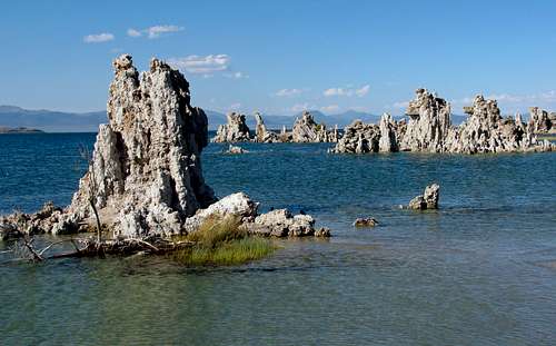
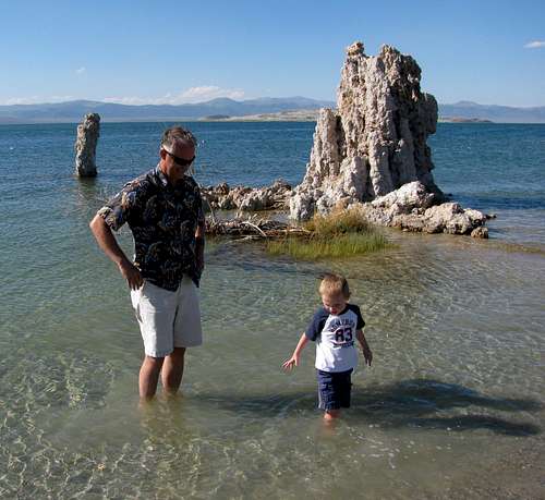
![Mono Lake Tufa rocks]() Tufa rock formations
Tufa rock formations![My Dad & Matthew at Mono Lake]() Matthew and my Dad wading in Mono Lake
Matthew and my Dad wading in Mono Lake![Tufa Trail]() Tufa Trail
Tufa Trail![Tufa Trail scenery]() More tufa goodness
More tufa goodness
We slipped the fee of $3 per person into a provided envelope and into the box at the trailhead parking lot, and made our way down to the water. The tufa rock formations were pretty neat, created by limestone calcium deposits underwater back when the levels used to be much higher. We followed the trail along the shoreline, where Matthew and my Dad decided to wade in the water. After a few pictures along the short trail, we hopped back into the van for the remainder of the drive down to Lone Pine.
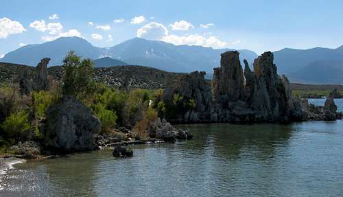
![Sierra behind Tufa rocks]() Eastern Sierra behind the Tufa Trail at Mono Lake
Eastern Sierra behind the Tufa Trail at Mono Lake
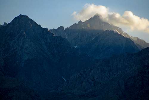
The eastern Sierra mountains along US-395 were quite impressive, and although they weren’t quite as eye-catching as the Tetons or rising as abruptly, it was still impressive knowing that in some spots we were looking at mountains almost 10,000 feet higher than us. We stopped at Carls Jr. for dinner in Bishop, and continued down to Lone Pine as the sun set over the mountains. I didn’t recognize most of the mountains I was looking at, so it was a nice surprise seeing so many jagged ones out the window:
![University Peak]() … and other rugged Sierra peaks.
… and other rugged Sierra peaks.![Mount Morrison east aspect]() Mount Morrison …
Mount Morrison …
It was a bit depressing overhearing people in the Dow Villa Motel parking lot talking about how tired they were (from hiking Mount Whitney) and how they had to wake up early for the next day (to hike Mount Whitney), but the advantage to this was that we had the pool and hot tub completely to ourselves that night. We stayed out soaking until about midnight, at which point we returned to our rooms.
Day 4 – Alabama Hills, Death Valley, & drive to St. George
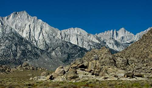
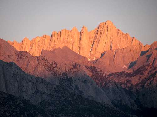
![Lone Pine Peak & Whitney]() Lone Pine Peak (left) and Mount Whitney (right) from the Alabama Hills
Lone Pine Peak (left) and Mount Whitney (right) from the Alabama Hills![Whitney at sunrise]() Sunrise on Mount Whitney, monarch of the Range of Light
Sunrise on Mount Whitney, monarch of the Range of Light![Alabama Hills]() Alabama Hills
Alabama Hills
We drove up to the Alabama Hills the next morning off of the Whitney Portal Road and wandered around a little bit. Since there were only unmarked dirt roads around, and I wasn’t exactly sure what I was looking for when using a map I printed out that shows where they’ve filmed scenes from various westerns over the years, our stay was short. The area was very hot and dry, so we decided against looking for the famous arch that photographers use to frame Mount Whitney. We continued on to CA-136 and CA-190, stopping once at the Crowley Memorial overlooking the Darwin Plateau west of Death Valley, and later on for gas a couple times on our way through Vegas to St. George, seeing several more French tourists along the way (I guess the southwestern US is one of their favorite vacation spots). The area was quite barren, and even though we saw quite a few people out and about we weren’t in the mood for hiking in 120-degree heat (winter would definitely be a better time to visit). Instead of driving all the way back to Salt Lake City in one day, we stopped off in St. George, relaxing at the hotel pool and hot tub once again after a filling dinner at Golden Corral.
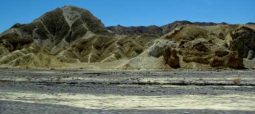
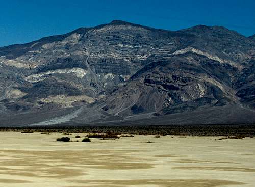
![Death Valley]() Death Valley
Death Valley![Panamint Butte]() Panamint Butte
Panamint ButteDay 5 – Kolob Canyon (Zion National Park) & drive home
![Buck Pasture Mountain canyon]() Sub-canyon leading to Buck Pasture Mountain
Sub-canyon leading to Buck Pasture Mountain![Kolob cliffs]() Steep sandstone cliffs in Zion National Park
Steep sandstone cliffs in Zion National Park![Buck Pasture Mountain south ridge]() Red rock over green canyons
Red rock over green canyons
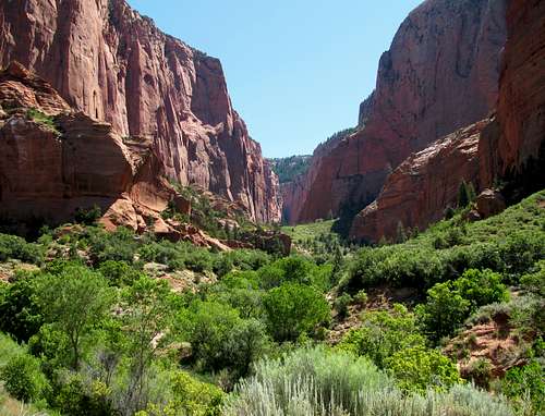
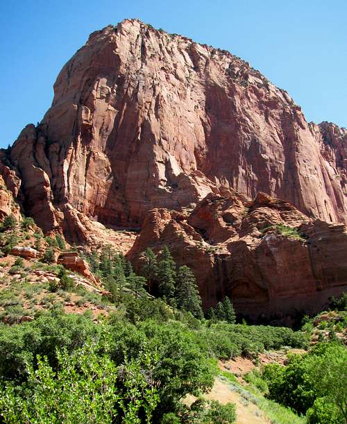
The last day we made a short detour off of I-15 to see Kolob Canyon, which is technically part of Zion National Park even though it is basically inaccessible from the main Zion Canyon (at least by road for lazy day hikers like me). The views were awesome and I was surprised how green all of the plants still were, but once again we decided against hiking due to the heat. In cooler conditions, I’d love to try some back-packing up one of the many canyons we saw off of the main road. After a few more hours of driving we made it back home.
![Liz & Matthew at Kolob Canyon]() Liz & Matthew at the end of the road
Liz & Matthew at the end of the road![Kolob Canyon Road view]() Views from Kolob Canyon Road
Views from Kolob Canyon RoadSummary
Did Yosemite National Park live up to the hype? I thought it did, and the variety seen between the impressive granite domes, roaring waterfalls, scenic meadows, and giant sequoia groves was one-of-a-kind. There’s a reason this park is so popular, because you really cannot see the same things anywhere else.
Was hiking Half Dome with the assistance of the cables an awesome experience? Yes, and I’d definitely label it as a must-do hike, although I wouldn’t go quite so far as to say it’s my favorite (I prefer the alpine scenery in places like the Tetons and Glacier National Park, which I probably would have had a better taste of in the Sierra if we’d been able to do Mount Whitney). The cables were really fun to climb though, and at least from my experience it didn’t seem nearly as bad as it probably used to be before the park instituted the quota system (the crux of the trip was probably having fast enough fingers to get permits for the day I wanted online). The general feeling I got from most of the people on the trail was that they were embarking on the most monumental undertaking of their lives, but I'm sure many of them will be inspired to move onto bigger and better things when it comes to climbing mountains.
![Vernal Falls crowds]() Crowds above Vernal Falls
Crowds above Vernal Falls
Did the crowds detract from the experience? Unfortunately, yes. Despite the warnings, I had never expected the crowds to be as bad as they were, and even though the Mist Trail in particular had some awesome views, it felt more like I was walking on a crowded city sidewalk with big posters of outdoor scenery hanging from nearby buildings. I know we only added to the problem, but I’d only go back at a less crowded time of year. My advice would be to go earlier in the summer, and not on a weekend (unfortunately for us, that was impossible this time). The areas off of the Tioga Pass Road seemed just as impressive but without the crowds, so that’s probably where we’d focus on going next time.
Just seeing peaks from the road, the eastern Sierra mountains all the way from Yosemite down to Lone Pine appeared quite scenic and rugged, so that’s still an area I’d like to explore in the future as well. It's too bad we didn't get to do Whitney (the frustrating part is that according to the Inyo National Forest website, 7 people ended up not using their Whitney day hike permits the day we could have done it), but with better luck I'd like to come back and do a Mountaineer's Route/Whitney Trail loop. Our first taste of the Range of Light did not disappoint, and I can see why so many people rave about the near perfect weather and awesome granite.
Comments
No comments posted yet.