
|
|
Mountain/Rock |
|---|---|
|
|
46.10382°N / 119.12995°W |
|
|
Benton |
|
|
Hiking |
|
|
Spring, Summer, Fall, Winter |
|
|
2200 ft / 671 m |
|
|
Overview
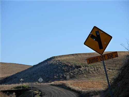
Jump Off Joe is a peak located near the Tri-Cities region of south-central Washington state. With a low elevation of only 2200', the peak is minor in the grand scheme of Washington mountains. However, the peak has the distinction of being the third-tallest official mountain in Benton County and the tallest mountain within a radius of 27 miles. In fact, Jump Off Joe is one of only 18 peaks total in Washington state to be isolated from a taller mountain by a radius of 25 miles of more. In addition, with 725' of prominence, the peak is the fourth-most prominent mountain in Benton County. Ascending east up mountain...
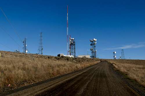
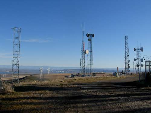
Ascents of Jump Off Joe are straightforward. Despite numerous wind turbines lining up the mountain slopes, and despite multiple radio tower facilities on and near the summit, public access to the summit area is allowed year-round. A non-gated dirt road (named "Jump Off Joe Road") leads to the summit, making the peak primarily a drive-up. However, it is common to find people hiking or biking the summit road on any given day.
 USGS Benchmark At Summit
With no trees on the mountain slopes and no higher peaks nearby, views from the summit area are outstanding. The peak has a great vantage point for the Tri-Cities, Badger Mountain, Columbia River, and peaks located far to the east and south.
 Northern View From Summit
Getting There
FROM KENNEWICK, WA:
1) Head east/south along I-82 for several miles.
2) Take Exit 114 (Highway 397 exit). Turn left (east) onto Highway 397, crossing under the freeway. From this point, there are two possible road approaches.
ROAD APPROACH #1:
3) From the I-82/Highway 397 intersection, head east for 0.1 miles and then turn right (south, parallel to I-82) towards Bateman Road.
4) Drive south for 0.5 miles, then turn left (east) onto Bateman Road. The road quickly becomes a dirt/gravel road.
5) After 2.2 miles along Bateman Road, turn right (south) onto Owens Road. Intersection elevation is 1104'.
6) After 1.6 miles along Owens Road, turn left (east) onto Jump Off Joe Road. Intersection elevation is 1454'.
 Approaching Turnoff For Summit Road...
7) After 1.3 miles along Jump Off Joe Road, veer left towards the summit area.
8) Reach the summit area (2200' elevation) within 0.2 miles.
 Approaching Summit...
ROAD APPROACH #2:
3) From the I-82/Highway 397 intersection, head east for 2.3 miles and then turn right (south) onto Owens Road.
4) After 3.8 miles along Owens Road, turn left (east) onto Jump Off Joe Road. Intersection elevation is 1454'.
5) After 1.3 miles along Jump Off Joe Road, veer left towards the summit area.
6) Reach the summit area (2200' elevation) within 0.2 miles.
 Looking East From Summit...
Red Tape
Public access is allowed only on road routes listed above.No public access is allowed within any fenced-in radio tower facilities or on any property directly containing wind turbines.