Overview
![Kolob04]() LaVerkin Creek trailhead at Lee Pass
LaVerkin Creek trailhead at Lee Pass![Kolob03]() Along the trail to Kolob Arch
Along the trail to Kolob Arch Kolob Arch is a fantastic hike in an area of Zion National Park that is relatively unknown. It is approximately 13 miles round trip and can be done in a day by experienced hikers or overnight for those that prefer. Kolob Arch was believed to be the longest free-standing arch in the world, but with laser measuring techniques it is now ranked second.
The hike to the arch is relatively easy, with an easy down hill grade for the first four miles and then a moderate up-creek hike for the rest. The return hike is harder, especially if it is in the heat of the summer. Temperatures can reach the 100+ range so it is best to hike back in the evening if possible. Temperatures are more moderate in the spring and fall. Winter hiking is also possible but perhaps not recommended because there is rarely enough snow to snowshoe but often lots of mud.
The trail is very easy to follow and is used frequently but there can be days when you will not see another hiker. Be sure to take plenty of water, especially for the hike out. There is water along many scetions of the trail but filtration or purification is necessary.
The elevation at Lee Pass is 6070. From there it is downhill for about 3.5 miles and just under 1000 feet of elevation loss. The low point of the hike is at the first meeting of LaVerkin Creek is which is elevation 5085. From there the next three miles slopes gradually up to an ending elevation at Kolob Arch of 5413.
![Kolob02]() A branch of LaVerkin Creek near Kolob Arch
A branch of LaVerkin Creek near Kolob ArchGetting There
![Kolob05]() Area map of the Kolob Canyons section of Zion National Park
Area map of the Kolob Canyons section of Zion National ParkGetting to the Kolob section of Zion National Park is much easier than the rest of Zion. Travelling either north or south on Interstate 15 in Southern Utah, get off at exit 40. After you exit turn east and within 200 yards you are at the Park entrance. Pay fees here and gather maps and any other information you may need. Leave the entrance by continuing east. The road leads north up an inclined dugway, then turns east again into the canyon. The road winds its way to the south, gaining elevation to Lee Pass, then more or less levels off for the last mile. The LaVerkin Creek trailhead is just south of Lee Pass. There is plenty of parking for day or extended trips.
Red Tape
You must pay the normal park entrance fees to enter the park. At present the fee is $25.00 per car which allows you up to seven days. Dogs are not permitted on hiking trails. Overnight camping requires a backcountry permit which runs another $5.00 per day.
Camping
There are several campsites available along the LaVerkin Creek trail inside the park but must be reserved. A backcountry permit must be acquired, reservations may be made up to two months before event. The nearest campground to the trailhead is around 3.5 miles.
External Links
Zion National Park officiel home page: http://www.nps.gov/zion/index.htm
Watch out for
Rattlesnakes are often seen in this area in the summer. There are also scorpins and tarantulas. Mountain Lions roam these canyons but are rartely seen by humans and are not a real threat.

 LaVerkin Creek trailhead at Lee Pass
 Along the trail to Kolob Arch
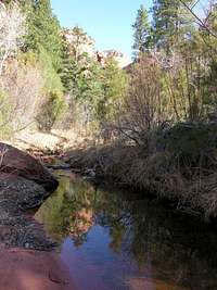 A branch of LaVerkin Creek near Kolob Arch
 Area map of the Kolob Canyons section of Zion National Park