
|
|
Mountain/Rock |
|---|---|
|
|
36.32783°N / 50.98160°E |
|
|
Mountaineering |
|
|
Summer |
|
|
13727 ft / 4184 m |
|
|
Overview
Click for Introduction to the Central Alborz Mountains.Click to see the Map of the Takhte Soleyman Massif.
My GPS measured an elevation of 4193 m. The 4184 m figure is per the Iranian 1:50 000 map.
In Farsi: Lashgarake Koochak
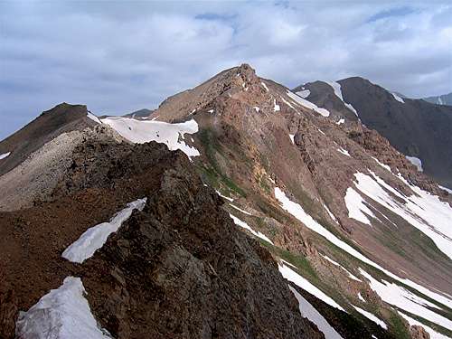 Souteast Face
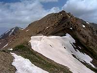 Southern Slopes
 Below Summit
There is nothing small about Lashgarak the Small. In fact it is a prominent peak that sits on the south side of a slightly higher peak known as Lashgarak the Great (4256 m) in the southern parts of the Takhte Soleyman Massif. To the southeast, Lashgarak the Small connects to the 4030 m Khers Char Peak. The eastern slopes of Lashgarak the Small go into a branch of the Chalus Valley and its western and southern slopes into a branch of the Taleghan (Shah Rood) Valley.
Lashgarak the Small rises on the crest of a ridgeline that forms the southeastern arm of the Takhte Soleyman Massif. This ridgeline (which is roughly 15 Km long) starts at the summit of Lashgarak the Great Peak and continues a few kilometers beyond Zarrin Kooh Peak to the southeast giving rise to a few 4000 m (and other 3800 and 3900 m) peaks.
Lashgarak the Small is usually climbed as a bonus peak by those who climb Lashgarak the Great. It can be easily accessed via its northern slopes which connect to Lashgarak the Great.
 North Face
If from the summit of Lashgarak the Small, you plan to continue the ridgeline southeast toward the Khers Char peak, you should be aware that the southern/southeastern slopes of Lashgarak the Small present more of a challenge to the hiker than its easy northern slopes. These slopes are made of steep scree interspersed with cliffs. With some route finding, however, the slopes can be negotiated without any technical difficulties.
 Southern Slopes Southern Slopes |  Southern Slopes Southern Slopes |  Southern Slopes Southern Slopes |  Southern Slopes Southern Slopes |
There is a 4022 m high point on the southeastern ridgeline of Lashgarak the Small that is sometimes counted as an individual peak under the name Dalzor (see picture). In my opinion, this point does not have enough prominence to be a separate peak.
 Southwest Face
Views from the summit of Lashgarak the Small:
 Zarrin Kooh Zarrin Kooh | 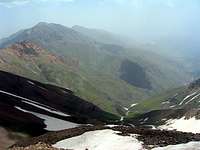 Abidar Abidar |  Lashgarak the Great Lashgarak the Great |
 Gardooneh Kooh Gardooneh Kooh |  Kolikosh Kolikosh |  Saddle Saddle |
Route Information
Click to see the Route Page for Lashgarak the Great Peak.
From the summit of Lashgarak the Great (4256 m), head south down the scree slopes to reach a 4090 m saddle and then hike up the northern scree slopes of Lashgarak the Small. Distance is 1.2 Km.