
-
 7417 Hits
-
 81.84% Score
-
 14 Votes
|
|
Mountain/Rock |
|---|---|
|
|
38.88870°N / 78.3386°W |
|
|
Shenandoah |
|
|
2265 ft / 690 m |
|
|
Overview
Little Crease Mountain forms a small ridge that intersects the main eastern ridge of the Massanuttten Mountains at its summit. Found in the northern section of the Massanuttens, Little Crease Mountain offers views of the Shenandoah Valley and the western and eastern Massanutten ridges, an elevation gain of 1,700 feet, a visit to the remains of a 19th Century iron furnace, and the opportunity to combine your hike with a canoe trip down Passage Creek. Not bad for a mountain only 2,265 feet tall!
Getting There
Sherman Gap Trail: From Front Royal, drive west on Route 55 until reaching SR 678. Turn left onto SR 678 and follow it to SR 619. Turn left on SR 619 and continue to SR 613. Turn right on SR 613 and follow it for 2.7 miles until the sign for the Sherman Gap Trail. There is limited roadside parking here.
The pink-blazed Sherman Gap Trail starts out as an old wagon road. It ascends gradually for about 1.4 miles. Then, the trail narrows and alternates between level and relatively steep sections. After another mile, the Sherman Gap Trail gains the eastern ridge of the Massanutten Mountains and intersects the orange-blazed Massanutten Trail. Turn left, and follow the Massanutten Trail , which skirts the summit of Little Crease Mountain, for about 0.3 miles. When the trail regains the ridge beyond the summit at this point, turn back towards the right and bushwhack along the ridge for 0.1 miles to the summit. The bushwhack is a B1 on the Bushwhacking Scale.
Round trip: 5.6 miles with an elevation gain of about 1,700 feet.
 |
 |
 |
Veach Gap Trail: From Front Royal, drive west on Route 55 until reaching SR 678. Turn left onto SR 678 and follow it past Elizabeth Furnace Recreation Area. Turn left onto SR 774 and follow it to the parking lot at the end.
Hike on the yellow-blazed Veach Gap Trail for 1.2 miles. At the junction with the Massanutten Trail, turn left and follow it for 3 miles until reaching this point. Bushwhack along the ridge for 0.1 miles to the summit. NOTE: This route has the best views and several good campsites, but also has received some complaints about being a tick magnet.
Round trip: 8.6 miles with an elevation gain of about 1,300 feet.
Elizabeth Furnace Loop: From Front Royal, drive west on Route 55 until reaching SR 678. Turn left onto SR 678 and follow it to the Elizabeth Furnace Recreation Area. Turn left into Elizabeth Furnace Recreation Area (past group camping sign) Parking is on your right over a small bridge.
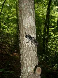
Huge Bug
The white-blazed Botts Trail starts at the right end of the parking lot. Hike for 0.8 miles until reaching the Sherman Gap Trail, where you bear left. Follow the Sherman Gap Trail for 2.7 miles until it gains the eastern ridge of the Massanutten Mountains and intersects the Massanutten Trail. Turn right, and follow the Massanutten Trail, which skirts the summit of Little Crease Mountain, for about 0.4 miles. When the trail regains the ridge beyond the summit at this point, turn back towards the right and bushwhack along the ridge for 0.1 miles to the summit.
On the way back, continue along the ridge on the Massanutten Trail when you reach the intersection with the Sherman Gap Trail instead of turning left. Follow the trail for 2.3 miles until you see a yellow blaze on a tree on the left. Turn left onto an old wagon road which descends steeply and reaches Elizabeth Furnace after about 0.9 miles. Turn left onto the Massanutten Trail and follow it for 0.1 miles back to the parking lot.
Round trip: 7.8 miles with an elevation gain of about 1,500 feet.
If you have a full day, it is possible to combine the Elizabeth Furnace Loop with a canoe trip down Passage Creek. There are sites in the Elizabeth Furnace Recreation Area where you can put your canoe into the creek. It is about 6 miles downstream to where you take your canoe out; rapids tend to be Class II and Class III.
Red Tape
Little Crease Mountain and the entire route to its summit are on public land in the George Washington National Forest. There are no fees or permits required for hiking or camping except at Elizabeth Furnace. Please respect private property on the right side of the trail near the trailhead.
When to Climb
Little Crease Mountain can be climbed nearly all year round. The best season to bushwhack is winter, when hostile flora and fauna are minimized. Fall colors arrive in October and November. Summer is the worst time for mosquitoes and ticks, and undergrowth is at its thickest.
Hiking should be avoided in the National Forest during the period in late November when it is permissible to hunt deer with modern firearms. In 2019, deer season runs from November 16 through November 30.
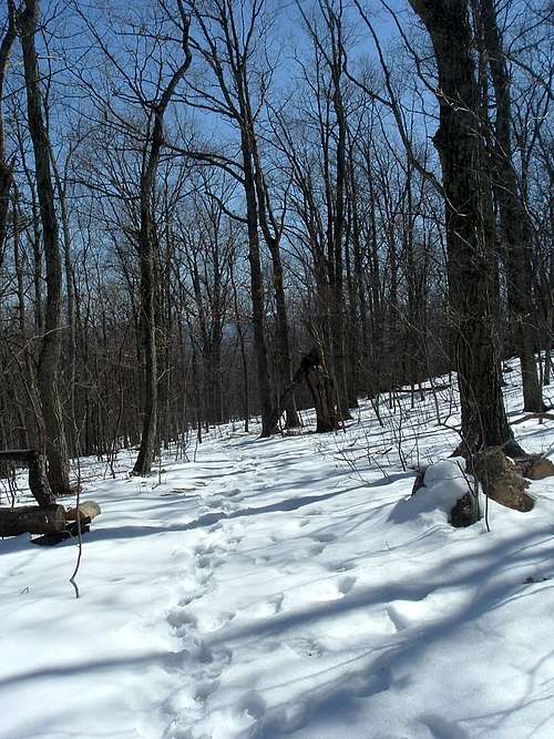
Winter on Sherman Gap Trail
Camping
Free camping is permitted throughout the George Washington National Forest except in the immediate vicinity of picnic areas and a few other locations. Elizabeth Furnace Recreation Area has a large campsite with restrooms and picnic areas. The fee is $10 per night; contact the Lee Ranger District for further information.
There are two good campsites along the Massanutten Trail that are 0.5 miles and 2.4 miles north of the intersection with the Veach Gap trail, respectively. The Veach Gap Shelter is on the Massanutten Trail 0.1 miles south of the intersection with the Veach Gap Trail.
External Links
George Washington National Forest- Lee Ranger District
The Potomac Appalachian Trail Club maintains the trails in the Massanutten Mountains, and provides maps, guidebooks, and other information.
American Whitewater offers some more details about canoeing Passage Creek.