Intro/Stats
"Peak Y" (12274')
"Zephyr Peak" (12067')
"Peak Z" (12244')
Payne Benchmark (11780')
"No Payne" (11789')
Shawnee Peak (11927')
"Platte Peak" (11941')
Foster Benchmark (11871')-unranked
Mt Blaine (12303')-unranked
N. Twin Cone Peak (12323')
S. Twin Cone Peak (12340')
"Kenosha Peak (12100')
"X Prime" (12100')-soft ranked (280' prominence)
"Peak X" (12429')
Lost Creek Wilderness
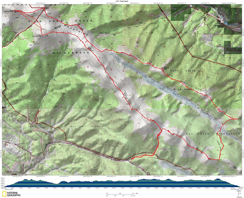
28.2 miles RT/8600' gain
Sept 27, 2008
Slideshow
Participants: Jeff & Allison Valliere & Sierra, Dave Hale & Shep, John Kirk, Dwight Sunwall, Keith Bershader, Patrick Lilly, Jill Salva, Bob Dawson, Ryan Kowalski, Greg Hakes, Jeremy Hakes, Derrill Rodgers, and Kevin Baker
Dwight sent out an open invite on 14erworld and Lists of John for a huge loop hike in the Lost Creek Wilderness (LCW) with the possibility of hitting as many as 14 summits! I wasn't too sure I had it in me to make it through this insane agenda, but it doesn't hurt to try! I had only done 3 out of the 37 ranked peaks and have been wanting to explore the area more this fall, so this was an efficient way to do it.
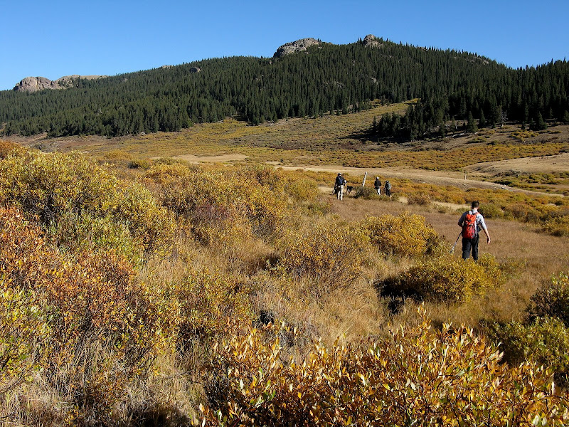
This circuit of 11ers and 12ers starts at the Long Gulch trailhead and about 85% of it is a bushwack/open tundra walk. Some of us met the night before about a mile west of the trailhead and camped along the road while others drove in the next morning.
Y, Zephyr, and Z
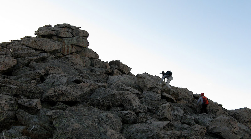
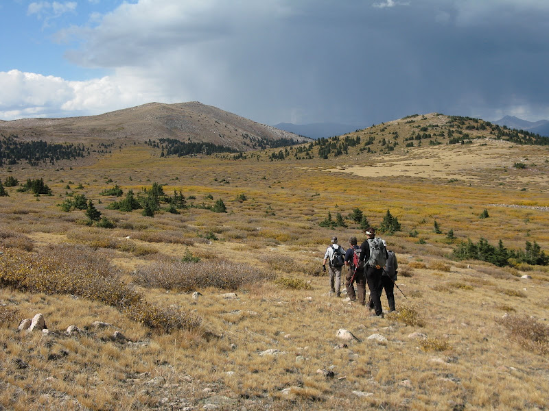
Our group of 14 was off at 5:45am under clear skies. We followed a decent trail on the right side of an unnamed creek. The trail was a bit faint in spots, but the creek could easily be used as a handrail when in doubt. Our large group ended up breaking up into 2 groups as we made good time to the Peak X/Y saddle and then eastward to the summit of Y, which afforded some nice boulder hopping.
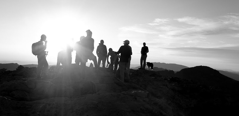
Group enjoying sunrise on Y summit:
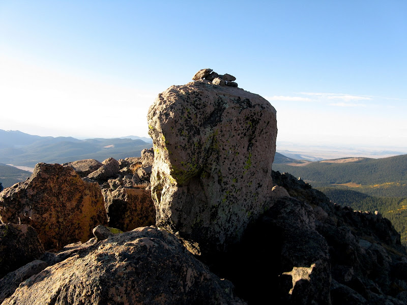
The theme of the day was short summit visits with all of the peaks on the agenda, so I made sure to eat more than I normally do and stay well hydrated. The true summit of Y is a nice class 3 boulder.
The first three peaks of the day come in quick succession, and we enjoyed the mellow tundra walk over to Zephyr, which was a cool little summit as well.
No Payne, No Gain
Everyone was doing well and enjoying this early fall day. The next leg of the journey would take us down to the Brookside/McCurdy trail as we followed it down to Craig Park. We would cross the creek and climb to the northern end of our loop across the Platte River mountains. Even the willows were inviting as this quite possibly was the prime weekend to see the fall colors.
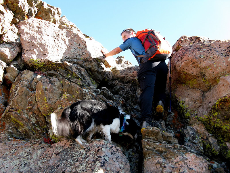
Only 6 miles into the hike, some of us refilled our water bladders at Craig Creek as this was quite possibly the only known water source for the rest of the day without going out of the way. We left the trail and bushwacked steeply up the s.w. slopes of Payne Benchmark. This would be our last sustained ascent of more than 1000' at a time, which is what makes this traverse so enjoyable. With only 300-600' climbs, most of these do not require a sustained amount of effort. Ryan was bummed when I announced we were going over a false summit, but he enjoyed this brief scramble with Shep. Shep is a professional scrambler who can show us all how it's done.
The summit of Payne soon came without a whole lot of pain, but the pain was yet to come. On to "No Payne". Wait, shouldn't we have do "No Payne" first? Here we see Shep again taking credit for an unranked bump he climbed.
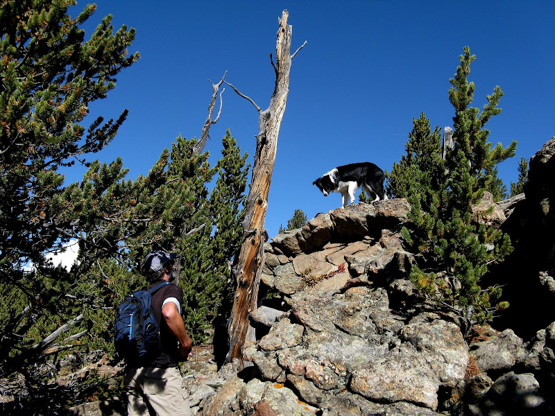
The bushwacking got a little thicker on No Payne, but was not even close to the annoyances of Douglas county. Just a few downed trees and flying branches to deal with, although Ryan about poked his eye out! We went over No Payne without much fanfare and continued on to Shawnee. The drill on this ridge is you break out of the trees for awhile near the summits and drop back down to the trees, which made for slower progress. I was ready to hit the wide open tundra further west, but the willow monster would have other ideas.
Shawnee, Platte, Foster, Blaine, & the Twin Cones
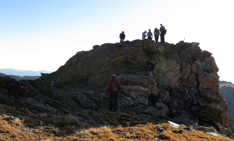
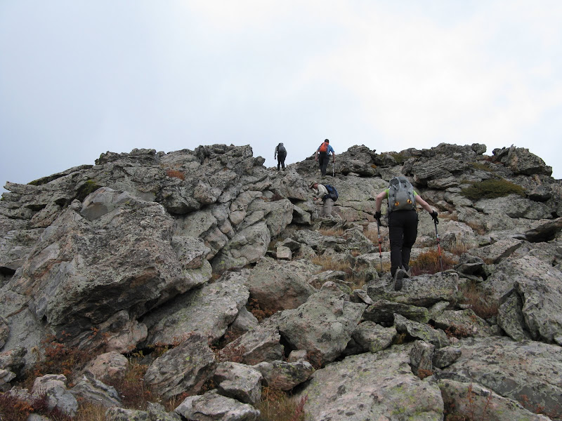
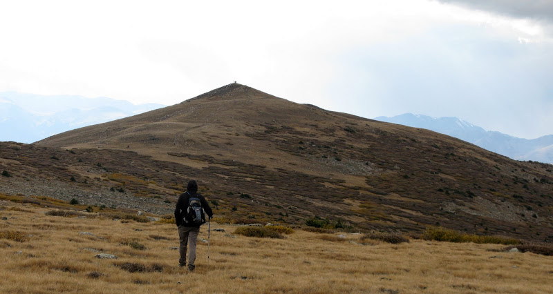
On the summit of Shawnee, some of the group decided to do a shorter loop and head over to X and X Prime mostly due to time constraints. I guess they were the sane ones of the group! 7 of us pressed on to Platte and summits westward. I was still feeling pretty good about the day after downing my 2nd Hershey bar and other sugary treats the dentist wouldn't approve of. As we made our way over to Platte, the clouds started building and we were wondering what the weather would hold later.
Nearing summit of Platte:
The next two summits of the journey were far apart and the willows and surprising bogs began to make their presence felt. Most of the willow bashing was of no concern because the elk did a good job making a path for us in advance as long as they were going the right way. Here's a video of Jill plowing her way through the worst section:
Willow Bashing 101
Unranked Foster Benchmark was next on the agenda and was no more than a blip on the radar. I guess we hiked over to Foster since Roach has it in his book and Bob can finish the book, although I was game.
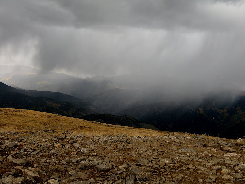
Next up was unranked Blaine, which turned out to be a long leg as there was a bit of boulder hopping and uneven grass to deal with. I was starting to feel it now on this leg, so it was more sugar to the rescue on the summit. The weather was no starting to close in from the northwest, although I didn't see any lightning and the clouds were moving very slow. We pressed on to nearby North Twin Cone, which would mark the western end of our long loop.
Thunder began to rumble in the distance, so we made haste for N. Twin and hoped the weather would skirt us. We caught the road and made it to the top around 4:45 with a few minutes to spare before some weather hit. 10 down and 4 to go if the lightning stays away!
With no rest for the weary, we made haste for S. Twin Cone, hoping we wouldn't have to bypass it. The wind picked up a bit a light graupel began to fall as we contoured over to S. Twin Cone. We took a break a few hundred feet below the summit and assessed the weather. Bob and Jill decided to call it a day while John, Dwight, Keith, and I headed up to S. Twin Cone as it began to snow.
We were reassured to see the clouds breaking to the west and the snow squall moved through pretty quick, ending just about when Dwight and I got to the summit.
Are We There Yet?
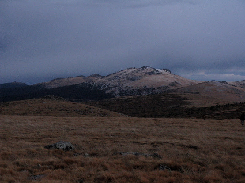
We all regrouped below the summit and Bob and Jill headed down on the Rock Creek trail while the rest of us pressed on. The weather was very fickle throughout the day as at one point I was considering breaking out the shorts and now I was breaking out the heavier gloves! The traverse over to mellow Kenosha was not as easy as it looks on the map as there were more willows and bogs to navigate. Be careful or those bogs will suck your shoe off!
Light snow and graupel was on and off as we headed over to Kenosha. Light was now beginning to fade. As we topped out on Kenosha, my heart sank as Peak X looked a LONG way away!
I was prepared to do X in the dark, but it's always a lot tougher mentally when it's just you and your headlamp. Conversation waned as we all drifted into zombie mode. A large herd of elk moved over the ridge and bugeled below us in the trees. I was actually feeling better than I thought I would with all the calories I consumed, but it was tough. Soft ranked X Prime was next and it held some surprises up its sleeve with 2 false summits. We would top out on one and shine our headlamps only to see a higher one off to the east. The GPS really came in handy.
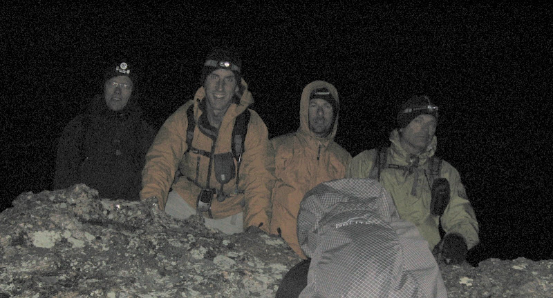
We finally found the true summit of X Prime, a short but steep grind up slick talus. As we moved east, the snow deepened but was still only a couple inches at most. The last summit of the day was the highest, Peak X. The climb from the saddle is steep initially then relents before turning into a talus hop mixed with grass. The summit or so we thought came sooner than I expected as I approached John and Keith's headlamps. Is this it? We couldn't find a register and John noted there was an equal contour to the east. Dwight didn't think this was it.
Down we went again over to the eastern contour, which looked more familiar to Dwight. We finally topped out at 8:50pm and were treated with a surreal view of the distant lights of Denver as the skies had cleared. This was my latest summit ever and a tough one it was after the long day!
As my friend Karen would say, I guess we're "insane in the membrane!" We were stoked to know that we only had 2 miles left back to the car. We slip-n-slided our way back down to the Y/Z saddle and found the trail without a problem. I kept tripping over rocks on the way down as my legs were shot, but it wasn't long until we emerged from the forest at 10:20pm after a 16.5 hour day. I have had some tougher days, but this will go down as a memory maker. Thanks for putting this together, Dwight!
Counter clockwise GPS track:


Comments
Post a Comment