Prologue
I wanted to hike the 7.3 mile long (14.6 mile roundtrip) Boulder Canyon Trail in the Superstition Mountains east of Phoenix, Arizona. After a few miles, I lost the trail and ended up in the La Barge Canyon. I bushwhacked my way up La Barge Canyon to a nonspecific point where I decided to turn around and go back. It wasn’t until the next day when on the internet, I read about Lower La Barge Box Canyon, which is supposedly the most impressive place in the Superstition Mountains. It turns out that I had reached within a few tenths of a mile of the start of the box canyon. I wonder what I missed.
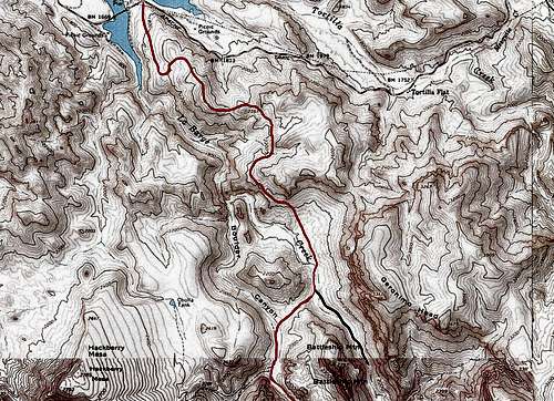
![Boulder Canyon Trail]() Map
MapGetting There & Parking
Left our rental house near Phoenix at 6:00 a.m. Drove to Apache Junction and took Route 88 north. The road became winding and narrow. It went up and down the hills until it reached Canyon Lake behind Mormon Flat Dam. After the second narrow one lane bridge (east of it), I saw the sign for Boulder Canyon Trail #103 but there was no parking area there. I saw a marina on the other side of the road but the gate to the marina was closed at that hour and I doubted that I could park there. A dirt pull-off had No Parking sign. I drove back to the west side of the one lane bridge where there was a parking area but signs said that parking in that area required the blah blah blah permit obtainable at forest service or local businesses. Well, where was the forest service? I saw no local businesses. Even if I had parked there, I would have had to walk over the narrow bridge. Later in the day when the traffic became heavier, this could have been dangerous. I was getting frustrated. I did not want to waste time trying to find a parking spot. I drove back to the east side of the bridge and drove a short distance to another dirt pull-off which did not have any No Parking signs. I parked there.
Hike Statistics
| Place | Elevation | Distance |
| Where I parked | 1680 ft | zero miles |
| Trailhead | 1680 ft | 0.20 miles |
| High Point | 2360 ft | 1.20 miles |
| La Barge Creek Crossing | 1800 ft | 2.0 miles |
| End of my hike | 1900 ft | 1.0 miles |
| Total | - | 4.40 miles |
| Roundtrip | 2000 ft uphill | 8.80 miles |
Trip Report
Monday April 1, 2013
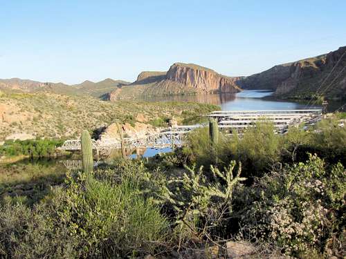
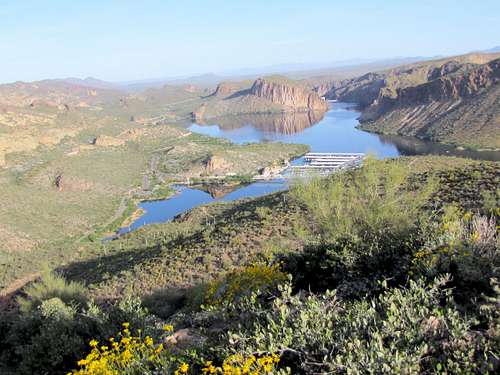
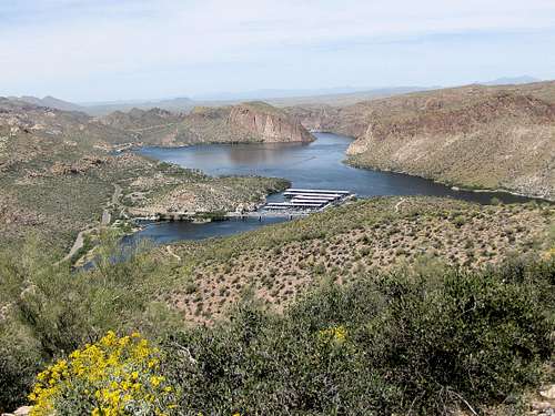
Started my hike at 7:00 a.m. Walked 0.2 miles along the road until I reached the trailhead. Elevation was 1680 ft there. The trail headed south/southeast and quickly began to go up a hill. The marina, the bridge that I had crossed and Canyon Lake were well visible. Most of the times, I was in direct sunlight. High temperature was supposed to reach 85 degrees Fahrenheit. I was already concerned about overheating.
![Canyon Lake]() Canyon Lake
Canyon Lake
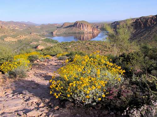
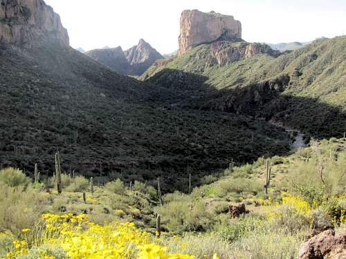
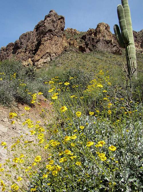
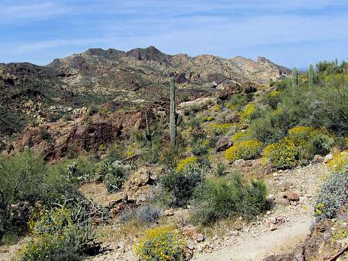
It was early April and yellow flowers covered much of the slopes. The mountains on the west side of the canyon were glowing in the morning sun light.
![Canyon Lake]() Canyon Lake
Canyon Lake![Looking west]() View West
View West
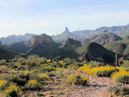
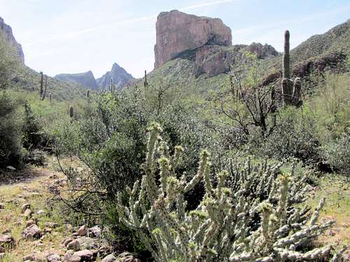
At 7:40 a.m. I reached the top of a hill at 2360 ft. I was now a good 500 ft above the bottom of Boulder Canyon. The views were great. To the south, Weavers Needle had come to view. To the north, the lake was still visible.
![Weavers Needle]() Weavers Needle
Weavers Needle![The Flatiron]() The Flatiron
The Flatiron![Canyon Lake]() Boulder Lake
Boulder Lake
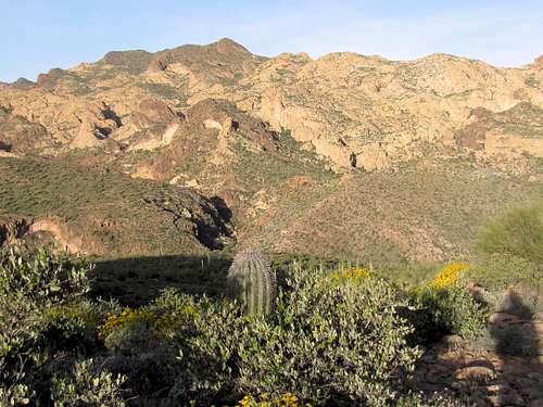
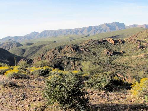
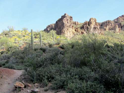
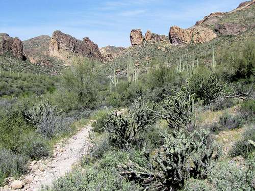
The trail continued south. It went up and down a number of times but continued to remain way above the bottom of the canyon. I did go in the shade. This helped me cool down.
![South of the high point]() Looking northwest
Looking northwest
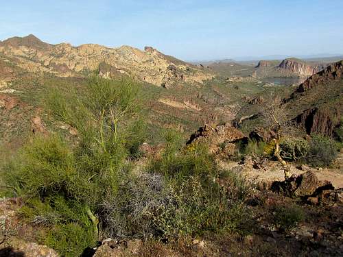
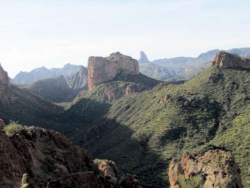
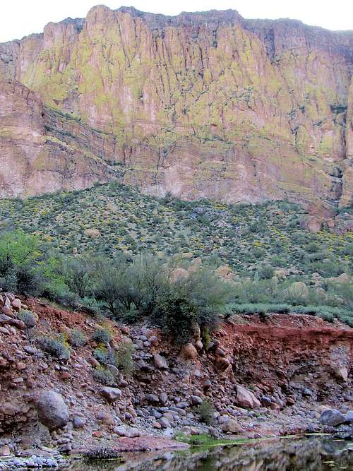
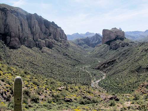
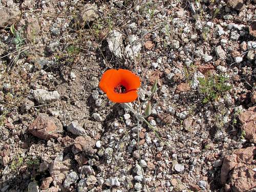
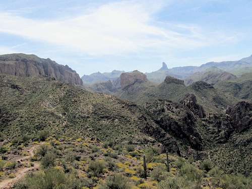
I then saw one hiker. He had started at First Water Trailhead and was hiking in the opposite direction that I was hiking. At that moment, he was taking pictures of a flower. He said he lived in the area and had never seen such a flower before. I decided to take the picture of the flower on my way back when it would hopefully be in the sun. As I continued on the trail, I kept getting good view of the canyon below. A mountain with a huge wall could be seen to the southeast of me. The morning sun was behind the mountain keeping the wall in the shade creating a big shadow over the canyon below. This mountain was the 3479 ft Geronimo Head. I did not look at my maps and was mistakenly thinking that it was the 2797 ft Battleship Mountain. I was looking at the real Battleship Mountain wondering which peak that was.
![La Barge Canyon]() La Barge Canyon, Weavers Needle & Battleship Mountain
La Barge Canyon, Weavers Needle & Battleship Mountain
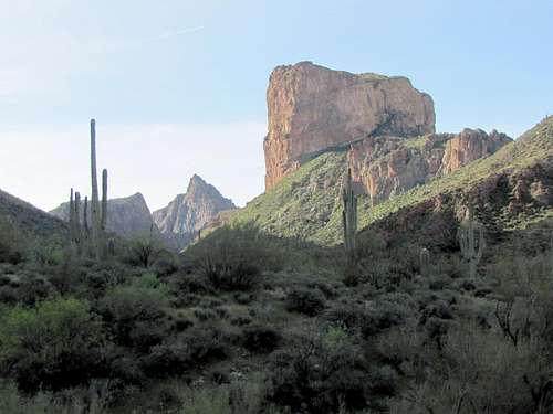
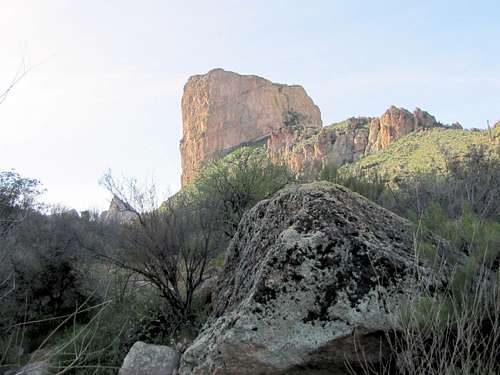
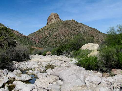
The trail reached a spot at around 2180 ft elevation and then began to go down quickly to reach the bottom of La Barge Canyon at 1800 ft. Battleship Mountain and another triangular peak were seen to the south.
![Descending into La Barge Canyon]() Battleship Mountain & Traingular Peak
Battleship Mountain & Traingular Peak![Descending into La Barge Canyon]() Descending
Descending![Battleship Mountain on the right]() Battleship Mountain & Traingular Peak
Battleship Mountain & Traingular Peak
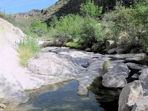
The trail then crossed to the west side of La Barge Creek. There was a little running water in La Barge Creek.
![Geronimo Head]() Geronimo Head from La Barge Creek
Geronimo Head from La Barge Creek![Battleship Mountain]() Battleship Mountain from La Barge Creek
Battleship Mountain from La Barge Creek
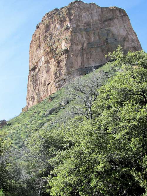
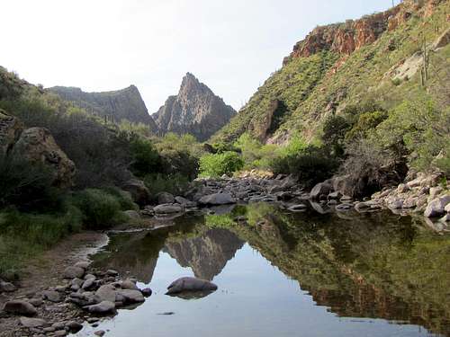
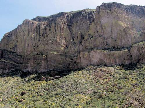
The trail then went parallel to the creek for a short distance until I reached a spot where I saw what looked like a 10 foot long spur trail on the right that went to a place where people had camped before. The main trail seemed to go to the left. This was my mistake. The main trail actually went to the right to go up a divide and then descend into Boulder Canyon. I followed the left branch. The trail quickly went to end at La Barge Creek bed. I kept looking but could not see a trail on the other side of the creek bed. I could see cairns where the trail had ended. This assured me that I was in the right spot. I was at the base of the wall of Geronimo Head but since I was mistaking that with Battleship Mountain, it was giving me additional false reassurance that I was on the trail.
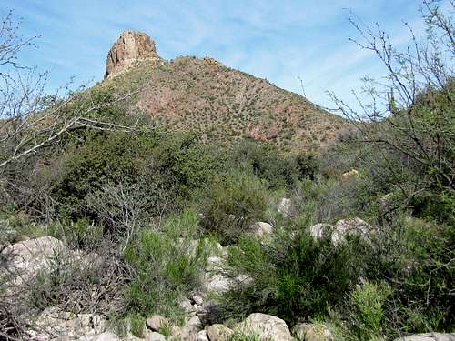
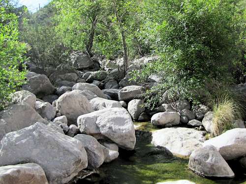
The creek bed was wide and covered with boulders. As I kept looking to the south, I saw a few more cairns. Spotting cairns in a place full of rocks and boulders was difficult but they were definitely there. The creek bed was at first wide making it easy to hike. Since I kept finding cairns, I kept going. Sometimes the creek went dry. A film of dried up green algae/scum covered large areas of dry creek bed. As I kept going, the area became overgrown. Bushes, trees, rocks and other obstacles made the progress slow. It became apparent that I was not on the trail. I finally pulled the map out of my pocket and realized that I was in La Barge Canyon not Boulder Canyon. I was thinking that behind every obstacle a snake or scorpion may be waiting to bite me. Continuing to hike off trail all alone was really not a very smart thing to do. I had told my wife that I would be on Boulder Canyon Trail. At 9:30 I thought that I had wasted enough time and decided to go back.
![Battleship Mountain]() Battleship Mountain
Battleship Mountain![Bushwhacking in La Barge Canyon]() La Barge Canyon
La Barge Canyon![La Barge Canyon]() La Barge Canyon and impressive nameless triangular peak
La Barge Canyon and impressive nameless triangular peak![Bushwhacking in La Barge Canyon]() Bushwhacking in La Barge Canyon
Bushwhacking in La Barge Canyon![Bushwhacking in La Barge Canyon]() Bushwhacking in La Barge Canyomn
Bushwhacking in La Barge Canyomn![Bushwhacking in La Barge Canyon]() Bushwhacking in La Barge Canyon
Bushwhacking in La Barge Canyon
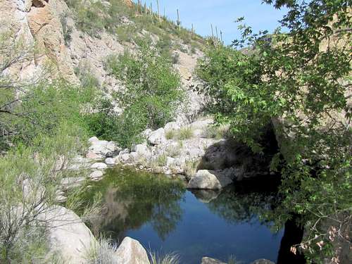
I sat there and enjoyed the views for some time then I began to go back. Took my GPS in hand and it directed me to the trail that had dumped me into this creek bed.
![La Barge Canyon]() La Barge Canyon
La Barge Canyon
It was now around 10:30 and the sun was just beginning to shine on the wall of Geronimo Head.
![Geronimo Head]() Geronimo Head
Geronimo Head
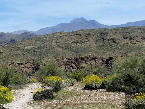
I then began to hike back up the trail. Now that the sun was up, everything looked much more colorful.
![On Boulder Canyon Trail]() Battleship Mountain
Battleship Mountain
As I went up, Battleship Mountain, Geronimo Head and La Barge Canyon could be seen below.
![La Barge Canyon]() La Barge Canyon, Geronimo Head, Battleship Mountain & Weavers Needle
La Barge Canyon, Geronimo Head, Battleship Mountain & Weavers Needle
I then noted the flower that the hiker had mentioned in the morning. There were 3 similar flowers near it but I do not recall seeing such a flower during the week that I spent in these mountains (Did not necessarily look for them either).
Continued on the trail until I reached my car at 12:15 p.m.
![Looking south from near the high point]() Weavers Needle
Weavers Needle![Four Peaks]() Four Peaks
Four Peaks![Canyon Lake]() Canyon Lake
Canyon Lake


Comments
Post a Comment