
-
 2250 Hits
-
 76.66% Score
-
 7 Votes
|
|
Canyon |
|---|---|
|
|
38.30811°N / 111.23052°W |
|
|
Overview
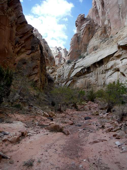
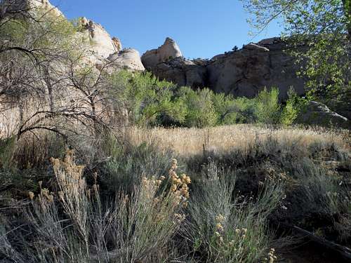
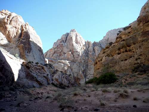
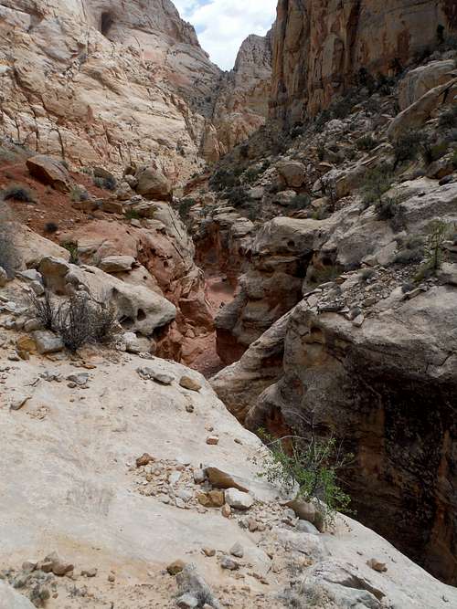
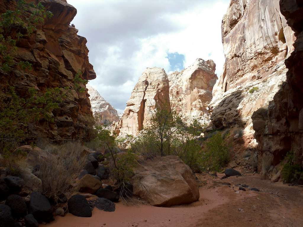
A topo map of Capitol Reef will show a massive knot of closely spaced rocky contours north of Route 24. There is a simple way to travel deeply into the heart of this sandstone mass that requires no technical canyoneering experience or equipment – just the ability to walk along a winding canyon floor. Lower Spring Canyon is your ready route into the rocky complexity of this part of Capitol Reef, and hours of solitude and scenery.
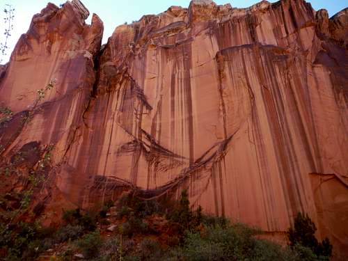
There are few big ‘highlights’ on this trip, though there is constant beautiful sandstone massifs and cliffs. But if you are like me, you will feel a strong sense of satisfaction for having explored deeply into this part of the Capitol Reef map.
Getting There
Lower Spring Canyon seems like it should be more popular in this National Park, but its 6.5 mile length requires a 3 mile hike to get to its western end and its eastern end is hidden and unmarked despite being right off of Route 24 - though you may get your boots wet at the start.
Obviously, the easiest way to see the canyon is by setting up a shuttle at one end or the other. But most of the time that just isn’t an option.
The western end can be reached using the Chimney Rock Loop trail. The Chimney Rock parking area is well signed and large, a few miles from the western edge of the park near Torrey along Route 24. You will have 3 miles of extremely scenic hiking, and some elevation gain, to reach Lower Spring Canyon.
The eastern end of the canyon starts in a grassy area just off Route 24, unmarked and invisible from the road. To start here you have to hunt for the canyon entrance (see below). Park near mile post 83, about 4 miles east of the visitor center. There is a shoulder parking area on the right side of the road. Cross the road and walk east hundred yards or so, then walk north through the grass toward the rock walls. Note you will have to risk wet boots with this option.
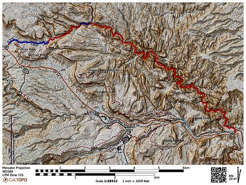
Red Line: Lower Spring Canyon Blue Line: Chimney Rock Canyon
Chimney Rock parking area to Route 24 (or vice versa) is nine miles one way.
Route 24 to Lower Spring Canyon’s intersection with Chimney Rock canyon and back is a round trip of 13 miles.
Chimney Rock parking area to Route 24 and back would be 19 miles round trip.
Route
I started from the eastern end on Route 24, so my description below will start with that method.
From Route 24
It isn’t much of a start. From the road, there is no trailhead or sign. Just walk east from where you parked a 100 yards then head north into the grass and find your way to a non-apparent gap in the rock walls.
There you will find Spring Creek’s exit from its canyon, which flows into the creek-like Fremont River and makes soaking your boots to cross a distinct possibility. I found a convenient place to cross in May but you may need to get wet.
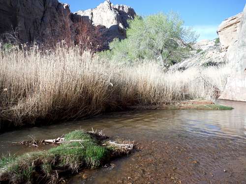
But as soon as you are in the canyon you will forget about wet boots.
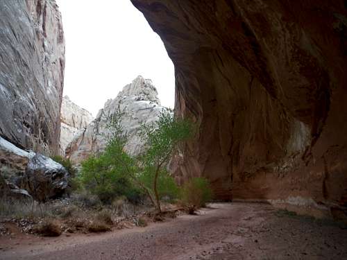
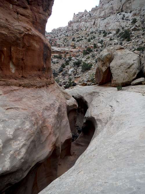
Find a use trail into the canyon and leave the Fremont River behind. Take the canyon streambed for most of the rest of the trip as it winds its way through the sandstone. Except for one dryfall obstacle, there is no way to get lost. Enjoy the solitude and the stone.
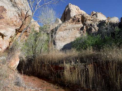
When I traveled this route in May, there were a few trees and a tiny muddy flow a few miles in that had a trickle of water. Assume that there will be no reliable water and pack accordingly – a gallon per person is not too much in warmer weather.
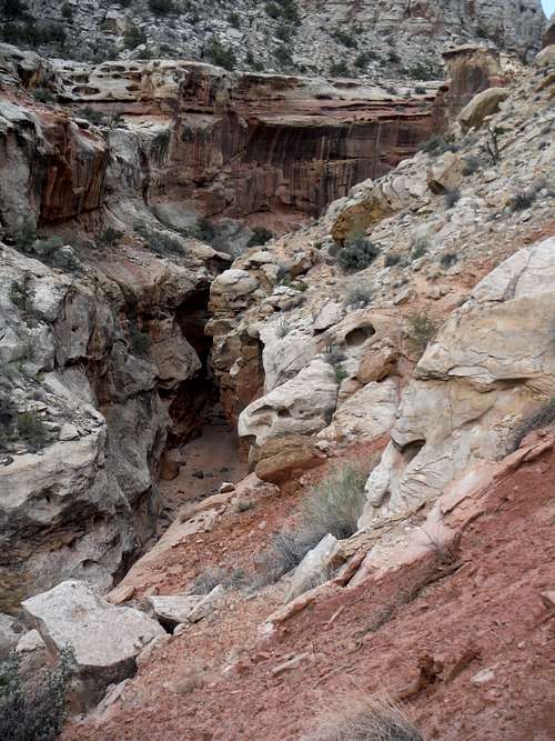
The only challenge to the route comes about two thirds of the way through, when a long dryfall complex keeps you from continuing along on the creek bed. A small use trail on the North side takes you higher along the wall and travels a way to get you around the large obstacle.
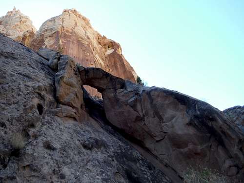
Check it out, as it has some unusual features.
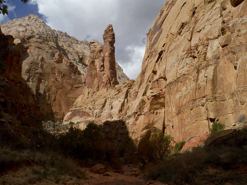
Near the western end the cliffs become more orange, and black rocks the size of basketballs from a volcanic field to the west of Capitol Reef also show up on the canyon floor.
After 6.5 miles of hiking, you will reach a signed intersection.
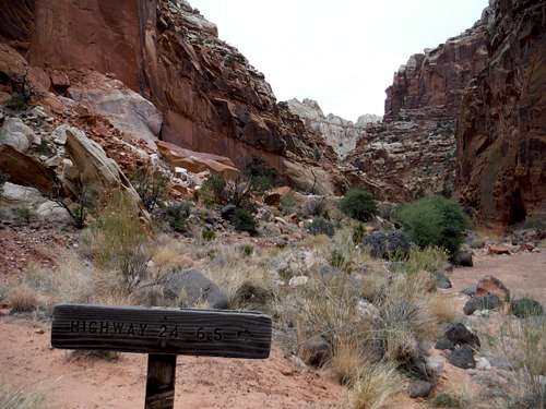
I turned around here and returned to Route 24. Upper Spring Canyon (an even longer route which I have not traveled) opens to the North, which will take you many more miles along Spring Creek. To the west, nearly straight ahead, is Chimney Rock Canyon that will after less than a mile of brilliant scenery bring you to a loop trail that leads to its parking area in less than 2 miles. I have hiked here, and its well worth a separate hike if you are not up to tackling it that day.
From Chimney Rock
If you are starting from Chimney Rock Canyon, start on the loop trail and stay left at the loop intersection. About halfway along the loop Chimney Rock Canyon will continue north east. Take it north and east to the signed 3 way intersection “Route 24 6.5 miles” and continue east in Lower Spring Canyon. If you do not want to do the whole thing, that’s fine – turn around once you have had your fill. It woud be 18 miles round trip unless you have a shuttle
Red Tape
No fees.
Thoughts
Yes. A very satisfying day in Capitol Reef.
External Links
I want to thnk 'Road Trip Ryan' for giving me the confidence to do this hike. See his great web site resource here