-
 2161 Hits
-
 79.78% Score
-
 11 Votes
|
|
Canyon |
|---|---|
|
|
38.16213°N / 111.21478°W |
|
|
Hiking |
|
|
Overview
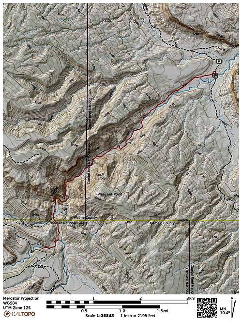
When exploring a place as varied as Capitol Reef, there is a lot of beautiful rock, and wonderful routes through it. But in this National Park you also have the option of water accompaniment in a couple of places. I enjoyed following Pleasant Creek downstream and east through the Capital Reef (see Nader’s excellent write-up Pleasant Creek). There is something about travelling along living, flowing water that makes any hike more relaxing and inspiring. But you can enjoy Pleasant Creek in a different way from the same trailhead: Go upstream from the Pleasant Creek trailhead through a beautiful canyon, and enjoy the flow of water most of the way.
Upper Pleasant Creek is not as grand as its downstream version, but if you are in the mood for a serene and beautiful 9 mile hike into a seldom visited beautiful, wild and lonely canyon, this will not disappoint.
Getting There
This hike leaves from the Pleasant Creek Trailhead. From the park’s Visitor Center on Route 24, drive the paved Scenic Drive 8 miles south ($20 fee in 2022) At the turnoff for Capitol Gorge, turn right onto a dirt road (signed Pleasant Creek Road) and continue another 2.8 miles south past Capitol Reef Field Station (on left) and then an old corral to a parking area with pit toilets.
Route
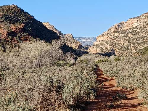
Your route to Upper Pleasant Creek starts in a quite uninspiring way. Walk north a bit from the parking area to a dirt road heading west (marked no vehicles allowed). Take the road west 1 mile through the sagebrush and juniper.
But wait… Pleasant Creek runs right to the south of the parking area…why don’t we start there? It certainly can be done (I used it on my way back), but on the whole this part of Pleasant Creek is not as ...well, pleasant. It is more brushy, has more flood debris, more twists.
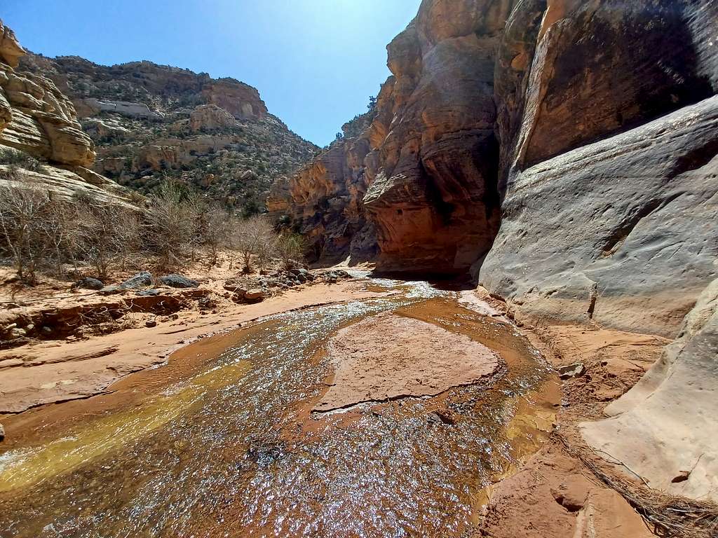
So take the road. It does give you a look as you walk of the canyon as you approach it and even the source of Pleasant Creek’s water - Boulder Mountain.
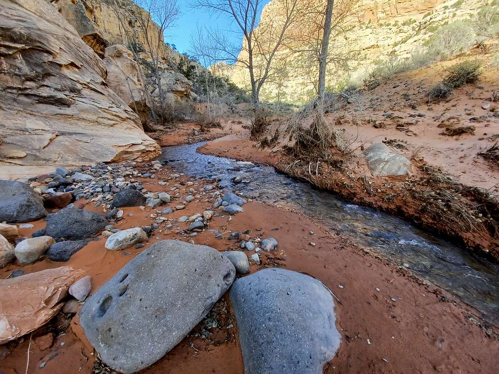
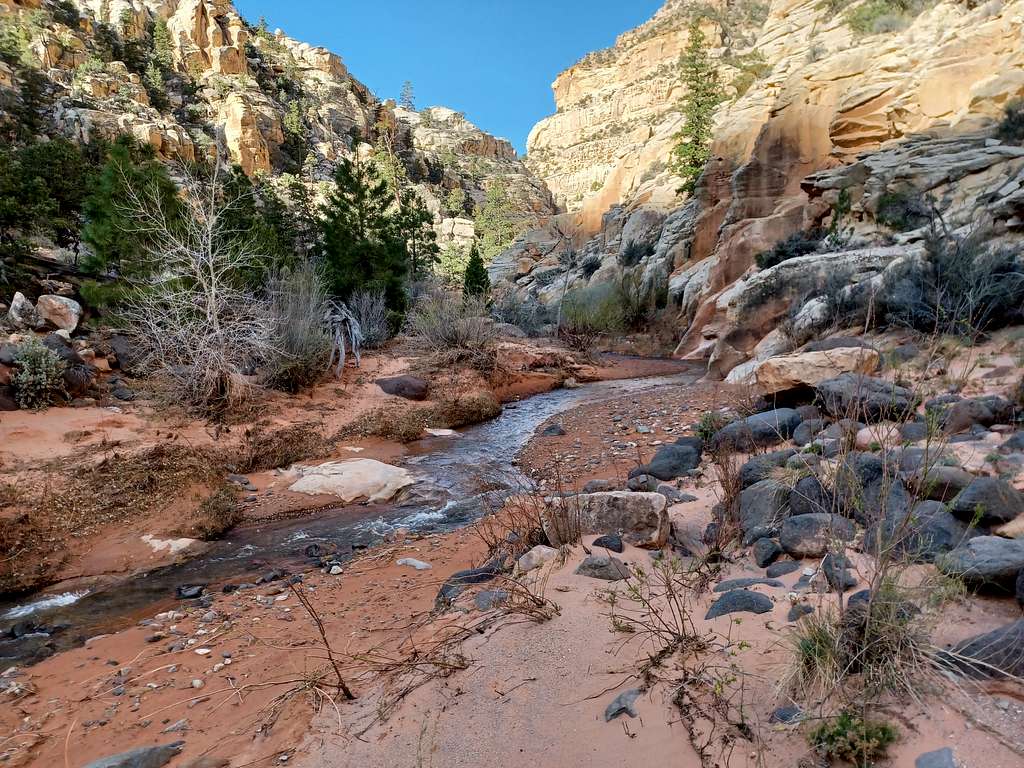
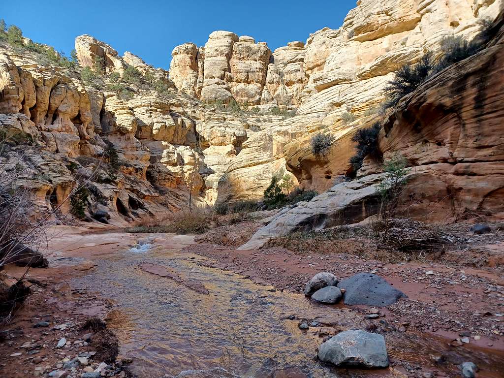
Soon you will dip down to Pleasant Creek near a rock overhang. From this point, you are following the creek: paralleling it, crossing it, sometimes in it. You are basically following the path of least resistance.
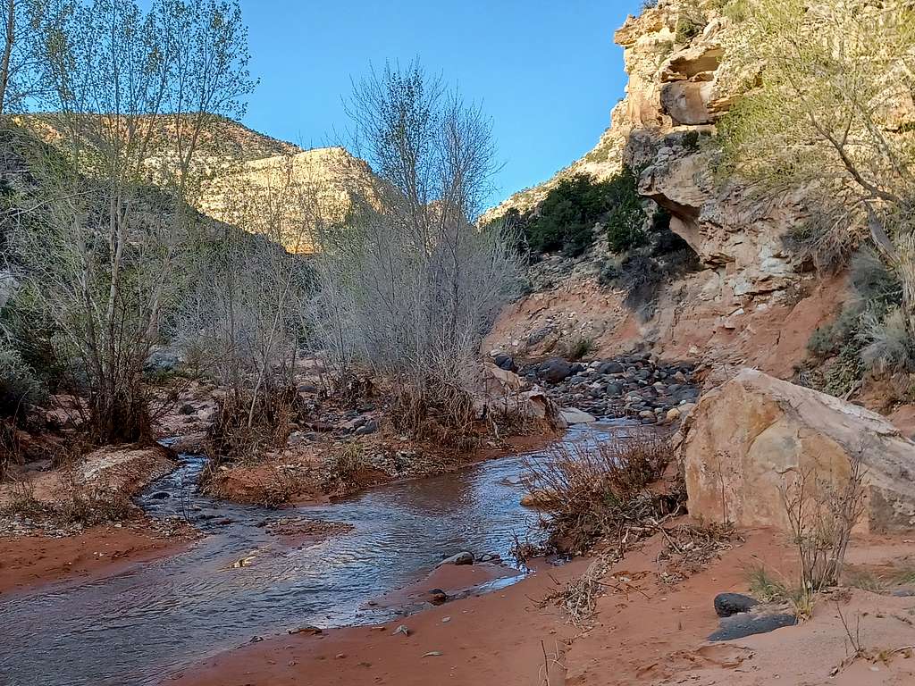
The aptly named creek provides a thread of grace through the somewhat chaotic canyon. The creek was not more than calf deep in April 2022 – but always check conditions.
In the cool of the morning you may want to take any use trail you can find that cuts off the bending creek’s course, and keep out of the cold water. In the warmer afternoon you may not mind spending a lot more time in the creek, enjoying the water and not minding the frequent bends.
You are never very far from the creek, so use common sense and stay on existing use trails, resist the urge to make new trails - try not to crush any cryptobiotic crust.
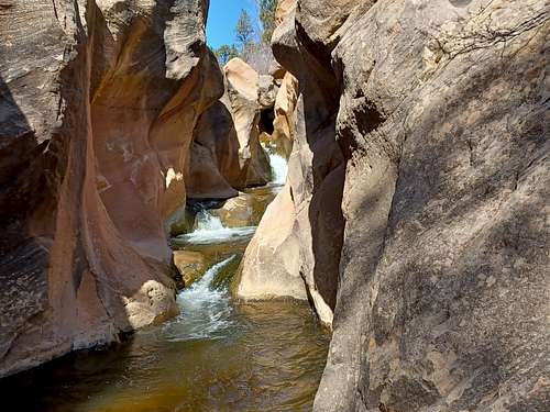
As you travel west you will be delighted by more frequent evergreens, and then the canyon will close in.
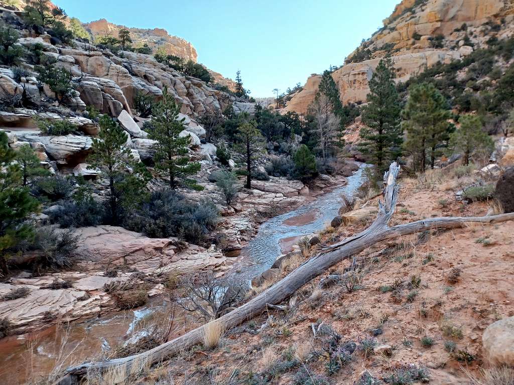
The inner canyon is beautiful and dramatic.
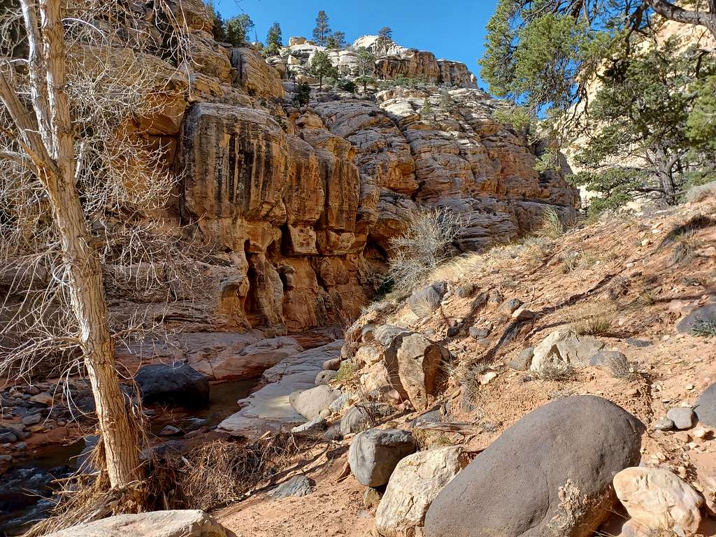
But suddenly the canyon walls cease and you will find yourself in a more open, rolling area. Though the canyon is over, it is worthwhile to keep following the creek.
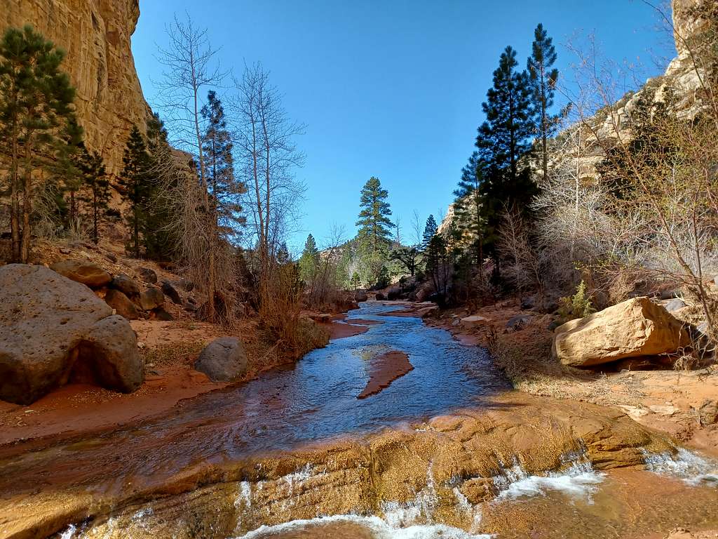
Serenity Abounds.
You will see a small creek come in from the north (Sulphur Creek – confusingly a different Sulphur Creek than the one further north in Capitol Reef).
Soon after Suplhur Creek, you are faced with an unexpected difficulty. A high, tight, gateless barb wire fence.
Death of Serenity.
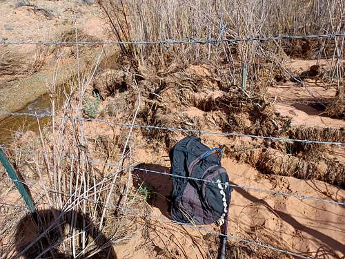
I have learned that the fence divides Capital Reef National park from Dixie National Forest. Horses and motorcycles are allowed in the National Forest, but not in the National Park. So it does serve a purpose, but without a hikers gate it blocks further easy progress toward a beautiful waterfall further up Pleasant Creek.
It is worth overcoming this obstacle – as of 2022 there was a weakness underneath one part of it if you do not mind getting dusty and sliding under.
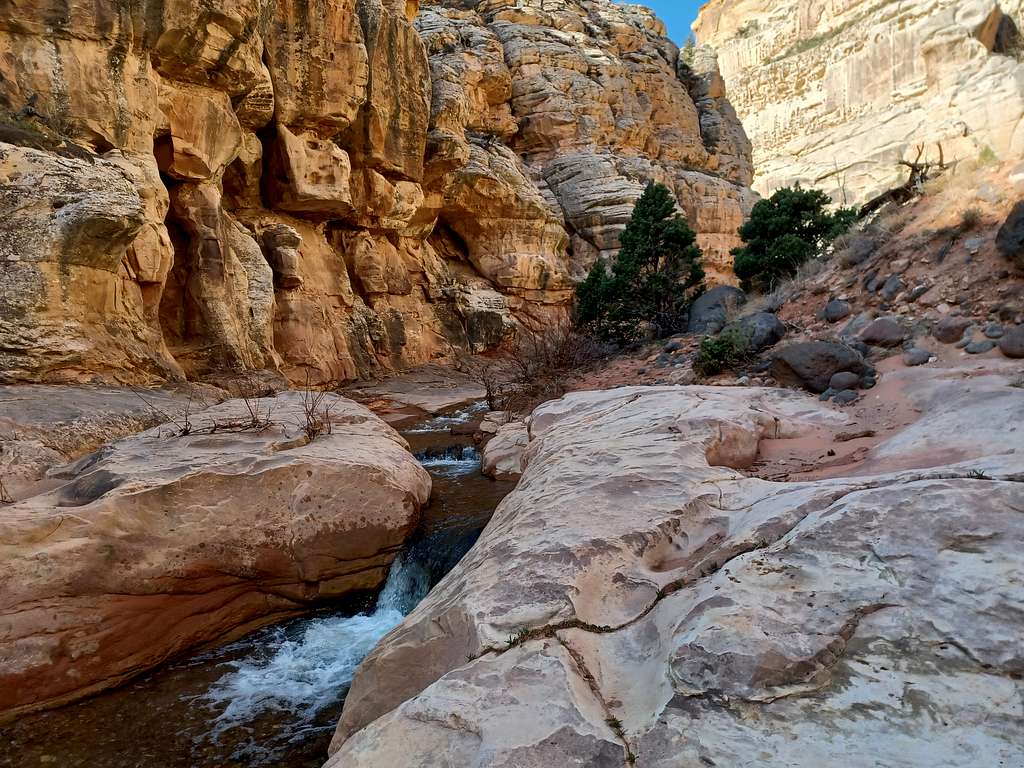
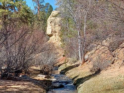
Pressing on up Pleasant Creek past the fence, you will see smaller Tantulus Creek come in on the left. Pass this up and continue up Pleasant Creek into an almost park-like setting. A large section of water carved rock contains the very nice but confusingly named Lower Pleasant Creek Falls.
Enjoy the Falls and turn around for your trip back, unless you have a horse or motorcycle shuttle arranged.
Go back the way you came.
Red Tape
Scenic Drive has $20 fee that gives you a weeks access.
External Links
Approximate Route - Upper Pleasant Creek