
-
 28433 Hits
-
 83.08% Score
-
 16 Votes
|
|
Canyon |
|---|---|
|
|
40.70042°N / 111.71242°W |
|
|
Hiking, Mountaineering, Trad Climbing, Sport Climbing, Skiing |
|
|
Spring, Summer, Fall, Winter |
|
|
Millcreek Canyon Overview
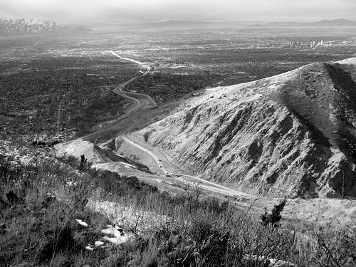
Located inbetween Big Cottonwood Canyon and Parleys Canyon is Millcreek Canyon. Spanning over 13 miles, this canyon is home to several large peaks, an extensive trail network, a couple of lakes, beautiful scenery and lots of wildlife. It is because of this is why Millcreek Canyon is popular with mountain bikers, trail runners, peak baggers, dog walkers, backcountry skiers, rock climbers, hikers, campers, and wildlife observers. In the summer and fall months you are allowed to drive your car up to the base of Big Water Gulch (Approximately 10 miles). In late fall, winter and spring the main road is closed to vehicular traffic about 5 miles up from the base of the canyon. Some peaks in this canyon that are worth climbing to are Mount Aire, Grandeur Peak, Little Water Peak, and Gobblers Knob. Each one of these peaks offers a unique and impressive view of the surrounding Wasatch Range. Some trails worthy of checking out are the Pipline Trail, Big Water Gulch Trail (aka The Dog Lake Trail) and the Desolation Trail. Wildlife such as Black Bears, Cougars, Moose, large Deer herds, and Rattle Snakes frequently rome this canyon so keep as close eye out there....because there might just be one on you. Be sure to not travel alone at night, keep pets close to you and carry bear spray.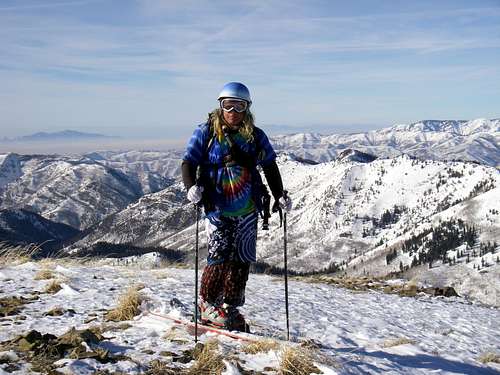
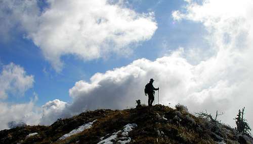
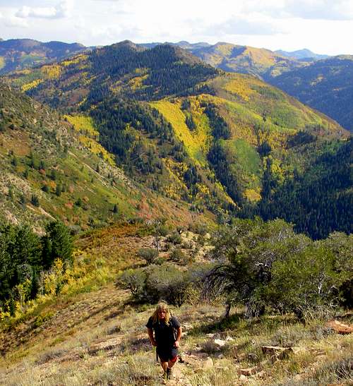
Troy standing on the summit of Little Water Peak
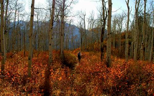
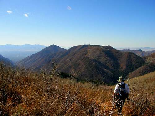
Brad hiking in some fall colors
Mount Aire from the North East. Photo Credit Byates
Some climbers standing on Little Water Peak
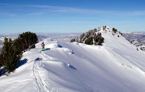
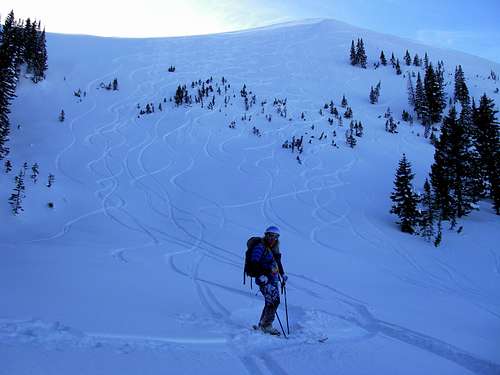
Troy skinning up to the summit of Gobblers Knob
Brad hiking down Millcreek Canyons
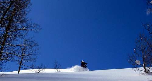
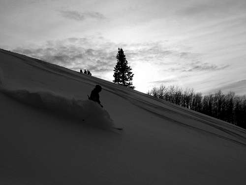
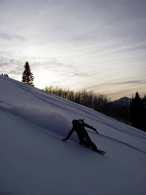
Troy skiing Big Water Gulch
Getting Up There
From I-215 get off at the 3900 South exit. Head along Wasatch Blvd (north) until you come up on the second traffic light 3800 South. From here make a right, go through the 4 way stop and the canyon will shortly come into view.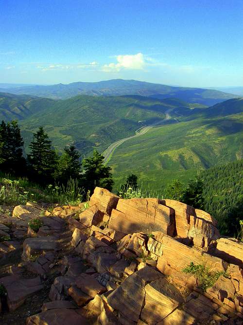
Looking at Parleys Canyon from the summit of Mount Aire
The mouth of Parleys Canyon from the slopes of Grandeur Peak
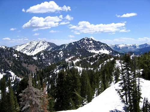
The Peak List
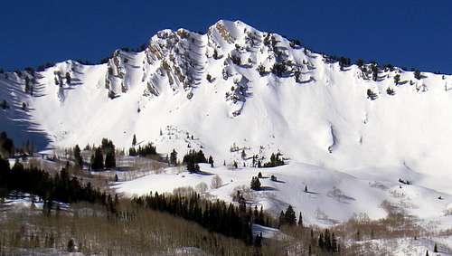
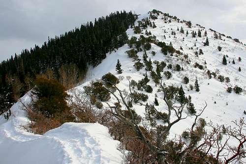
Millcreek Canyon has several peaks above 10,000 feet that are worth climbing to. Each peak offers its own unique views of the Salt Lake City valley and of the surrounding peaks in the Central Wasatch Range. Most of the trails to these peaks are inbetween 1,500 to 4,000 vertical feet one way. This section will have a short description of the peaks in Millcreek Canyon in order of the ones I liked the best.Gobblers Knob- Standing tall at 10,246 feet, this is one of the better peaks of Millcreek Canyon if not the Central Wasatch Range. The Porter Fork trailhead is the most popular starting point for summiting this mountain. From Porter Fork there are 3 seperate trails to the summit. Starting from the base up they are Bowman Fork, Yellow Jacket Gulch and Pole Canyon. Another less popular and more extream route is Alexander Basin. Caution should be used here in the winter months. This Basin has been the site of several brutal avalanche accidents in years past and even this year (Feb. 7th 2010). Whether it is summer, fall, winter or spring, a climb up Gobblers Knob is sure to please.
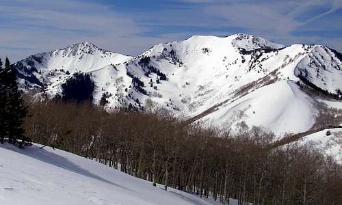
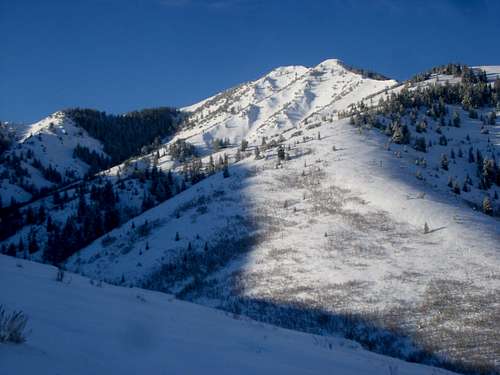
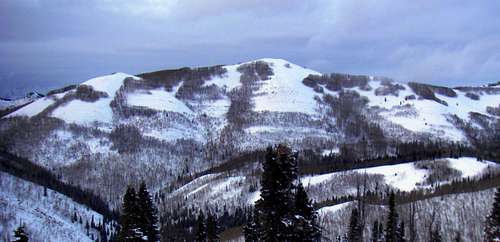
Gobblers Knob from Little Water Peak
Gobblers Knob from the summit of Grandeur Peak
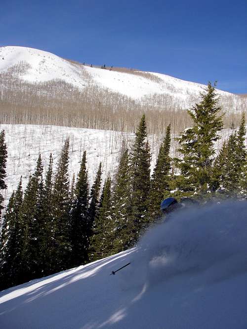
Troy skiing the infamous "Cabin Run" on Gobblers Knob
Troy skinning up to the North Summit of Gobblers Knob
Brad standing on the South Summit of Gobblers Knob
The infamous Cabin Run
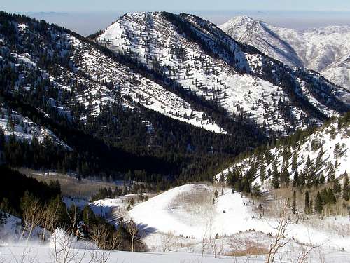
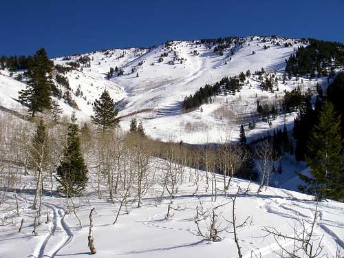
Little Water Peak- Located in Upper Millcreek Canyon this peak actually more easily accessed (in winter) from the Big Cottonwood Canyon side (Mill D North). With Dog Lake along the trail to the summit, one can expect to encounter large crowds on the weekends (especially in summer). Once you get past the lake the remaining mile is quite lonely. For backcountry skiers there are several slopes to choose from on this peak. These range from steep avalanche prone bowls to gentle gladed trees.
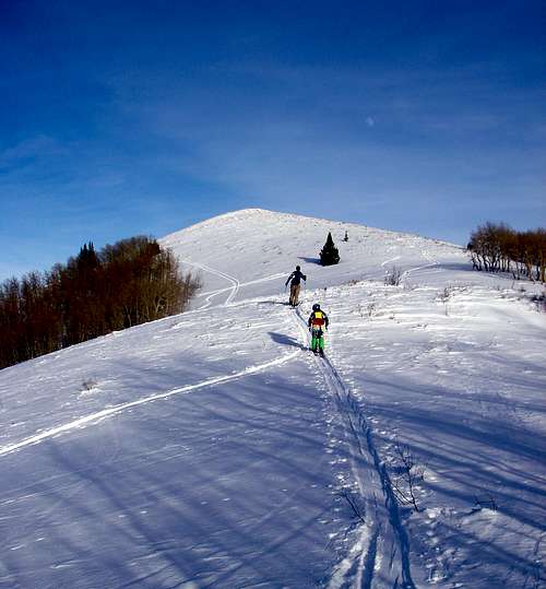
Troy and Ron skinning to the summit of Little Water Peak
Troy on the summit of Little Water Peak
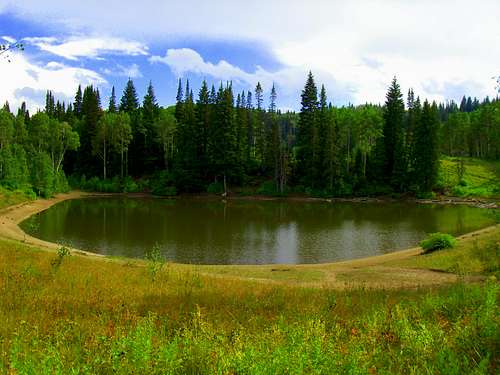
Dog Lake
Troy skiing down Little Water Gulch
The south face of Little Water Peak
Troy at the base of Little Water Peak's steep North Bowl
Troy skiing some dark powder on Little Water Peak
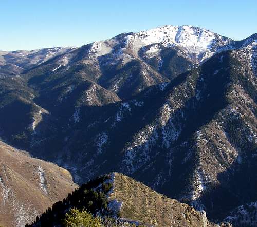
Mount Aire- Starting at Elbow Fork the distance to this trail depends on the time of year make your attempt. In the summer months one can drive to and park at the base of Elbow Fork (a narrow and obvious bend in the canyon). In the winter months the road is closed so you will have to start 1.5 miles down canyon from here. Lots and I mean lots of dogs use this 1.5 mile stretch so if your looking for any kind of solitude well.....good luck. Do not let all this dicourage you. The remaing 2 miles are steep and a lot less popular. At the summit the veiws of Upper Millcreek Canyon and Parleys Canyon are outstanding.
Upper Parleys Canyon from the summit of Mount Aire
Troy climbing up to Mount Aire in fall
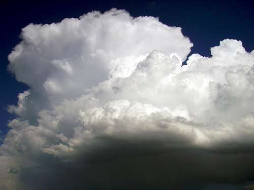
A dangerous cloud above Mout Aire

Matt hiking down Mount Aire
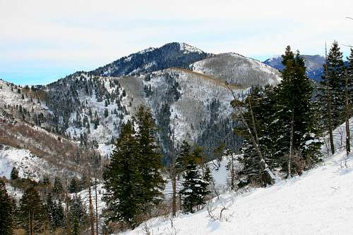
Granduer Peak- One of the few Salt Lake City valley facing peaks in Millcreek Canyon, this peak has the option of avoiding the canyon fee by starting near the base of Parleys Canyon. Large deer herds, rattle snakes, courgars, are known to roam this peak frequently so do not travel alone at nite and keep a close eye on your pets. Beacuse of the valley facing nature of this peak standing alone on the summit usually is not the case, even at night. No matter where you start from (Church Fork, Dragons Tail, West Slopes, and Pharrows Glenn) this one is worth the effort that it is going to take.
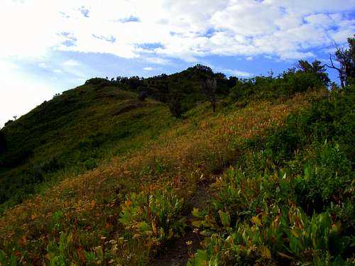
One of the many trails that head up to Grandeur Peak
Grandeur Peak
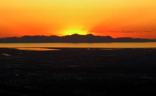
A beautiful sunset from the slopes of Grandeur Peak
The Big Cottonwood Canyon side of Mount Raymond
Mount Raymond- This very steep mountain is about as far south as the peaks Millcreek go into the Wasatch Range. On a clear sunny day, one can see from the summit almost all the peaks of the Central Wasatch. It is no suprize that climbers and skiers alike love what this peak has to offer.
The Millcreek side of Mount Raymond (pictured in center). Photo Credit Joseph Bullough
Millvue Peak. Photo Credit Wasatchvoyage
Millvue Peak-
Millvue Peak. Photo Credit Wasatchvoyage
Millvue Peak. Photo Credit GeoPooch Sobachka
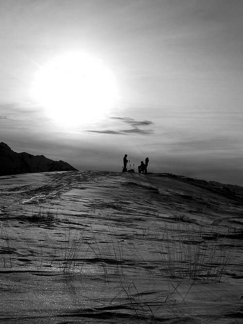
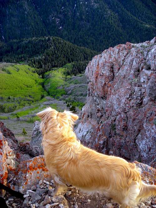
Ron petting the dog just before sunset in Little Water Gulch
Skiing
Because of the overall size of Millcreek Canyon, there are several skiing possiblities. If you choose to tour the upper reaches of the canyon, you are going to have to face a 5+ mile flat. For tours in the lower canyon, a shallow or non-exsistant snowpack is likely to be encountered. Do not let all this scare you....Millcreek Canyon is one of the best canyons for backcountry skiing in Utah. With steep chutes, open bowls, expansive faces and the best tree skiing in the state, a tour here is sure to please. There are several ways to access Millcreek in the winter. You can come up from Big Cottonwood Canyon (via Mill A Gulch, Butler Fork, and Mill D North), from the base of Millcreek Canyon itself or Lambs Canyon.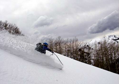
Troy skiing Big Water Gulch just before a thunder storm
Troy skinning up to the summit of Gobblers Knob
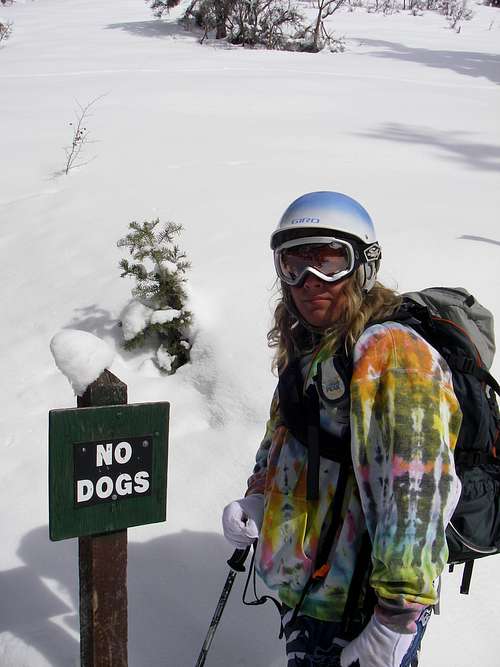
No dogs in Big Cottonwood Canyon
Red Tape
Millcreek Canyon costs $3.00 per vehicle (and NO they do not take checks or credit cards). Season passes are avalible at the pay station that is located at the base of the canyon.There are some private property areas off the western side of Mount Air, but these can be easily avoided.
Mountain bikers are only allowed in the Millcreek Canyon everyday. However on the Big Water Trail, Little Water Trail and Great Western Trail mountain bikers are only allowed on even days.
Dogs are allowed everyday, however on even days they must be leashed. In all picnic areas, cabin properties and some select trails, leashes are required at all times. If you have a dog remember that once you leave Millcreek Canyon, there are No Dogs allowed in Big Cottonwood Canyon.
Fishing is allowed on most of the river however you will need to purchase a permit before getting out there.
 No dogs in Big Cottonwood Canyon
Kadee - Apr 25, 2013 11:50 am - Hasn't voted
DogsCorrection - dogs are allowed off leash on odd days, but must be leashed on even days. Also, do you know which trailheads are below the gate that is locked during winter? Mainly, Mt Aire trailhead - is this before or after the gate.
TyeDyeTwins - Apr 26, 2013 1:22 am - Hasn't voted
Re: DogsThanks for the catch! The Mount Aire Trailhead is above the winter gate. The winter gate is located approx. 5 or so miles up the canyon. It is about another mile beyond the gate to the Mt Aire Trailhead. Thanes Canyon, Church Fork, and Porter Fork, are all trailheads below the winter gate.