
-
 12819 Hits
-
 81.84% Score
-
 14 Votes
|
|
Mountain/Rock |
|---|---|
|
|
40.70270°N / 111.66564°W |
|
|
Salt Lake |
|
|
Hiking, Mountaineering, Skiing |
|
|
Spring, Summer, Fall, Winter |
|
|
8926 ft / 2721 m |
|
|
An Overview of Millvue Peak
Resting on the Millcreek Canyon/Lambs Canyon divide at 8,926 feet, is a well known local favorite peak of hunters, hikers, snowshoers and backcountry skiers known as Millvue Peak. Starting from Millcreek Canyon or Lambs Canyon, this mountain was once a horrific bushwhack that required most to climb it when it was bush free in the winter. Then just a few years ago that all changed. A trail seemed to appear out of nowhere, and within one year, a lovely man made tower now rests just shy of the summit. Some call it a fair trade, others do not. The new trail extending from the Lambs Canyon Pass to the summit of Millvue Peak is a lovely walk along the Millcreek Canyon/Lambs Canyon divide. While hiking this new trail there are amazing vistas into and down Millcreek Canyon and Gobblers Knob. At the summit on a bright sunny day one can see most of the peaks of the Northern/Central Wasatch Ranges, The Oquirrh Mountain Range, as well as the Uinta Mountain Range. The views, the excellent year round access and wildlife viewing opportunities makes this mountain worthy of any Wasatch climbers to do list.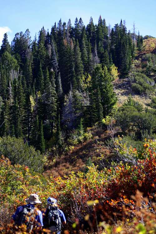
Troy and Matt approaching Millvue Peak using one of the newest trail additions to the Central Wasatch Range
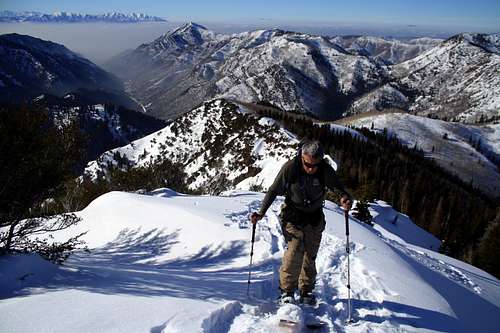
Ron skinning up the last few feet of Millvue Peak
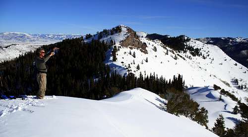
Ron on the summit of Millvue Peak
Getting Up There
There are two main trailheads for Millvue Peak. The most user friendly is from Lambs Canyon....however the parking area is quite small, especailly in the winter. The next most common trailhead is in Millcreek Canyon at Elbow Fork. This trailhead is closed to vehical traffic in the winter, adding 1 to 2 miles to the climb. Below are the climbing directions from both trailheads.
Lambs Canyon Pass
LAMBS CANYON- The easiest and cheapest way to approach this mountain is from Lambs Canyon. Approximately 2 or so miles up Lambs Canyon is the well marked Lambs Canyon Trailhead. The trail starts by crossing the year round flowing river, then it makes a couple of small switchbacks as it climbs up to the Northwest drainage. Soon the trail bends right into the Northwest Drainage and continues to gain elevation. Be sure to keep an eye out for moose...they are VERY COMMON along this section of the route. After a mile or so the trail will approach the Millcreek Canyon/Lambs Canyon Divide and bare a sharp left insted of climbing the steep slope. Follow this for what seems like forever and eventually it will gracefully make its way up and back to the Lambs Canyon Pass. From here make a left and follow the well beaten path up to Millvue Peak.
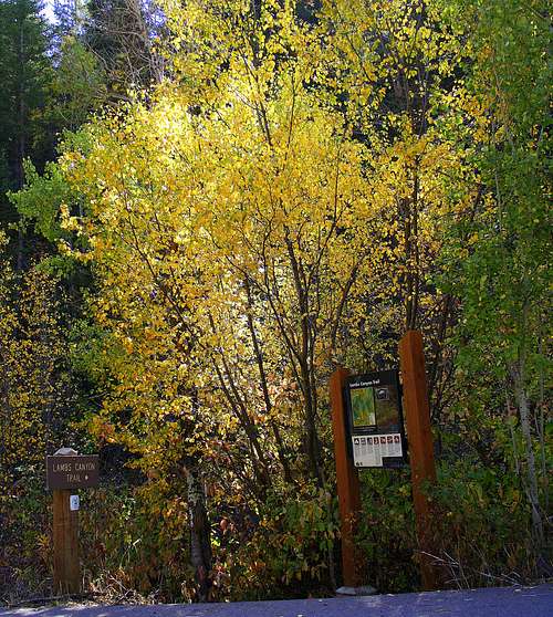
The Lambs Canyon Trailhead
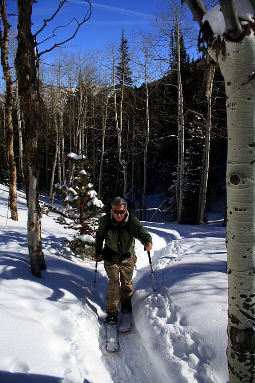
Ron skinning up the Northwest Drainage of Millvue Peak
MILLCREEK CANYON (Elbow Fork)- In the summer (and especailly on weekends) when the parking is full at Lambs Canyon you can climb this peak from the Elbow Fork Trailhead located in Millcreek Canyon. This trail starts out by following a river. In a couple of minutes you will come up on a well marked junction. Continue straight (or more to the right depending on how you look at it) and follow the well beaten path up to Lambs Canyon Pass. Make a right and follow the trail to the summit of Millvue Peak.
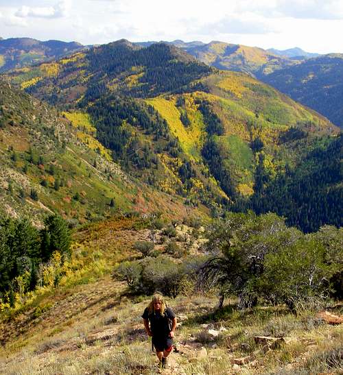
The colorful slope behind Troy is the Elbow Fork Route to Lambs Canyon Pass and Millvue Peak. Please note that this picture was taken while climbing Mount Aire
Skiing Millvue Peak
When avalanche conditions are stable a backcountry skiing tour up to Millvue Peak is well worth the effort and the sometimes (depending on the time of the year) bushwhack. The Northeast and Northwest facing trees/gullies are known for being scenic and skiing soft days after a storm. The steep south facing slope that drops into Millcreek Canyon is rarely skied, but is quite inviting to the extreme backcountry skier. When skiing/hiking this peak please bare in mind that it is located along the Millcreek Canyon/Lambs Canyon divide, which means that the West, North and East aspects of this mountain are famous for surface hoar. Once this surface hoar is burried by new snow it becomes depth hoar, which is a DANGEROUS AVALANCHE LAYER when it becomes a active. The Main Gully in the Northeast Gulch is especailly dangerous when depth hoar is present. A recent avalanche (February 21st 2011) involving a couple of skiers burried the main gully 40+ feet!!!! The details to that close call can be found by clicking on this link Close Call on Millvue Peak
Ron splitboarding the Northeast Face of Millvue Peak on a LOW avalanche danger day.