
-
 13693 Hits
-
 85.87% Score
-
 21 Votes
|
|
Mountain/Rock |
|---|---|
|
|
40.43048°N / 121.49969°W |
|
|
Tehama |
|
|
Hiking, Skiing |
|
|
Summer, Winter |
|
|
8204 ft / 2501 m |
|
|
Overview
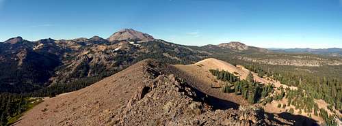
North pan from Mt. Conard. Mt. Diller, left, Lassen Peak, center, Reading Peak, right
This is an easy walk up hike that can be done in a few hours from 2 roadside trailheads with camping. There are fine views of Lassen Peak and the lesser peaks around it to the north and west. To the south is Mt. Harkness and a sweeping view of Lake Almanor. To the west across Sacramento Valley the Yolla Bolly Mountains of the Coast Range rise in the distance.
Getting There
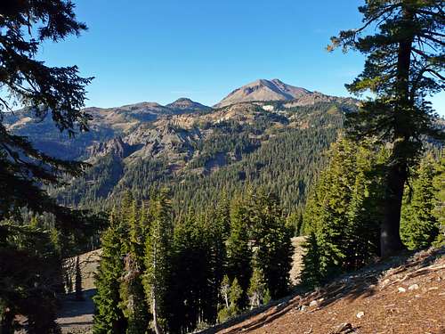
Lassen Peak from northwest slope of Mt. Conard
Crumbaugh Lake trail, north side approach Class 1: From Interstate 5 in Redding go east 46 miles on Hwy. 44 to Hwy. 89. Turn right into the park on 89 and drive 17 miles around Lassen Peak to Kings Creek Campground trailhead (7,300'). Take the Crumbaugh Lake trail (same as Cold Boiling Springs trail) 2 miles to the same saddle and take the north ridge.
Red Tape

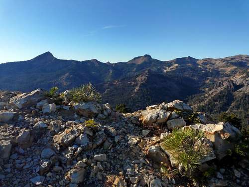
Mt. Conard from Bumpass Mtn. to the north
Camping
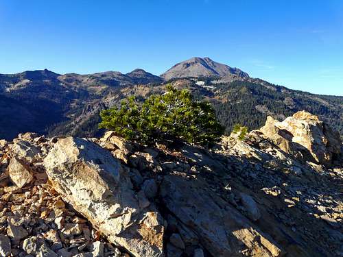
Brokeoff Mtn. and Mt. Diller from Mt. Conard
Lassen Volcanic National Park current conditions
Lassen Peak from Mt. Conard
T. White - Sep 25, 2021 7:34 am - Hasn't voted
Dixie FireAs of 09/2021, Mount Conard has been burned in the Dixie Fire.