
|
|
Mountain/Rock |
|---|---|
|
|
12.11810°N / 61.69831°W |
|
|
Hiking, Mountaineering, Scrambling |
|
|
Spring, Winter |
|
|
2346 ft / 715 m |
|
|
Overview
Mount Qua Qua is the second or third highest peak on the island of Grenada and is probably the most pleasant and interesting. It is also the most popular mountain to climb on the island. The route from Grand Etang Lake to Mont Qua Qua and to Concorde Falls is probably the best hike in Grenada.Grenada is one of the best hiking islands in the Caribbean. Dominica is probably the best island when it comes to hiking, but Grenada isn't that far behind. Also, Grenada has better beaches than Dominica so if you want to do hiking and visit the beaches, this might be the best island in the vicinity. Grenada is a great mostly off-key Caribbean destination.
Mount Qua Qua and the vegetation around Grand Etang Lake was severely damaged by Hurricane Ivan in 2004, but the area is recovering nicely. Most trails have been repaired.
 Mount Qua Qua as seen from the trail above Grand Etang Lake.
The ascent of Mount Qua Qua via its standard route has a little mud and some steep places, but overall it was an easier ascent by rain forest standards. We found the written descriptions of exposure and steep scrambling to be highly exaggerated. At the summit, was an interesting boulder to climb, and adding more interest to the area. Unlike Mount Saint Catherine, the highest summit on Grenada, there is no radio tower to mar the pristine summit.
Those who want more of an adventure can descend Mount Qua Qua to Concorde Falls. This is a challenging and muddy route, but is very rewarding and scenic.
 Descending through the mud on the west side of Mount Qua Qua.
Also worth a visit is the Visitor Center at Grand Etang Lake and the lake itself. This is a good place to see the Mona Monkey.
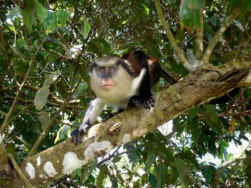 A mona monkey on Mount Qua Qua.
 Getting There
Grand Etang TrailheadThis trailhead is very easy to get to. From the bus terminal in Saint Georges, take Bus 6 (as of April 2016) to Grenville. Instead of getting off at Grenville, have the driver drop you off at Grand Etang Lake.
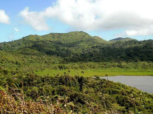
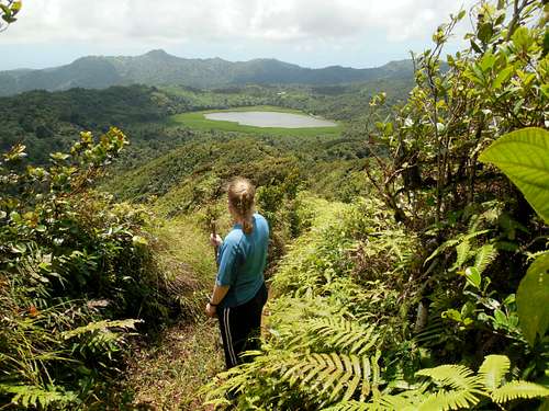
 Grand Etang Lake and Mount Qua Qua as seen from near the trailhead.
Annandale Falls Trailhead
From the bus terminal in Saint Georges, take Bus 7 (as of April 2016) to Annandale Falls. The bus can drop you off right at the falls.
 Annandale Falls.
Concorde Falls Trailhead
From the bus terminal in Saint Georges, take Bus 5 (as of April 2016). The turn off to Concorde Falls is off the West Coast Road between Black Bay and Grand Roy. Since buses don't go all the way to the falls, you will have to hitchhike, take a taxi, or walk from the West Coast Road.
 Lower Concorde Falls is the trailhead at the end of the descent route from Mount Qua Qua.
Routes Overview
Mount Qua Qua via Grand Etang LakeThis is the standard route on the mountain and is a great introduction to rain forest hiking in the mountains. There is usually some mud and some steep sections, but this is an easy climb in comparison with most rain forest mountains.
The route is 6 miles or 10 kilometers round trip. To make a longer hike of it, you can combine it with the 2.5 mile/4.5 kilometer loop trail around Grand Etang Lake.
The trail to the summit is well marked and easy to follow, so a guide is not needed, but if he or she knows about the plant and animal life, it might be worthwhile to have one.
Reports of exposure and steep scrambling along the trail are greatly exaggerated, at least for experienced hikers and climbers. On the summit, there is a class 3-4 boulder to climb however, if you want to stand on the very highest point.
The summit provides good views of much of Grenada and both the Atlantic Ocean and Caribbean Sea can be seen. Grand Etang Lake can also be seen.
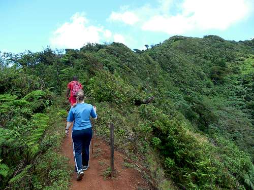 High on the ridge.
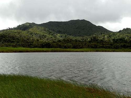
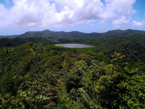 Grand Etang Lake is in the old crater of Mount Qua Qua. This is seen from along the summit trail.
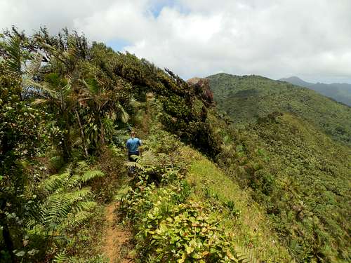 High on the ridge and close to the Mount Qua Qua summit.
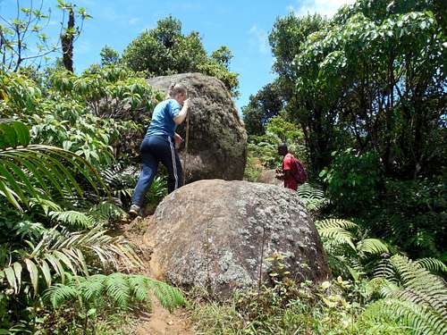 Boulders near the summit of Mount Qua Qua.
Mount Qua Qua via Annandale Falls
I have not done this route and am not familiar with it. The trail did look to be little used, so some bushwhacking may be involved. The trail is normally used as a descent route and is sign posted from the main Mount Qua Qua Trail. It is said to be steep and muddy.
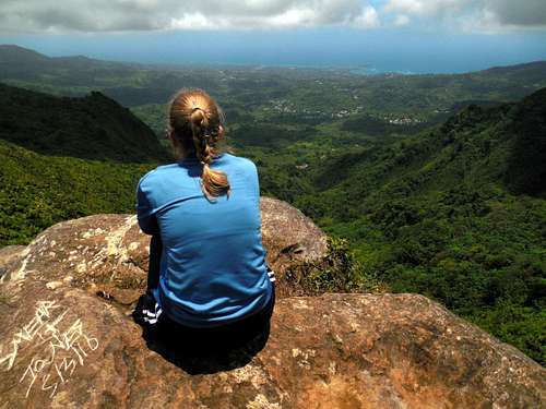 Enjoying the views from the summit of Mount Qua Qua.
Mount Qua Qua to Concorde Falls
This challenging route, when combined with Mount Qua Qua is probably the best hike in Grenada. The trail from Mt Qua Qua to Concorde Falls was obliterated by Hurricane Ivan, but is now passable. It is steep and muddy, but is pretty easy to find.
At one landslide, you must downclimb (unless the trail gets reconstructed) a nearly vertical 50 feet/15 meter section, but there is a cable in place and holds carved into the rocks, so it's not too bad, though there is some exposure. This route is attractive since it passes four nice waterfalls and is very scenic. After hearing that the trail had been destroyed, we were talked into a guide, but any experienced rain forest hiker/climber should be able to do this one without one. Tourist might need one, but not experienced hikers/climbers. We could have done without. The entire route took five hours and is 10 miles/16 kilometers long.
For experienced hikers who have all day to spare, this is the recommended route.
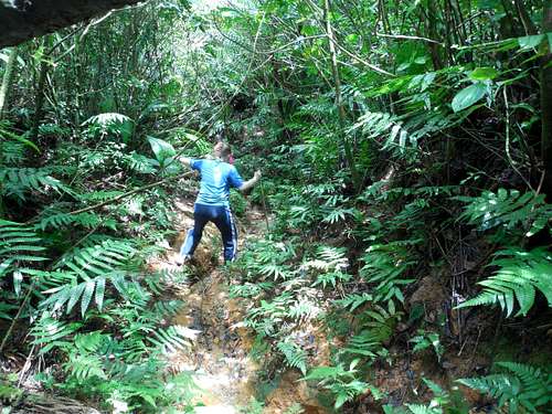
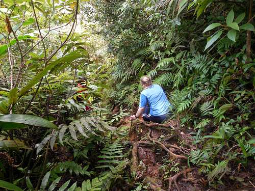 Climbing over the roots in the rainforest on the descent.
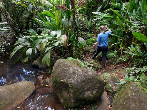 Part of the descent route of Mount Qua Qua just after a stream crossing.
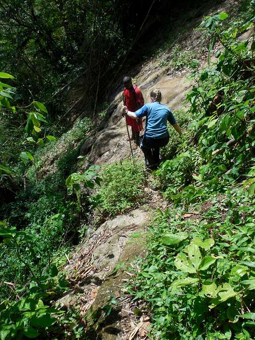 A very slippery section of the descent route from Mount Qua Qua. You don't want to fall here. It's farther down than it looks!
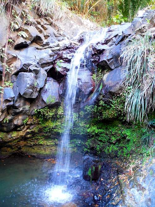
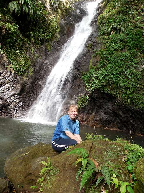
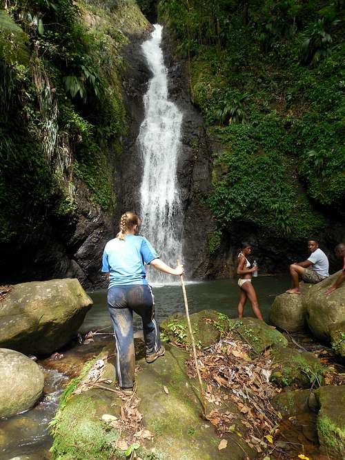 Concorde Falls. It was a challenging hike to get here, but we took the hard way in-from the summit of Mount Qua Qua of course!
Red Tape
A small fee ($2 US) is collected at the Grand Etang Trailhead for hiking the trails in the national park.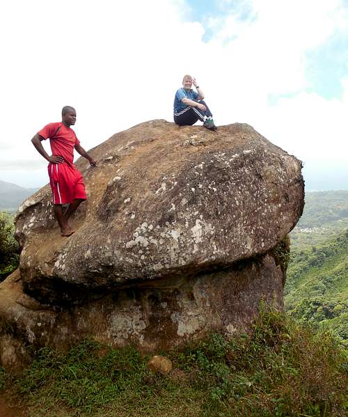 The Summit of Mount Qua Qua. Please take care of this beautiful area.
Camping
Camping is allowed in Grand Etang National Park. Inquire at the visitor center.When to Climb
The trail to Mount Qua Qua itself can be done year round as long as the weather isn't extreme. The routes from or two Concorde Falls or Annandale Falls should only be done in the dry season. Even in the dry season, it rains frequently and the trail from Mount Qua Qua to Concorde Falls is always muddy and wet.There are no real dry seasons in this region, but some seasons are certainly wetter still than others. Needless to say, this region is very wet and heavy rains are possible at any time.
On average, February, March and April are the driest months, followed by December and January. June through November are wetter, although the difference from the dry season is not always dramatic. From about mid-December through early May is the best time to climb, but even in the driest seasons, it rains almost every day up high.
Weather averages for the Camp Jacob (Guadeloupe) at an elevation of 1750 feet/533 meters are below. Information is from the book World Weather Guide, page 323. Although Camp Jacob is on Guadeloupe, weather conditions at Camp Jacob are more representative of the mountains on Grenada than the weather stations near the coast.
| Month | High (° F ) | High (° C) | Low (° F ) | Low (° C) | in. Rain | mm Rain | Rain Days |
| Jan | 77 | 25 | 64 | 18 | 9.2 | 234 | 23 |
| Feb | 76 | 24 | 63 | 17 | 6.1 | 155 | 18 |
| Mar | 77 | 25 | 63 | 17 | 8.1 | 206 | 20 |
| Apr | 79 | 26 | 65 | 18 | 7.3 | 185 | 20 |
| May | 80 | 27 | 67 | 19 | 11.5 | 292 | 23 |
| Jun | 80 | 27 | 69 | 21 | 14.1 | 358 | 25 |
| Jul | 81 | 27 | 68 | 20 | 17.6 | 447 | 27 |
| Aug | 82 | 28 | 69 | 21 | 15.3 | 389 | 26 |
| Sep | 82 | 28 | 69 | 21 | 16.4 | 417 | 23 |
| Oct | 81 | 27 | 68 | 20 | 12.4 | 315 | 24 |
| Nov | 80 | 27 | 67 | 19 | 12.3 | 312 | 22 |
| Dec | 78 | 26 | 65 | 18 | 10.1 | 257 | 23 |
 Looking back towards Grand Etang Lake on a beautiful day in April.
Other Nearby Hikes
Other hikes in the area of Mount Qua Qua that are highly recommended are the hike around Grand Etang Lake and the hike to Seven Sisters Falls, which is just northeast of Grand Etang and is reached via the same bus.This may be the second best hike on the island.
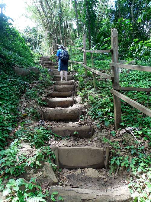 Part of the trail to Seven Sisters Falls. The trail to the Seven Sisters Falls is very well constructed and easy to the first two falls.
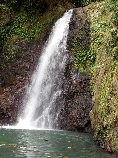 The Seven Sisters Falls #2. This is probably the best of the seven falls.
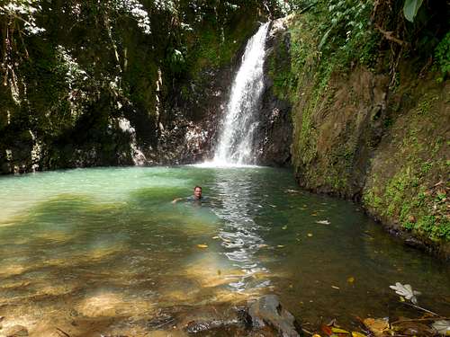 Cooling off at #2 of the Seven Sisters Falls in Grenada. It was a really beautiful hike and the water was perfect.