

Comments
No comments posted yet.
|
|
Trip Report |
|---|---|
|
|
May 24, 2015 |
|
|
Mountaineering |
|
|
Spring |
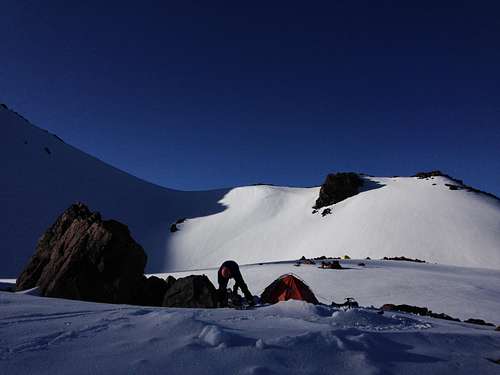
Our climb up Shasta began even later than our climb up Shastina- we had the advantage of being up 2,500′ higher than we had for the Shastina climb but were equally at the disadvantage of needing to climb nearly another 2,000′ to make it to the summit. And this climb ended up pushing both of our physical limits to the maximum.
The first pitch of climbing out of Hidden Valley was fairly steep- likely the steepest section of the entire day. There are several options, but we opted for a ~200′ tall shoot between two rock outcroppings. Luckily, once again, we were blessed with beautiful weather and the snow was primo for crampon’ing. The angle was too steep and snow too hard for efficent skinning without ski crampons so Andy packed his skis up to the top of the West Face and left them there for the final summit push.
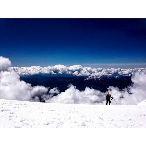
The slog up to the top of the West Face of Shasta is nothing more than a steep, steep hike (we gained 2,000’ in the first 1.25 miles- it was nuts) with nothing to look at besides the guided parties struggling up the face with their ropes and harnesses, and the occasional glance up from the blindingly white snow to admire the landscape around us. From the top of the West Face (~13,000′), we traversed east, to meet the Avalanche Gully and Casaval Ridge routes for the climb up Misery Hill (500′ of gain). Once atop Misery, its another quarter mile and a few hundred feet of gain to the summit pinnacle. We reversed the route for descent.
As with all mountains, Shasta should be researched prior to planning your trip. We had initially planned on doing a route that, in the last year or so, has developed a relatively spicy Bergschrund- a fact that we were not aware of until we had already traveled 2 hours south of Portland. We did not have the necessary gear to deal with the Bergschrund so we changed our plans at the last minute to accommodate what we had prepared for. Point being, research, research, research: conditions, trip reports, and necessary gear. Shasta is not technically difficult, but being at 14,000′ puts it in a class of its own. Respect the mountains and they will be good to you.
For a more detailed trip report and additional photos (including a TR about Shastina), check out this page.