
|
|
Mountain/Rock |
|---|---|
|
|
39.44310°N / 106.102°W |
|
|
Hiking, Mountaineering, Skiing |
|
|
Spring, Summer, Fall, Winter |
|
|
13633 ft / 4155 m |
|
|
Overview

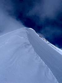
Peak 10
Peak 10 is the last and highest of the numbered mountains of the Tenmile Range, near Breckenridge, Colorado. It is ranked at #178 (depending on the list you use!) of the highest Colorado mountains. It is known to some as a "Bi" (a Bicentennial Peak - one of the 200 highest in the state). Peak 10 offers wonderful views of the rest of the Tenmile Range to the south, the Mosquito Range to the South, the Gore Range to the North, and the Front Range to the East. As often, the lesser peaks have some of the best views!
The Tenmile Range has ten numbered peaks, 10 being the highest. The lower slopes of Peaks 7-10 comprise the popular Breckenridge ski area. The top of Peak 8 is the actual resort high point. The numbered peaks of the Tenmile are a very linear range of about 9 miles that create a wall of peaks only one mountain wide, towering above the towns of Breckenridge and Frisco. Peak 10 rises to 13,633 feet in anticipation of the rest of the range that rises in earnest to Quandary Peak., which reaches well above the 14,000 foot mark.
Peak 10 can be easily climbed with its higher neighbor, Crystal Peak. They are connected by a high saddle.
| Peak 1 | 12,805 feet |
| Tenmile Peak | 12,933 feet |
| Peak 3 | 12,676 feet |
| Peak 4 | 12,866 feet |
| Peak 5 | 12,855 feet |
| Peak 6 | 12,573 feet |
| Peak 7 | 12,655 feet |
| Peak 8 | 12,987 feet |
| Peak 9 | 13,195 feet |
| Peak 10 | 13,633 feet |
Getting There
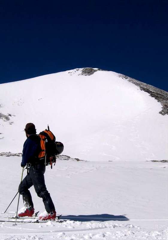
Spring on Peak 10
Spruce Creek Trailhead
From Hoosier Pass, south of Breckenridge on Colorado 9, go 7.6 miles north to the well-marked Spruce Creek Road. Turn onto the Spruce Creek Road, and follow it for approximately 2 miles to an obvious parking area.
4 wheel drive vehicles with high clearance can proceed much further. Go past the obvious parking area, and come to a Y in the road. Take the right of the Y. Soon you will come to another Y, and again, you should veer right. When you make this right turn, you will be passing through an open forest service gate. Go past the turn for Francie's Cabin, one of the 10th Mountain Association Huts, and continue up the road past treeline. After 2.3 miles, you will arrive at the Lower Crystal Lake. This is as far as you can drive.
There are several pullouts along this 4x4 road if you decide to bail out and walk the rest of the way. The worst section is near the middle where a number of large rocks line the roadway. A standard 4x4 should be fine for the road, but I wouldn't try it without skid plates.

The Summit
Breckenridge Ski Resort
Begin at the Breckenridge ski resort. Your starting point will differ based upon snow and whether Breck is still operating.
Drive to South Park Avenue on the south end of Breckenridge. Turn west and drive 0.2 miles and turn left on Village Road. Drive 0.2 miles on Village Road and turn left into a large parking lot near the Beaver Run complex. Turn left, cross the lot and turn right onto County Road (CR) 751 (dirt). This road leads to the top of the Peak 9 section of the ski area. After 0.5 miles keep left. There is a gated road on the right. Pass a lift and drive around to another intersection near 0.8 miles. Stay right on the main road and begin the climb into the ski area. Near 1.5 miles, stay right. Near 3.0 miles, go under a lift. Stay on the main road and pass the Peak 9 Restaurant. Continue up to the highest lifts near 3.6 miles. This is the trailhead. Past this point, the road is rough and 4WD is required.
In winter and spring while Breckenridge Ski Resort is still operating, you can take the Mercury Super Chair to the start of this route. Above the lift, start up the road. Backcountry access is not always open here, so call the ski patrol to check on the status before you plan a trip. Never duck closed backcountry gates. This violates the Colorado Skier Act, and will get you a hefty fine.
Routes
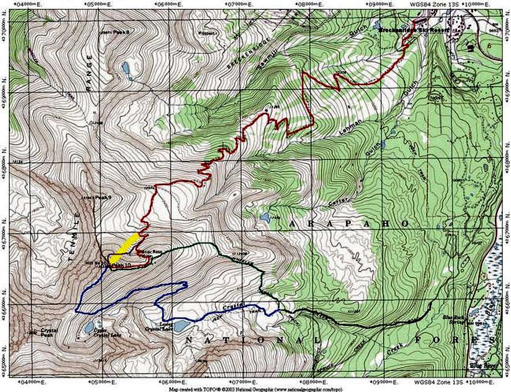
BLUE = Crystal Peak / Peak 10 Saddle Route
GREEN=East Ridge from Spruce Creek
RED=East Ridge via Breckenridge Ski Resort
YELLOW=Northeast Face Ski Descents
BLACK=Shared Approach to East Ridge and Crystal Creek Routes
BROWN=Peak 9-Peak 10 Traverse(from Peak 9 Page)
PURPLE=Northeast Face Traverse to North Ridge
Red Tape
There are no fees for anything on this route. As always, obey private property postings.
When To Climb
Peak 10 can be climbed all year-round. Be aware of Avalanche danger in the winter and spring. Visit the Colorado Avalanche information Center's Website for current information.
Camping
As mentioned above, Francie's Hut, a 10th Mountain Association Hut, is along the route.
There are no formal campsites in the area.
Weather
Click this link for a high altitude NOAA weather forecast for Peak 10.
Breckenridge Mountain Cams
Click here for the Breckenridge Ski Area Mountain Cams.
External Links
 Ski Peak 10