

-
 91037 Hits
-
 86.83% Score
-
 23 Votes
|
|
Mountain/Rock |
|---|---|
|
|
48.01294°N / 121.51795°W |
|
|
Download GPX » View Route on Map |
|
|
Snohomish |
|
|
6214 ft / 1894 m |
|
|
Overview
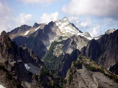 Vesper Peak
The majority of people who attempt this summit do so by the standard hiking route. For the technically inclined, climbing routes are also an option. The main route to Vesper Peak starts where the Sunrise Mine road ends. Even the view from the end of the road is pretty good. Looking up to Morning Star Peak and Sperry Peak gets the blood pumping.
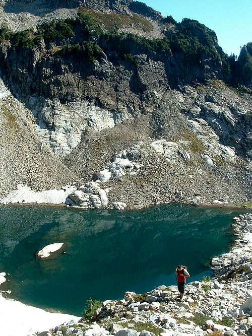 Lake Elan
From the end of the Sunrise Mine Road, the hike begins in a wooded area. It's thick with tree roots that are often slick. The path is somewhat faint at times, but always evident. There are some small waterfalls to pass and a few stream crossings. There is at least one place that could use a bridge so exercise caution if the melt off water is high. Usually a couple of logs are in place to walk or scoot across the south fork of the Stillaguamish. From the last crossing, the trail begins switch backing up through a ferny avalanche meadow.
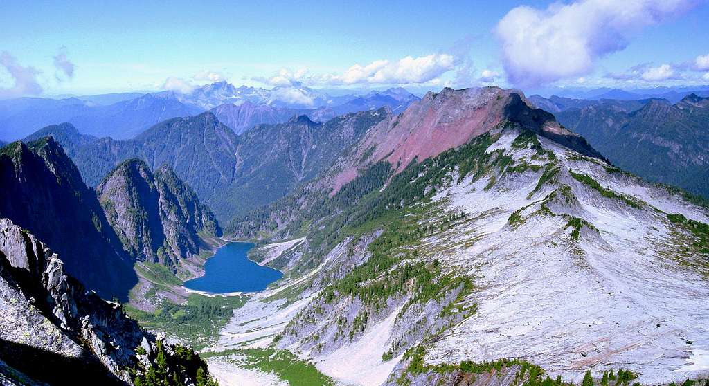 Summit View
Coming around the bend the trail enters lower Wirtz Basin. There basin has enough salmon berries, huckleberries (in season), and blueberries to slow down the pace. There is some blow down and brush to be navigated in the lower part of the basin. This is one of the rockiest trails I have been on in the Cascades. Much of it is talus and cobbles, which make tough shoes and tougher feet a big plus. Waterfalls and slabs surround you. One of the surprises of the Wirtz Basin it's ability to hide Headlee Pass. The route through the cliffs is not evident until your are directly below it. If you lose the trail at this point, just proceed up the basin towards the back right walls, From there the trail is evident again and so is the pass.
Warning: Even in summer, hard, steep snow sometimes exist in the gully below Headlee pass. There have been a few accidents here, and one death. Please be competent in ice axe use before attempting to climb up the slot when snow-filled. This is not the place to practice, as the runout involves big boulders.
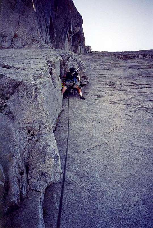 technical route (non standard)
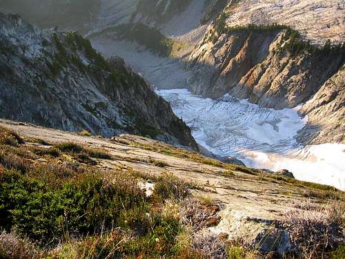 the northern glacier
If summit fever has not gripped you, turn right off the main path, heading upstream into the basin between Vesper and Sperry. Perhaps you will lay down in the heather until the urge to climb goes away. Just gaze up at the peaks and wonder why anyone would want to climb them. Otherwise, continue following the main path which will put you on slabs for the last 1000' to the summit. There are some nice spots to curl up, relax, and play 'name that peak'. You will find the register in a small brass tube. Look at all the peaks, lakes, glaciers, and abundant rock climbing. This is an area you will want to revisit.
Getting There
From Seattle take I-5 North to Exit 194. Follow Highway 2 East for 2.3 miles, stay in left lane, go to Lake Stevens Highway 204 East, in 2.2 miles take left (north) on Highway 9 to Lake Stevens, in 1.7 miles take right (east) on Highway 92 to Granite Falls, in 8.4 miles turn left (north) to Mountain Loop Highway. Follow for about 30 miles to the Sunrise Mine Road on the right. Road dead ends in about 1 mile where parking is limited to one side of the road. Leave room for others to turn around.Remember to display your Northwest Forest Pass so you don't get a ticket.
When To Climb / Camping
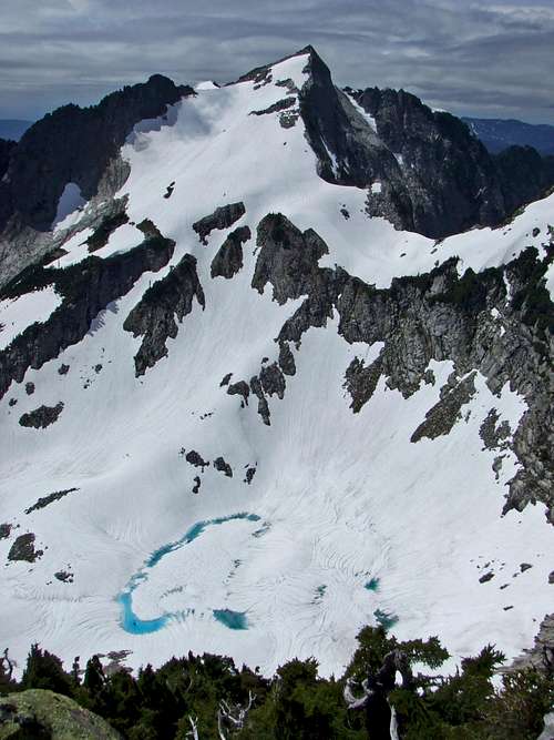 Vesper seen from Sperry
High avalanche danger during the melting months in the Upper Basin, hence the debris in the gulch. Carry an avalanche probe and/or beacons if backcountry skiing.
Consult the Verlot Ranger District office.
No Camping is abundant along the Mountain Loop Highway towards the trailhead. (Gold Basin/Verlot/Turlo) Contact the Verlot Ranger Station for more info.