
-
 77323 Hits
-
 89.35% Score
-
 29 Votes
|
|
Mountain/Rock |
|---|---|
|
|
39.59300°N / 105.763°W |
|
|
13794 ft / 4204 m |
|
|
Overview
 |
 |
 |
NOTE: This page was originally written by Colonelpyat
Prominence = 814 feet
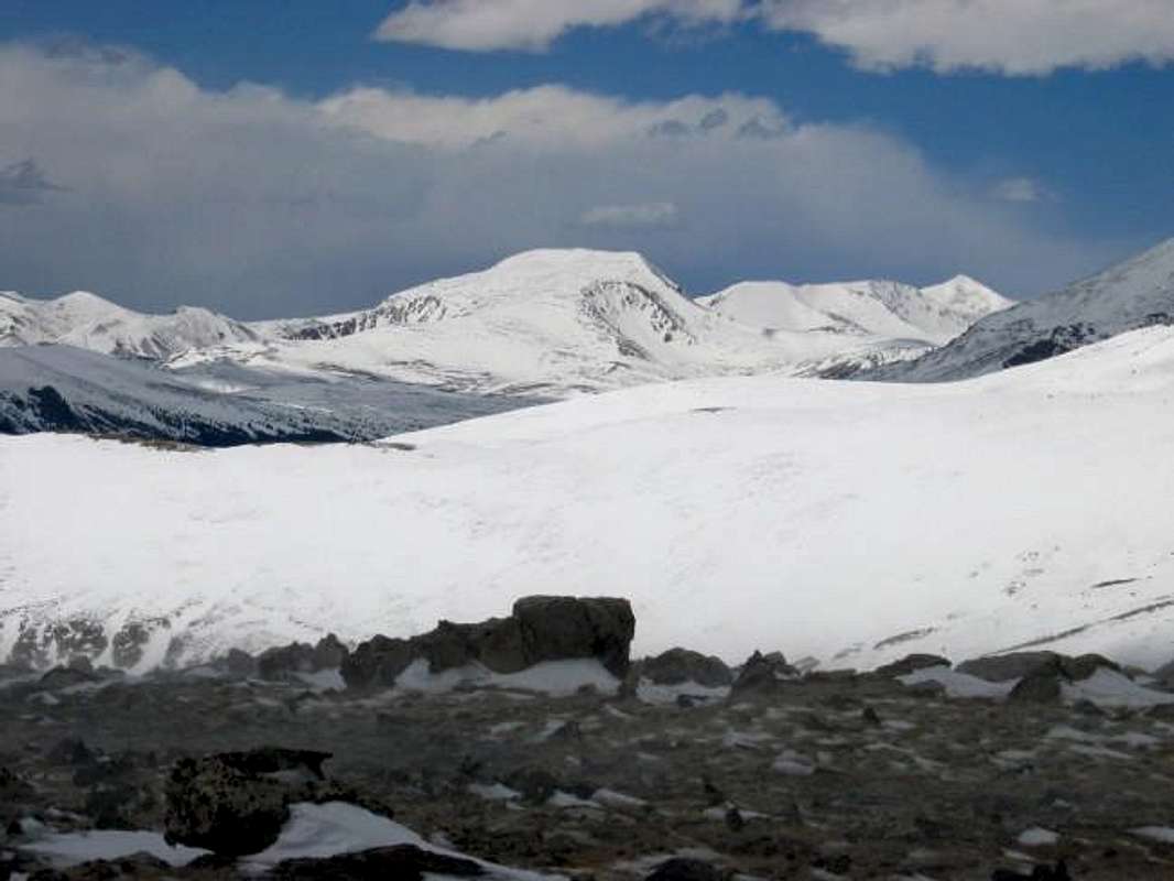
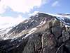
At 13,794' Square Top Mountain is the 111th highest peak in Colorado. Situated in Colorado's Front Range, near Guanella Pass, Square Top lies midway between the 14er duos of Evans-Bierstadt and Grays-Torreys. Overshadowed by these loftier neighbors, Square Top attracts relatively little traffic from alpine travelers.
Square Top is best characterized by its large summit area. A set of ridges rise from four directions to meet at the east and west ends of a broad summit ridge that runs for nearly half a mile with a vertical relief of less than 100 feet. Viewed from the north or south, a square top it is. The slopes below this defining summit harbor a large expanse of gentle tundra and several fine alpine lakes. Numbers of mountain goats have also been known to take up residence in the vicinity.
An easy ridge hike from Guanella Pass is the usual route for Square Top. Generally good access to the trailhead makes this a mountain that can be climbed year-round. Strong winds from the northwest sweep snow from a good portion of the route making it a safe outing for those with relatively little winter training.
 |
 |
 |
 |
 |
Getting There
Guanella Pass:
The trailhead is accessible from either I-70 or US 285 west of Denver. From I-70, leave the interstate at Georgetown (Exit 228 on I-70) and follow the signs for 10 miles to the pass. From US 285, exit at Grant and drive for 12 miles to the pass.
Red Tape
No permits are required for hikes in this area.
When To Climb
Square Top is climbed year-round, but optimal conditions generally occur from late June through September. Be aware that this also the season for afternoon thunderstorms in the Colorado mountains. Hikers should plan to be on the way down by noon.
Mthiker wrote a route page on the route from Guanella Pass.
Note, if you are hiking this mountain in the spring or fall be prepared for all kinds of conditions. When I hiked Square Top it was warm from the start. Then once I got on to the open ridge it became windy with tropical storm like gusts. I had to get out my face masks and winter gloves out (in mid October). Then on the way down on the SE ridge we were shielded from the wind and was able to take off some layers again.
 |
 |
 |
 |
 |
Camping
Click here for information on established campgrounds in the Clear Creek Ranger District. The Clear Lake and Guanella Pass campgrounds are located between Georgetown and the pass.
Click here for information on established campgrounds in the South Platte Ranger District. The Burning Bear, Geneva Park, and Whiteside campgrounds are located between Grant and the pass.
One can pitch a tent or build an igloo at the pass itself.
Mountain Conditions
Clear Creek Ranger District
101 Chicago Creek Road
Idaho Springs, CO 80452
(303) 567-3000
Click here for the latest forecast from the National Weather Service.
Click here for the latest report from the Colorado Avalanche Information Center.
External Links
- An early winter ascent of Square Top
Photos and trip report from a fairly casual, yet windy trip up Square Top from Guanella Pass. Early winter conditions apply which made life a little more exciting than it otherwise could have been. - An October ascent from Guanella Pass
- Square Top Mountain (12/26/2005)