
|
|
Mountain/Rock |
|---|---|
|
|
45.04720°N / 70.3828°W |
|
|
4228 ft / 1289 m |
|
|
Overview
Crocker, North Peak - 4,228
South Crocker - 4,050 feet
While the twin peaks of Crocker Mountain may not be as high as nearby Sugarloaf nor as interesting as the quadruple peaks of Bigelow Mountain, this 4,228-foot mountain in Maine's Carrabassett Region still offers a vigorous and pleasant day hike to the Appalachian Trail enthusiast. Perhaps the most notable part of this mostly wooded mountain is that the best views can be found if one climbs South Crocker via Caribou Valley Road approach from the south.
Although some summit area vistas can be scouted out, neither peak offers much in terms of outstanding scenery as compared to what neighboring mountains have to offer. Despite its proximity to Sugarloaf (just three and a half miles as the crow flies), a deep col gives North Crocker a prominence of more than 1,200 feet.
 The Cirque of North Crocker
Route choice is very easy as the only trail to the summit is the Appalachian Trail itself. One can approach from the north along Maine State Route 27 or from the south on the rugged and seasonal-use Caribou Valley Road (CVR). Many eastern peakbaggers approach these peaks from the north, which offers not only an easy to find trailhead and parking area but also a better section of trail for hiking. Starting at an elevation of 1,400 feet, the Appalachian Trail climbs about 2,800 feet over 5.2 miles to the summit of North Crocker, but at no point does the trail feel very steep. Footing is good and the climbing is fairly gentle in the early going, becoming more moderate in the mountain's upper reaches.
After summiting North Crocker, the hiker will descend to about 3,700 feet before climbing back over the 4,000-foot mark on South Crocker. These two peaks are separated by only one mile of trail. Nearby Mount Redington - located one mile SSW of South Crocker - is also of interest to peakbaggers as recent surveys have placed it above the magical 4,000-foot mark. Though tantalizingly close, Redington should only be attempted from this point by those comfortable with off-trail navigation.
When I finally climbed Redington in 2000 (on my third try), it was via a thick and time-consuming bushwhack from South Crocker. Some recent reports, however, have suggested that a herd path has begun to develop between the two peaks. If you don't mind a roadwalk, one can make a loop of this hike by descending the steep southbound section of Appalachian Trail which drops nearly 1,900 feet in just 2.1 miles between South Crocker and Caribou Valley Road. From the A.T. crossing on CVR, Route 27 is 4.5 miles distant. The Crocker parking area is an additional 1.6 miles west (left turn) along Route 27. Maine Mountain Guide and Maps are recommended. Map #29 of DeLorme's Maine Atlas and Gazetteer is also useful.
Getting ThereThe Route 27 Appalachian Trail crossing is located about 5 miles east of the village of Stratton, Maine. This point is also 2.6 miles west of the Sugarloaf USA ski area.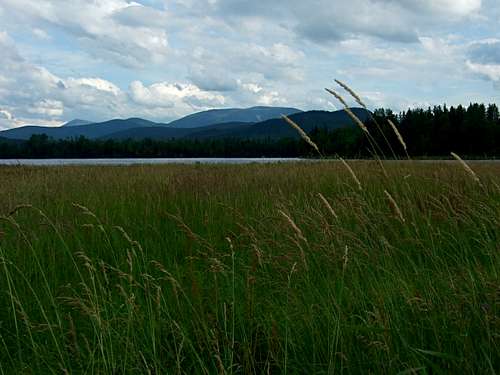 North Crocker from Stratton North Crocker from StrattonUpdate from Technicolor NH (May, 2016): As of May 2016 the AT crosses the Caribou Valley Road half a mile from the locked gates at the end. There is a small parking area before the gates, which are placed directly before a metal grate bridge that is starting to decay badly enough to merit not crossing it with a vehicle. As of this date the wooden bridges on the road prior to the gate were intact, but there were noticeable signs of wear on at least one bridge so if it has been a few years since I wrote this comment do check any spots that appear sketchy BEFORE crossing them. The advantage of taking this route is that it is a mere 2.6 miles to the top of South Crocker from the road, whereas it is 5.2 miles just to get to the top of North Crocker from the highway trailhead. The Caribou Valley Road is clearly recognizable by the Plum Creek sign a short distance in from the highway at the highest point of land. If you pass by a power substation on the left as you go northwest you have driven past it.
Red TapeThere is certainly no red tape involved in hiking this section of the Appalachian Trail. However, those looking to approach these peaks from Caribou Valley Road should be aware that CVR is a seasonal use road whose maintenance depends upon the logging companies who utilize it. It has been reasonably well-kept in recent years although there have been some reports of deterioration in the last couple of years. Be prepared to walk.
When To ClimbYear-round hiking/climbing although this region receives heavy snowfall in the winter.
Camping Bunchberry Bunchberry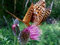 ... and butterflies ... and butterfliesExternal LinksMaine Appalachian Trail Club MATC is a volunteer nonprofit corporation that manages 267 miles of the Appalachian Trail in Maine, its facilities and corridor. MATC is a trail maintenance club, not a hiking club. Anyone is welcome to come out on trail work projects with the club or its Maine Trail Crew.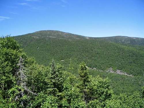 Weather
Personal StuffFormer page maintainer Bark Eater climbed the Crockers on an AT section hike the summer of 1987. His best hiking buddy Rainier hiked most of the Maine AT with him. She was the best trail dog ever. Page author and current maintainer Puma concolor also considers this a favorite area. He has spent 15-20 days hiking in the Carrabassett Valley - Stratton and considers it among the best mountain destinations in the Northeast.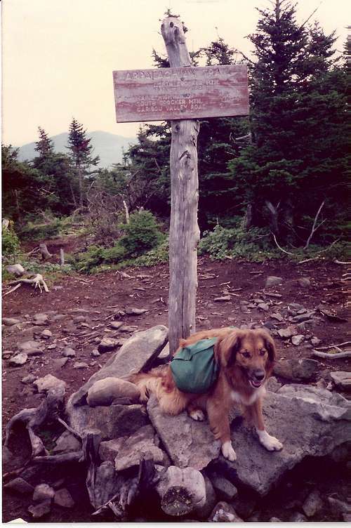 Rainier on North Crocker Summit Rainier on North Crocker Summit |
technicolorNH - May 17, 2016 2:24 am - Hasn't voted
Caribou Valley RoadAs of May 2016 the AT crosses this road half a mile from the locked gates at the end. There is a small parking area before the gates, which are placed directly before a metal grate bridge that is starting to decay badly enough to merit not crossing it with a vehicle. As of this date the wooden bridges on the road prior to the gate were intact, but there were noticeable signs of wear on at least one bridge so if it has been a few years since I wrote this comment do check any spots that appear sketchy BEFORE crossing them. The advantage of taking this route is that it is a mere 2.6 miles to the top of South Crocker from the road, whereas it is 5.2 miles just to get to the top of North Crocker from the highway trailhead. The Caribou Valley Road is clearly recognizable by the Plum Creek sign a short distance in from the highway at the highest point of land. If you pass by a power substation on the left as you go northwest you have driven past it.
Bark Eater - May 24, 2016 12:31 pm - Hasn't voted
Re: Caribou Valley RoadThanks for the update!