-
 10621 Hits
-
 85.87% Score
-
 21 Votes
|
|
Mountain/Rock |
|---|---|
|
|
45.82983°N / 114.51052°W |
|
|
ravalli |
|
|
Hiking, Mountaineering, Scrambling, Skiing |
|
|
Spring, Summer, Fall, Winter |
|
|
8780 ft / 2676 m |
|
|
Overview
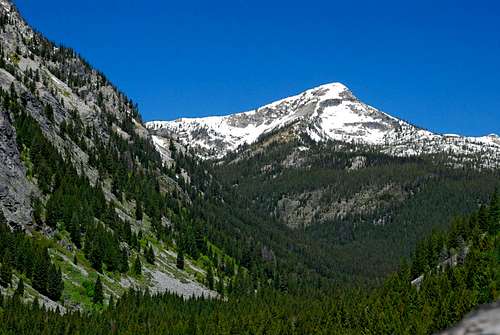
Of the few who do visit the area of the West Fork, most are horsemen and/or hunters. Since they generally stay low in the drainages, they benefit our “climbing experience” by helping keep the access trails open. I’ve been in the area many times, even during hunting season, but have yet to see a single person in the backcountry. I have run across foot and hoof prints, a vehicle or two on the roads, and one time, a tethered horse and a mule at a trailhead. This is wild country, and I love it! How Watchtower Peak got its name is undocumented. There is speculation that it was named after the creek which could have received its name from early settlers who were impressed by the many gendarmes along the ridge-lines on both sides of the drainage. But now that I have visited the summit and seen the unparalleled views in every direction, I prefer to believe the peak was named for what it is, a watchtower, and the creek (several of whose tributaries flow from its base) was named for the peak. Just speculation of course, but as there is no documentation to disprove my contention, who can justly argue differently? Getting ThereFrom Hwy 93 take Montana Hwy 473 (West Fork Road) west for 14.3 miles to the junction with Nez Perce Road (468). Follow the Nez Perce Road for 9.2 miles to the signed turnoff for Watchtower Creek Trail (142). Turn right (northwest) onto FR road 5638 and follow it .4 mile to the trailhead loop. There are stock facilities and an outhouse at the trailhead. Area Restrictions (Red tape)Watchtower Creek Trail passes into “official” Wilderness in just under 3 miles from the trailhead. Wilderness rules apply.CampingThere are plenty of places to camp along Watchtower Creek, but there are also lots of mosquitoes. I saw some nice camp sites high along the ridge-crest to Watchtower Peak – no water but fewer mosquitoes! It may be prudent to camp at one of those spots.RoutesFor information about the climbers' route, see the link included in the picture's description.
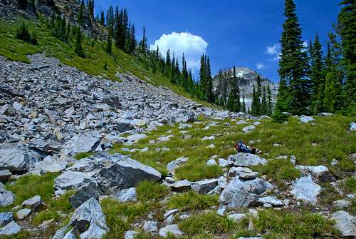
During the approach along the Watchtower Creek Trail, you cover almost 6.5 miles while achieving only 1,143’ of elevation gain. The trail is excellent, well maintained, and very enjoyable to hike. The remaining 1.5 miles to the summit requires that you gain 2,580’ of elevation. If I’m doing that on rock, I don’t mind even though it requires some effort. But, I do NOT like having to make that amount of gain on poor footing, especially in a heavily forested area. 1,000’ of the elevation gain on this route is just what I dislike. Yuck! While on the summit, I spent time studying another possible route. It would be longer than this route by 3 to 4 miles, round trip. What it would not do is force one to climb in heavy forest. It is likely to have sections of Class 4 climbing. In a nutshell, my proposed route continues on the Watchtower Creek Trail (past the base of Watchtower Peak) toward the pass into Idaho. Either before reaching the pass or at the pass, it leaves the Watchtower Creek Trail and follows the ridge-crest in a northeasterly direction to the summit of Watchtower Peak. There are gendarmes guarding the ridge in several places, but it appears it would be possible to circumnavigate them with only a small amount of down-climbing. I’ll trade a 20 mile round trip and Class 4 climbing for a 16 mile round trip, a portion of which requires climbing 1,000’ on poor footing through a thick forest, any day! Even if it requires an overnight stay in the backcountry. Come to think of it, that could be rather nice. |


