-
 4726 Hits
-
 78.27% Score
-
 9 Votes
|
|
Mountain/Rock |
|---|---|
|
|
38.99900°N / 77.2544°W |
|
|
Toprope, Bouldering, Scrambling |
|
|
Spring, Summer, Fall, Winter |
|
|
120 ft / 37 m |
|
|


Overview and Routes
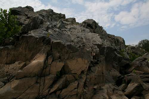
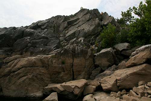
The Fish Face is a downstream-facing wall a short distance downstream from Microdome and just a stone's throw upstream from Flat Iron in Great Falls Park. It is a small crag with short routes (30'), but it also has bouldering appeal, and there are many Class 3 and 4 scrambling opportunities in the immediate vicinity.
There are three established routes on the crag. With only about 10 feet between the first and third routes, the crag is nicely suited for topropers who want to set up once and climb all three. Bringing your own gear for building up anchors is necessary; the top of this crag lacks the large trees commonly found atop many other Great Falls-area crags.
The crags downstream from Fish Face have longer routes and more of them, but they are also very popular. Fish Face sees almost no climbers; most people who see the crag are anglers and hikers scrambling along the rocks on the banks of the Potomac River. Although Fish Face overlooks the Potomac River, it is set back far enough from the main channel (and its routes start from a ledge several feet above the river level) that water levels usually do not impede access.
The three routes on the crag are, from left to right as one faces the wall, as follows:
Shad (5.9-)-- Face and overhang.
Fish Ladder (5.7)-- Crack and overhang.
Fish Face (5.7)-- About 5' right of Fish Ladder; climb the face.
Getting There
Locals will know their own best ways. For others, though, these directions are easiest to follow:
From the western part of I-495, a piece of the Capital Beltway, take Exit 44 for Route 193, Georgetown Pike; this is the second exit south of the Maryland border. Drive west for a few miles until you see the well-signed road leading to Great Falls Park. Turn right and follow the road about a mile to the entrance station. Take an immediate right to reach the "lower lot."
Hike toward the river and the third overlook of the falls (the one farthest downstream and closest to the parking area). Look downstream from the overlook and spot Microdome. Then go back to the main path heading south. Just past the turnoff to the overlook you just visited, look for a wooden fence on your left. Follow that fence until you see a use trail leading out to the rocks, and then walk out onto the boulders. Hop, walk, and scramble to Microdome and then descend right (downstream) from the top of Microdome. The Fish Face appears shortly after you round a buttress; when locating it, remember that the wall faces downstream.
Red Tape
The park is open from 7 A.M. until dark. There is an admission fee, good for three days, of $10 per vehicle.
Climbers are asked to register (free). There is a registration box at the visitor center.
Drilling to place bolts is prohibited. Tradition and regulations require toproping or removable trad gear. Great Falls is not a sport climbing area.
Camping
There is no camping in the park. The area adjacent to the park is private property. Great Falls is a day-use area.
More Information
Link to Great Falls NPS site.
In the neighborhood...