
-
 5995 Hits
-
 84.27% Score
-
 18 Votes
|
|
Mountain/Rock |
|---|---|
|
|
43.32107°N / 110.36984°W |
|
|
Hiking |
|
|
Spring, Summer, Fall |
|
|
8829 ft / 2691 m |
|
|

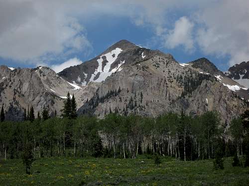
Overview
Deer Ridge is a low peak near Granite Creek in Wyoming’s rugged and remote Gros Ventre Range, where summertime hiking on maintained trails can often mean wading through huge meadows of waist-deep wildflowers.
Deer Ridge is less than a typical mountain but more than a simple ridge. Most named Gros Ventre peaks are at least 2000’ higher than Deer Ridge is, and Deer Ridge, like a true ridge, is long and has a highpoint that is more a bump than a peak. However, the ridge is isolated and rises from valley bottoms on all but one side-- the north-- where it does join a much higher peak, but not before dropping to a saddle that gives it about 300’ of prominence, the standard accepted in much of the U.S. for considering a peak to be a “real” peak.
In making a page for this “peak,” I decided that the prominence factor and the official name merited the effort and distinction. Also:
--Deer Ridge’s elevation makes it a great early-season or late-season hike. If you go in the fall, though, go knowing you are sharing the area with hunters of the human variety, and take proper precautions (bright orange and maybe some body armor, the latter especially the closer you are to the road).
--The round-trip distance of about 13 miles and the moderate elevation gain make this peak one of just a few in the range that are friendly to day trips.
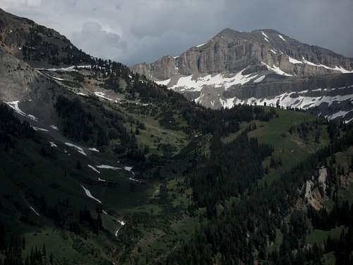
--The views are outstanding and include the range’s highpoint, Doubletop Peak.
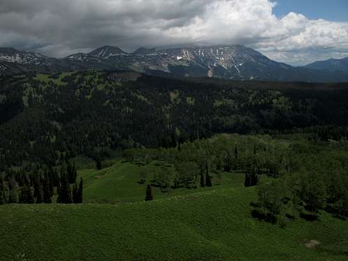
The ridge is mostly tree-covered, but much of the crest and the eastern slopes are covered with grassy, wildflower-filled meadows, and it is those places, of course, where one finds the outstanding views.

Getting There
About 11 miles southeast of Hoback Junction, look for a signed road heading north into the Granite Creek Recreation Area. This gravel-and-dirt road, which can be a little rough but is still passable for most passenger vehicles, follows Granite Creek for 10 miles to Granite Hot Springs, a popular spa (admission fee required). Along the way there are spectacular views of Granite Creek and the Gros Ventre Range.
7.5 miles up the road, look for a spur that makes a bridged crossing of Granite Creek. Turn here and follow signs for 0.1 mi to a trailhead. Look for the trail marked for Shoal Falls; this is your trail.
Route Information
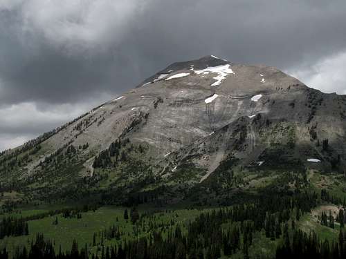
RT distance is about 14 miles. The trailhead is at 6800’ and the summit is 8829’, making a climb of just over 2000’, but the route involves a drop to a creek bottom (very easy to cross) and climb back up. This adds about 350’ each way, so the real elevation gain is closer to 2700-2800’. Most of the route is moderate, and there are trails all the way, keeping this as just a Class 1 hike, but there are some steep sections that will push your thighs and lungs.
Hike the Shoal Falls Trail for close to 6 miles to an open saddle (around 8520') that offers a panoramic view of the interior of the range. At the saddle, turn right and head up the ridge along a use trail until you reach what seems to be the highpoint (it is not obvious, but maps mark it as being on the first "summit" south from the saddle). The hike up the ridge is around a mile.
As you approach the saddle, you might consider striking out cross-country for the ridge . This is what a friend and I did; it added some easy Class 2 and made the RT distance closer to 13 miles.
Shoal Falls
There is very little trail information at the trailhead, and the sign pointing you to Shoal Falls implies that the waterfall is a short day hike. It is not. Shoal Falls is about 7 miles from the trailhead. To reach it, you must hike to the saddle described above and then hike down into the valley of Shoal Creek, crossing into the Gros Ventre Wilderness and losing 700' of elevation along the way. Then you must negotiate your way upstream to the falls unless you are satisfied with the trail views, which are only so-so. Furthermore, the falls are not visible from the saddle itself; to see them, you must hike down a bit or go up Deer Ridge, from which the full waterfall is visible, though it seems far away.
I note this because I have run into hikers who seem to think they are out on just a jaunt to the falls, as indicated by their gear-- bottle of water in one hand, camera in the other.
Up close, Shoal Falls is spectacular and worth the visit.
Some Views


Red Tape
No fees or permits. This is bear country, though, and habitat for both black and grizzly bears, so know your bear etiquette for both.
Camping
Granite Creek Campground is a mile up the road from the trailhead. It is a large campground with running water and flush toilets. Sites cannot be reserved. The camping fee was $10 per night in July 2009.
Dispersed camping is widely available, and backcountry camping is free (and no permit is needed).
More Information
Bridger-Teton National Forest