
-
 9712 Hits
-
 79.78% Score
-
 11 Votes
|
|
Mountain/Rock |
|---|---|
|
|
43.54617°N / 110.45392°W |
|
|
Hiking, Scrambling |
|
|
Summer |
|
|
10717 ft / 3267 m |
|
|
Overview
First, and this is important, I need to make it clear that this is not the 11,107’ Pyramid Peak marked on maps of the range. Instead, it is a local name, seemingly well known to the owners, managers, and staff of the Red Rock Ranch, which has some of the best views of the peak and most definitely offers the easiest access.
From either the ranch or the nearby Crystal Creek trailhead, Pyramid Peak makes a nice destination for a day climb; from its summit are excellent views of the massive complex of Sheep Mountain, aka Sleeping Indian (in fact, this Pyramid Peak is really probably a subpeak of the Sheep massif, and it does not have the prominence to stand as a ranked peak), and, on a clear day, the Tetons, the Absarokas from the Togwotee Pass area all the way to super-remote Younts Peak, and the Wind River Range, including Gannett Peak, Wyoming’s highest. This is a view that takes in Wyoming’s two highest peaks and its most remote.
As is the case on most of Wyoming’s alpine summits, there is neither a cairn nor a register up top. Enjoy the frontier feel and don’t ruin it.
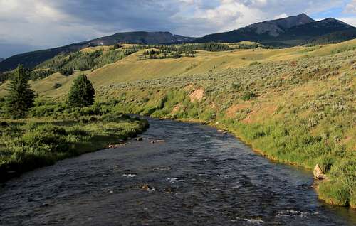
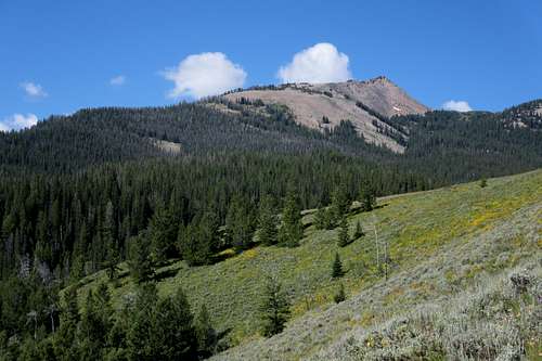
 Pyramid Peak from the Red Hills | 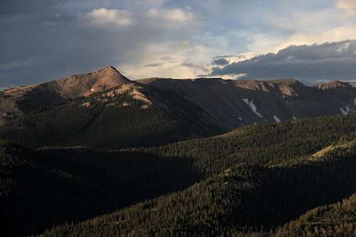 |
Getting There
From the main highway heading through Jackson Hole between Jackson and Yellowstone, follow roads and signs that direct you west toward Kelly.If you have even a park map, and you should, you will see the different options, so I’m not going to go into detail for people too unwise to have a decent map.
Depending on your approach drive, the intersection with the Gros Ventre Road will be either a couple miles north or south of Kelly. Turn onto that road and head east into some really pretty country.
Around 10 miles along the road, and after it has turned from a narrow paved road to a narrow dirt one, you pass the Red Hills, the currently closed Red Hills Campground, and then the currently open Crystal Creek Campground. Shortly past the second campground is a bridged crossing of Crystal Creek, and not far past that is a right turn onto the road that accesses the Red Rock Ranch and the Crystal Creek TH.
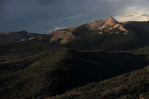
Pyramid Peak and Crystal Creek
I have been a guest at the ranch, and the owners, managers, and staff are great people, but I will tell you that there are signs placed in a way that might make you think the whole road is off-limits. It isn’t. If you are a ranch guest, head in and enjoy the hospitality and utilize the easiest approach to this peak. For those who are not ranch guests, just bear left at the major fork and drive 2 easy miles to the trailhead. High clearance is not necessary for most cars, but people with high clearance and 4wd can shave a little more distance if they want; as the road continues a little bit beyond the official trailhead.
Route
If you are a ranch guest, just head west or southwest across pastureland and then start ascending steep, open slopes in the general direction of the peak. Those starting from the trailhead should make for the same slopes while staying off private property. Resist the temptation to head up the drainage of Shorty Creek. It would work, but it would be a mess. I descended that way and had to stay high above the creek to avoid cliffs and the worst bushwhacking. On the other hand, I did see a pretty gorge and some waterfalls that very few others ever see.
Pyramid Peak from Red Rock Ranch
Higher up now, follow easier open ground toward the peak and Point 10,144. Although it's not the way I went-- I ended up doing a long, forested slog up to talus slopes in a bowl just northeast of the summit-- I think the best way, because the terrain is more open even though this way will mean giving back some earned elevation gain, is to go up Point 10,144 and then head south to Pyramid Peak's summit.
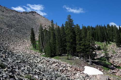
Bowl Beneath the Summit Ridge
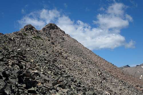
Summit
One-way distance is about 3 miles. Elevation gain is about 3500'. The difficulty should not exceed Class 2, but it is possible to get into some Class 3 near the summit.
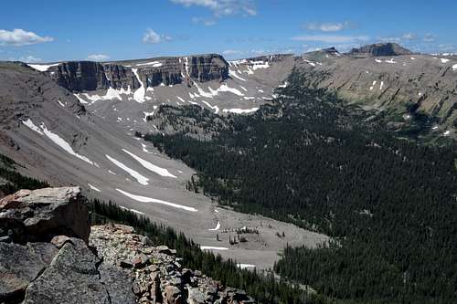
Sheep Mountain (Sleeping Indian) as seen from the summit