
|
|
Mountain/Rock |
|---|---|
|
|
40.66274°N / 110.91104°W |
|
|
Wasatch |
|
|
Hiking, Skiing |
|
|
Spring, Summer, Fall, Winter |
|
|
10743 ft / 3274 m |
|
|
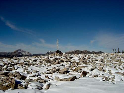 Summit
Overview
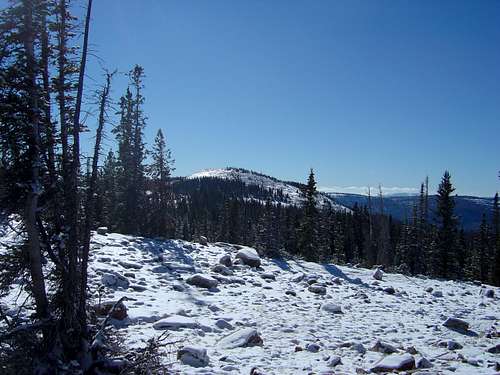
An easy hike/adventure to Wasatch County's high peak. The actual high point for the county is on the south flank of Murdock Mountain, just to the north of Mt. Cardwell. This peak earned it's name in a contest by The Salt Lake Tribune to name the county high points which were un-named in 1996. The winner for the Wasatch County Peak was Mt. Cardwell, after Henry Cardwell Clegg who lived in Wasatch County and spent most of his life working water/recreation near this peak. This small peak sits in the shadows of Bald Mountain (11,943 feet) to the northwest, and Murdock Mountain (11,212 feet) to the north. Though not as challenging as it's larger rivals it makes for some fun back-country travel. Note: I'm not quite sure how I became the author of this page and just discovered that I am. I did do a report for the Wasatch county highpoint which is on the side of this peak but I will try and improve this page now that I am aware that I am listed as the author. (Dean 9-1-2015)
 Wasatch County highpoint
Getting There
From Kamas, drive east on Utah Highway 150, better known at the Mirror Lake Highway. Stop at or just after Bald Mountain Pass to park. About .3 miles north east of the pass there is a large section on the east side of the road to park. Admire the stunning views from this location. See getting there for road closure information.
 Register found at highpoint
Red Tape
The Mirror Lake Highway now toll's $6.00 for a 3 day recreation pass for vehicles parked anywhere along the highway. Camping in one of the Forest Service campgrounds also requires a fee. The Mirror Lake Highway is closed 17 miles from Kamas in winter, and the fastest approach during winter months will be via snowmobile. Please check out UDOT's seasonal road closure page here for real time access limitations on the highway.
 GPS taken at Wasatch County HP
Camping
There are numerous campgrounds along the Mirror Lake Highway. The closest one is in the vicinity of Moosehorn Lake, just north of Bald Mountain Pass. Another is Lost Lake about 2 miles before reaching the pass area. All are Forest Service campgrounds and have water/restroom facilities, and of course charge a fee.
Routes.
One can route-find up and over the southwest side of Murdock Mountain to this peak, however combining Murdock Mountain and Mt. Cardwell as a loop makes for some scenic travel. There are no trails established in this area. However most of the route is on fairly sturdy boulders, which can make for some fast travel if wanted. The distance from the north side of Bald Mountain Pass is just under two miles, with +/- 500 feet of elevation gain and loss. A decent topographical map and compass are recommended.
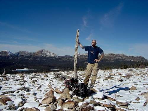 Kirt Davis at Summit