Add Heading Here
Mount Waas
12,331'
Highpoint of Grand County
August 5, 2009
We got a slow start on the peak bagging this year, and wanted, no, needed to get some elevation.
Our plans were to hit Delano and Mine Camp, but seeing how easily Mine Camp would be, we opted to take the kids on this one, and hit Waas and Peale instead.
We headed out on a tuesday afternoon and made goog time to Moab. Here we topped off the gastank, and backtracked to Highway 128 following directions from SummitPost.org.
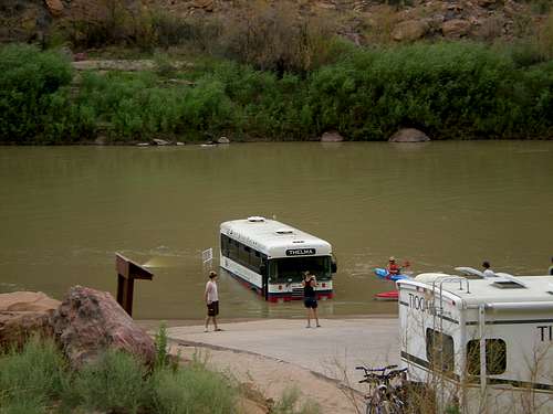
We were driving along the highway, when I saw something out of place in the river. I just caught a glimpse of it, but it sure didn't look like a boat. As we got a better look, it was a bus. We pulled off in the pakking lot for the loading ramp and took some pics and watched for a bit.
The road took us through Castle Valley. What a neat place. We soon left pavement and followed a dirt road a ways then the road got pretty rough. It was probably the roughest road we have traveled yet chasing highpoints.
We took this road until it nearly peetered out in Beaver Basin. We found a nice place to camp, but the only bad thing about it is it was a Bear Lure Station. Okay, so its not a good place to stay for too long. We took a bit of a look, and in the middleof the camp there was a pile of sticks with a piece of carpet suspended above it with wire. The lure kinda reminded me of black licorise. Good think I don't like it, and don't take it camping with me. Barbed wire was strung along the ground at about knee-height. Wonder if they are looking for hair for DNA samples??? We headed up a bit furter and found a pretty good place, hoping we wouldn't have company.
We set up camp, and wandered around for a bit. We came across an old miner's cabin and some mines. AFter our little stroll, we went back to camp, fixed dinner, and went to bed.
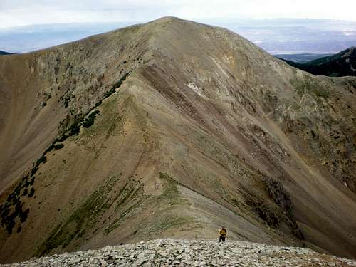
We got out of bed at 06:00 and after a quick breakfast, and started for the summit at 06:30. There is no trail to the saddle, but it is within view, and can easily be reached, even though it looks rough. The view from the saddle down the other side is awesome! I couldn't wait to see what the view from the peak is like.
From the saddle, there are faint switchbacks up to the peak. It sure makes the going a lot easier through all the talus.
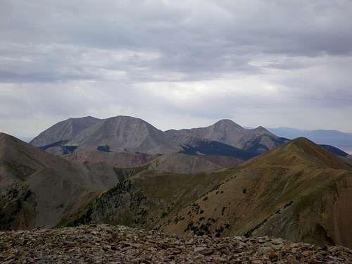
At the summit, there is a rock shelter, which offers a nice place to kick back and take in the view.
Stats:
Total hike time : 3hrs
Elevation Gain: 1,731' in 1.4 miles
Total Time: 3 hours, round trip
--------------------------------------------------------------------------------
Waas Vert. Profile.JPG
Description: Verticle Profile
Filesize: 29.51 KB
Viewed: 8 Time(s)
--------------------------------------------------------------------------------
Comments
No comments posted yet.