
|
|
Route |
|---|---|
|
|
46.86825°N / 10.11612°E |
|
|
Mountaineering |
|
|
Spring, Summer |
|
|
Most of a day |
|
|
F, UIAA grade I-II |
|
|
Overview
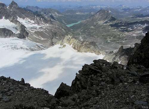
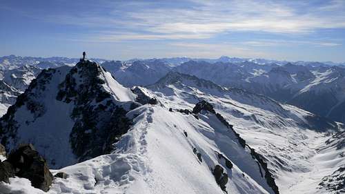
Piz Buin summit view to the north. The white expanse is the Ochsentaler Glacier, and the normal route is well on the left, mostly outside this photo actually. In the distance is the colorful Silvretta Stausee.
That said, it actually is a very scenic peak, it has great summit views and there are several easy routes to the top, from Austria as well as from Switzerland. All of these share the final part of the ascent, some 250m up from the Buinlücke (3056m), the saddle between Piz Buin and its smaller sibling Kleiner Piz Buin (3255m). The differences lie in how to get there.
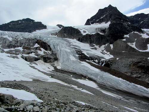
The snout of the Ochsental Glacier
Of all the high peaks in the Silvretta group, Piz Buin is the most popular mountain, so on a nice summer day don't expect to be alone.
In winter people ski down this route from the Buinlücke. To ski down all the way from the summit didn't appear impossible to me, but would require extremely good skills.
What's in a Name?
Piz Buin is sometimes called Großer Piz Buin, to distinguish it from it's smaller next door neighbor. The Swiss, just south of the border, call the pair Piz Buin Grond and Piz Buin Pitschen, respectively, and their name for Buinlücke is Fuorcla Buin.
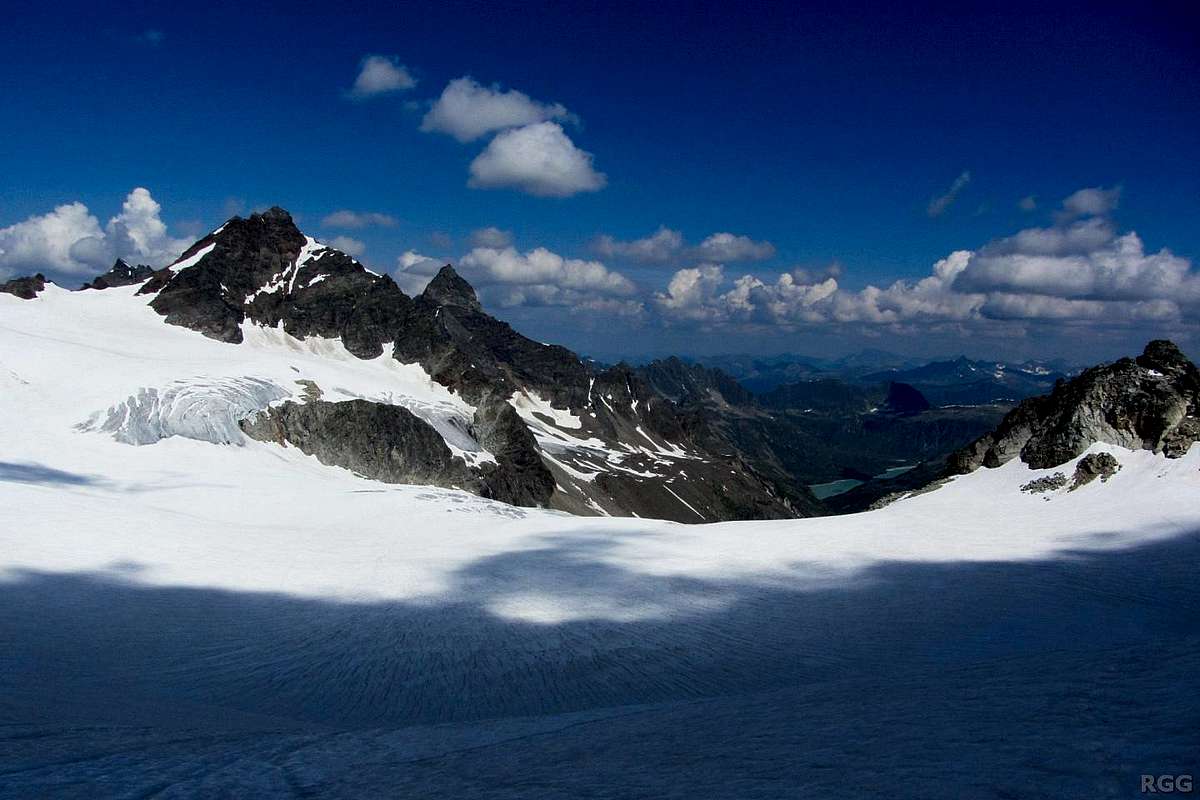
![Looking back from the Ochsentaler Glacier to Piz Buin and Kleiner Piz Buin]()
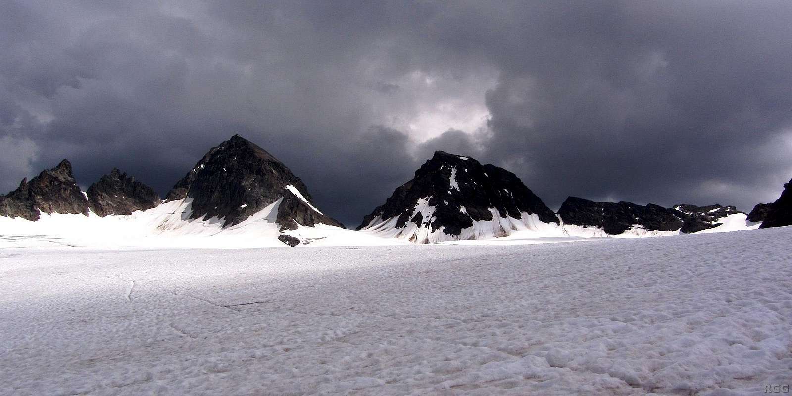
View back from high on the Ochsental Glacier, during the descent after climbing Piz Buin on a hot summer day. The clouds don't promise anything good.
The Buinlücke is the saddle in the center, with Piz Buin on its left and Kleiner Piz Buin on the right. The saddle on the far right is Fuorcla dal Confin.
Getting There

The Wiesbadener Hütte
From the north
The logical starting point is the Wiesbadener Hütte (2443m). That's a two hour walk on a marked, clear hiking trail from the northern end of the Silvretta Stausee at Bielerhöhe, the nearest road. This is also a popular route with mountain bikers. Public buses from Landeck and from Bludenz service Bielerhöhe. It's a toll road, and it's closed during the winter.If you're in good shape and start real early at Bielerhöhe, or bring a bike yourself to save time, you could make it to Piz Buin and back from there in a day. Most people spend the night before at the hut and leave around the crack of dawn.
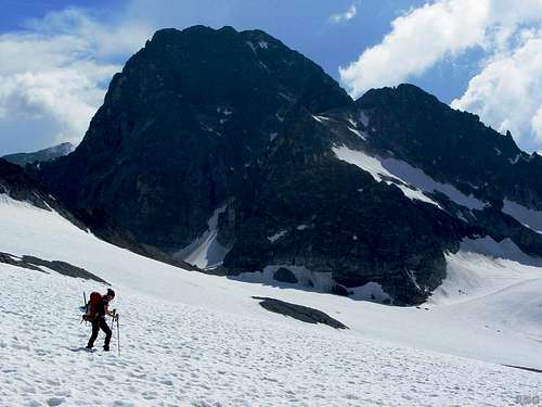
Piz Buin towering over the Vermunt Glacier
From the south
The Wiesbadener Hütte can also be reached from the south, from the Swiss village of Guarda. The trail leads over the Vermunt Pass (2797m), called Fuorcla Vermunt in Switzerland. Once you've crossed the border into Austria, the trail descends on the small and relatively harmless Vermunt Glacier. I've been just north of the pass, on the Vermunt Glacier, but haven't been on the south side. As Guarda lies at around 1650m, this approach would require the better part of a day.The trail passes Chamonna Tuoi (2250m), which is the starting point for the Swiss routes to Piz Buin. Consquently, coming from Guarda, it makes more sense to climb Piz Buin by the Swiss normal route.
Route Description
Open Source map, including the normal route. Switch to satellite view to get a good impression of the glacier (and the crevasses!).
Note: The route from Switzerland over the Vermunt Pass to the Wiesbadener Hütte is shown, with some viariations, but the two easiest routes to Piz Buin from Switzerland are not. It does show the other Austrian route to Piz Buin, the "Wiesbadener Grätle route": That also starts at the Wiesbadener Hütte, but instead of turning west soon and heading up the length of the Ochsentaler Glacier, it continues south, to the Vermunt glacier, and turns west much higher up, to cross the Wiesbadener Grätle to reach the upper part of the Ochsentaler Glacier just north of Piz Buin. Although still an easy route, it's a little harder than the normal one, for crossing the Wiesbadener Grätle involves more scrambling. On a map it looks shorter, but it takes longer. It's also safer, because the glacier crossings are shorter and not highly crevassed.
The not shown normal Swiss route comes up from the south, well west of Kleiner Piz Buin, over Fuorcla dal Cunfin, and joins the normal route from Austria shortly after that. A somewhat harder Swiss route comes directly up the Buinlücke.
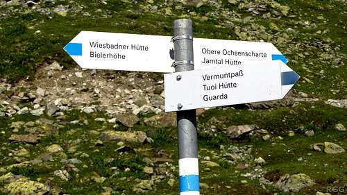
The sign post just south of the Wiesbadener Hütte
The terrain on either side is a mixture of bare rocks, grassy patches and small plants. When the snow disappears, many of these seem to be in a hurry to quickly produce beautiful flowers.
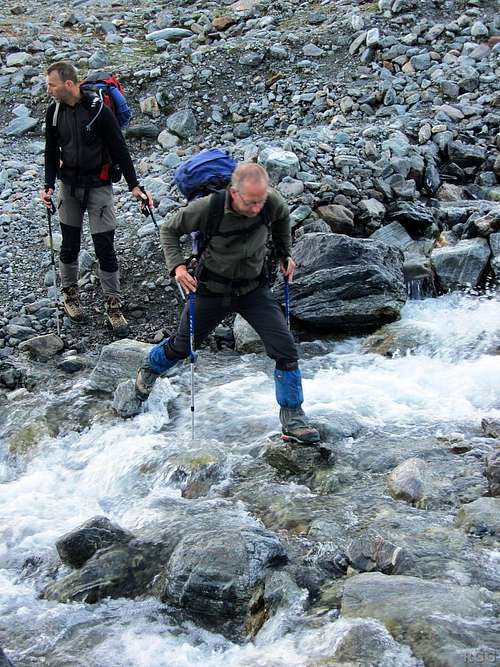
Crossing the small mountain stream
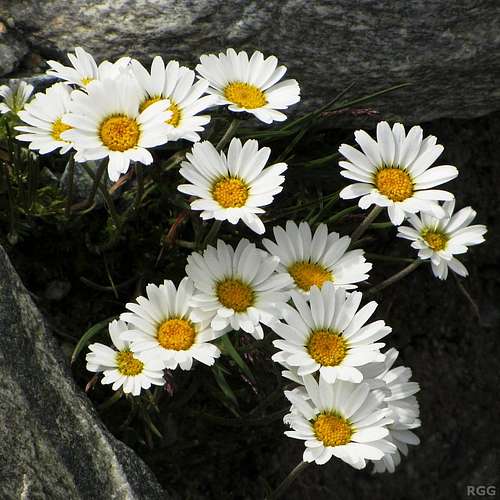
Alpine daisies along the trail

Looking west across the snout of the Ochsentaler Glacier, and the Silvrettahorn towering above it
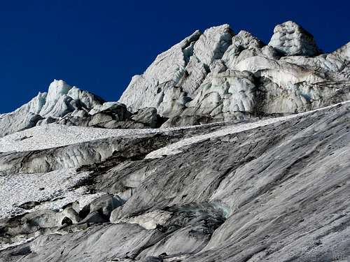
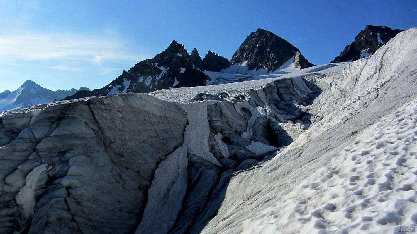
Wild ice formations on the east side of the glacier, just above the tongue
As you get higher as well as closer to the western edge of the glacier, lined by the steep walls of the Silvrettahorn, the slopes become easy. Mind you, there are still some crevasses in this area, but much less than on the eastern side of the glacier. Turn south now, and head up the glacier. A few hundred meters later, start making a gradual turn to the southeast, heading for the Buinlücke (3056m), the obvious saddle ahead. Not long before you get there, you may see smaller trails joining your own, coming from left and right. The one from the left, i.e. the east, is from the Wiesbadener Grätle route, the one from the right, i.e. the west, is from Fuorcla dal Confin, a saddle on the border with Switzerland.
A little higher on the Ochsentaler glacier it gets easier. The Buinlücke is the saddle on the right, flanked by Piz Buin and Kleiner Piz Buin. From here, to avoid the more crevassed parts, the normal route first goes south, i.e. aiming to the right of Kleiner Piz Buin (and just outside of this picture), but before long it starts a gentle turn left to the Buinlücke.
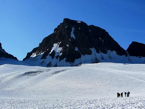
A group of climbers having a break on the Ochsentaler Glacier, in front of Kleiner Piz Buin. As you can see, there is a crevasse field direcly between them and the Buinlücke. The route takes a wide turn to avoid that.
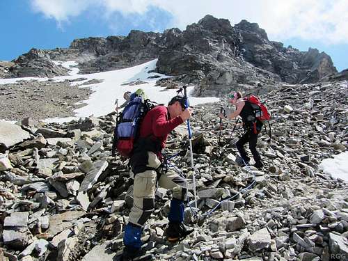
Ascending the scree above the Buinlücke
The trail on the scree slope
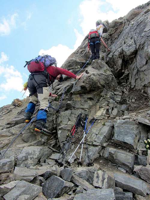
Start of the scramble...
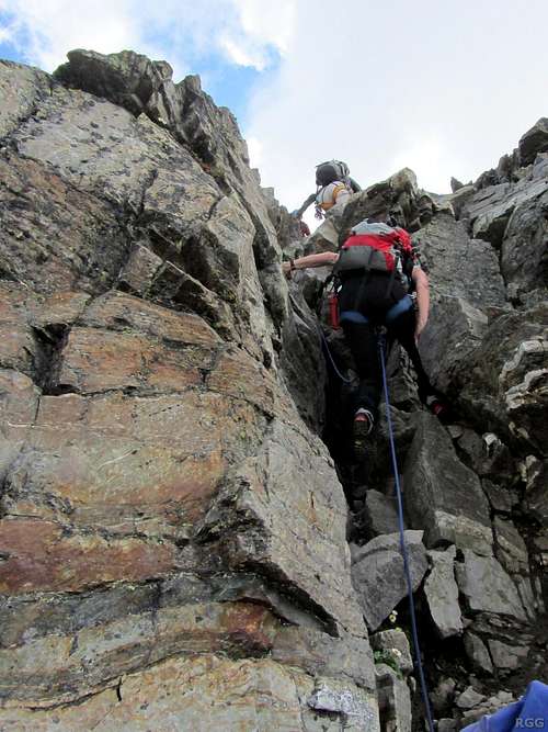
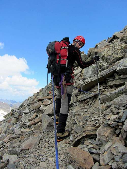
Scrambling...
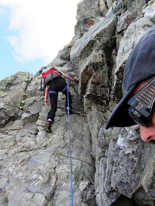
The short crux...
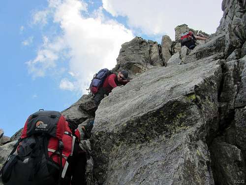
More scrambling...
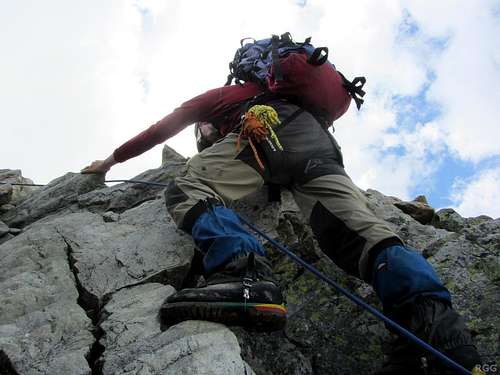
Last bit of scrambling...
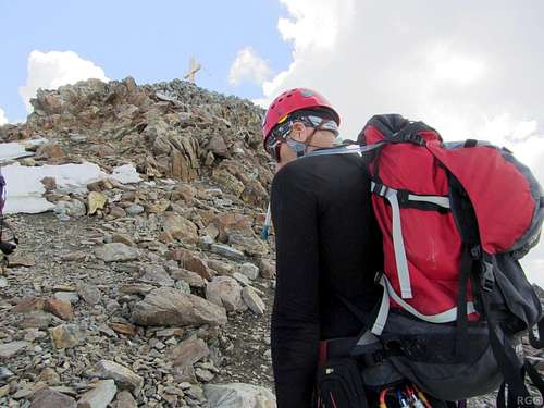
And finally a short walk to the summit cross
After the scramble, the final short bit to the top is a plain walk on a clear trail again. A big cross marks the summit. It's not huge, but there is still room enough for a sizable party.
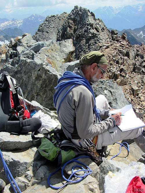
Writing an entry in the summit log
Red Tape
The road to Bielerhöhe, the Silvretta Hochalpenstraße, is a toll road. Parking at or near Bielerhöhe is free.When to Climb
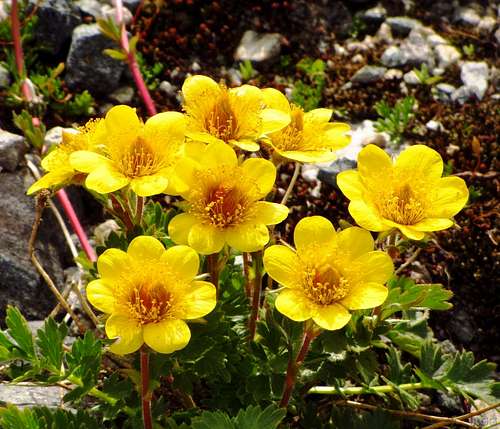
Flowers along the trail, not far south of the Wiesbadener Hütte
A wintry panorama to the Swiss side, February 24, 2008 - photo by mvs.
Essential Gear
- Helmet- Glacier Equipment:
- Crampons
- Ice axe
- Harness
- Rope
- Crevasse rescue gear
External Links
Piz Buin normal route on Tourentip.de, in German.Piz Buin on Steinmandl.de, also in German.
Panoramic view down the Ochsentaler Glacier from near the Buinlücke