
|
|
Route |
|---|---|
|
|
39.33250°N / 106.1785°W |
|
|
Download GPX » View Route on Map |
|
|
Hiking, Mountaineering, Skiing |
|
|
Spring |
|
|
Half a day |
|
|
Moderate Snow |
|
|
III |
|
|
Overview
This is a fun snow climb on the northeast face of Mt Arkansas. It looks daunting from afar, but with continuous snow it goes for 700' at Moderate. The maximum slope angle is less than 50 degrees. Ski descents have been recorded.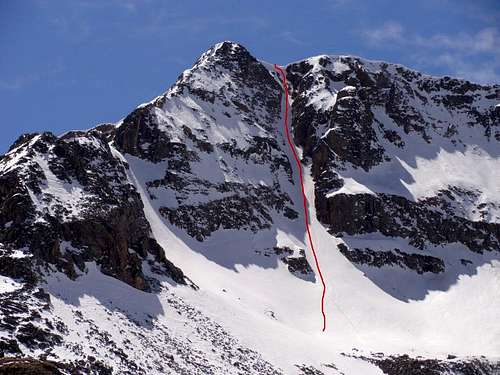 North Couloir
Getting There
The trailhead is located off Hwy 91, 11.7 mi south of Copper Mountain and 11.5 mi north of Leadville. At the hairpin turn just below the Climax Mine, turn east onto the dirt road marked by a "No Camping" sign. On Google Maps it is marked as Trail Rd, and on the ArcGIS topos it is labeled 135. Just off the highway there is a small parking area marked by boulders. It is likely you will have to park here.Approach
Travel east on Trail Rd. (As the road is crowded by willows, hiking or snowshoeing out on a warm spring afternoon will be a challenge--skis are recommended.) After 1.7 mi on the road, at roughly 11800', the entire couloir should be visible to the southwest. Leave the road and continue to the base of the route.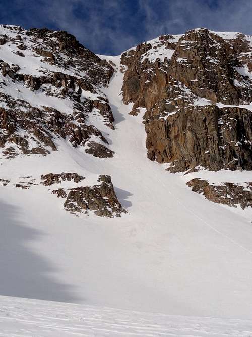 Approaching the couloir
Route Description
Start early to minimize rockfall hazard. From 13000' the slope gradually becomes steeper to around 48 degrees. Usually a large cornice forms over the couloir. Bypass it on the left to exit onto the ridge at 13700'. The summit is a short walk to the south. For the descent, there are many options. Ski down the couloir, or east off the north or south ridges. If on foot, the 3rd-classNorth Ridge would make a fun descent. Or continue south to Mt Tweto.
 Looking up
 Looking down
 Minimal cornice after a dry winter
 View of the exit