
|
|
Route |
|---|---|
|
|
45.45000°N / 84.87°W |
|
|
Hiking |
|
|
Spring, Summer, Fall, Winter |
|
|
A few days |
|
|
Overview
This section of the North Country Trail (NCT) has a stated length of 90.2 miles, though there has been at least one re-routing since the current version of the map was printed. Section MI-07 passes through two counties: Charlevoix and Emmet. (The website says that the length is 81.4 miles.) Looking up the Bear River in Petoskey
The Tittabawassee Chapter maintains the NCT in Charlevoix County to north of Conway in Emmet County. The Harbor Springs Chapter maintains the NCT in the rest of Emmet County.
Most of this NCT section is trail, though most is not certified (as of the map printing date). A lot of the trail is in the Mackinaw State Forest and Wilderness State Park. I estimate that ~22 miles are road connector in section MI-07.
Descriptions on this page are made in the New York-to-North Dakota direction.
Most pictures will be placed in the trip and trailhead reports, attached as children, but some of the scenic ones will be attached to this page.
Getting There
The NCT either crosses or is located near the following highways in Michigan:* US-131: follows the route of this highway from south edge of this section to Petoskey
* US-31: crosses and follows the route of this highway from Petoskey to just south of Mackinaw City
* M-119: crosses and follows the route of this highway to the east of Petoskey
* I-75: crosses in Mackinaw City
* US-23: passes close to its end in Mackinaw City
Trailheads are located off local roads near these highways.
For Charlevoix County, there are trailheads or parking located near the route of the NCT, such as:
* Springbrook Pathway, ~0.5 miles west along Chandler Hill Road
* probable parking at the end of Kuznick Road (east of Boyne Falls)
* probable parking at the end of Giem Road (south of Boyne Falls)
For Emmet County, there are trailheads or parking located near the route of the NCT, such as:
* North Central Michigan College
* Bayfront Park
* Little Traverse Wheelway parking
* Brutus Road trailhead
* Larks Lake Road trailhead
* Levering Road trailhead
* Sturgeon Bay Trail trailhead
* Lakeview Road trailhead
* at French Farm Lake
Route Description
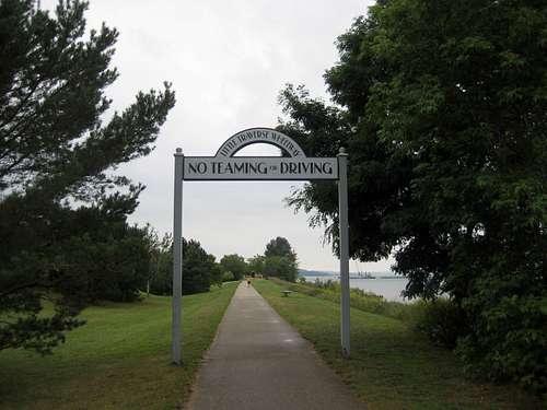 Little Traverse Wheelway archway sign
The NCT leaves the LTW to cross M-119 and head northeast to Conway. There, a short road connector goes north to two more section of the MSF. After a 6 mile road connector, the NCT enters and continues through Wilderness State Park and then the most northern portion of the MSF. Finally, the NCT arrives at Mackinaw City and the Mackinac Bridge to end section MI-07.
Essential Gear
Typical season-appropriate hiking gear, including sun block and bug spray, is needed.Maps are always a good idea, too.
External Links
Tittabawassee Chapter:http://northcountrytrail.org/tbw
Harbor Springs Chapter:
http://northcountrytrail.org/hrb
Current guide from the North Country Trail Association:
http://northcountrytrail.org/guide/index.php/Michigan
However, it should be noted that the current guide does not cover section MI-07.
Current online maps from the Tittabawassee Chapter:
northcountrytrail.org/tbw/maps/brochure.pdf
Current online maps from the Harbor Springs Chapter:
northcountrytrail.org/hrb/maps.html
Link for purchasing map MI-07:
http://northcountrytrail.org/shop/item.php?item_id=259&category_id=54
USGS maps can be downloaded at:
www.usgs.gov
Maps and Route Changes
Map: MI-07 -- Charlevoix County to the Mackinac BridgeThere have been two changes to the route of the NCT since the current version of map MI-07 was created.
Conway:
Shortly southeast of Conway, the NCT does not proceed on the apparent trail ahead. Instead:
* Turn right (east) onto Powell Road, then;
* Immediately turn left (northeast) onto Hiawatha Trail.
* After turning east, Hiawatha Trail becomes Rosada Street when it enters Conway.
* Turn left onto Heydey Street.
* Turn left onto and then cross W Conway Road to rejoin actual trail.
Near Brutus Road:
A small section marked as trail has been diverted to a short road connector.
USGS 7.5 Minute Topos (all in Michigan)
Elmira
Thumb Lake
Epsilon
Petoskey
Harbor Springs
Alanson
Larks Lake
Bliss
Levering
McGulpin Point
Saint Ignace
Notes and Revisions
Submissions and suggestions are welcome to improve this page!Revision history:
22 May 2011 - page created