Chinigo
Offline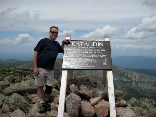
| Gender/Age | Male, 57 years old |
|---|---|
| Location | North Oxford, Massachusetts, United States |
| Power | 68 |
| Vote Weight | 73.3% |
| Occupation | Pharma Sales & Marketing Mgr |
| Website | http://www.linkedin.com/in/peterchinigo |
A Little About Me
I enjoy hill and mountain hiking, and am a member of the Highpointers Club.
I welcome emails to p.chinigo@att.net .
I welcome emails to p.chinigo@att.net .
My Images
My Mountains & Rocks (5)
- Bald Hill SW0.5 - Cass County High Point Michigan County Highpoints
- Crum Hill
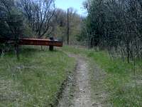
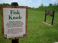
- Fisk Knob - Kent County High Point Michigan County Highpoints
- French Benchmark - Barry County High Point Michigan County Highpoints
- Holt Hill - Essex County High Point
My Routes (5)
- North Country Trail - MI-01: OH/MI State Line to Marshall North Country Trail - Michigan
- North Country Trail - MI-02: Marshall to 76th Street North Country Trail - Michigan
- North Country Trail - MI-03: 76th Street to M-37 North Country Trail - Michigan
- North Country Trail - MI-07: Charlevoix County to the Mackinac Bridge North Country Trail - Michigan
- North Country Trail - Michigan
My Trip Reports (20)
- Hike of Wachusett Mount Wachusett
- Kinsman Mtn, N & S via Lonesome Lake, Fishin Jimmy, & Kinsman Ridge Trails Kinsman Mountain, South Peak
- Mount Osceola and East Osceola via the Mount Osceola Trail Mount Osceola
- Mt Marcy via the Van Hoevenberg - 1 day Mount Marcy
- Mt Rogers via the Rhododendron and Appalachian Trails Mount Rogers
- North Country Trail - Augusta to Kellogg Experimental Forest North Country Trail - MI-02: Marshall to 76th Street
- North Country Trail - Barry State Game Area (north) to M-37 North Country Trail - MI-02: Marshall to 76th Street
- North Country Trail - Barry State Game Area (south) North Country Trail - MI-02: Marshall to 76th Street
- North Country Trail - Battle Creek Linear Park (east) North Country Trail - MI-02: Marshall to 76th Street
- North Country Trail - Baw Beese Trail (north section) North Country Trail - MI-01: OH/MI State Line to Marshall
- North Country Trail - Grand River Drive SE to north of Lowell North Country Trail - MI-03: 76th Street to M-37
- North Country Trail - Historic Bridge Park to Wattles Park North Country Trail - MI-02: Marshall to 76th Street
- North Country Trail - Kellogg Experimental Forest to M-89 North Country Trail - MI-02: Marshall to 76th Street
- North Country Trail - Lost Nation State Game Area (northwest section) North Country Trail - MI-01: OH/MI State Line to Marshall
- North Country Trail - Lowell State Game Area and south North Country Trail - MI-03: 76th Street to M-37
- North Country Trail - M-34 to Lake Baw Beese North Country Trail - MI-01: OH/MI State Line to Marshall
- North Country Trail - M-89 to Kellogg Biological Station North Country Trail - MI-02: Marshall to 76th Street
- North Country Trail - Petoskey to Conway North Country Trail - MI-07: Charlevoix County to the Mackinac Bridge
- North Country Trail - Wattles Park, Kimball Pines, and Ott Preserve North Country Trail - MI-02: Marshall to 76th Street
- North Country Trail - Yankee Springs Recreation Area North Country Trail - MI-02: Marshall to 76th Street
My Albums (35)
- Bald Hill SW0.5 - 2011 Bald Hill SW0.5 - Cass County High Point
- Charles W Ward Reservation - 2021 Holt Hill - Essex County High Point
- Chief Noonday Trail | Yankee Springs Recreation Area - 2010
- Crum Hill - 2021 Crum Hill
- Fisk Knob - 2011 Fisk Knob - Kent County High Point
- French Benchmark - 2009/2011 French Benchmark - Barry County High Point
- Hall Lake Trail | Yankee Springs Recreation Area - 2010
- Harney Peak: Loop by Trails 4, 3, and 9 - 2010 Black Elk Peak / Harney Peak
- Jewell Benchmark - 2011
- Kalamazoo River Valley Trail - 2010
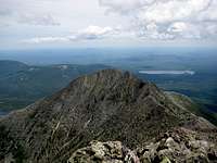
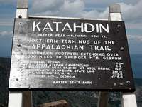
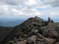
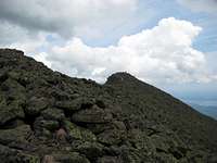
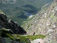
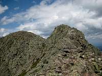
- Katahdin: Helon Taylor and Knife Edge - 2010 Katahdin
- Mount Osceola and East Osceola - 2011 Mount Osceola and East Osceola via the Mount Osceola Trail
- NCT MI-01 / Baw Beese Trail (north section) - 2010 North Country Trail - Baw Beese Trail (north section)
- NCT MI-01 | Lake Baw Beese and east - 2010 North Country Trail - M-34 to Lake Baw Beese
- NCT MI-01 | Lost Nation State Game Area (northwest section) - 20100402 North Country Trail - Lost Nation State Game Area (northwest section)
- NCT MI-01 | Lost Nation State Game Area (northwest section) - 20100417 North Country Trail - Lost Nation State Game Area (northwest section)
- NCT MI-02 | Augusta and north - 2010 North Country Trail - Augusta to Kellogg Experimental Forest
- NCT MI-02 | Barry State Game Area (northeast) - 2010 North Country Trail - Barry State Game Area (north) to M-37
- NCT MI-02 | Barry State Game Area (northwest) - 2010 North Country Trail - Barry State Game Area (north) to M-37
- NCT MI-02 | Barry State Game Area (south) - 2010 North Country Trail - Barry State Game Area (south)
- NCT MI-02 | Battle Creek Linear Park (east) - 2010 North Country Trail - Battle Creek Linear Park (east)
- NCT MI-02 | Battle Creek Linear Park (middle) - 2010
- NCT MI-02 | Historic Bridge Park - 2010 North Country Trail - Historic Bridge Park to Wattles Park
- NCT MI-02 | Kellogg Biological Station and north - 2010
- NCT MI-02 | Kellogg Biological Station and south - 2010 North Country Trail - M-89 to Kellogg Biological Station
- NCT MI-02 | Kellogg Experimental Forest - 2010 North Country Trail - Kellogg Experimental Forest to M-89
- NCT MI-02 | Kimball Pines & Ott Preserve - 2010 North Country Trail - Wattles Park, Kimball Pines, and Ott Preserve
- NCT MI-02 | South of Irving
- NCT MI-02 | Yankee Springs Recreation Area (north) - 2010 North Country Trail - Yankee Springs Recreation Area
- NCT MI-02 | Yankee Springs Recreation Area (south) - 2010 North Country Trail - Yankee Springs Recreation Area
- NCT MI-02 | Yankee Springs Recreation Area (west) - 2010 North Country Trail - Yankee Springs Recreation Area
- NCT MI-03 | Fallasburg County Park and south - 2010
- NCT MI-03 | Lowell and north - 2010 North Country Trail - Grand River Drive SE to north of Lowell
- NCT MI-03 | Lowell State Game Area - 2010 North Country Trail - Lowell State Game Area and south
- NCT MI-07 | Petoskey and northeast - 2010 North Country Trail - Petoskey to Conway
My Trailheads (6)
- Mount Osceola Trail - Tripoli Road Trailhead Mount Osceola
- North Country Trail - MI-01 South Segment Trailheads North Country Trail - MI-01: OH/MI State Line to Marshall
- North Country Trail - MI-02 North Segment Trailheads North Country Trail - MI-02: Marshall to 76th Street
- North Country Trail - MI-02 South Segment Trailheads North Country Trail - MI-02: Marshall to 76th Street
- North Country Trail - MI-03 North Segment Trailheads North Country Trail - MI-03: 76th Street to M-37
- North Country Trail - MI-03 South Segment Trailheads North Country Trail - MI-03: 76th Street to M-37
Climber's Logs I've Signed (73)
Mountains & Rocks (57)
- Crum Hill
- Holt Hill - Essex County High Point
- Great Blue Hill Blue Hills
- Taum Sauk Mountain U.S. State Highpoints
- Mount Wachusett
- Mount Magazine-Signal Hill U.S. State Highpoints
- Mount LeConte Southern Sixers
- Bald Hill SW0.5 - Cass County High Point Michigan County Highpoints
- Bear Mountain NY/NJ Highlands
- Breakneck Ridge NY/NJ Highlands
- Anthony's Nose NY/NJ Highlands
- Popolopen Torne (The Torne) NY/NJ Highlands
- Catfish Ledges Kittatinny Mountains
- Mount Mohican Kittatinny Mountains
- Craggy Pinnacle Blue Ridge Parkway
- Mount Craig Black Mountains
- Bear Mountain Southern Taconic Range
- Mount Everett Southern Taconic Range
- Culver Ridge (Normanook) Sunrise Mountain, NJ
- Schunnemunk Mountain NY/NJ Highlands
- Mount Tammany - Delaware Water Gap Kittatinny Mountains
- Fort Reno ("Point Reno") - DC USA County Highpoints
- East Osceola White Mountains (NH/ME)
- Mount Osceola White Mountains (NH/ME)
- French Benchmark - Barry County High Point Michigan County Highpoints
- Fisk Knob - Kent County High Point Michigan County Highpoints
- Black Elk Peak / Harney Peak U.S. State Highpoints
- Hawkeye Point U.S. State Highpoints
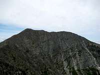
- Katahdin Katahdin Group
- Timms Hill U.S. State Highpoints
- Mount Arvon Huron Mountains
- Schwarzhorn/Corno Nero Latemar Group
- Mount Sunapee Dartmouth-Sunapee Region
- Mount Monadnock Monadnock Region
- Mount Washington Presidential Range
- Blue, Bird, and Rattlesnake Mountains Kittatinny Mountains
- Mount Frissell (Southwest Shoulder) U.S. State Highpoints
- Clingmans Dome Southern Sixers
- Black Mountain (KY) U.S. State Highpoints
- Mount Mitchell Black Mountains
- Sassafras Mountain U.S. State Highpoints
- Brasstown Bald U.S. State Highpoints
- Ebright Azimuth U.S. State Highpoints
- Spruce Knob U.S. State Highpoints
- Backbone Mountain U.S. State Highpoints
- Mount Davis U.S. State Highpoints
- Campbell Hill U.S. State Highpoints
- Hoosier Hill U.S. State Highpoints
- Mount Mansfield Green Mountains (Vermont)
- High Point (New Jersey) Kittatinny Mountains
- South Peak (Moosilauke) White Mountains (NH/ME)
- Mount Moosilauke White Mountains (NH/ME)
- Kinsman Mountain, South Peak White Mountains (NH/ME)
- Mount Greylock U.S. State Highpoints
- Jerimoth Hill U.S. State Highpoints
- Mount Rogers U.S. State Highpoints
- Mount Marcy Adirondacks
Routes (16)
- Rainbow Falls Trail Mount LeConte
- Alum Cave Trail Mount LeConte
- Appalachian Trail (South Bound) Blue, Bird, and Rattlesnake Mountains
- Appalachain Trail (North Bound) Catfish Ledges
- Appalachian Trail (South Bound) Catfish Ledges
- Appalachain Trail (South Bound) Mount Mohican
- Appalachain Trail (Northbound) Mount Mohican
- Appalachian Trail North Bound Culver Ridge (Normanook)
- Jessup Trail Schunnemunk Mountain
- Mount Osceola Trail via Tripoli Road Mount Osceola
- Glencliff Trail Mount Moosilauke
- Long Trail Mount Mansfield
- Huntington Ravine Trail Mount Washington
- Marlboro Trail Mount Monadnock
- White Dot Trail Mount Monadnock
- Knife Edge, Helon Taylor Katahdin
My Lists
Content loading here...
Messages I Posted/ Editable Objects
Reviews I Posted/Reviews Posted to my Gear
Objects Others Have Attached to My Objects
Content loading here...
Photos Others Have Attached to My Objects
Content loading here...