
|
|
Route |
|---|---|
|
|
46.12723°N / 7.74655°E |
|
|
Mountaineering |
|
|
Spring, Summer |
|
|
A long day |
|
|
D |
|
|
Introduction

Zooming in on the top of the Brunegghorn North Face from the Topalihütte
The first time I laid eyes on the Brunegghorn North Face was back in 2012. After that, I couldn't get it out of my head. Not that I wanted to, for that matter. It looked very steep, and without knowing anything about it except what I could see with my own two eyes, I figured that it was much too hard for me. But later I learned more about the route, met the right climbing partner, and then one thing led to another...
Overview
Satellite view of the Brunegghorn North Face, centered on the top of the bergschrund.
For the record, sometimes this route is referred to as North East Face or even the NNE Face, but judging by the map I find the North Face the most appropriate designation.
Getting There
Click here for a larger map.
The Turtmanntal trailhead is at the barrier that marks the end of the public road (1901m). Immediately after the barrier the - now private - road crosses a bridge and continues further up the valley. Be aware that even if the barrier is open, the road is closed to the general public (with a sign to explain it). There is limited (free) space to park a number of cars right before the barrier. When you do, keep in mind that there may be the occasional small bus transporting groups of people to the end of the road, and they will need some room to turn around at the barrier. If there is no space left, you can probably find a spot a little earlier along the road. When we visited, there was ample room near Brändji (1874m), a small picnic area next to a pond with a spring, about 1.5 km before the barrier (46.1968°N / 7.6981°E).
There is a train station at Turtmann village, and from late spring to early fall public buses service the Turtmanntal, with the last stop at the tiny village of Gruben (±1820m), about 3.5 km or an hour of easy hiking from the barrier.
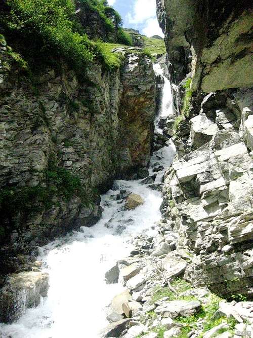
A scenic waterfall along the trail from Schwidernu to the Topalihütte
Approach
The North Face is covered by the Abberg Glacier. The route proper starts at the bergschrund high on the face, and there are several ways to approach the schrund.From the Turtmanntal
From the trailhead, hike up one of the several trails to the Turtmannhütte (2519m) (2-2.5 hours, depending on which trail you take). The shortest and easiest first follows the (private) road to a couple of reservoirs - which are the reason that the road is there in the first place. Well before reaching the lakes, you can see the refuge perched high above on the left.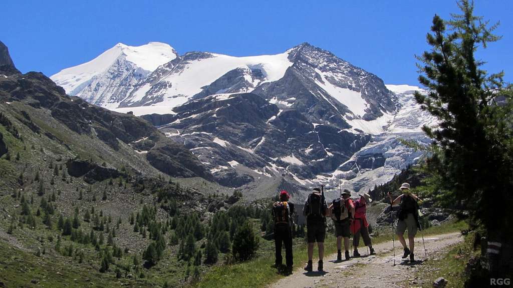
Bishorn from the (private) road up the Turtmanntal - the Turtmannhütte can be seen on the left
From the hut you can see a pretty impressive rock face to the southeast. Near its southern end is a steepish couloir, Gässi. From a distance the terrain looks much too steep for it, but in fact a hiking trail goes up there, secured by steel cables at the most exposed places (UIAA grade F). Most people on this route will be aiming for Barrhorn (3610m), arguably the highest hiking peak in the Alps that can be reached without crossing a glacier.
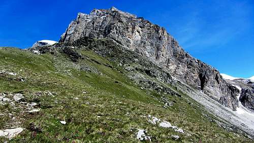
The sheer rock wall east by southeast of the Turtmannhütte.
The snow on the far right marks the steepish couloir.
On the glacier, aim for the still seemingly tiny Brunegghorn in the southeast, keeping Bishorn well on your right. After a while you'll find yourself on the glacier between Bishorn still well on the right and Schöllihorn closer by on the left. To get to the Abberg Glacier and the North Face, cross the Bruneggjoch (3365m), the saddle between Brunegghorn and Schöllihorn. This saddle also marks the start of the Brunegghorn NW ridge.
The second, decidedly easier option is to keep following the trail to the Schöllijoch a bit longer. At around 2850 m stands a big cairn marking an otherwise not very conspicuous small side trail veering off to the right. This leads to the Bruneggbach, a small rivulet wedged between the main trail and the Brunegg Glacier, from which it is separated by only one rocky ridge. The small trail drops down a little to cross the stream, then heads up the flanks of the rocky ridge to reach the edge of the glacier at around 2900 m, at a point marked by a cairns, and in 2014 even by an old ice axe! As before, ascend the glacier to the Bruneggjoch (3365m).
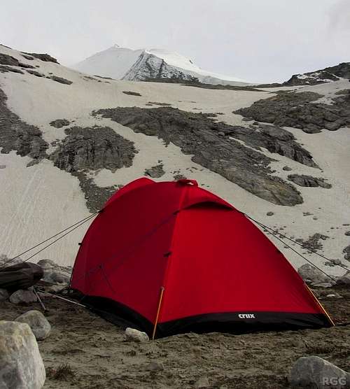
When the huts are still closed, you may want to bivvy somewhere. There is an excellent spot along the second route, not far from the edge of the glacier, on the north bank of the Bruneggbach. There is running water as long as it's not too cold, it's flat and sheltered from high winds.
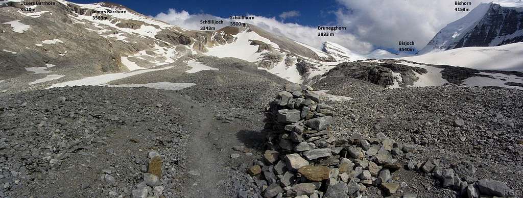
Annotated panorama of the trail junction at around 2850 m: for Schöllijoch and Barrhorn follow the main trail, for the Brunegg Glacier take the smaller one to the right
 Cairn and old ice axe at the edge of the Brunegg Glacier | 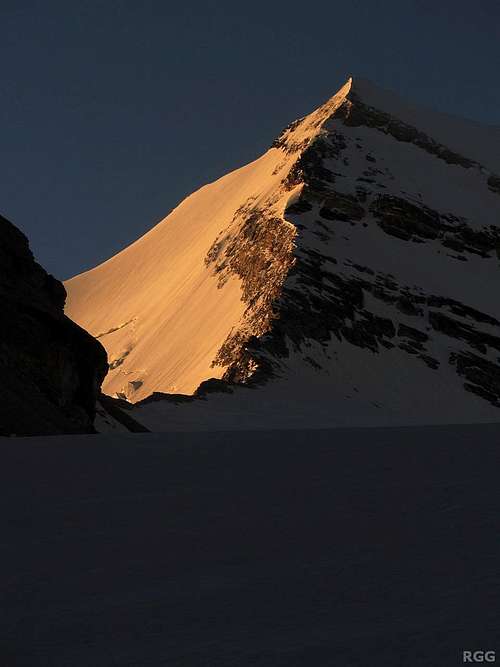 North Face and NW ridge, from the approach to the Bruneggjoch |
Up to this point, the approach is actually the same as for the Brunegghorn normal route. However, instead of staying on the Brunegg Glacier and passing right below the Bruneggjoch, the approach to the North Face crosses the saddle to get on the Abberg Glacier. From the saddle, you can have a good look at the face and pick your spot where to cross the bergschrund. Somewhere in the middle, close to the highest point, is probably a good bet.
The North Face seen from the Bruneggjoch
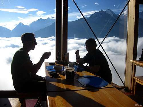
Breakfast above the clouds, at the Topalihütte
From the Mattertal
Starting at Schwidernu (also called Schwiedernen), a well marked and very scenic hiking trail steeply climbs 1500 m to the Topalihütte (2674m) (4-5 hours). If the weather is good, the views from the hut are breathtaking, and it was there that I first saw the Brunegghorn North Face.The Topalihütte can be reached from Randa as well, via the marked trail over the Guggiberg (6-7 hours). If you plan to bivvy, you don't necessarily have to go quite to the Topalihütte. Instead leave the trail and turn left when you clearly see a way to the base of the lower Abberg Glacier coming down the Brunneghorn North Face.
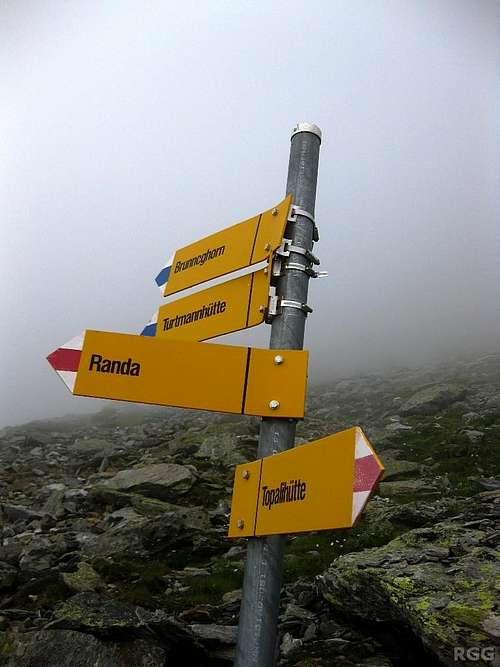
Signpost at the trail junction a few hundred meters SW of the Topalihütte
To get to the North Face, follow this trail to just over 3000 m. After a steep section it levels off and by now it heads generally to the west. Before it starts to ascend again, there are two options.
The shorter one leaves the trail (roughly at 46.147°N / 7.749°E) and heads south, towards the base of a rocky spur. Pass below it, keeping the spur to your right. By now the Abberg Glacier is close, with two tongues, separated by a rocky bit. The normal route to the base of the face is up the right, which is less steep but more crevassed. If you are capable of climbing the North Face, ascending the left side shouldn't pose any problems either, though it might take a little bit more time.
The longer option is to continue on the trail to the Schöllijoch and turn left, traversing the Schöllihorn to reach the Bruneggjoch. The advantages of the longer option are that you avoid the crevasses on the lower part of the Abberg glacier and by traversing the Schöllihorn you get to bag another summit. A big possible disadvantage would be running late. If there is no time to climb the north face, you may still be able to climb the NW ridge or the normal route instead, but that's not the same...
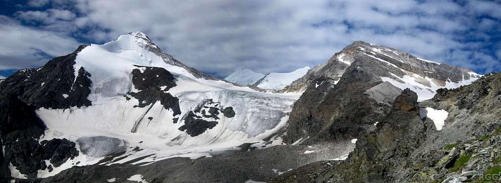
Panorama from Brunegghorn to Schöllihorn, seen from the trail from the Topalihütte to the Schöllijoch (which is on the far right, not quite visible).
The saddle in the center is the Bruneggjoch, with Weisshorn and Bishorn further back.
To get to the face, either head up directly on the Abberg Glacier, or, to avoid the crevasses, follow the trail to the Schöllijoch and traverse the Schöllihorn.
Route Description
Route Sketch
| Summary | |
| Difficulty | UIAA grade D |
| Steepest section | 57° |
| Elevation gain | 200 m |
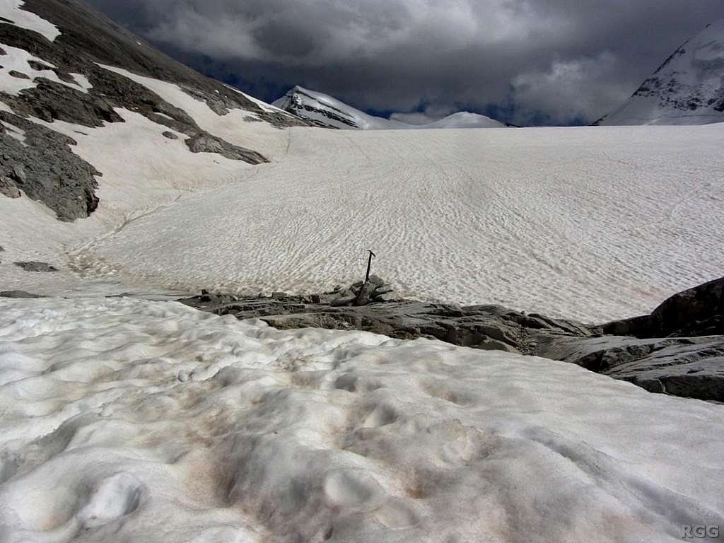
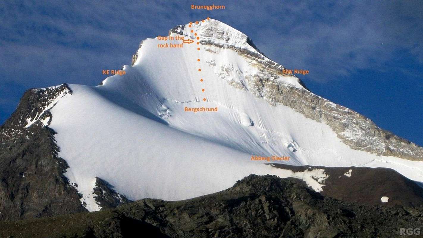
The bergschrund on the north face

Sideways view from the first pitch above the bergschrund, with the NW ridge and Bruneggjoch at its base
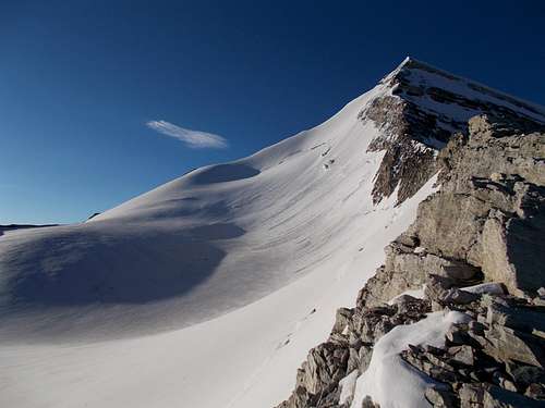
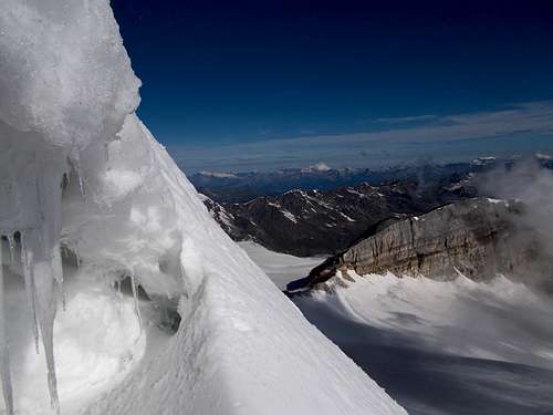
A complication above the band is that the ice isn't very clean; there are quite a few small rocks embedded in it, posing a bit of a challenge to get an ice screw in. The very top of the face is rockier still, and to avoid the rockfall hazard it is common to go left shortly before the summit, ascending the final meters along the NE ridge, very exposed but not steep at all.
With a 60 m rope, we climbed four pitches to get to that NE ridge. As could be expected for the time of the year, it was covered with somewhat unconsolidated snow, and not knowing if I could make a good belay up there, I decided instead to put in a couple of screws in the ice on the face just below the ridge. Even when going up the face all the way, a (short) fifth pitch would be necessary. At the top, the summit cross offers an excellent belay point.
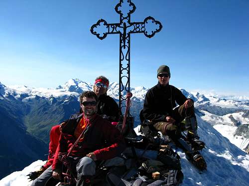
Summit cross
For the descent, take the normal route, starting down the SW ridge.
When to Go
The best time is late spring or early summer, preferably when it's freezing.Gear
In addition to the usual glacier gear, the face requires at least one ice tool in addition to a normal ice axe, or, better, two ice tools. The number of ice screws and expresses depends on how close together you like to place your protection; we brought eight screws. One normal rope will do, but we climbed with two 60 m half ropes, which is safer. Don't bother to bring any rock gear, there isn't enough exposed rock to use it on.
Looking up my climbing partner Jan, who is just below the mixed band at the top of the third pitch. There is still enough ice and snow in the center of the band to avoid having to climb on the rocks.
Links
Brunegghorn NO-Wand on Bergsteigen.com (in German).Maps and Guidebooks
Maps
| Swiss Topo map 1328 Randa, 1:25 000. | The most detailed map, covering the north face and the approach from Randa, but not the approach from Schwidernu or from the Turtmanntal. |
| Swiss Topo map 5028T Monte Rosa Matterhorn, 1:50 000. | Still detailed enough and covering a much larger area. |