
|
|
Route |
|---|---|
|
|
19.10167°N / 99.7675°W |
|
|
Half a day |
|
|
Class 3 |
|
|
Overview
This is one of the two standard routes to Pico del Fraile, the highest summit of Nevado de Toluca (the other standard route being the East Ridge. From a technical standpoint, this is probably the least technical route, but the route up to the ridge is very steep. From the ridge, it is an enjoyable class 3 climb to the summit. This climb can be done in less than half a day, but you may want to hang out longer in the summit area and around the lakes.
Getting There
By Car from Mexico City (from Secor and maybe out of date, it's best to use Google Directions!)
Follow Highway 15 west from Mexico City towards the city of Toluca. Before the city, take a bypass (Paseo Tollocan) which leads south around the city. At the southern edge of Toluca, turn left on Highway 134 and be aware that the road turns right in 1.2 mi (2 km). Continue on Highway 134 for 11.2 mi (18 km) to reach Highway 3, which branches off to the left toward Sultepec. There is also a sign here which indicates the Park and Volcan de Nevado de Toluca. Follow Highway 3 for 5 mi (8 km) to the gravel road which leads up to the peak (also signposted for the park and the volcano). The gravel road winds 9 miles (15 kms) around the mountain to the National Park Hut. You are no longer permitted to drive to the crater.
By Bus from Mexico City
Flecha Roja (Red Arrow) offers shockingly frequent bus service to Toluca from Mexico City's Observatorio bus station, also known as Mexico Central Poniente. The trip takes a little over one hour. Taxis can then be taken from the station to any of several hotels in the center of town.
A taxi can be hired in town to take you all the way to the crater (or to the hut at 4,050 m) for around $30, if you're negotiating skills are good. Make sure the driver understands that you need to go almost completely to the end of the gravel road. You can arrange for the driver to pick you up again after your climb.
It is also possible to travel by bus all the way to the aforementioned gravel road. Take a bus from Toluca towards Sultepec and get off at Raices. From Raices, it is usually fairly easy to catch a ride to the National Park Station/Hut.
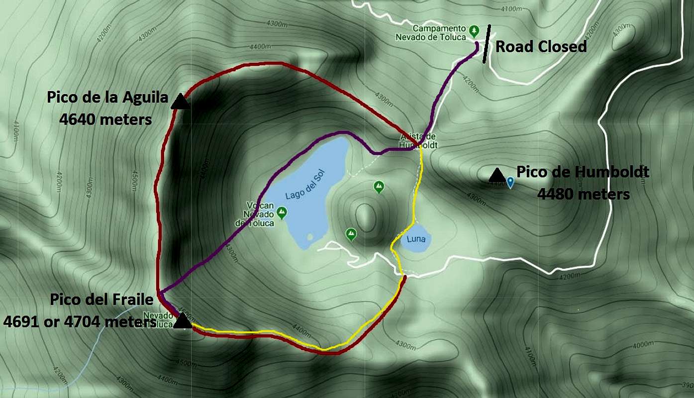
From the National Park Hut
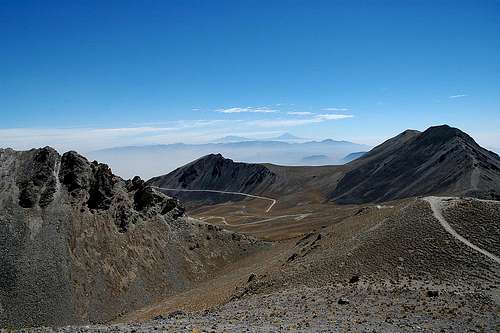
Once at the National Park Hut, a brief straight and steep trail that gains 500 feet/150 meters or so leads down into the crater. To climb the peak you then need to cross the crater and ascend the ridge from the other side. This probably adds perhaps two miles/3 kms round trip and some 1000 feet/300 meters of cumulative gain to the climb compared to the old trailhead in the crater.
The old road continues on from this closure for foot or bicycle traffic, but it seems much too long to merit travelling that way on foot for a climb. It's better to take the trail.

Route Description
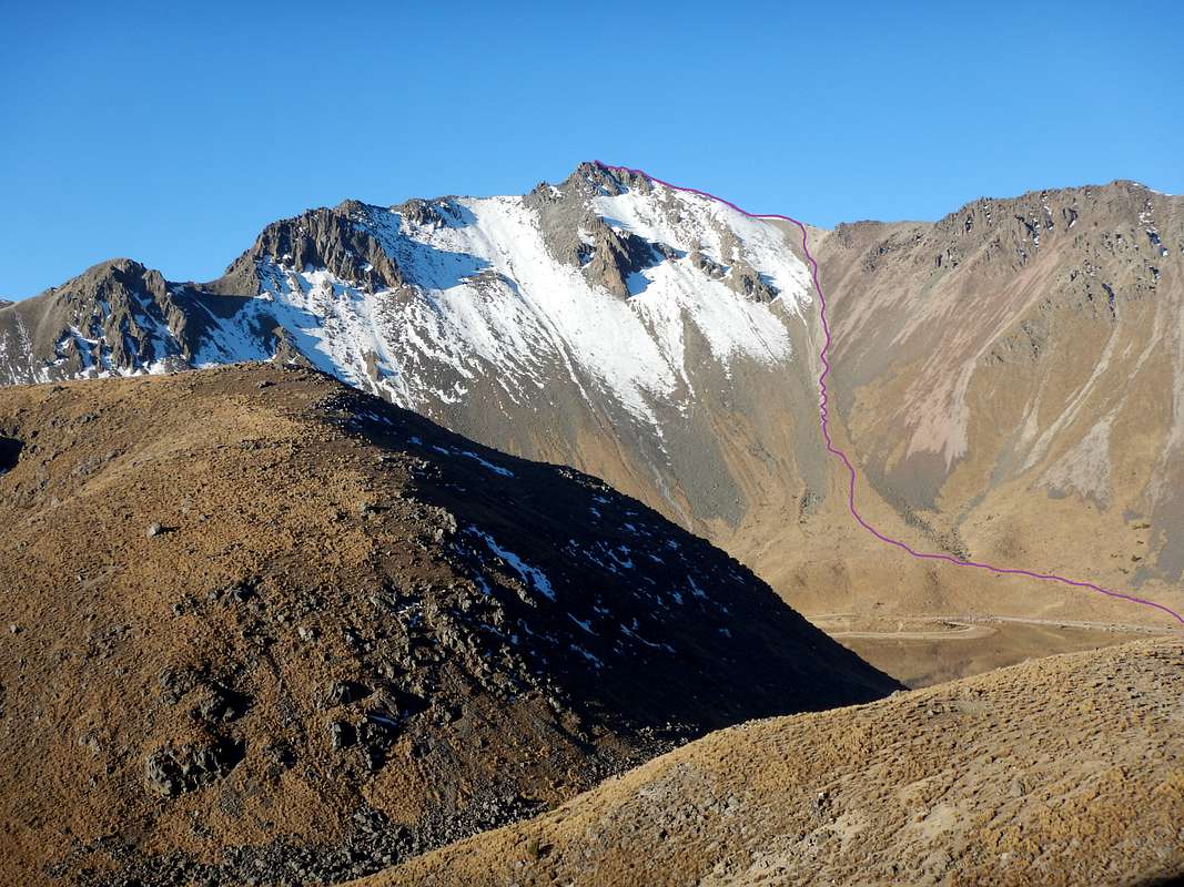
From the National Park Hut, take the obvious trail to the SSW heading up to the Arista de Humboldt. This pass overs a nice view of the rest of the route to Pico Fraile on Nevado de Toluca.
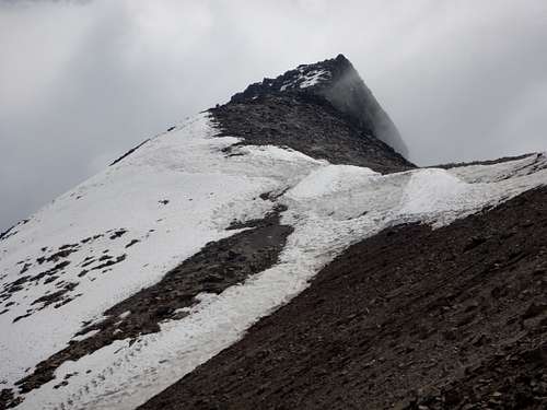
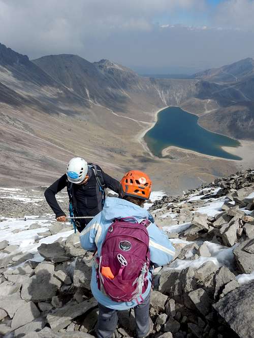
From the pass, descend the trail towards the northwest shore of Lago del Sol. Follow the trail along the beautiful lake and from the far west end of the lake look for a side trail heading straight up the slope towards Pico del Fraile. This slope is very steep and has relentless scree in places, but has no major difficulties. A climber made trail is present all the way to the ridge.
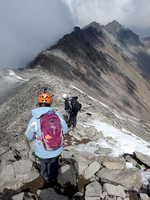
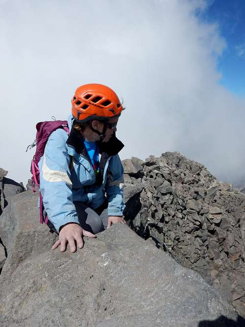
Once you are at the shallow col on the ridgetop, head along the ridgetop south and to the summit. This ridge has several class 3 scrambling sections. If the ridge is icy and/or snowy an ice axe and crampons is needed and maybe a rope. Enjoy the views from the spectacular summit!
Essential Gear
The Northeast Slopes and North Ridge Route can be done without any mountaineering equipment, but under icy and snowy conditions and ice axe, crampons, and ropes are needed. A helmet is highly recommended and should be considered to be standard equipment.